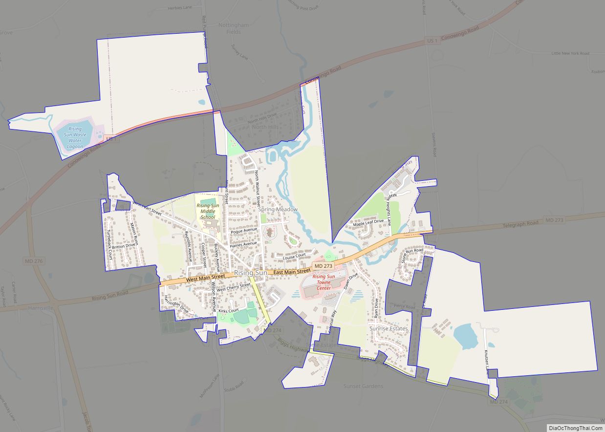
Rising Sun is a town in Cecil County, Maryland, United States. The population was 2,781 at the 2010 census.
| Name: | Rising Sun town |
|---|---|
| LSAD Code: | 43 |
| LSAD Description: | town (suffix) |
| State: | Maryland |
| County: | Cecil County |
| Incorporated: | 1860 |
| Elevation: | 390 ft (119 m) |
| Total Area: | 1.66 sq mi (4.29 km²) |
| Land Area: | 1.63 sq mi (4.21 km²) |
| Water Area: | 0.03 sq mi (0.07 km²) |
| Total Population: | 2,740 |
| Population Density: | 1,684.08/sq mi (650.35/km²) |
| ZIP code: | 21911 |
| Area code: | 410 |
| FIPS code: | 2466275 |
| GNISfeature ID: | 0595204 |
| Website: | http://www.risingsunmd.org/ |
Online Interactive Map
Click on ![]() to view map in "full screen" mode.
to view map in "full screen" mode.
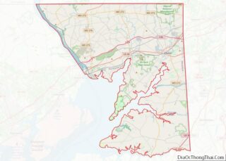
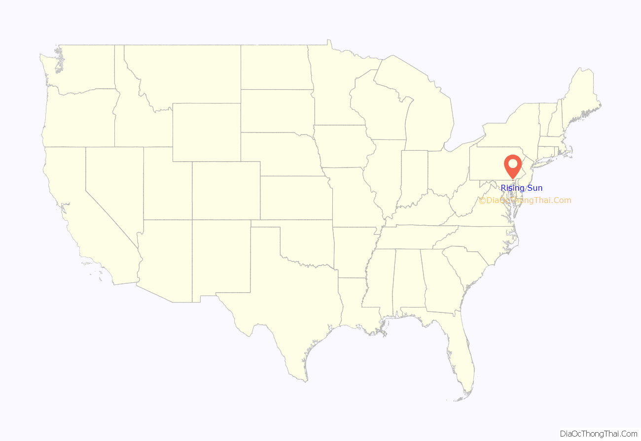
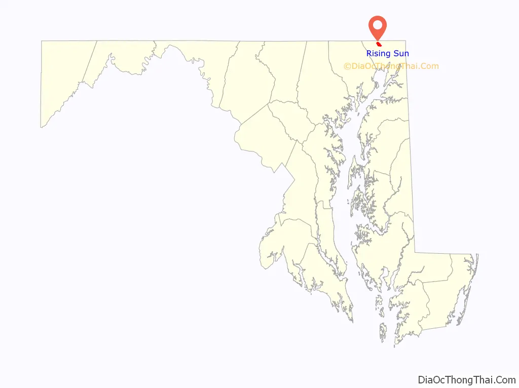
Rising Sun location map. Where is Rising Sun town?
History
The town which became known as Rising Sun was located in the disputed “Nottingham Lots” along the border between colonial Pennsylvania and Maryland. This area was claimed by William Penn and settled by Quakers in 1702 over the objection of Maryland. When Charles Mason and Jeremiah Dixon conducted a survey of the order in the 1760s, Rising Sun was found to be located in Maryland.
Around 1720, Henry Reynolds established a stone tavern on Nottingham Lot No. 17 to serve as a stage coach stop. According to local lore, he erected a sign over the entrance of the tavern depicting the rays of the sun at dawn and the words “The Rising Sun”. As the tavern was located along the route between Baltimore and Philadelphia, it became known as a meeting place for business, politics, elections, and other public activities. Local legend states that the tavern was more well known than the surrounding village (Summer Hill) so that by the time the town’s first post office was established around 1815, Rising Sun was chosen as the official name. There is some conjecture that the post office was located in the tavern.
When the town was incorporated in 1860, the commissioners had slate sidewalks installed, erected street lamps, and hired a lamplighter who doubled as bailiff and street maintenance man. Six years later the Philadelphia and Baltimore Central Railroad began to serve Rising Sun. Most of the town’s current structure has been built since then.
In 1895, a 24-year-old Rising Sun Man, Sailor John A. Kay, enlisted in the Navy. When the Battleship Maine sailed for Havana Harbor in January 1898, Kay was an assistant machinist on this voyage. He and about 268 crew members perished when an explosion ripped through the vessel on Feb. 15, 1898. On Independence Day 1900, a tall, handsome monument was dedicated at the Brookview Cemetery, which sits on a hilltop at the edge of town.
In 1916 women voted in the Rising Sun municipal election for the first time. This was four years before the 19th Amendment to the Constitution passed, which provided voting privileges to women across the nation.
Listed on the National Register of Historic Places at Rising Sun are: the Jeremiah Brown House and Mill Site, East Nottingham Friends Meetinghouse, Joshua Lowe House, Thomas Richards House, and West Nottingham Meetinghouse.
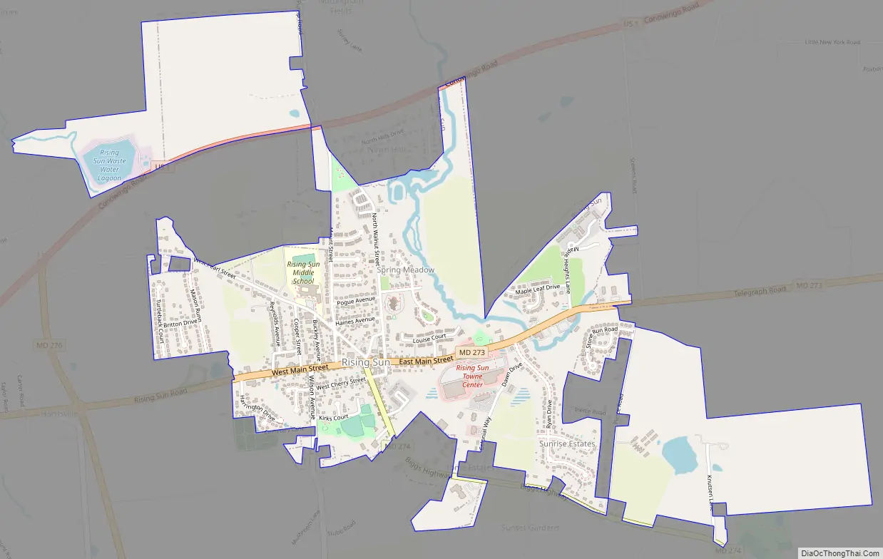
Rising Sun Road Map
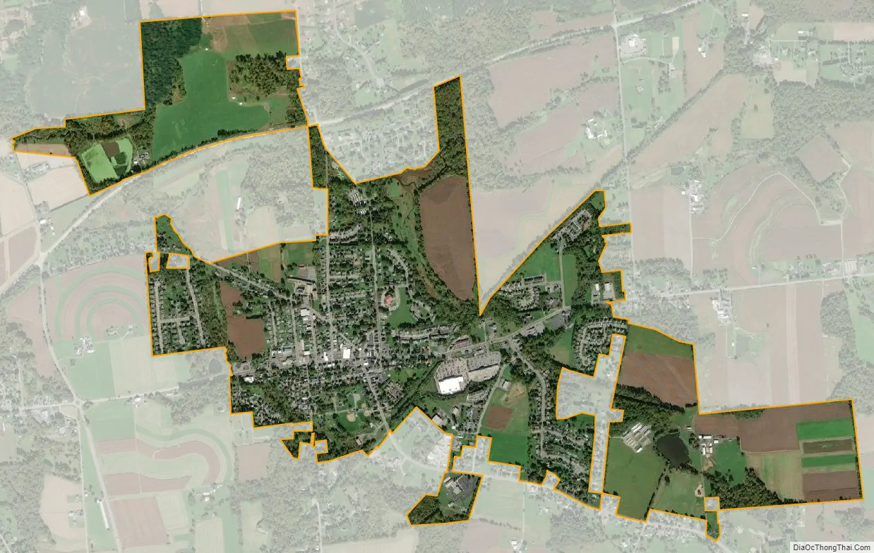
Rising Sun city Satellite Map
Geography
Rising Sun is located at 39°41′58″N 76°3′47″W / 39.69944°N 76.06306°W / 39.69944; -76.06306 (39.6994, -76.0630). According to the United States Census Bureau, the town has a total area of 1.27 square miles (3.29 km), of which 1.26 square miles (3.26 km) is land and 0.01 square miles (0.03 km) is water.
See also
Map of Maryland State and its subdivision: Map of other states:- Alabama
- Alaska
- Arizona
- Arkansas
- California
- Colorado
- Connecticut
- Delaware
- District of Columbia
- Florida
- Georgia
- Hawaii
- Idaho
- Illinois
- Indiana
- Iowa
- Kansas
- Kentucky
- Louisiana
- Maine
- Maryland
- Massachusetts
- Michigan
- Minnesota
- Mississippi
- Missouri
- Montana
- Nebraska
- Nevada
- New Hampshire
- New Jersey
- New Mexico
- New York
- North Carolina
- North Dakota
- Ohio
- Oklahoma
- Oregon
- Pennsylvania
- Rhode Island
- South Carolina
- South Dakota
- Tennessee
- Texas
- Utah
- Vermont
- Virginia
- Washington
- West Virginia
- Wisconsin
- Wyoming