Timonium /ˌtɪˈmoʊniːəm/ is a census-designated place (CDP) in Baltimore County, Maryland, United States. As of the 2010 census it had a population of 9,926. Prior to 2010 the area was part of the Lutherville-Timonium CDP. The Maryland State Fair is held in Timonium each year near Labor Day on the grounds of the former Timonium Race Course, which is an important site along with Pimlico Race Course in northwest Baltimore and Laurel Park in Prince George’s County, along with other former tracks at Bowie and Rosecroft in Maryland thoroughbred horse racing traditions.
| Name: | Timonium CDP |
|---|---|
| LSAD Code: | 57 |
| LSAD Description: | CDP (suffix) |
| State: | Maryland |
| County: | Baltimore County |
| Total Area: | 6.54 sq mi (16.95 km²) |
| Land Area: | 5.72 sq mi (14.82 km²) |
| Water Area: | 0.82 sq mi (2.13 km²) |
| Total Population: | 10,458 |
| Population Density: | 1,828.00/sq mi (705.82/km²) |
| ZIP code: | 21093-21094 |
| Area code: | 410, 443 |
| FIPS code: | 2478050 |
Online Interactive Map
Click on ![]() to view map in "full screen" mode.
to view map in "full screen" mode.
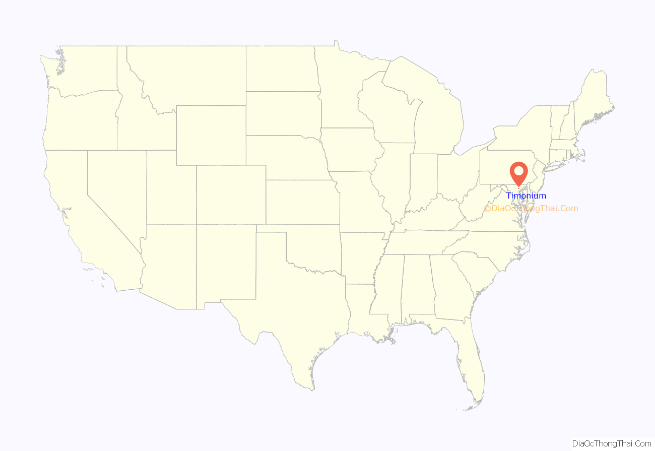
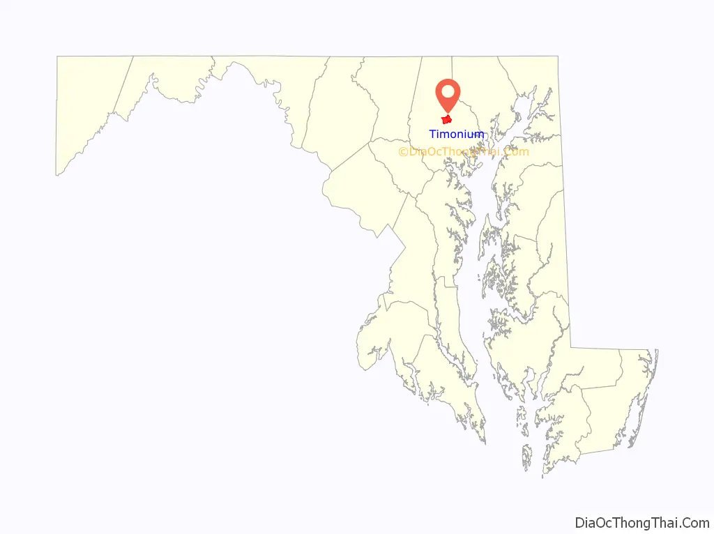
Timonium location map. Where is Timonium CDP?
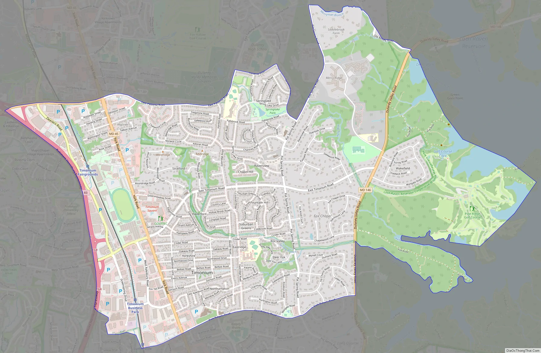
Timonium Road Map
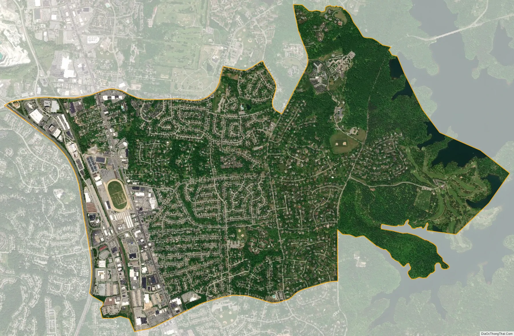
Timonium city Satellite Map
Geography
Timonium is at 39°26′26″N 76°37′34″W / 39.44056°N 76.62611°W / 39.44056; -76.62611 (39.4441, −76.6076). According to the United States Census Bureau, the CDP has a total area of 5.4 square miles (13.9 km), all land.
The town is north of Baltimore City along York Road (Maryland Route 45). It is bordered on the north by Cockeysville, on the south by Lutherville, on the east by Loch Raven Reservoir, and on the west by Falls Road (Maryland Route 25), with the Greenspring and Worthington Valleys beyond. Ridgely Road forms the boundary between Timonium and Lutherville, while Padonia Road separates Timonium from Cockeysville.
Timonium is in the Piedmont region of the United States, and is in the transition zone between the Humid subtropical climate zone to the south and the humid continental climate to the north, with hot and humid summers leading into winters that are cold but not extreme by American standards. The average annual snowfall is 25 inches (64 cm) and average annual rainfall is 42 inches (107 cm).
See also
Map of Maryland State and its subdivision: Map of other states:- Alabama
- Alaska
- Arizona
- Arkansas
- California
- Colorado
- Connecticut
- Delaware
- District of Columbia
- Florida
- Georgia
- Hawaii
- Idaho
- Illinois
- Indiana
- Iowa
- Kansas
- Kentucky
- Louisiana
- Maine
- Maryland
- Massachusetts
- Michigan
- Minnesota
- Mississippi
- Missouri
- Montana
- Nebraska
- Nevada
- New Hampshire
- New Jersey
- New Mexico
- New York
- North Carolina
- North Dakota
- Ohio
- Oklahoma
- Oregon
- Pennsylvania
- Rhode Island
- South Carolina
- South Dakota
- Tennessee
- Texas
- Utah
- Vermont
- Virginia
- Washington
- West Virginia
- Wisconsin
- Wyoming


