Vienna is a town in Dorchester County, Maryland, United States. The population was 271 at the 2010 census.
| Name: | Vienna town |
|---|---|
| LSAD Code: | 43 |
| LSAD Description: | town (suffix) |
| State: | Maryland |
| County: | Dorchester County |
| Founded: | 1706 |
| Incorporated: | 1833 |
| Elevation: | 10 ft (3 m) |
| Total Area: | 0.77 sq mi (1.98 km²) |
| Land Area: | 0.77 sq mi (1.98 km²) |
| Water Area: | 0.00 sq mi (0.00 km²) |
| Total Population: | 270 |
| Population Density: | 352.94/sq mi (136.32/km²) |
| ZIP code: | 21869 |
| Area code: | 410 |
| FIPS code: | 2480600 |
| GNISfeature ID: | 0591474 |
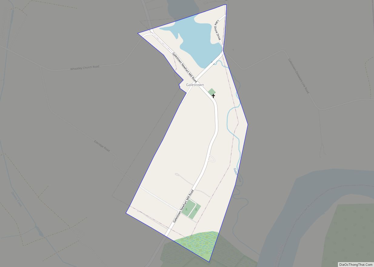
Online Interactive Map
Click on ![]() to view map in "full screen" mode.
to view map in "full screen" mode.
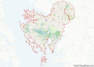
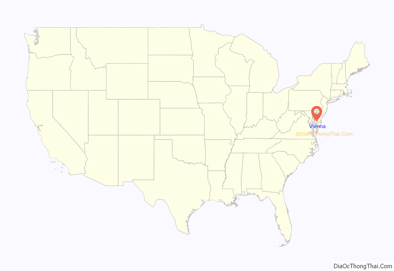
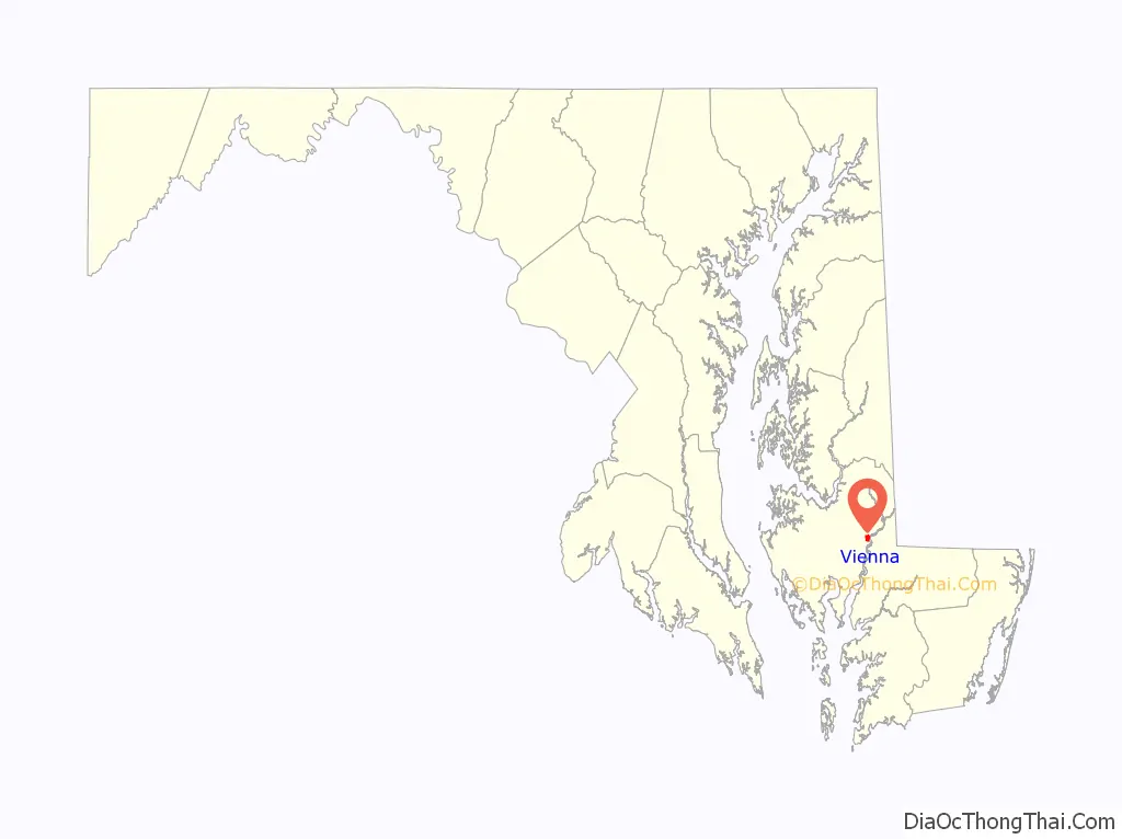
Vienna location map. Where is Vienna town?
History
Prior to European colonization, a Nanticoke town called “Chicacone” existed where Vienna is now located. The Nanticokes are an Algonquian people. Chicacone was the largest Nanticoke settlement at the time of John Smith’s exploration of the Chesapeake Bay in 1608. By 1742, ongoing violations of Indian reservation rights by English colonizers caused the Nanticoke people to abandon Chicacone. In 1768–69, the Colony of Maryland dissolved the Nanticoke reservation. Many of the Nanticokes of Chicacone migrated north to Pennsylvania, New York, and Canada, while others stayed and assimilated into the white or black communities of lower Dorchester and Wicomico counties.
Vienna was founded in 1706. It thrived on trade, shipbuilding and tobacco farming. The wreck of a 45-foot cargo ship that was likely built at a small shipyard or plantation in Maryland was found in 2015 under the US 50 Bridge over the Nanticoke River. Charring suggests it was torched by British sympathizers in the 1780s. The British raided the town repeatedly during the American Revolutionary War, and again during the War of 1812. This led to the building of a wall across the city’s waterfront on the Nanticoke River. This wall is in ruins today. Handsell was listed on the National Register of Historic Places in 2008.
Vienna was incorporated in 1833.
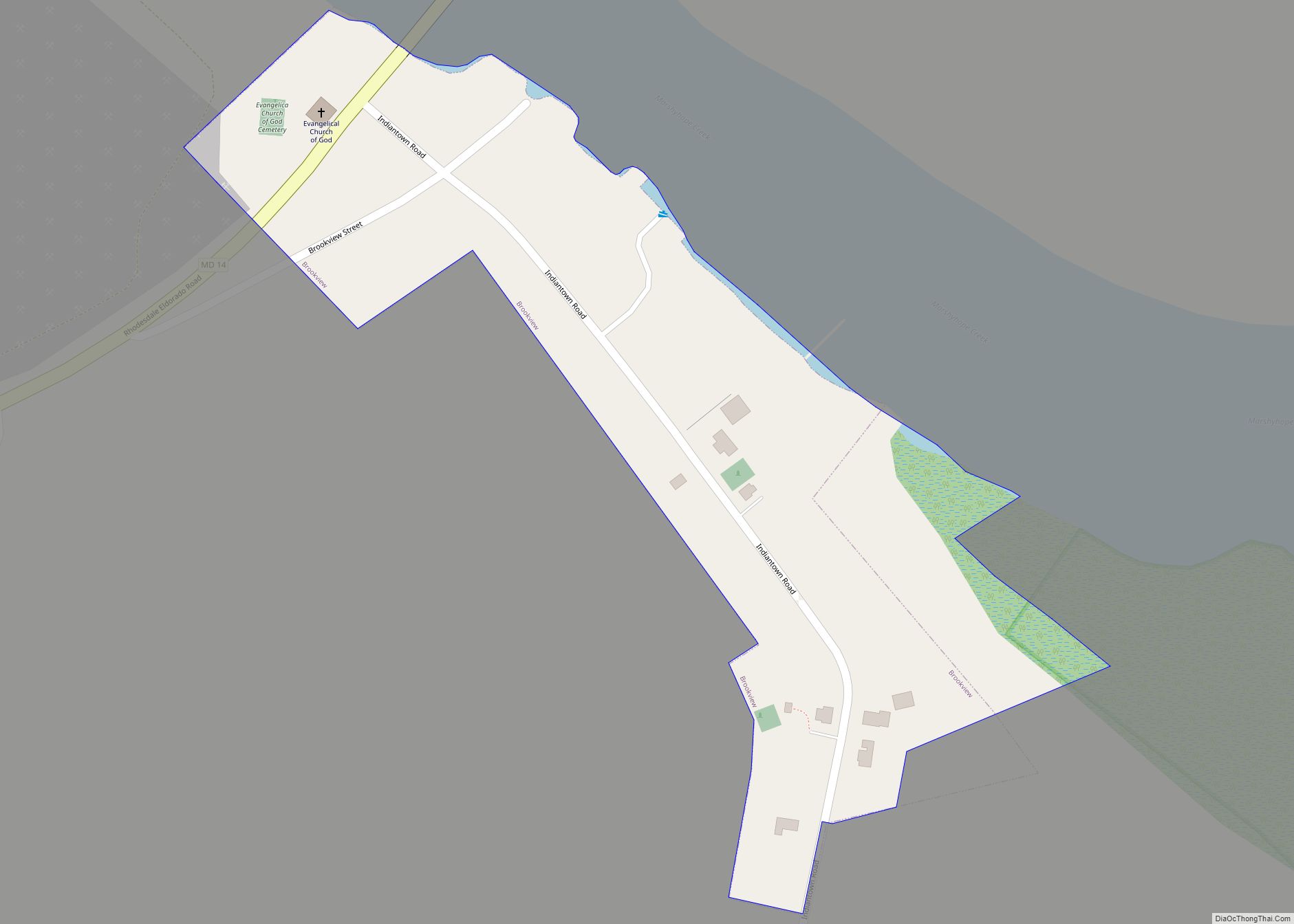
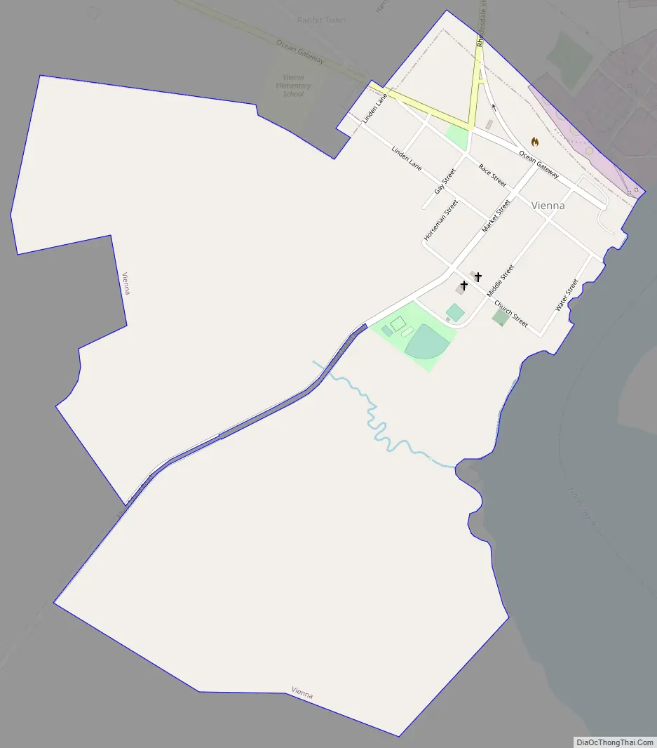
Vienna Road Map
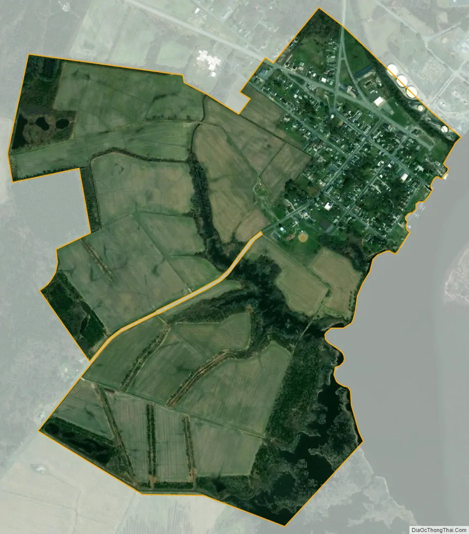
Vienna city Satellite Map
Geography
Vienna is located at 38°29′7″N 75°49′37″W / 38.48528°N 75.82694°W / 38.48528; -75.82694 (38.485152, -75.827020).
According to the United States Census Bureau, the town has a total area of 0.19 square miles (0.49 km), all land.
See also
Map of Maryland State and its subdivision: Map of other states:- Alabama
- Alaska
- Arizona
- Arkansas
- California
- Colorado
- Connecticut
- Delaware
- District of Columbia
- Florida
- Georgia
- Hawaii
- Idaho
- Illinois
- Indiana
- Iowa
- Kansas
- Kentucky
- Louisiana
- Maine
- Maryland
- Massachusetts
- Michigan
- Minnesota
- Mississippi
- Missouri
- Montana
- Nebraska
- Nevada
- New Hampshire
- New Jersey
- New Mexico
- New York
- North Carolina
- North Dakota
- Ohio
- Oklahoma
- Oregon
- Pennsylvania
- Rhode Island
- South Carolina
- South Dakota
- Tennessee
- Texas
- Utah
- Vermont
- Virginia
- Washington
- West Virginia
- Wisconsin
- Wyoming