Rochester is a city in Strafford County, New Hampshire, United States. The population was 32,492 at the 2020 census. In addition to the downtown area, the city contains the villages of East Rochester, Gonic, and North Rochester. Rochester is home to Skyhaven Airport and part of Baxter Lake.
Rochester was one of New Hampshire‘s fastest growing cities between 2010 and 2020.
| Name: | Rochester city |
|---|---|
| LSAD Code: | 25 |
| LSAD Description: | city (suffix) |
| State: | New Hampshire |
| County: | Strafford County |
| Incorporated: | 1722; 301 years ago (1722) |
| Elevation: | 225 ft (69 m) |
| Total Area: | 45.44 sq mi (117.68 km²) |
| Land Area: | 45.02 sq mi (116.60 km²) |
| Water Area: | 0.41 sq mi (1.08 km²) |
| Total Population: | 32,492 |
| Population Density: | 721.71/sq mi (278.65/km²) |
| ZIP code: | 03839, 03866–03868 |
| Area code: | 603 |
| FIPS code: | 3365140 |
| GNISfeature ID: | 0869554 |
| Website: | www.rochesternh.net |
Online Interactive Map
Click on ![]() to view map in "full screen" mode.
to view map in "full screen" mode.
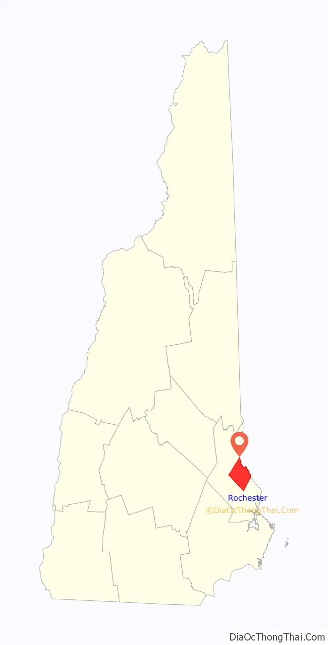
Rochester location map. Where is Rochester city?
History
Origins
Rochester was once inhabited by Abenaki Indians of the Pennacook tribe. They fished, hunted and farmed, moving locations when their agriculture exhausted the soil for growing pumpkins, squash, beans and maize. Squanamagonic (abbreviated to “Gonic”) means “the water of the clay place hill”.
The town was one of four granted by colonial governor Samuel Shute of Massachusetts and New Hampshire during his brief term. Incorporated in 1722, it was named for his close friend, Laurence Hyde, 1st Earl of Rochester, brother-in-law to King James II. As was customary, tall white pine trees were reserved for use as masts by the Royal Navy. But hostility with the Abenaki people delayed settlement until 1728, although attacks would continue until 1748. Early dwellings clustered together for protection, beginning near Haven Hill. Due to warfare or disease, after 1749 Native American numbers dwindled, although many descendants remain in or around Rochester communities. The community at that time included Farmington, which was incorporated in 1798, and Milton, in 1802.
Rochester Common
In 1737, the Reverend Amos Main became the first settled pastor of the Congregational Church, located on Rochester Hill. The building would be moved to Rochester Common, which then encompassed 250 acres (1.0 km) and was called “Norway Plain Mille Common” after its abundant Norway pines. At the time, the Common extended into what is now downtown Rochester. By 1738, the farming community contained 60 families. A statue of Parson Main, sculpted by Giuseppe Moretti, today presides over the town square.
By 1780 the area surrounding the Common was the most thickly settled part of town, so a meeting house/church was erected on the east end of the Common with the entrance facing what is now South Main Street. A cemetery was also established near the new meeting house, but the ground was found to be too wet, and the bodies were removed to the Old Rochester Cemetery. In 1842 the Meeting House/church was moved to the present-day location at the corner of Liberty and South Main streets. As the years went by the size of the Common would shrink as more of it was sold off for development. A bandstand was constructed in 1914. Today, the Common is used for community activities such as Memorial Day events and for concerts throughout the summer months, in addition to having a walking track.
During the Revolutionary War the Common was used as the meeting place for soldiers before going off to war. The common is also the location of the city’s Civil War monument that bears the names of the 54 men who died then. The monument was dedicated in the 1870s, and in the 1880s the statue was added to the monument. Four Civil War cannons also decorated the monument, but during World War II the cannon were melted down for use in the war. They were replaced by World War II guns.
The bandstand was built in 1914 by Miles Dustin; before then band concerts were held on the square. The flag pole was donated by J. Frank Place in 1917. He was the former publisher of the Rochester Courier.
Early education
In 1750, Rochester voted at a town meeting to establish a public school to teach writing and reading to the town’s children. The vote was quickly overturned, which violated colonial laws mandating schools in each community. In 1752 the first public schooling began. The school lasted for 16 weeks and the schoolmaster was named John Forst. He was paid a salary of 15 pounds and boarded with a different family each month (this family received 30 cents a week from the city).
For many years the city followed the pattern of the first school by opening one and closing it shortly after. Eventually the citizens realized a school was necessary, but funding one was an issue. In 1783 the state demanded that schools were opened permanently or else the state would penalize them. A year later permanent schools were established. Corporal punishment was commonly used by the schoolmasters.
In 1806 the school system was divided into districts in accordance with state law that was passed in 1805. This system of districts remained in place until 1884 when laws regarding districts changed. The schools in this system often lacked the necessary educational materials. Eventually the number of students attending school across the state diminished. This led to the abolishment of this system, because communities across the state including Rochester had many schools with extremely low numbers of students.
In 1850 the city voted to allow high schools and the funding of them. However money wasn’t actually raised for high schools until 1868. The first high school opened in 1857. The principal and teacher was William A. Kimball. At that time a school year lasted for 22 weeks. High school attendance was relatively low, and most dropped out before graduating.
Growth through the 19th century
Mail service was established in 1768 when a post rider traveled from Portsmouth through Berwick, Dover and Rochester bringing gazettes. In 1792 this improved when Joseph Paine would deliver and pick up mail once a week. When he arrived in town a horn would blow to inform the town of his presence. A regular post office was established on March 26, 1812, in the Barke Tavern. The first postmaster in Rochester was William Barker.
The first large business was lumbering, although it would be overtaken by other industries as Rochester developed into a mill town with the Cochecho River to provide water power. In 1806, six tanneries were operating, along with a sawmill, fulling mill, and two gristmills. By the 1820s–1830s, the town had a cabinet maker and clockmaker. The Mechanics Company was established in 1834, producing woolen blankets that won the premium quality award at the 1853 New York World’s Fair. The Norway Plains Woolen Company manufactured blankets used by the Union Army in the Civil War, and in 1870 wove 1,600,000 yards (1,500,000 m) of textiles, but by century’s end was out of business. Shoe manufacturing had surpassed textiles as Rochester’s dominant industry by 1880.
In 1854, the E.G. & E. Wallace Shoe Company was established, eventually becoming the city’s largest employer, with over 700 workers in 1901. Its name changed to the Rochester Shoe Corporation in the 1920s. The Wallace brothers died in the 1890s, and other shoe factories opened, including Perkins, Linscott & Company (later the Linscott, Tyler, Wilson Company) off Wakefield Street and N. B. Thayer & Company, Inc., in East Rochester. In the early twentieth century, more people were employed in shoe manufacturing than in all other local industries combined. Rochester contributed to New Hampshire’s position as the nation’s third largest shoe-producing state. The Kessel Fire Brick Company was established in 1889, and at one time bricks for new buildings at Harvard University were made in Gonic. Carrying the freight were four railroads that once passed through Rochester, a major junction between Haverhill, Massachusetts, and Portland, Maine. Agriculture continued to be important, and in 1875 the Rochester Fair was established. In 1891, Rochester was incorporated as a city.
The first telephone was installed in 1885 in the K.C. Sanborn Drug Store. The phone was connected to the Dover Telephone Exchange. By the early 1900s there were 1,200 local calls and 400 toll calls a day made from Rochester.
In 1889 and 1900 Jonas Spaulding and his three sons Leon, Huntley, and Rolland, built a leatherboard mill at North Rochester. Jonas died before the mill became operational, but his three sons ran it well in co-partnership and expanded the company nationally and internationally. Leon Cummings Spaulding served as the J Spaulding and Sons Company president after his father’s death.
During the Great Depression, however, several industries left for cheaper operating conditions in the South or went bankrupt. But the affluent mill era left behind fine architecture, including the Rochester Public Library, a Carnegie Library designed by the Concord architects Randlett & Griffin.
Library
The Rochester Public Library was approved in 1893 but was not open to the public until early 1894. Back then, the library was located on the corner of Portland Street and South Main Street. In 1897, the library moved to City Hall, where it remained for over eight years.
In the early 1900s, Osman Warren, Rochester’s postmaster, contacted Andrew Carnegie for help in securing an endowment to build the new library. The Carnegie Institute donated $20,000 to construct the new building. The new library was built on the site of what was the Main Street School. The library was built in the Georgian revival style, using brick and granite, and the inside was finished with golden oak and cypress. The library opened on October 2, 1905, and 150 people registered the first day. Miss Lillian Parshley was the first librarian, serving until her death in 1945. Velma Foss, Miss Parshley’s assistant, was the second librarian of the Rochester Library.
City Hall and Opera House
Another notable structure is Rochester City Hall, built in 1908, and Opera House designed by George G. Adams. Adams designed other municipal government/opera house dual-purpose buildings around New England, including in Bellows Falls, Vermont (1887); Amesbury, Massachusetts (1887); Dover, New Hampshire (1891); and Derry, New Hampshire (1901). Only four of his structures survive today (in Waterville, Maine, Montpelier, Vermont, Derry, and Rochester), with many of his buildings destroyed by fires.
Adams’ opera houses were unique because of their floors, which were movable and could function in both inclined or level position. With the floor in the inclined position, the opera house would show plays, concerts, etc. When the floor was level, the building could be used for dances or public meetings. The Rochester Opera House opened on Memorial Day 1908. Almost all of Adams’ buildings contained movable floors, though the buildings in Waterville and Montpelier did not. Because of the destruction of the other opera houses, the Rochester Opera House is the only known theatre in the United States to use this type of movable floor.
Rochester City Hall contained the Rochester Police Department in its basement offices for many years. Some historical portraits of officers remain in an upstairs chamber where a collection of portraits of city officials was traditionally preserved, including officers Nelson S. Hatch and Red Hayes.
Today, visitors may still attend shows at the Rochester Opera House. The City of Rochester has preserved the 90-year-old historical décor of the Opera House.
20th century
Rochester’s thriving shoe industry in the early twentieth century attracted entrepreneurs from out of state. In 1930 Samuel J. Katz of Brookline, Massachusetts, incorporated the Hubbard Shoe Company and commenced operations in N. B. Thayer & Company’s factory on Pleasant Street in East Rochester before the end of the year. By 1931 the firm had also taken over the Linscott, Tyler, Wilson factory off Wakefield Street in Rochester, which it purchased outright in May 1932. At its peak, the Hubbard Shoe Company employed about four hundred people in East Rochester making men’s shoes and five hundred in Rochester making women’s shoes, with a total annual payroll of $3 million and total annual output of 2.5 million shoes. In 1934 the Maybury Shoe Company began operations on the former E.G. & E. Wallace site on South Main Street. Both firms survived the Great Depression, providing steady jobs for hundreds of Rochester citizens, and converted to a wartime footing during World War Two, but were unable to compete against the flood of cheap foreign imports in the 1970s. Hubbard Shoe Company went out of business in 1973, and Maybury Shoe closed in the mid-1970s. Samuel Katz’s son Saul, however, went on to found the profitable Rockport Shoe Company with his son, Bruce R. Katz.
Rochester passed out of the silent film era on May 20, 1929, with the arrival of the first talking motion picture in the city, titled The Wild Party, starring Clara Bow. The movie was shown at the Scenic Theater. The evening admission price was 35 cents for adults and 15 cents for children.
A Rochester Courier article from October 1930 described a new indoor golf course:
Natural disasters
The summer of 1947 was dry. In late October of that year only 1/8 inch of rain had fallen since mid-September, and the temperatures were high. Small ponds and streams were dried up, and local farmers were using water from the Salmon Falls River and Cocheco River to provide water for their livestock. Fire risk was high. On October 21, sparks from a passing train car in Farmington ignited the dry grass on both sides of the track, starting the biggest fire to strike Rochester.
At first, firefighters seemed to have the fire in control, but two days later, winds up to 60 miles per hour (97 km/h) drove the “small” fire out of control. The wind-driven fire moved to the south and east into Rochester. The fire would engulf an area over 9 miles (14 km) long and over 2 miles (3 km) wide with walls of flame 40 feet (12 m) high. Before the fire was under control, over 30 homes in Rochester would be lost.
Hurricane Carol struck New Hampshire on September 2, 1954. The winds of the hurricane were in excess of 90 miles per hour (140 km/h). The property damage in New Hampshire was estimated to be 3 million dollars, and 4 inches (100 mm) of rain fell during the storm.
A Category 5 hurricane, known locally as the Hurricane of ’38, was the most deadly of New Hampshire’s history, causing excessive damage to Rochester and outlying communities. Hurricane Carol was a Category 3 storm.
Upper Dam c. 1905
Public Library c. 1908
City Hall c. 1910
Central Square in 1909
City Hotel c. 1910
Wallace Factory c. 1910
Stone Bridge c. 1910
Rochester Fair c. 1910
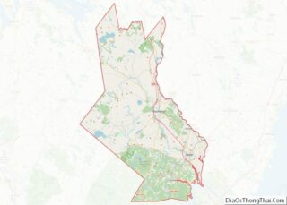
Rochester Road Map
Rochester city Satellite Map
Geography
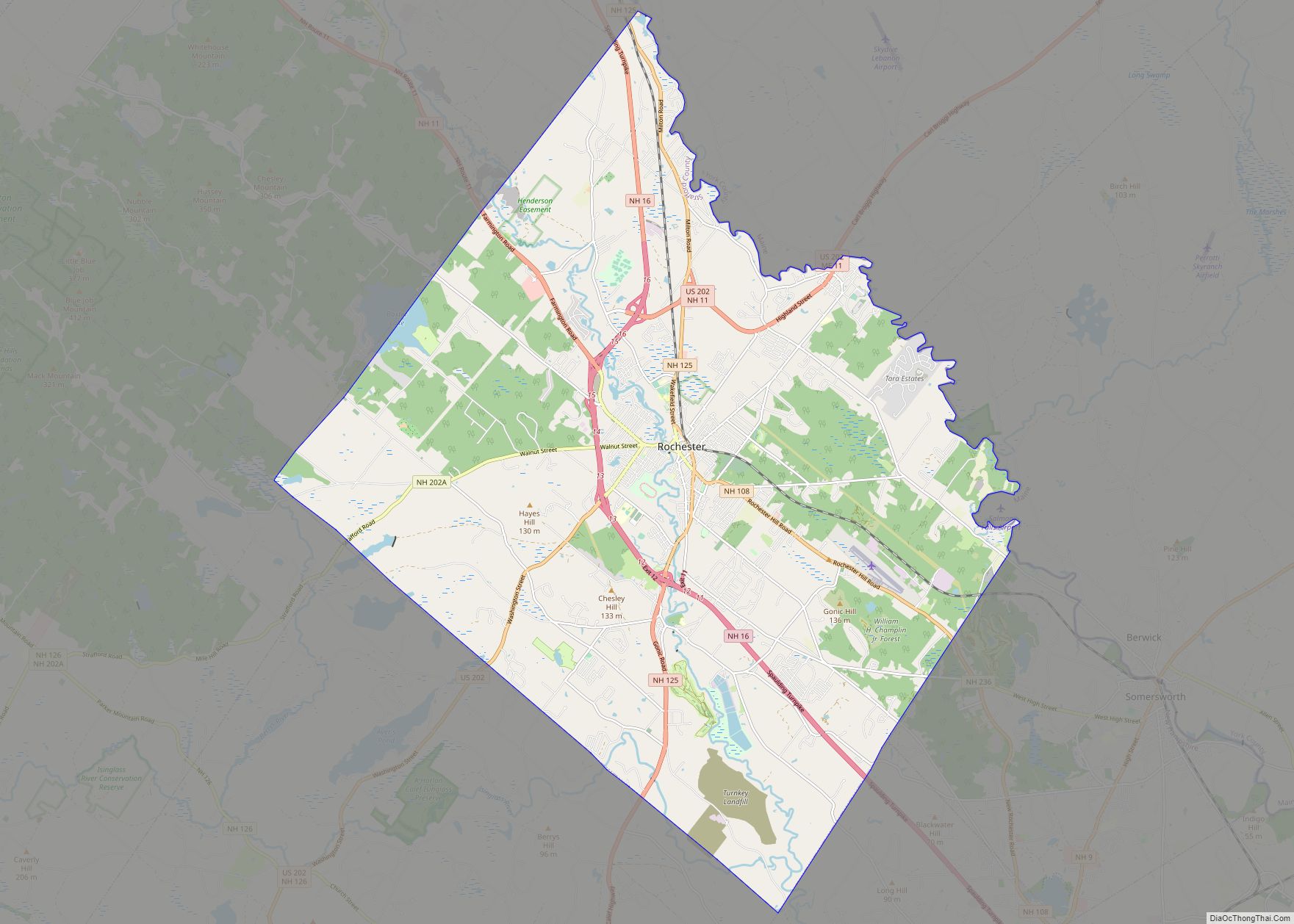
According to the United States Census Bureau, the city has a total area of 45.4 square miles (117.7 km), of which 45.0 square miles (116.6 km) are land and 0.4 square miles (1.1 km) are water, comprising 0.91% of the city. Rochester is drained by the Salmon Falls, Isinglass and Cochecho rivers. The highest point in Rochester is 581-foot-high (177 m) Chestnut Hill, occupying the northern corner of the city.
New Hampshire Route 16 (the Spaulding Turnpike) is a six-lane controlled-access highway that passes through the city, leading north towards Conway and south to Dover and Portsmouth. U.S. Route 202 uses the turnpike to bypass the city center, then heads northeast into Maine and southwest towards Concord. New Hampshire Route 125 passes north–south through the center of town, leading south to Lee and Epping, and traveling north parallel to NH 16 into Milton. New Hampshire Route 11 leads west to Alton and Laconia and northeast along US 202 into Maine. New Hampshire Route 108 leads southeast to Dover, and New Hampshire Route 202A leads southwest to Strafford and Northwood.
Besides the main downtown part of Rochester, there are two other named communities of significance within the city limits. East Rochester, a small neighborhood, is located near the northeast border of the city along routes 202 and 11, next to the Salmon Falls River, while Gonic (from the Native American name Squanamagonic) is located south of downtown along NH 125 at a dam on the Cocheco River.
Adjacent municipalities
- Lebanon, Maine (north)
- Berwick, Maine (northeast)
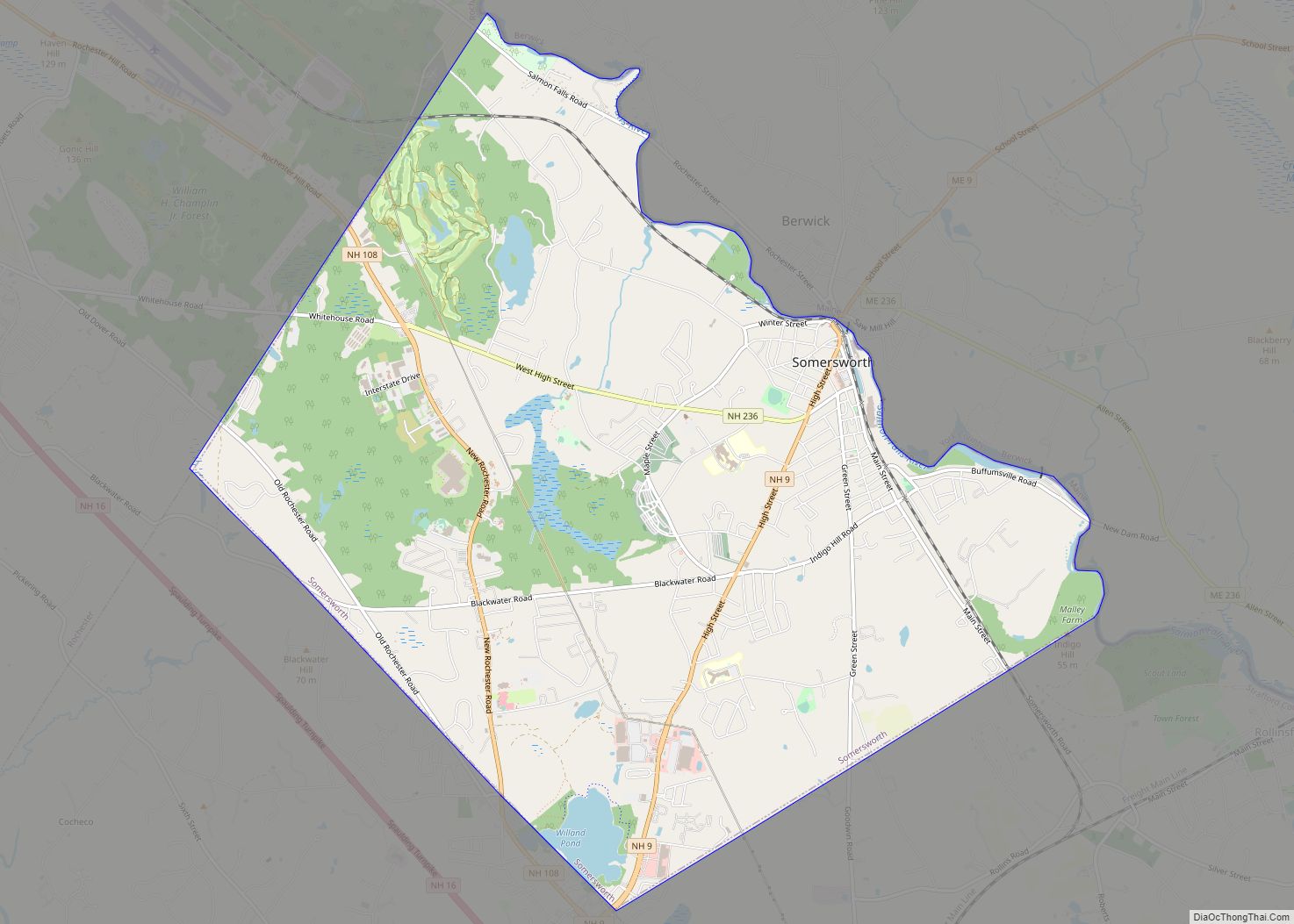
- Somersworth, New Hampshire (east)
- Dover, New Hampshire (southeast)
- Barrington, New Hampshire (southwest)
- Strafford, New Hampshire (west)
- Farmington, New Hampshire (northwest)
- Milton, New Hampshire (north)
See also
Map of New Hampshire State and its subdivision: Map of other states:- Alabama
- Alaska
- Arizona
- Arkansas
- California
- Colorado
- Connecticut
- Delaware
- District of Columbia
- Florida
- Georgia
- Hawaii
- Idaho
- Illinois
- Indiana
- Iowa
- Kansas
- Kentucky
- Louisiana
- Maine
- Maryland
- Massachusetts
- Michigan
- Minnesota
- Mississippi
- Missouri
- Montana
- Nebraska
- Nevada
- New Hampshire
- New Jersey
- New Mexico
- New York
- North Carolina
- North Dakota
- Ohio
- Oklahoma
- Oregon
- Pennsylvania
- Rhode Island
- South Carolina
- South Dakota
- Tennessee
- Texas
- Utah
- Vermont
- Virginia
- Washington
- West Virginia
- Wisconsin
- Wyoming

