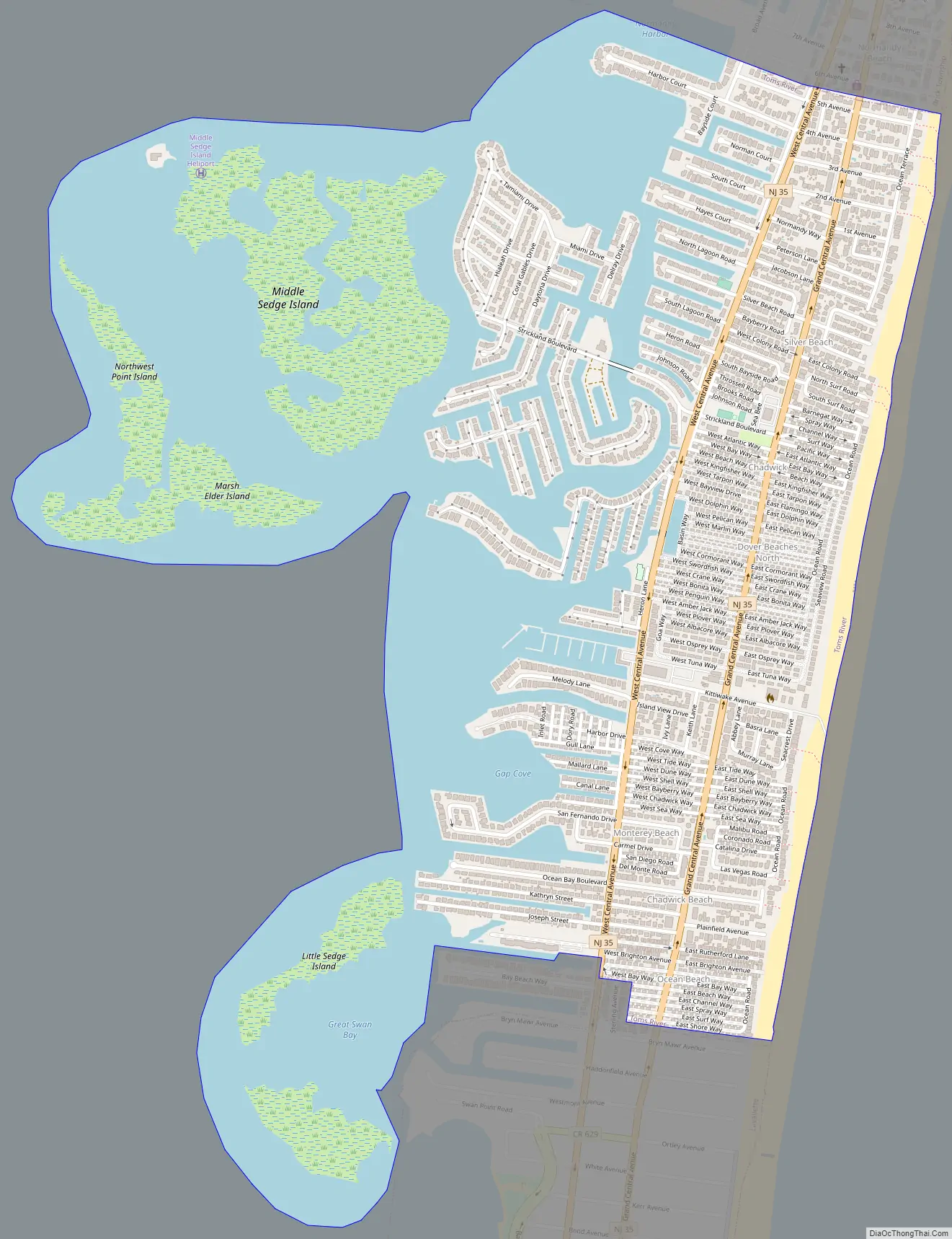
Dover Beaches North is an unincorporated community and census-designated place (CDP) located within Toms River, in Ocean County, New Jersey, United States. As of the 2010 United States Census, the CDP’s population was 1,239. The CDP includes the communities of Ocean Beaches 1, 2 and 3, Chadwick Beach, Chadwick Island, Seacrest Beach, Monterey Beach, Silver Beach, Normandy Shores and half of Normandy Beach. Dover Beaches North is situated on the Barnegat Peninsula, a long, narrow barrier peninsula that separates Barnegat Bay from the Atlantic Ocean.
Toms River Township is split by the United States Census Bureau into three CDPs; Toms River CDP on the mainland including over 95% of the township’s population, along with Dover Beaches North and Dover Beaches South.
| Name: | Dover Beaches North CDP |
|---|---|
| LSAD Code: | 57 |
| LSAD Description: | CDP (suffix) |
| State: | New Jersey |
| County: | Ocean County |
| Elevation: | 0 ft (0 m) |
| Total Area: | 1.58 sq mi (4.09 km²) |
| Land Area: | 0.92 sq mi (2.38 km²) |
| Water Area: | 0.66 sq mi (1.71 km²) 41.92% |
| Total Population: | 1,277 |
| Population Density: | 1,388.04/sq mi (536.11/km²) |
| FIPS code: | 3418148 |
| GNISfeature ID: | 02389413 |
Online Interactive Map
Click on ![]() to view map in "full screen" mode.
to view map in "full screen" mode.
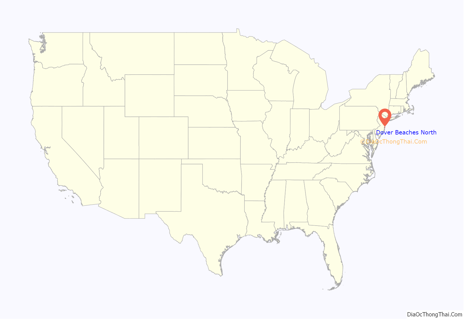
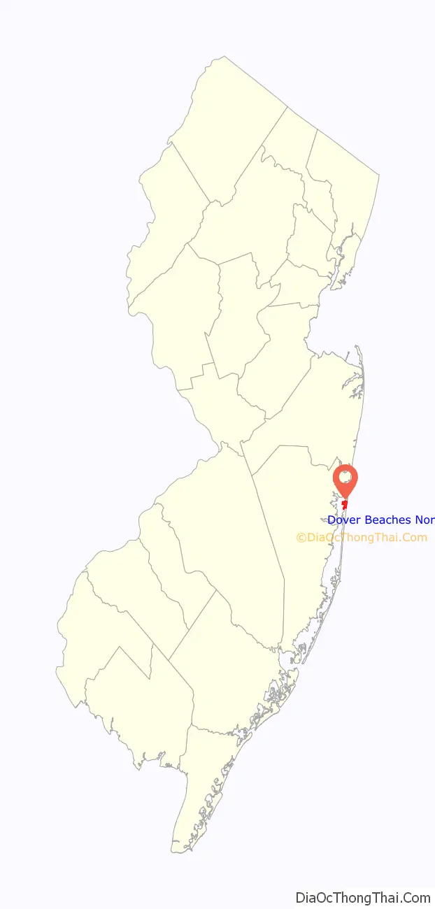
Dover Beaches North location map. Where is Dover Beaches North CDP?
History
What is now Dover Beaches North was first settled in the early 19th century by the Chadwick family as a hunting and fishing resort. Further development continued in 1883 with the construction of a Coast Guard Lifesaving Station and the completion of the Pennsylvania Railroad on the peninsula, which included a stop at Chadwick Beach. The area was opened to major development after the completion of what is now Route 35 in 1913. The area saw its largest growth as a vacation resort in the middle of the 20th century. In 1961, the Pennsylvania Railroad right-of-way was converted into a new southbound roadway for Route 35, allowing the original 1913 roadway to exclusively carry northbound traffic. Today, the area consists of several private beaches governed by homeowners’ associations; there are no public beaches in the CDP. These private beach communities, from south to north, are roughly as follows:
- Ocean Beach, developed from 1946 into the 1960s and consisting of four sections (Units 1-3 and Ocean Beach Shores)
- Brightwater Beach
- Rutherford Beach
- Sunset Manor
- Monterey Beach, established in 1948
- Seacrest Beach, established in 1954
- Chadwick Beach
- Silver Beach
- Normandy Beach, established in 1916
Dover Beaches North Road Map
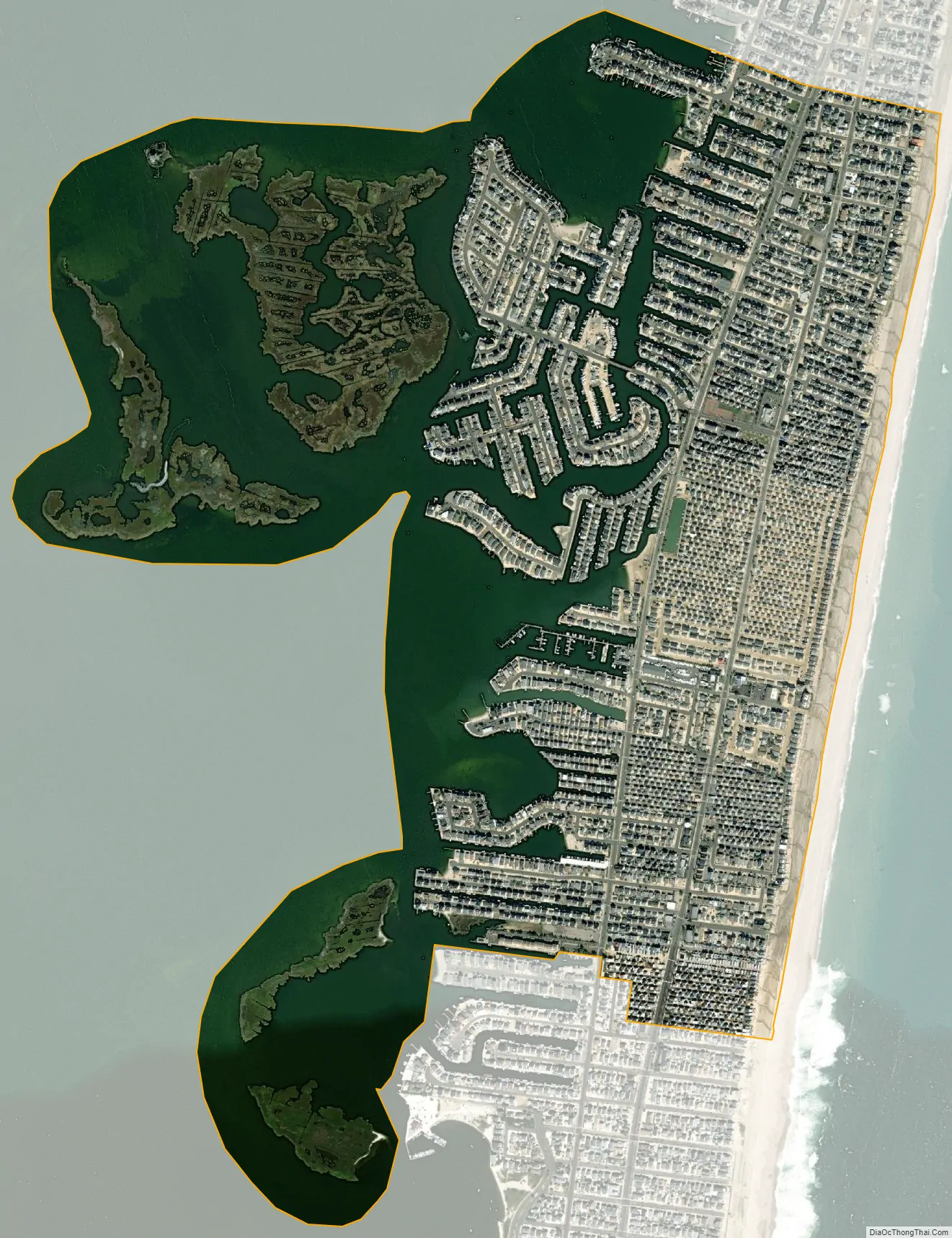
Dover Beaches North city Satellite Map
Geography
According to the United States Census Bureau, the CDP had a total area of 1.587 square miles (4.111 km), including 0.922 square miles (2.387 km) of land and 0.665 square miles (1.723 km) of water (41.92%).
See also
Map of New Jersey State and its subdivision: Map of other states:- Alabama
- Alaska
- Arizona
- Arkansas
- California
- Colorado
- Connecticut
- Delaware
- District of Columbia
- Florida
- Georgia
- Hawaii
- Idaho
- Illinois
- Indiana
- Iowa
- Kansas
- Kentucky
- Louisiana
- Maine
- Maryland
- Massachusetts
- Michigan
- Minnesota
- Mississippi
- Missouri
- Montana
- Nebraska
- Nevada
- New Hampshire
- New Jersey
- New Mexico
- New York
- North Carolina
- North Dakota
- Ohio
- Oklahoma
- Oregon
- Pennsylvania
- Rhode Island
- South Carolina
- South Dakota
- Tennessee
- Texas
- Utah
- Vermont
- Virginia
- Washington
- West Virginia
- Wisconsin
- Wyoming


