Englishtown is a rapidly growing borough in western Monmouth County, in the U.S. state of New Jersey. The community is located within the Raritan Valley region. As of the 2020 United States census, the borough’s population was 2,346, its highest decennial count ever and an increase of 499 (+27.0%) from the 2010 census count of 1,847, which in turn reflected reflected an increase of 83 (+4.7%) from the 1,764 counted at the 2000 census.
Englishtown was incorporated as a borough by an act of the New Jersey Legislature on January 4, 1888, from portions of Manalapan Township, based on the results of a referendum held the previous day. The borough was named for James English, an early settler.
| Name: | Englishtown borough |
|---|---|
| LSAD Code: | 21 |
| LSAD Description: | borough (suffix) |
| State: | New Jersey |
| County: | Monmouth County |
| Incorporated: | January 4, 1888 |
| Elevation: | 69 ft (21 m) |
| Total Area: | 0.59 sq mi (1.52 km²) |
| Land Area: | 0.57 sq mi (1.48 km²) |
| Water Area: | 0.02 sq mi (0.04 km²) 2.88% |
| Total Population: | 2,346 |
| Population Density: | 4,117.0/sq mi (1,589.6/km²) |
| ZIP code: | 07726 |
| Area code: | 732 exchanges: 446, 536, 591, 617, 786, 792, 970 |
| FIPS code: | 3421570 |
| GNISfeature ID: | 0885211 |
| Website: | englishtownnj.com |
Online Interactive Map
Click on ![]() to view map in "full screen" mode.
to view map in "full screen" mode.
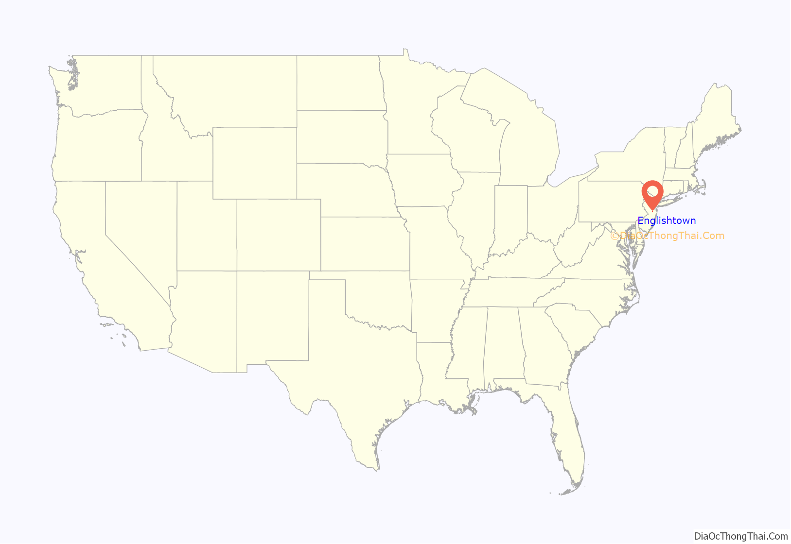
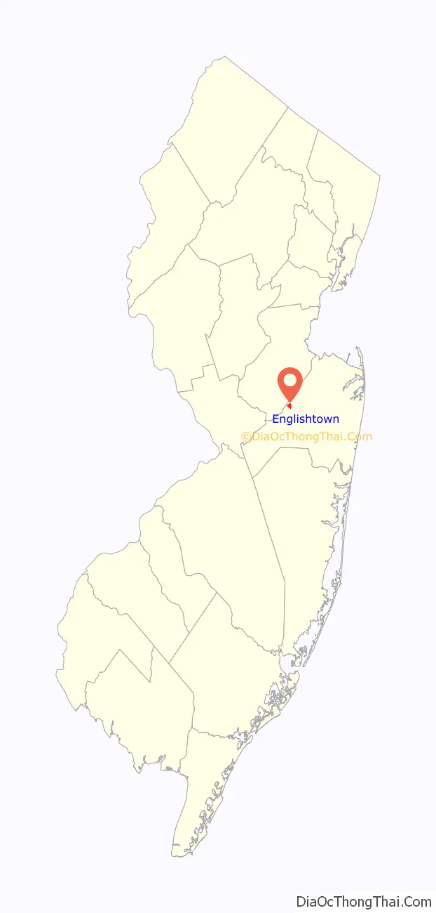
Englishtown location map. Where is Englishtown borough?
History
At the Battle of Monmouth, an American Revolutionary War battle fought on June 28, 1778, in Monmouth County, American General Charles Lee led the advance and initiated the first attack on the column’s rear. When the British turned to flank him, he ordered a general retreat without as much as firing a shot at the enemy, and his soldiers soon became disorganized. General George Washington continued the battle, earning respect for the Continental Army troops under his command. In the dining room of the Village Inn, located in the center of Englishtown, General Washington and Lord Stirling drew up the court martial papers citing Lee for his conduct during and after the battle.
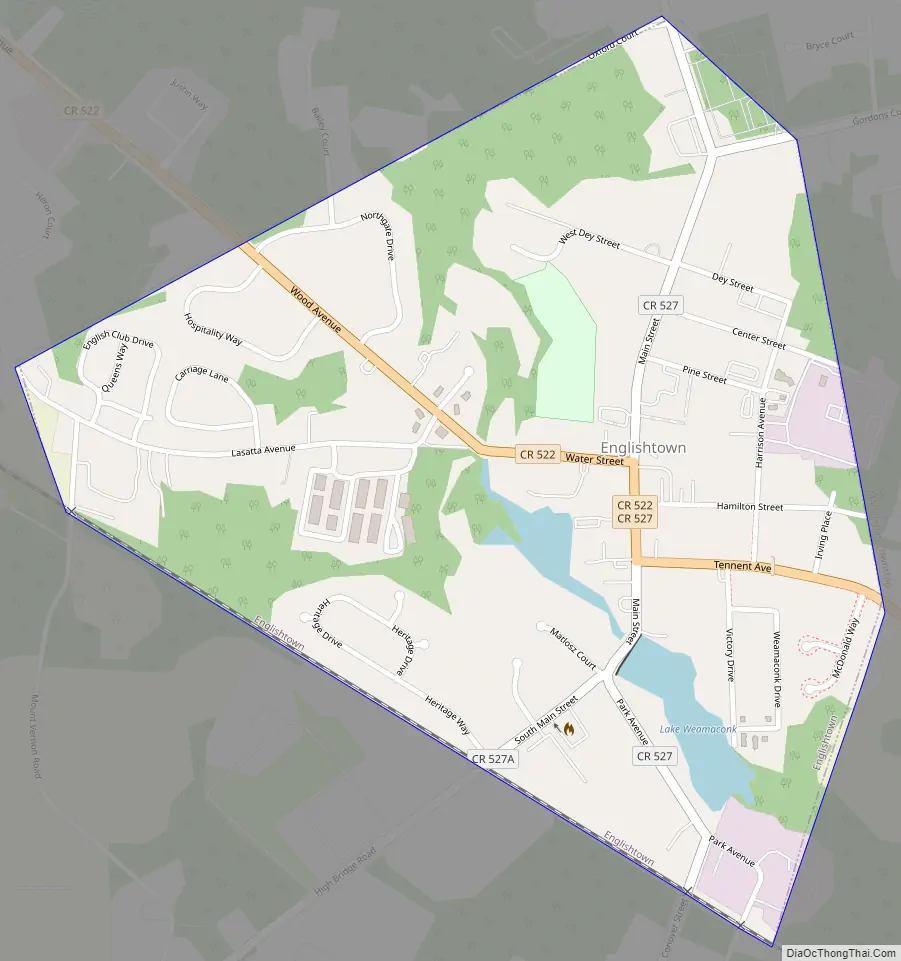
Englishtown Road Map
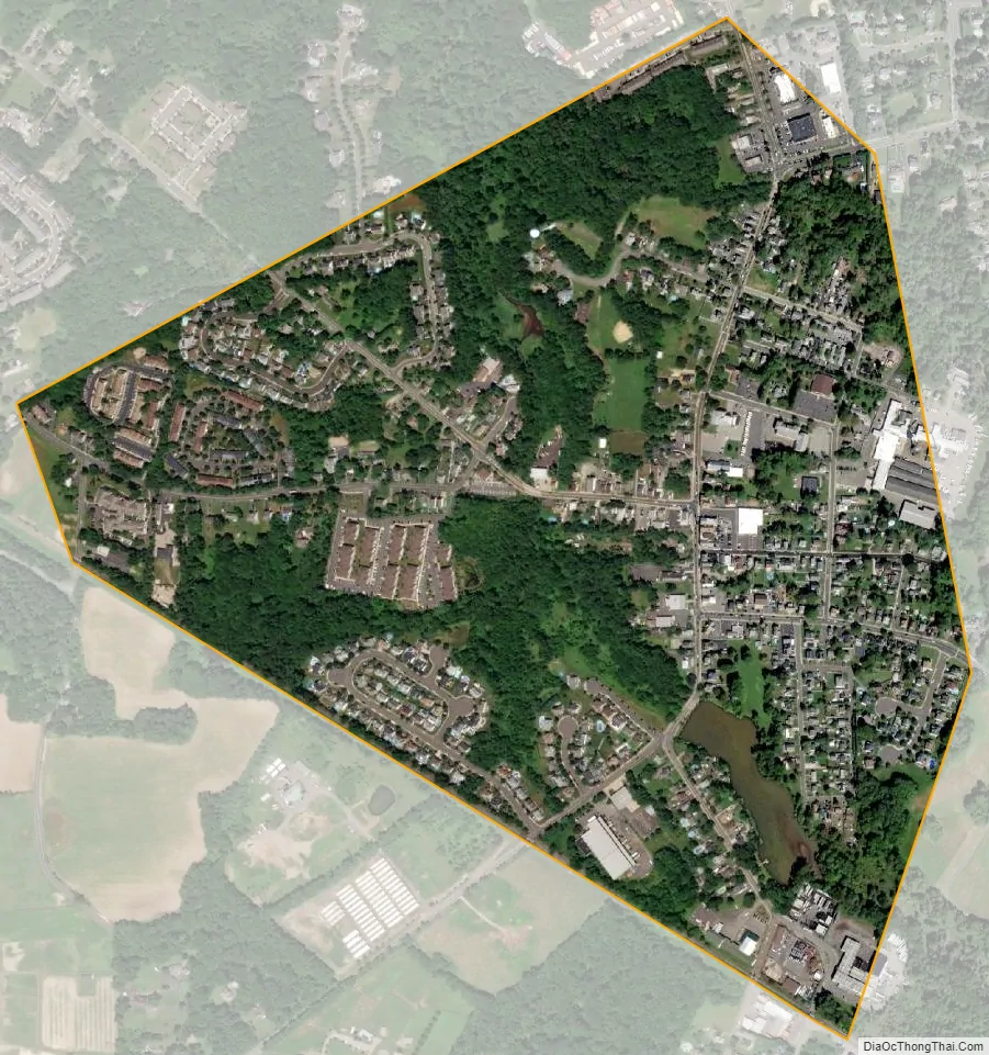
Englishtown city Satellite Map
Geography
According to the United States Census Bureau, the borough had a total area of 0.59 square miles (1.52 km), including 0.57 square miles (1.48 km) of land and 0.02 square miles (0.04 km) of water (2.88%).
The borough is entirely surrounded by Manalapan Township, making it part of 21 pairs of “doughnut towns” in the state, where one municipality entirely surrounds another.
See also
Map of New Jersey State and its subdivision: Map of other states:- Alabama
- Alaska
- Arizona
- Arkansas
- California
- Colorado
- Connecticut
- Delaware
- District of Columbia
- Florida
- Georgia
- Hawaii
- Idaho
- Illinois
- Indiana
- Iowa
- Kansas
- Kentucky
- Louisiana
- Maine
- Maryland
- Massachusetts
- Michigan
- Minnesota
- Mississippi
- Missouri
- Montana
- Nebraska
- Nevada
- New Hampshire
- New Jersey
- New Mexico
- New York
- North Carolina
- North Dakota
- Ohio
- Oklahoma
- Oregon
- Pennsylvania
- Rhode Island
- South Carolina
- South Dakota
- Tennessee
- Texas
- Utah
- Vermont
- Virginia
- Washington
- West Virginia
- Wisconsin
- Wyoming


