Atlantic Highlands is a borough in Monmouth County in the U.S. state of New Jersey, in the Bayshore Region. As of the 2020 United States census, the borough’s population was 4,414, an increase of 29 (+0.7%) from the 2010 census count of 4,385, which in turn reflected a decline of 320 (−6.8%) from the 4,705 in the 2000 census.
Atlantic Highlands contains Mount Mitchill, the highest point on the eastern seaboard south of Maine, rising 266 feet (81 m) above sea level. The borough’s name comes from its location overlooking the Atlantic Ocean.
Atlantic Highlands was incorporated as a borough by an act of the New Jersey Legislature on February 28, 1887, from portions of Middletown Township, based on the results of a referendum held that day. The borough was reincorporated on September 1, 1891.
Atlantic Highlands is part of the Bayshore Regional Strategic Plan, an effort by nine municipalities in northern Monmouth County to reinvigorate the area’s economy by emphasizing the traditional downtowns, dense residential neighborhoods, maritime history, and the natural beauty of the Raritan Bayshore coastline.
| Name: | Atlantic Highlands borough |
|---|---|
| LSAD Code: | 21 |
| LSAD Description: | borough (suffix) |
| State: | New Jersey |
| County: | Monmouth County |
| Incorporated: | February 28, 1887 |
| Elevation: | 266 ft (81 m) |
| Total Area: | 4.56 sq mi (11.82 km²) |
| Land Area: | 1.26 sq mi (3.27 km²) |
| Water Area: | 3.30 sq mi (8.54 km²) 72.35% |
| Total Population: | 4,414 |
| Population Density: | 3,491.9/sq mi (1,348.2/km²) |
| ZIP code: | 07716 |
| FIPS code: | 3402110 |
| GNISfeature ID: | 0885143 |
| Website: | www.ahnj.com |
Online Interactive Map
Click on ![]() to view map in "full screen" mode.
to view map in "full screen" mode.
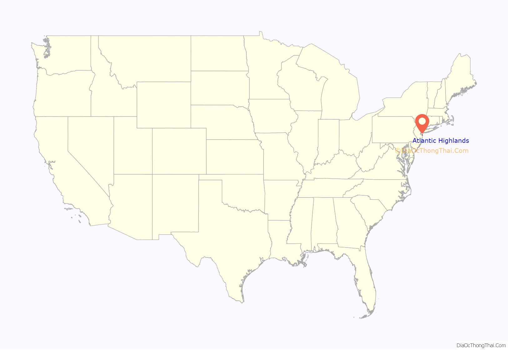
Atlantic Highlands location map. Where is Atlantic Highlands borough?

History
The town overlooks where the Atlantic Ocean and Raritan Bay meet at Sandy Hook, and its hills mark the highest point on the eastern seaboard of the U.S. south of Maine.
For hundreds of years, the original inhabitants were the Lenape, who lived in and along the cliffs and creeks of Atlantic Highlands. The Lenape traded with the Europeans and sold a group of English settlers an area that covered the entire peninsula that was named Portland Poynt. The area was laid out with 10 lots in 1667, making them the first European residents of present-day Atlantic Highlands.
Colonists convened the first Assembly of New Jersey in 1667 in what is now Atlantic Highlands. During Revolutionary War years, loyalists to the British crown and patriots of the new America clashed in repeated raids and counterattacks across these lands. Retreating English troops passed through after their defeat in 1778 by George Washington at the Battle of Monmouth.
During the late 1800s, the many farms were subdivided by resort developers, church groups and builders who created the Victorian core of the borough, attracting thousands of visitors and year-round residents.
In 1879, a surveyor was engaged to lay roads and lots for a permanent community. The Atlantic Highlands Association was formed by prominent members of the Methodist Church. This organization developed the community of Atlantic Highlands.
Individuals and groups came from New York City and the surrounding vicinity to camp along the water in tent colonies. An outdoor amphitheater was created with a large seating capacity and outstanding acoustics. An indoor auditorium was built, which was utilized for entertaining visitors at the camp meetings. In 1887, Atlantic Highlands was incorporated as a borough, containing 1.2 square miles (3.1 km) of land bordering on the Raritan Bay.
Major construction occurred from the 1880s through 1900. It included hotels, cottages, rooming houses, and private homes. A pier was built extending well into the bay to accommodate steamboats from New York City. The next twenty years saw rapid development within the community. A water and sewer system was constructed, cottages were erected, and the road system was completed. During this period of development a fire department was organized.
A number of churches saw their beginning in the 1880s: the Central Baptist, First Presbyterian, Saint Agnes Roman Catholic, First Methodist, and Saint Paul Baptist Church.
Atlantic Highlands became a haven for bootleggers during the Prohibition era.
Steamer service was the most important transport during the formation of the borough, and continued through the 1940s. In the 1890s, rail service came to Atlantic Highlands. This opened up Highlands and points south to vacationers. The 1920s saw 26 passenger trains daily passing through the borough. The Central Railroad of New Jersey built a major pier at the end of First Avenue. Several trains at a time could continue to the end of the pier to offload steamboat passengers. From the 1910s through the 1940s, the steamers Sandy Hook and the Monmouth navigated the waters bringing businessmen and vacationers to Atlantic Highlands.
The Manhattan skyline can be seen from the borough’s ridges and its shoreline. Pleasure, fishing and commuter boats sail from its harbor. The municipal harbor was built from 1938 through 1940 with municipal, state, and federal funds. It is the largest on the East Coast, home to 715 craft, including high-speed ferry service to New York City, which was introduced in 1986. In 1966, the Central Railroad of New Jersey pier was destroyed by fire. Its rail route is now used by the Henry Hudson Trail.
The bungalows on the East Side of the borough, which in the 1920s were summer bungalows, are now occupied year-round. Portland Pointe, a five-story senior citizens building, provides housing for the elderly.
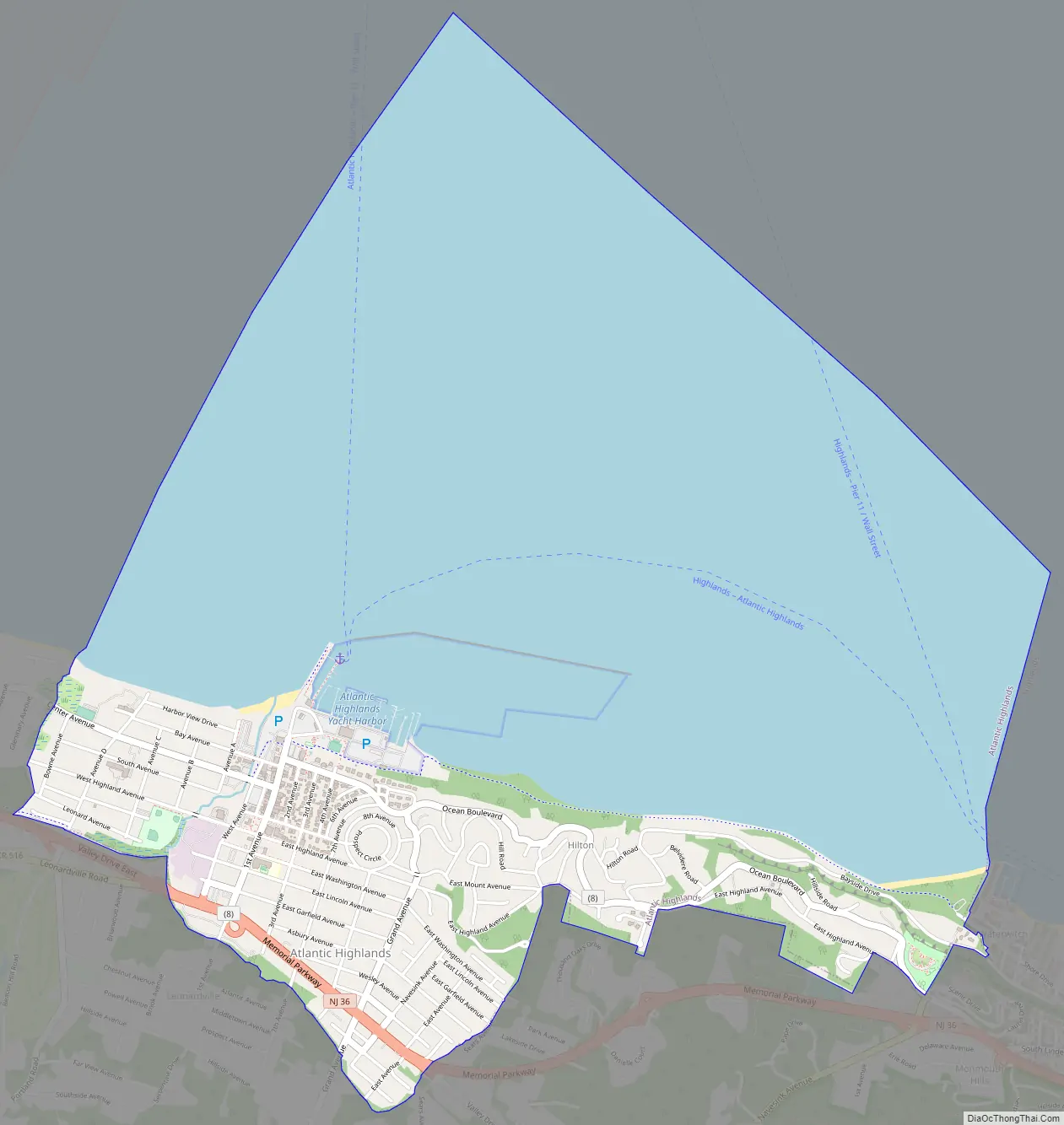
Atlantic Highlands Road Map
Atlantic Highlands city Satellite Map
Geography
According to the United States Census Bureau, the borough had a total area of 4.56 square miles (11.82 km), including 1.26 square miles (3.27 km) of land and 3.30 square miles (8.54 km) of water (72.35%).
The township borders the Monmouth County communities of Highlands and Middletown Township.
Unincorporated communities, localities and place names located partially or completely within the borough include Brevent Park, Hillside, Hilton, Hilton Park, Navesink and Stone Church.
Atlantic Highlands has a humid subtropical climate (Cfa) and average monthly temperatures range from 32.6 °F (0.3 °C) in January to 75.9 °F (24.4 °C) in July. The hardiness zone is 7a or 7b depending upon elevation.
See also
Map of New Jersey State and its subdivision: Map of other states:- Alabama
- Alaska
- Arizona
- Arkansas
- California
- Colorado
- Connecticut
- Delaware
- District of Columbia
- Florida
- Georgia
- Hawaii
- Idaho
- Illinois
- Indiana
- Iowa
- Kansas
- Kentucky
- Louisiana
- Maine
- Maryland
- Massachusetts
- Michigan
- Minnesota
- Mississippi
- Missouri
- Montana
- Nebraska
- Nevada
- New Hampshire
- New Jersey
- New Mexico
- New York
- North Carolina
- North Dakota
- Ohio
- Oklahoma
- Oregon
- Pennsylvania
- Rhode Island
- South Carolina
- South Dakota
- Tennessee
- Texas
- Utah
- Vermont
- Virginia
- Washington
- West Virginia
- Wisconsin
- Wyoming


