Harvey Cedars is a coastal borough situated on the Jersey Shore, in southern Ocean County, in the U.S. state of New Jersey. The borough encompasses a narrow strip of Long Beach Island fronting both the Atlantic Ocean and Barnegat Bay. As of the 2020 United States census, the borough’s population was 391, its highest decennial count ever and an increase of 54 (+16.0%) from the 2010 census count of 337, which in turn reflected a decline of 22 (−6.1%) from the 359 counted at the 2000 census.
Harvey Cedars was incorporated as a borough by an act of the New Jersey Legislature on December 15, 1894, from portions of Union Township (now Barnegat Township), based on the results of a referendum held on November 20, 1894. The community’s post office was initially known as High Point, the name of a neighborhood in the borough that lies at a higher elevation, before a name change was made in the 1930s at the request of the United States Postal Service to differentiate the post office from the northern New Jersey community of High Point in Sussex County.
The majority of the housing units in the borough are seasonal houses used primarily in the summer by owners who live elsewhere, bringing the summer population to 12,000. The borough’s quiet character and bay and ocean access make housing very expensive, with many bay or oceanfront houses priced at $2 million or more. Despite the borough’s small size, its property was assessed at over $1.28 billion in 2019.
| Name: | Harvey Cedars borough |
|---|---|
| LSAD Code: | 21 |
| LSAD Description: | borough (suffix) |
| State: | New Jersey |
| County: | Ocean County |
| Incorporated: | November 20, 1894 |
| Elevation: | 3 ft (0.9 m) |
| Total Area: | 1.19 sq mi (3.08 km²) |
| Land Area: | 0.56 sq mi (1.45 km²) |
| Water Area: | 0.63 sq mi (1.62 km²) 52.61% |
| Total Population: | 391 |
| Population Density: | 696.7/sq mi (269.0/km²) |
| ZIP code: | 08008 |
| Area code: | 609 exchanges: 207, 361, 492, 494 |
| FIPS code: | 3430390 |
| GNISfeature ID: | 0885246 |
| Website: | www.harveycedars.org |
Online Interactive Map
Click on ![]() to view map in "full screen" mode.
to view map in "full screen" mode.
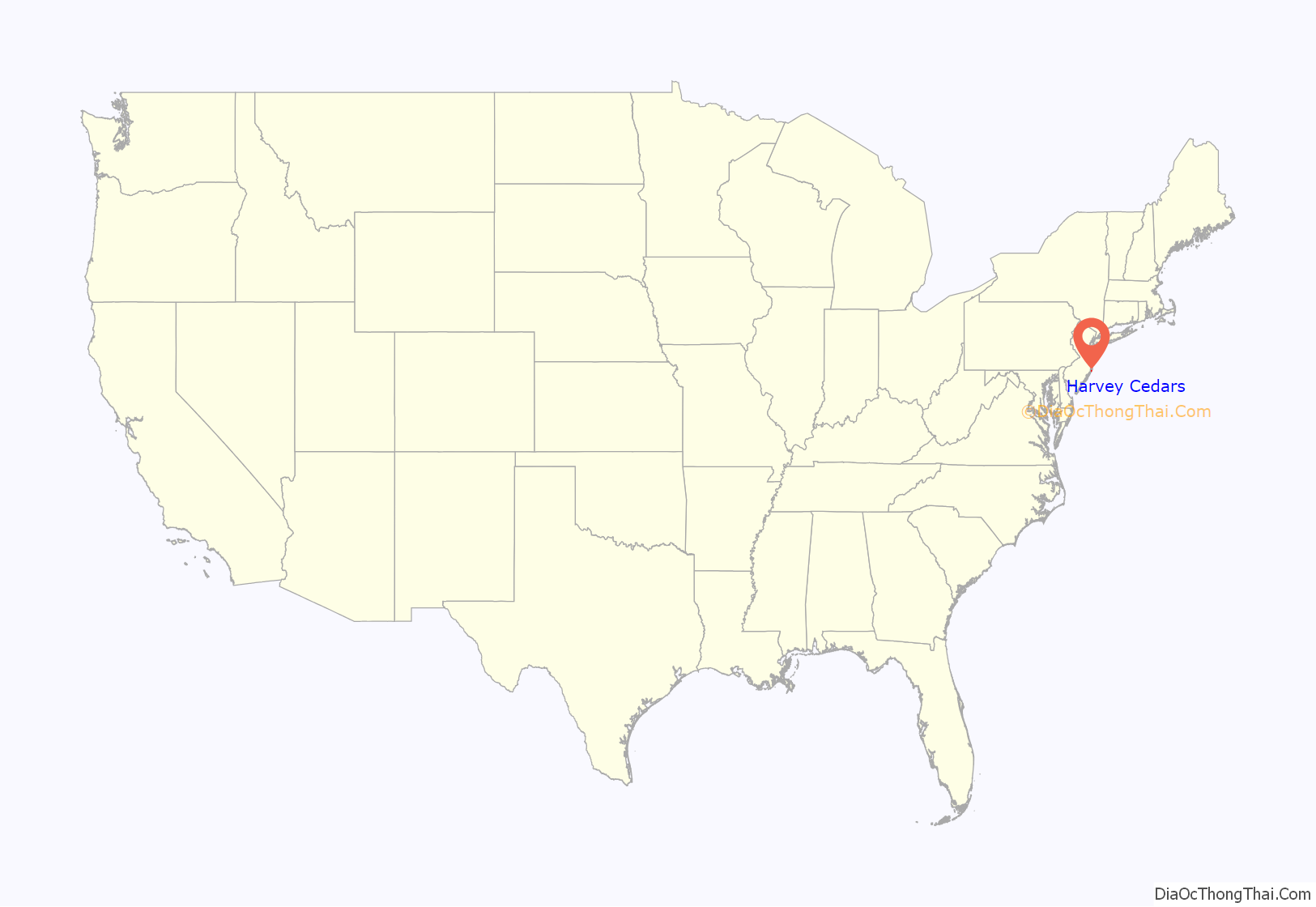
Harvey Cedars location map. Where is Harvey Cedars borough?
History
Before Long Beach Island was developed, its northern area, from the Barnegat Inlet to the Great Swamp (now Surf City), was covered with Atlantic white cedar (chamaecyparis thyoides). Early inhabitants of the area harvested salt hay (spartina patens) and seaweed to make a living.
The earliest reference to the area was a deed from 1751 that called the place “Harvest Quarters”. The name “Harvey Cedars” may be derived from the “harvest” housing used by these farmers and the “cedars” that grew in the area.
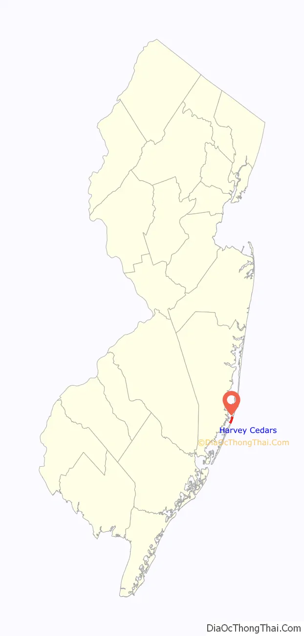
Harvey Cedars Road Map

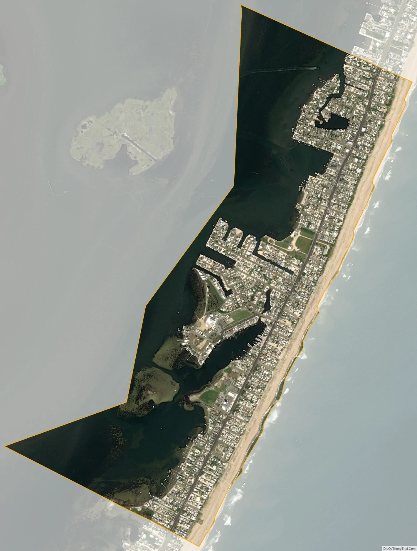
Harvey Cedars city Satellite Map
Geography
According to the United States Census Bureau, the borough had a total area of 1.19 square miles (3.08 km), including 0.56 square miles (1.45 km) of land and 0.63 square miles (1.62 km) of water (52.61%).
Unincorporated communities, localities and place names located partially or completely within the borough include High Point.
The borough borders the Ocean County municipalities of Barnegat Township, Long Beach Township and Stafford Township.
See also
Map of New Jersey State and its subdivision: Map of other states:- Alabama
- Alaska
- Arizona
- Arkansas
- California
- Colorado
- Connecticut
- Delaware
- District of Columbia
- Florida
- Georgia
- Hawaii
- Idaho
- Illinois
- Indiana
- Iowa
- Kansas
- Kentucky
- Louisiana
- Maine
- Maryland
- Massachusetts
- Michigan
- Minnesota
- Mississippi
- Missouri
- Montana
- Nebraska
- Nevada
- New Hampshire
- New Jersey
- New Mexico
- New York
- North Carolina
- North Dakota
- Ohio
- Oklahoma
- Oregon
- Pennsylvania
- Rhode Island
- South Carolina
- South Dakota
- Tennessee
- Texas
- Utah
- Vermont
- Virginia
- Washington
- West Virginia
- Wisconsin
- Wyoming


