Surf City is a borough in Ocean County, in the U.S. state of New Jersey. As of the 2020 United States census, the borough’s population was 1,243, an increase of 38 (+3.2%) from the 2010 census count of 1,205, which in turn reflected a decline of 237 (−16.4%) from the 1,442 counted in the 2000 census. The borough borders the Atlantic Ocean on Long Beach Island.
What is now Surf City was originally formed as Long Beach City borough by an act of the New Jersey Legislature on September 19, 1894, from portions of Stafford Township, based on the results of a referendum held the previous day. The borough was renamed Surf City by a resolution of the Borough Council as of May 26, 1899. The name was changed to avoid confusion with other places on the island and along the Jersey Shore.
| Name: | Surf City borough |
|---|---|
| LSAD Code: | 21 |
| LSAD Description: | borough (suffix) |
| State: | New Jersey |
| County: | Ocean County |
| Incorporated: | September 19, 1894 as Long Beach City |
| Elevation: | 3 ft (0.9 m) |
| Total Area: | 1.32 sq mi (3.43 km²) |
| Land Area: | 0.74 sq mi (1.93 km²) |
| Water Area: | 0.58 sq mi (1.50 km²) 43.94% |
| Total Population: | 1,243 |
| Population Density: | 1,670.6/sq mi (645.0/km²) |
| ZIP code: | 08008 – Beach Haven |
| Area code: | 609 |
| FIPS code: | 3471640 |
| GNISfeature ID: | 0885413 |
| Website: | surfcitynj.org |
Online Interactive Map
Click on ![]() to view map in "full screen" mode.
to view map in "full screen" mode.
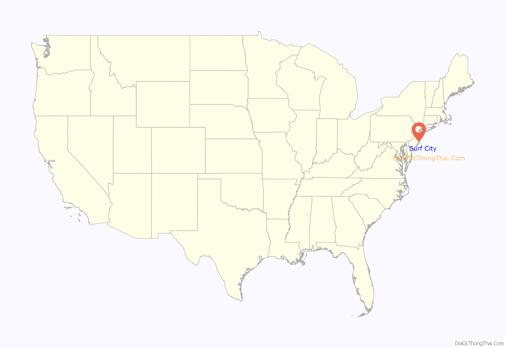
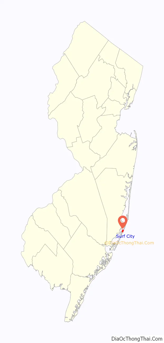
Surf City location map. Where is Surf City borough?
History
Present-day Surf City was home to one of the earliest big boarding hotels on the Jersey Shore, called the Mansion of Health, one of whose owners was Hudson Buzby. In the 1830s and 1840s, the area surrounding this hotel was called “Buzby’s Place”. The Mansion of Health burned down in 1874, but some old-timers still call the cove at the foot of South First Street on the bay side “Mansion Cove.”
In 1875, the 20 or so permanent residents of the area decided to call the area Long Beach City, even though the area was still part of Stafford Township. In 1894, Surf City was incorporated, changing its name to Surf City in 1899 after the United States Postal Service required a name change before the town could incorporate, preventing it from being confused with Long Branch in Monmouth County.
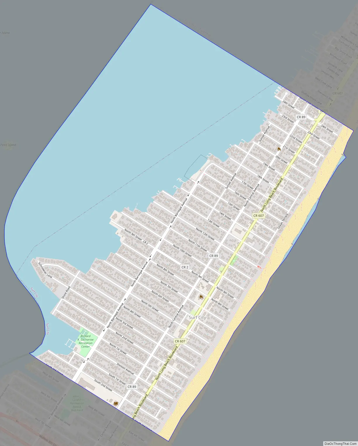
Surf City Road Map
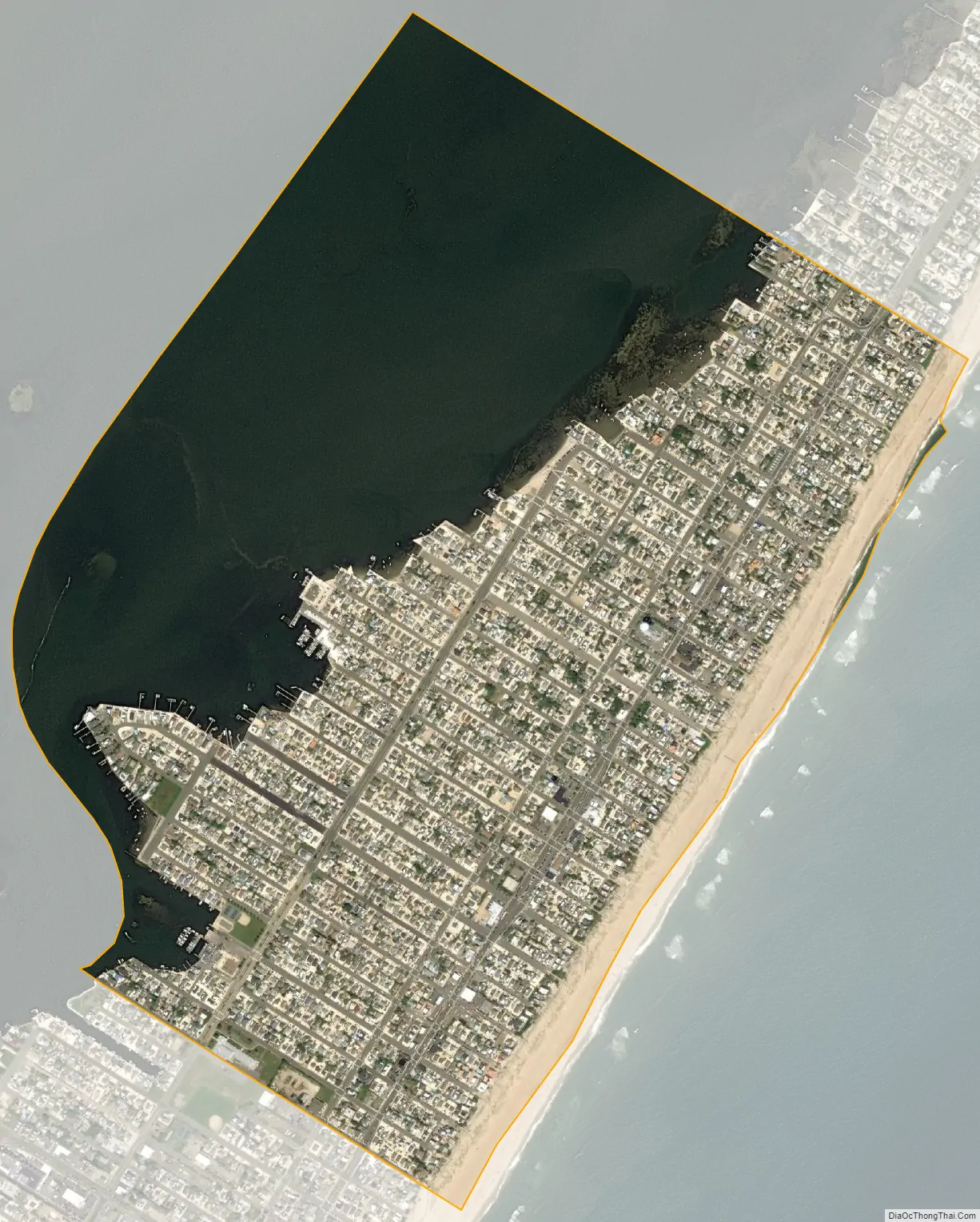
Surf City city Satellite Map
Geography
According to the United States Census Bureau, the borough had a total area of 1.32 square miles (3.43 km), including 0.74 square miles (1.93 km) of land and 0.58 square miles (1.5 km) of water (43.94%).
The borough is located 57 mi (92 km) east-southeast of Philadelphia and 71 mi (114 km) south of New York City. Surf City is also 60 mi (97 km) from the capitol of New Jersey, Trenton.
The borough borders the Ocean County municipalities of Long Beach Township, Ship Bottom and Stafford Township.
See also
Map of New Jersey State and its subdivision: Map of other states:- Alabama
- Alaska
- Arizona
- Arkansas
- California
- Colorado
- Connecticut
- Delaware
- District of Columbia
- Florida
- Georgia
- Hawaii
- Idaho
- Illinois
- Indiana
- Iowa
- Kansas
- Kentucky
- Louisiana
- Maine
- Maryland
- Massachusetts
- Michigan
- Minnesota
- Mississippi
- Missouri
- Montana
- Nebraska
- Nevada
- New Hampshire
- New Jersey
- New Mexico
- New York
- North Carolina
- North Dakota
- Ohio
- Oklahoma
- Oregon
- Pennsylvania
- Rhode Island
- South Carolina
- South Dakota
- Tennessee
- Texas
- Utah
- Vermont
- Virginia
- Washington
- West Virginia
- Wisconsin
- Wyoming


