Highlands is a borough in northern Monmouth County, in the U.S. state of New Jersey. An historic waterfront community located on the Raritan Bay within the Raritan Valley region, this scenic borough is a commuter town of New York City in the New York metropolitan area. As of the 2020 United States census, the borough’s population was 4,621, a decrease of 384 (−7.7%) from the 2010 census count of 5,005, which in turn reflected a decline of 92 (−1.8%) from the 5,097 counted in the 2000 census. The eastern part of the town is on a high bluff that overlooks Sandy Hook Bay, the entrance to New York Harbor, and the Atlantic Ocean, from which the borough derives its name. Atop this bluff are the Navesink Twin Lights.
Highlands was incorporated as a borough by an act of the New Jersey Legislature on March 22, 1900, from parts of Middletown Township. Additional parts of Middletown Township were annexed in 1914.
Highlands is part of the Bayshore Regional Strategic Plan, an effort by nine municipalities in northern Monmouth County to reinvigorate the area’s economy by emphasizing the traditional downtowns, residential neighborhoods, maritime history, and the natural environment of the Raritan Bayshore coastline.
On October 29, 2012, Hurricane Sandy struck the eastern seaboard of the United States, making landfall just north of Atlantic City, before causing significant damage to businesses and homes in the borough.
| Name: | Highlands borough |
|---|---|
| LSAD Code: | 21 |
| LSAD Description: | borough (suffix) |
| State: | New Jersey |
| County: | Monmouth County |
| Incorporated: | March 22, 1900 |
| Elevation: | 13 ft (4 m) |
| Total Area: | 1.39 sq mi (3.59 km²) |
| Land Area: | 0.74 sq mi (1.92 km²) |
| Water Area: | 0.65 sq mi (1.67 km²) 46.47% |
| Total Population: | 4,621 |
| Population Density: | 6,244.6/sq mi (2,411.1/km²) |
| ZIP code: | 07732 |
| Area code: | 732 exchanges: 291, 708, 872 |
| FIPS code: | 3431500 |
| GNISfeature ID: | 0885253 |
| Website: | www.highlandsborough.org |
Online Interactive Map
Click on ![]() to view map in "full screen" mode.
to view map in "full screen" mode.
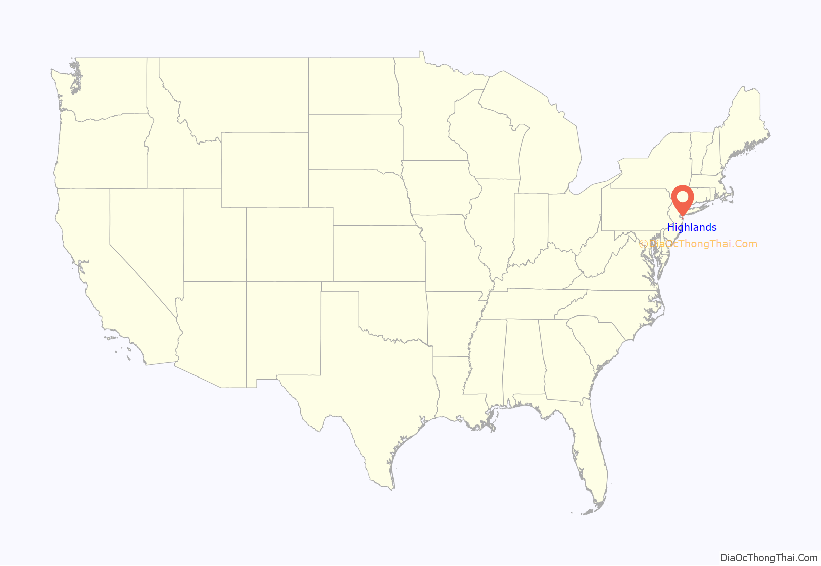
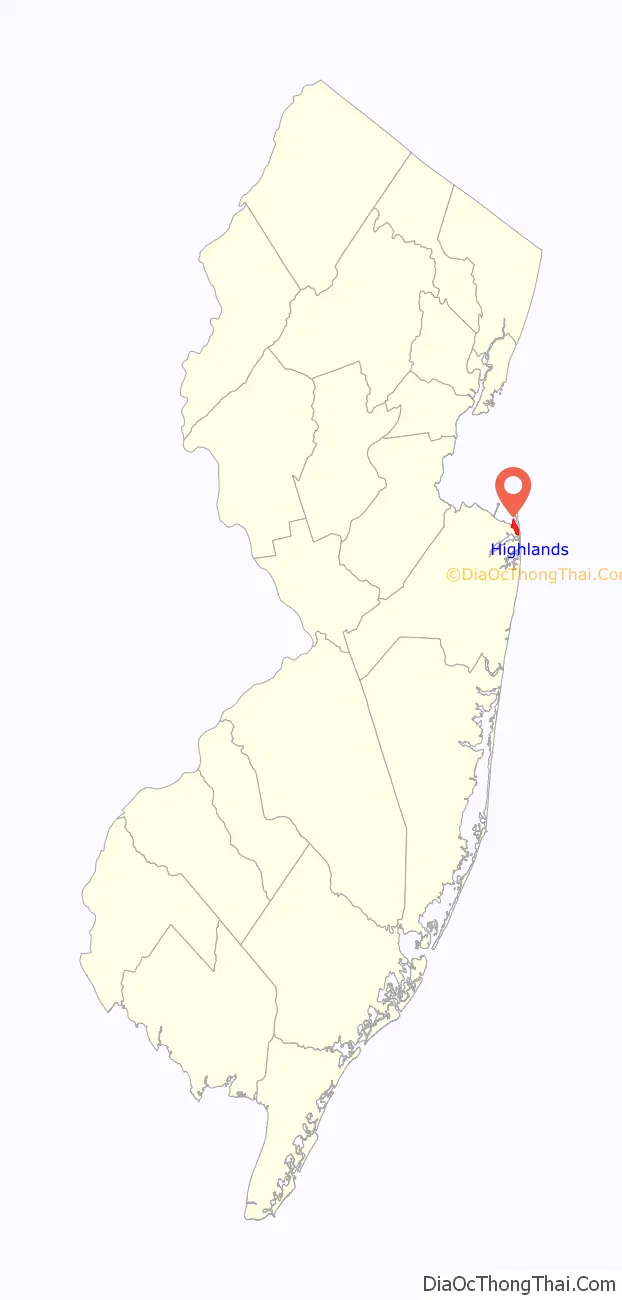
Highlands location map. Where is Highlands borough?
History
Giovanni da Verrazzano explored the area known today as Highlands in 1525. During the next two centuries, the Highlands area would welcome English and Dutch settlers. Even by the 20th Century, many immigrants saw the hills of the Highlands of Navesink which were almost 300 feet (91 m) above sea level.
The oldest route to the eastern coast of the United States is the Minisink Trail which started on the upper Delaware River, came through northern New Jersey and ended at the Navesink River. Navesink means “good fishing spot” in the native tongue at the time. The trail was used by Native Americans, such as the Algonquin and Lenni Lenapi tribes. They came from all over New Jersey to spend the summer fishing and finding clams. The Newasunks, Raritans, and Sachem Papomorga (or Lenni Lenapis) were the most prevalent tribes and stayed the longest. These were the tribes which mostly traded with early settlers.
One year after Verrazzano explored the area, Portuguese explorer Estevan Gomez visited the Highlands of Navesink and created the first maps of the area. These were the maps in which Sandy Hook was first drawn and called “Cabo de Arenas” or “Cape of Sands.”
In 1609, Henry Hudson sailed into the Sandy Hook Bay and wrote: “This is very good land to fall in with and a pleasant land to see. Our men went on land, so they went up into the woods and saw great stores of very goodly oaks and some currants”. One of Hudson’s crew became the first man killed by Native Americans who were frightened by his scouting party.
Many years after Hudson’s trip to the area, the Highlands of Navesink saw a number of Dutch who traded with the Navesink Indians and prepared nautical charts. William Reape, one of the Dutch, made a bargain with the local natives to trade land in exchange for rum, blankets and gunpowder.
Eventually, the Dutch settlers named the land “Rensselaer’s Hoeck,” but British settlers took over and renamed the settlement “Portland” in 1664. The group purchasing the land included James Hubbard, John Bawne, John Tilton Jr., Richard Stout, William Goulding and Samuel Spear.
Three years later, in 1677, Richard Hartshorne purchased a 2,320-acre (940 ha) tract of land from the Native Americans which provided him with control of nearly all of Sandy Hook and Highlands which was then called “Portland Poynt.” Hartshorne and his family became the first permanent settlers of the area.
Some early settlers soon realized the importance Highlands and Sandy Hook would have in the defense of the country. People in Highlands and Sandy Hook could warn New York of any enemies approaching by sea and also to help guide ships into New York harbor. In 1762, New York merchants purchased a four-acre site from the Hartshorne family for a light house. Two years later, the Sandy Hook Light House was lighted for the first time.
The hills of the Highlands of Navesink and Sandy Hook also played an important role during the American Revolutionary War. It was a vital strategic site for the British and Colonial Armies. When the British fleet arrived close to Sandy Hook in 1776, sympathizers with the British built fortifications and with the help of the British were able to hold Sandy Hook for the remainder of the Revolutionary War. The Loyalists stayed in control of Sandy Hook even after the war was ended by the surrender of Cornwallis at Yorktown on October 19, 1781.
Captain Joshua Huddy was the eldest of seven brothers and a member of the Monmouth Continental Militia. He pursued gangs of Tory (Loyalist) refugees who plundered the area searching for American rebels. The refugees made Huddy a target and tried to kill him several times. Unfortunately, one of the Loyalists’ raids from Sandy Hook ended with setting Huddy’s house on fire. Huddy agreed to surrender if they would help him to put out the fire. They agreed and took Huddy as a prisoner. The fire from the house had attracted the attention of Huddy’s neighbors and the local militia raced after the Tories, catching them before they could reach their boats at Black Point in Rumson. In the fight that ensued, Huddy escaped.
However, two years later the Loyalists captured Huddy and brought him to Gravelly Point in Highlands where he was allowed to write his will. Then Huddy was hanged for the death of Captain Philip White who had been captured by Rebels earlier in Long Branch and shot while being transported to Freehold. Huddy was not involved in the shooting, as he was in a British prison at the time, but was hanged anyway. His body was carried by patriots to Freehold and buried. Today, a monument in Huddy Park honors Captain Joshua Huddy.
In 1796, the first hotel in the Highlands of Navesink was built and many other hotels were built until the War of 1812. Two years later, the tourism began to grow and new hotels were built on Sandy Hook and on the hills of Highlands. In addition, a number of new homes were being built and visitors were coming to Highlands by the boatload.
Author James Fenimore Cooper, author of Last of the Mohicans, also wrote Water Witch, a novel which was inspired by his visits to Highlands. Walt Whitman, one of America’s most famous poets, celebrated his excursions to Highlands in his journals and a group of his poems entitled, “Fancies at Navesink.”
By 1880, numerous hotels, beach pavilions and private clubs were flourishing in Highlands. It was the beginning of a glorious era for the small town on the Shrewsbury River. Trains and steamships brought vacationers to celebrate post-Civil War prosperity.
New York theatrical producers and famous actors built summer homes in Highlands. The area became so popular that Harper’s Magazine sent a journalist down nearly every summer in the 1870s and 1880s to write about the community and its people.
The Seashore Railroad had been built on the Sandy Hook peninsula during 1865 and a ferry service was established to take passengers across the river from Highlands to his hotel on Sandy Hook. Then a bridge was constructed in 1872 and the ferry service ceased operations. The new drawbridge was about 1,500 feet (460 m) and 18 feet (5.5 m) wide. It was constructed at a cost of $35,000 and opened in 1872, but was closed for three years when a schooner ran into it in 1875. By 1883, a railroad came to Atlantic Highlands and in 1892 the old draw bridge at Highlands was torn down and a new railroad bridge was built by the New Jersey Central Railroad Company for their coastal line. This new bridge for rail, vehicular, and foot traffic was opened in 1892.
On Lighthouse Hill were the Twin Lights which is one of the most historic sites in the nation. Built in 1862, it was the first twin light house, the first electric powered light, the first glimpse of America for incoming ships, the first in the nation to use the Fresnel lens, the first to use wireless telegraphy, and the site of the first experiments with radar.
Light House Hill (also known as Beacon Hill) was employed as a site for a beacon as early as 1746, when England was in conflict with France in the War of Austrian Succession, and the colonies of both were up for grabs. The beacon—whale oil burned in pots—was not only to welcome sailors, but to warn citizens that the French were coming up the harbor and it was time to take down the musket from over the fireplace. During the Revolutionary War, the beacon served the same purpose, only Britain was the enemy.
In 1899, Guglielmo Marconi, the inventor of wireless telegraphy demonstrated his invention at the Twin Lights so the New York Herald could be the first to have news of the 1899 America’s Cup races to be run off the New Jersey Coast.
By the 1920s, Highlands was a popular tourist destination. By 1932, however, century-long steamboat operations on the Shrewsbury and Navesink Rivers came quickly to an end.
Before World War II, the northern tower was the first place where experiments with radar were held. So successful were the tests that, soon after the war, radar was the major tool of navigation and the government decided to decommission the Twin Lights and abandon the building as an operative light house.
During 1900, Highlands was incorporated and passed an ordinance prohibiting horses, cows and pigs from running loose on the streets. It also ordered that three-inch hemlock and chestnut planking be used as curbs along the officially designated streets.
By 1920 the “manufacture, sale or transportation of intoxicating liquors” was prohibited. However, “rum-running” was a common practice for New Jersey’s beachfront and Highlands became the main port for the infamous trade. Highlands also had great boat-building facilities which could produce boats faster than the authorities could catch. The Jersey Skiff, designed and built in Highlands, became the primary craft to be used in the smuggling operations.
Highlands became known for sport fishing in the 1920s. Today, countless boats can be seen in the rivers, bays and ocean to catch fluke, bluefish, striped bass or whiting.
Clamming was an important activity here for the Native Americans and the first settlers learned from them. A writer in 1890 reported that clams were to Parkertown what the whale once was to Nantucket.
Gertrude Ederle spent all of her summers in Highlands and learned to swim at the beach on Miller Street. She would swim from Sandy Hook to the Highlands Bridge in two hours and forty minutes to train for her famous English Channel swim in 1926. She became the first woman to swim the English Channel, and also the first to be given a ticker-tape parade on Broadway. Ederle attended the 1975 dedication of a park in Highlands named in her honor.
During 1975, all military installations on Sandy Hook (except for the U.S. Coast Guard) were decommissioned and the land was given to the National Park Service to become the Gateway National Recreation Area.
In 2012, during Hurricane Sandy, the borough was heavily damaged when a storm surge of nearly 10 feet (3.0 m) swept in from the bay beginning October 28. Most homes and businesses, including the Bahrs Landing and Lusty Lobster fishery were either damaged or totally destroyed. With 80% of homes and most businesses severely damaged by the storm, considerations were made for a $25 million project to raise the borough by about 10 feet (3.0 m) as a long-term solution to flooding.
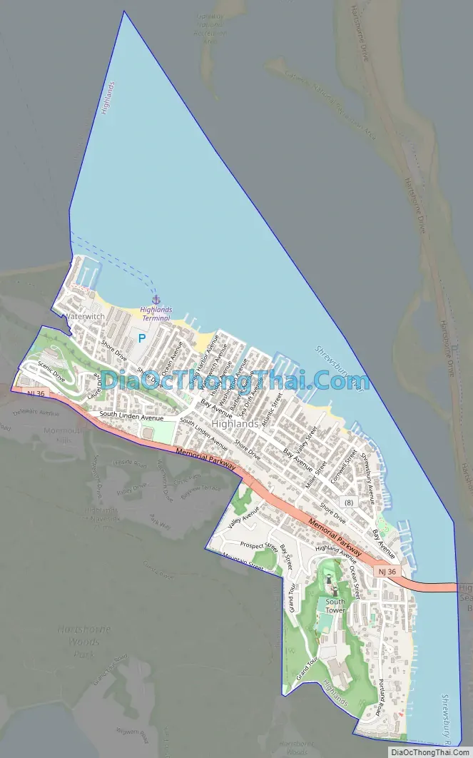
Highlands Road Map
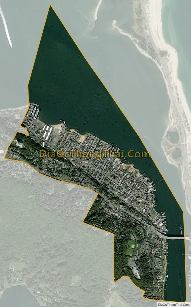
Highlands city Satellite Map
Geography
According to the United States Census Bureau, the borough had a total area of 1.39 square miles (3.59 km), including 0.74 square miles (1.92 km) of land and 0.65 square miles (1.67 km) of water (46.47%).
Unincorporated communities, localities and place names located partially or completely within the borough include Parkertown and Waterwitch (also spelled as “Water Witch”).
The borough borders the Monmouth County municipalities of Atlantic Highlands, Middletown Township and Sea Bright.
Climate
The climate in this area is characterized by hot, humid summers and generally mild to cool winters. According to the Köppen Climate Classification system, Highlands has a humid subtropical climate, abbreviated “Cfa” on climate maps.
See also
Map of New Jersey State and its subdivision: Map of other states:- Alabama
- Alaska
- Arizona
- Arkansas
- California
- Colorado
- Connecticut
- Delaware
- District of Columbia
- Florida
- Georgia
- Hawaii
- Idaho
- Illinois
- Indiana
- Iowa
- Kansas
- Kentucky
- Louisiana
- Maine
- Maryland
- Massachusetts
- Michigan
- Minnesota
- Mississippi
- Missouri
- Montana
- Nebraska
- Nevada
- New Hampshire
- New Jersey
- New Mexico
- New York
- North Carolina
- North Dakota
- Ohio
- Oklahoma
- Oregon
- Pennsylvania
- Rhode Island
- South Carolina
- South Dakota
- Tennessee
- Texas
- Utah
- Vermont
- Virginia
- Washington
- West Virginia
- Wisconsin
- Wyoming


