Roselle (/roʊˈzɛl/, row-ZELL) is a borough located in Union County in the U.S. state of New Jersey, United States. As of the 2020 United States census, the borough’s population was 22,695, an increase of 1,610 (+7.6%) from the 2010 census count of 21,085, which in turn reflected a decline of 189 (−0.9%) from the 21,274 counted in the 2000 census.
On January 19, 1883, the world’s first electric lighting system employing overhead wires began service in Roselle. It had been built by Thomas Edison to demonstrate that an entire community could be illuminated by electricity. This success encouraged the installation of electric lighting in numerous other villages and cities. The First Presbyterian Church, located on the corner of West 5th Avenue and Chestnut Street, was the first church in the United States to be lit by electricity, and the second in the world after the City Temple church in London.
Roselle was incorporated on December 20, 1894, at the height of the Boroughitis phenomenon sweeping through New Jersey at the time, based on the results of a referendum held two days earlier, from portions of Linden. Roselle’s name is derived from the Roselle Land Improvement Company, which was created in 1866 to lay out a community around the Mulford Station on the Central Railroad of New Jersey. The name “Roselle” is said to have been based on the company’s founder, John Conklin Rose or from John Pierre Roselle, a friend of the railroad’s president.
| Name: | Roselle borough |
|---|---|
| LSAD Code: | 21 |
| LSAD Description: | borough (suffix) |
| State: | New Jersey |
| County: | Union County |
| Incorporated: | December 20, 1894 |
| Elevation: | 56 ft (17 m) |
| Total Area: | 2.65 sq mi (6.86 km²) |
| Land Area: | 2.63 sq mi (6.82 km²) |
| Water Area: | 0.01 sq mi (0.03 km²) 0.49% |
| Total Population: | 22,695 |
| Population Density: | 8,612.9/sq mi (3,325.5/km²) |
| ZIP code: | 07203 |
| Area code: | 908 |
| FIPS code: | 3464620 |
| GNISfeature ID: | 0885379 |
| Website: | www.boroughofroselle.com |
Online Interactive Map
Click on ![]() to view map in "full screen" mode.
to view map in "full screen" mode.
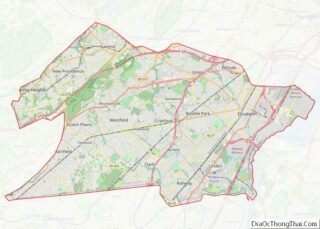
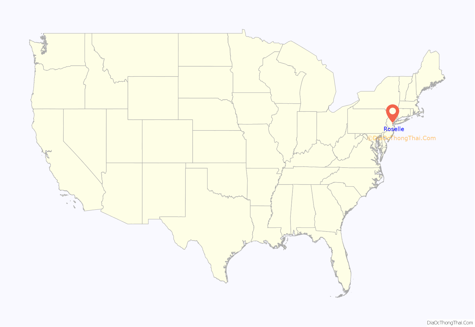
Roselle location map. Where is Roselle borough?
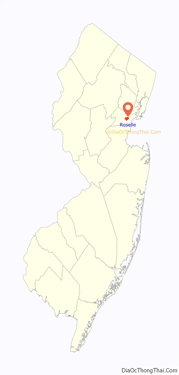
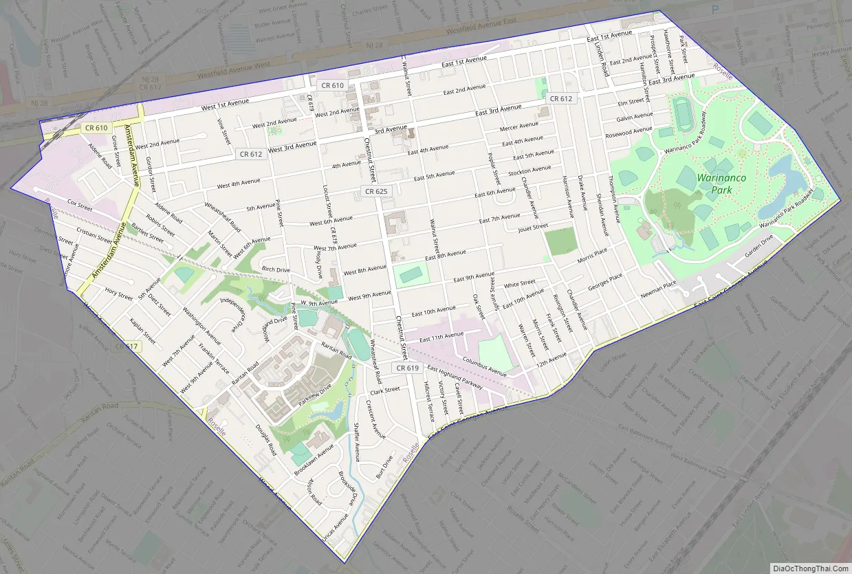
Roselle Road Map
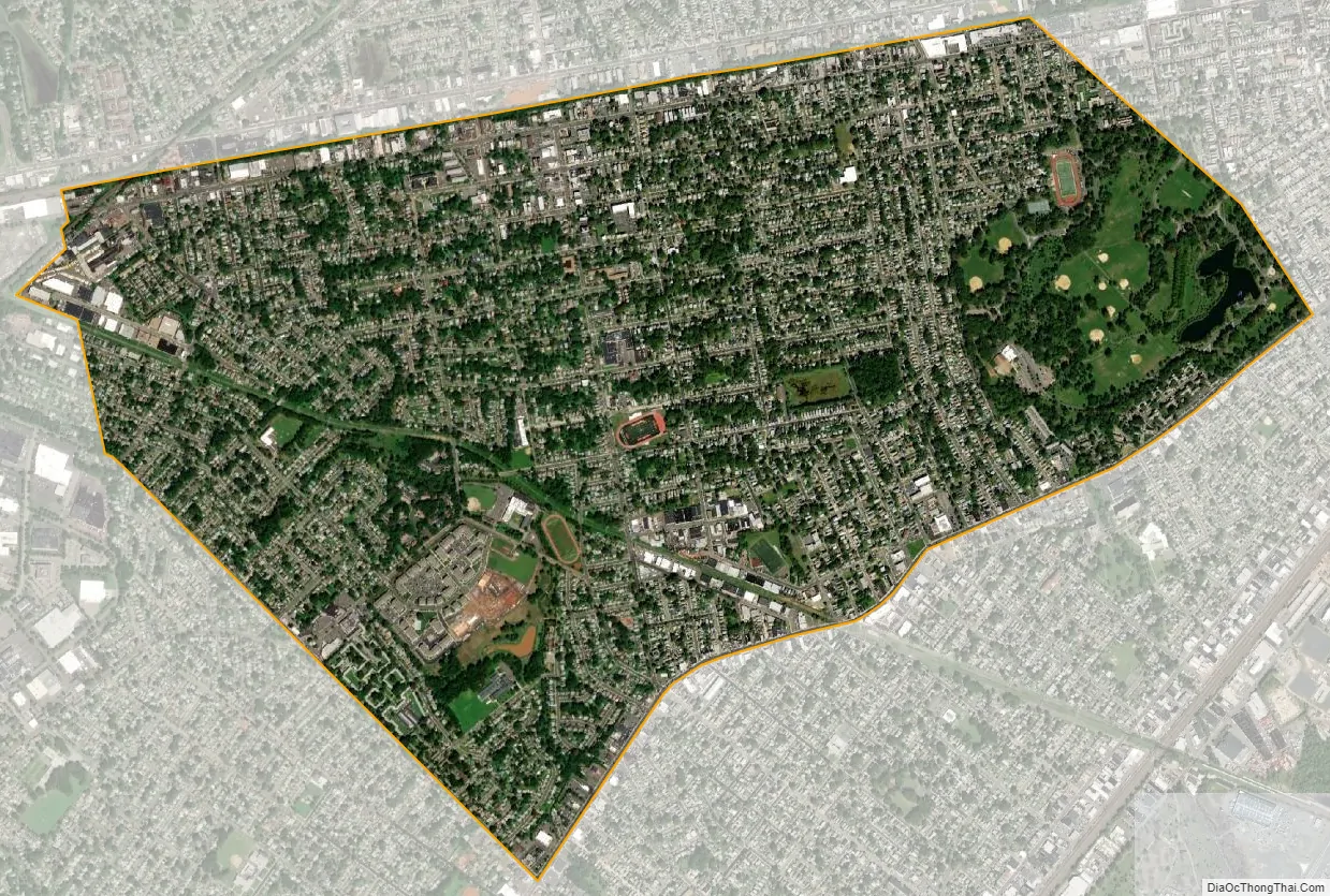
Roselle city Satellite Map
Geography
According to the United States Census Bureau, the borough had a total area of 2.65 square miles (6.86 km), including 2.64 square miles (6.82 km) of land and 0.01 square miles (0.03 km) of water (0.49%).
Unincorporated communities, localities and place names located partially or completely within the borough include Aldene.
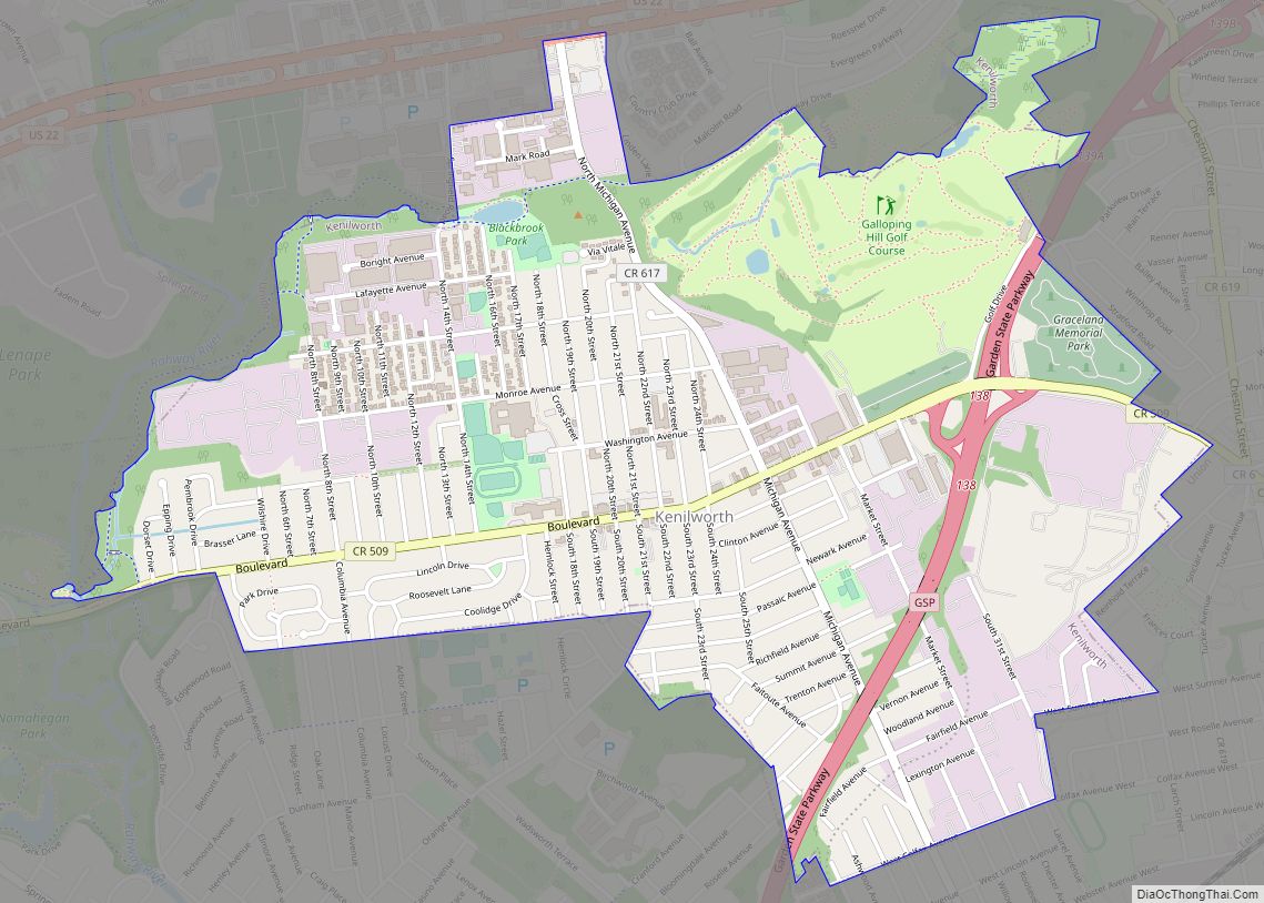
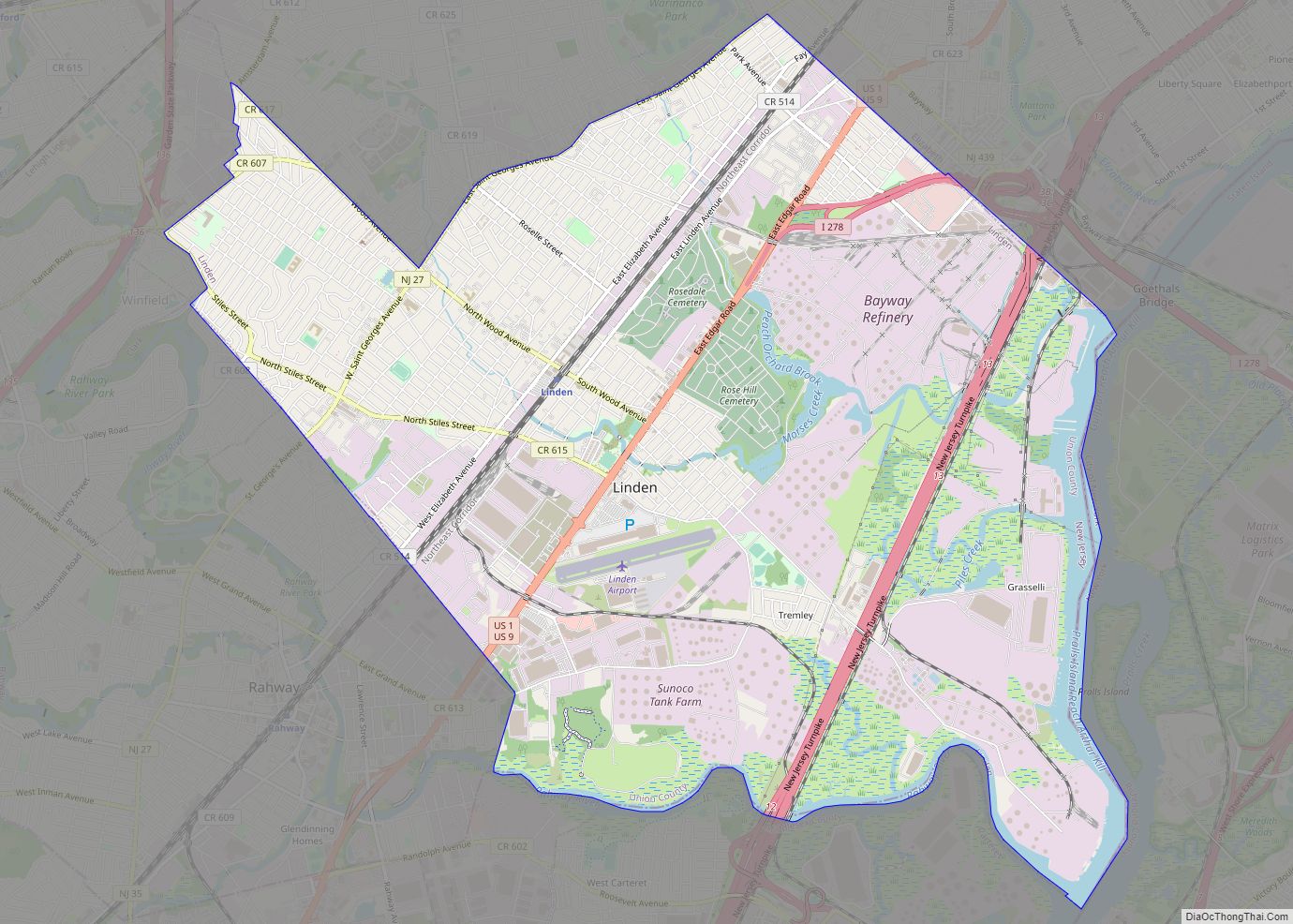
The borough is bordered by the Union County municipalities of Roselle Park to the north, Linden to the south and Cranford to the west and Elizabeth, along the edges of Warinanco Park, to the east. Morses Creek runs through the borough.
See also
Map of New Jersey State and its subdivision: Map of other states:- Alabama
- Alaska
- Arizona
- Arkansas
- California
- Colorado
- Connecticut
- Delaware
- District of Columbia
- Florida
- Georgia
- Hawaii
- Idaho
- Illinois
- Indiana
- Iowa
- Kansas
- Kentucky
- Louisiana
- Maine
- Maryland
- Massachusetts
- Michigan
- Minnesota
- Mississippi
- Missouri
- Montana
- Nebraska
- Nevada
- New Hampshire
- New Jersey
- New Mexico
- New York
- North Carolina
- North Dakota
- Ohio
- Oklahoma
- Oregon
- Pennsylvania
- Rhode Island
- South Carolina
- South Dakota
- Tennessee
- Texas
- Utah
- Vermont
- Virginia
- Washington
- West Virginia
- Wisconsin
- Wyoming