Manasquan (/mænəskwɑːn/, man-ə-SKWAHN) is a borough in Monmouth County, in the U.S. state of New Jersey, on the Jersey Shore. As of the 2020 United States census, the borough’s population was 5,938, an increase of 41 (+0.7%) from the 2010 census count of 5,897, which in turn reflected a decline of 413 (−6.5%) from the 6,310 counted at the 2000 Census.
The borough’s name is of Lenape Native American origin, deriving from “Mënàskunk” meaning “Place to Gather Grass or Reeds”. Manasquan, Maniquan, Mannisquan, Manasquam, Squan, and Squan Village are variations on the original pronunciation and spelling. The borough’s name has also been described as deriving from “Man-A-Squaw-Han” meaning “stream of the island of squaws”, “an island with enclosure for squans”, “island door” or “point” / “top”. Manasquan, Maniquan, Mannisquan, Manasquam, Squan, and Squan Village are variations on the original pronunciation and spelling.
Manasquan was formed as a borough by an act of the New Jersey Legislature on December 30, 1887, from portions of Wall Township, based on the results of a referendum held the previous day.
New Jersey Monthly magazine ranked Manasquan as its 22nd best place to live in its 2008 rankings of the “Best Places To Live” in New Jersey.
| Name: | Manasquan borough |
|---|---|
| LSAD Code: | 21 |
| LSAD Description: | borough (suffix) |
| State: | New Jersey |
| County: | Monmouth County |
| Incorporated: | December 30, 1887 |
| Elevation: | 3 ft (0.9 m) |
| Total Area: | 2.52 sq mi (6.54 km²) |
| Land Area: | 1.38 sq mi (3.57 km²) |
| Water Area: | 1.15 sq mi (2.97 km²) 45.26% |
| Total Population: | 5,938 |
| Population Density: | 4,302.9/sq mi (1,661.4/km²) |
| ZIP code: | 08736 |
| Area code: | 732 |
| FIPS code: | 3443050 |
| GNISfeature ID: | 0885289 |
| Website: | www.manasquan-nj.gov |
Online Interactive Map
Click on ![]() to view map in "full screen" mode.
to view map in "full screen" mode.
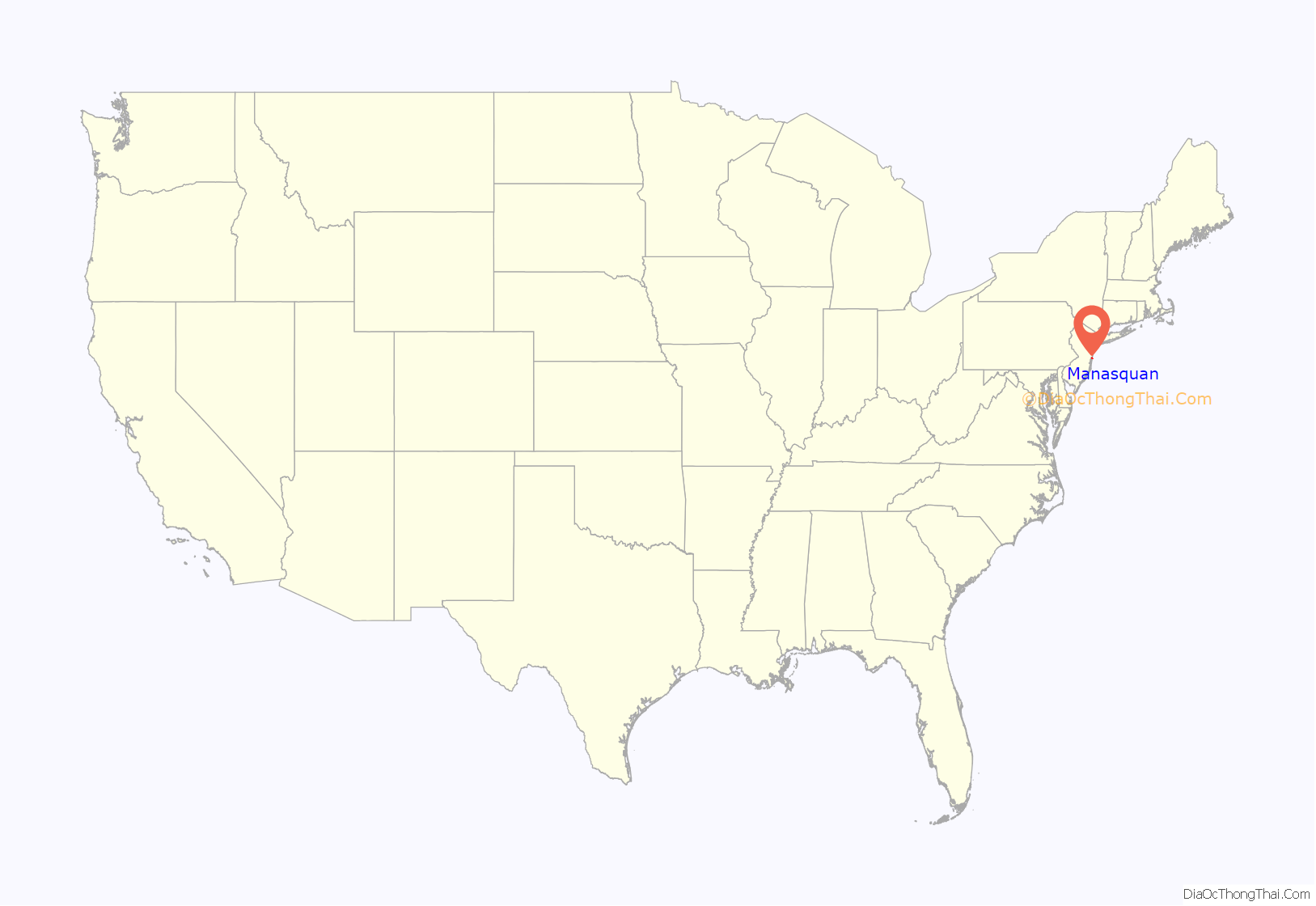
Manasquan location map. Where is Manasquan borough?
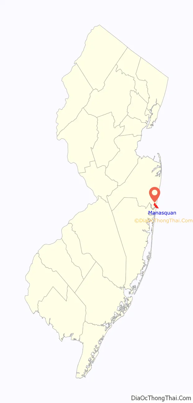
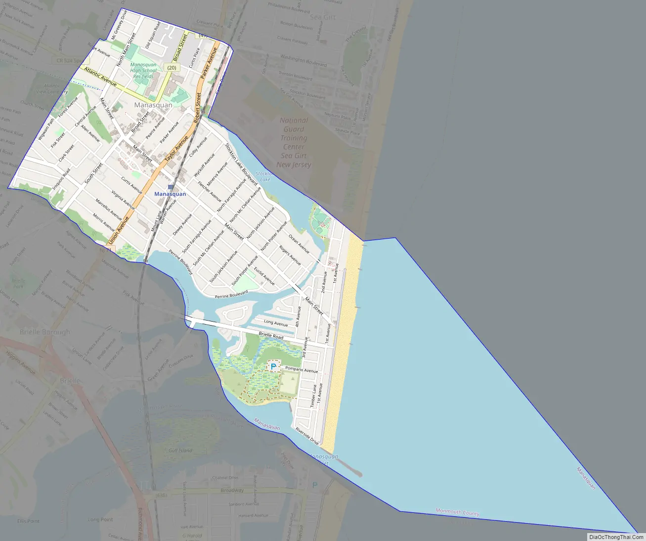
Manasquan Road Map
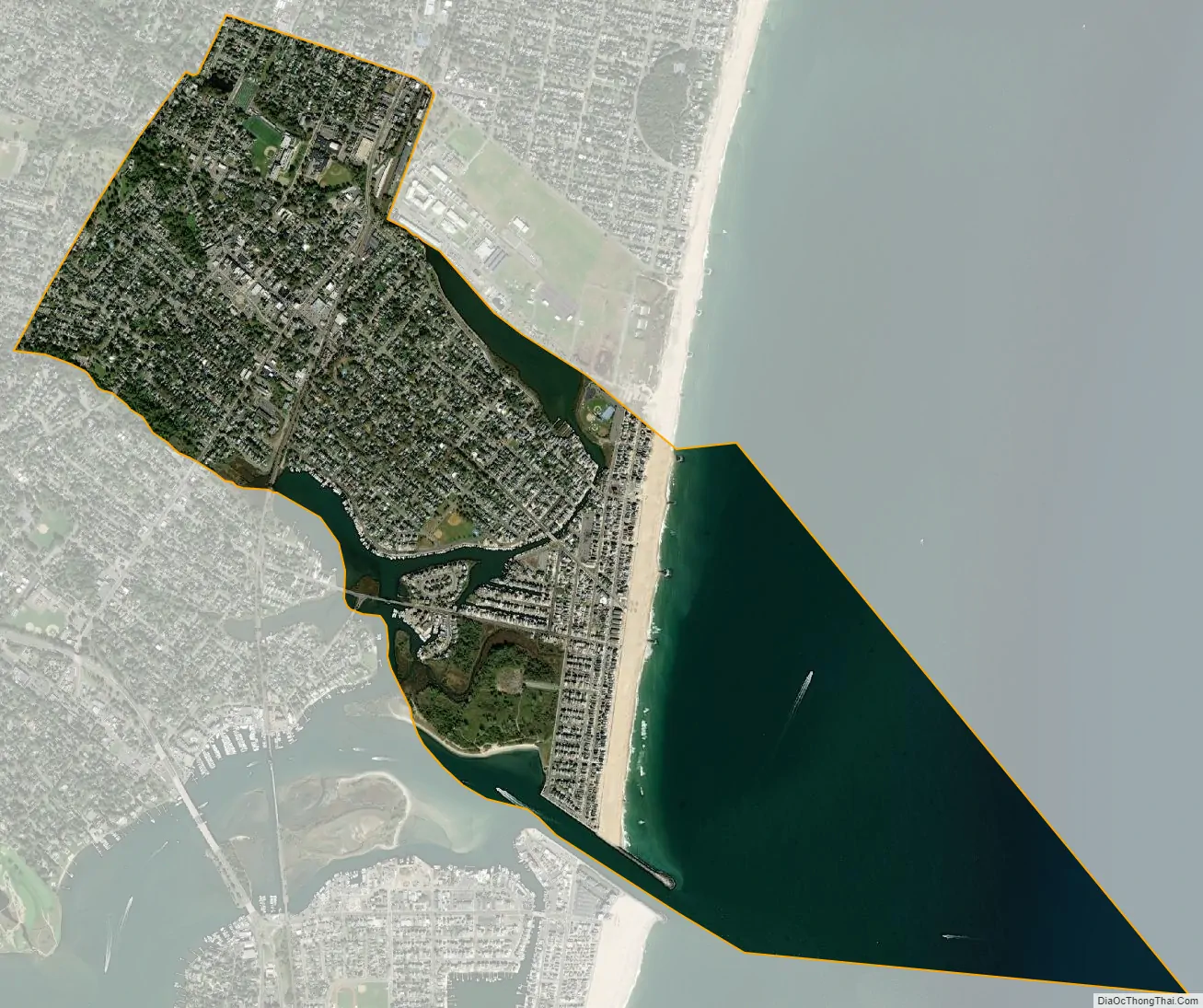
Manasquan city Satellite Map
Geography
According to the United States Census Bureau, the borough had a total area of 2.53 square miles (6.54 km), including 1.38 square miles (3.57 km) of land and 1.15 square miles (2.97 km) of water (45.26%).
The borough borders the municipalities of Brielle, Sea Girt and Wall Township in Monmouth County; and Point Pleasant Beach in Ocean County.
The borough has a humid subtropical climate (Cfa) and average monthly temperatures range from 32.3 °F (0.2 °C) in January to 75.2 °F (24.0 °C) in July. The hardiness zone is 7a.
See also
Map of New Jersey State and its subdivision: Map of other states:- Alabama
- Alaska
- Arizona
- Arkansas
- California
- Colorado
- Connecticut
- Delaware
- District of Columbia
- Florida
- Georgia
- Hawaii
- Idaho
- Illinois
- Indiana
- Iowa
- Kansas
- Kentucky
- Louisiana
- Maine
- Maryland
- Massachusetts
- Michigan
- Minnesota
- Mississippi
- Missouri
- Montana
- Nebraska
- Nevada
- New Hampshire
- New Jersey
- New Mexico
- New York
- North Carolina
- North Dakota
- Ohio
- Oklahoma
- Oregon
- Pennsylvania
- Rhode Island
- South Carolina
- South Dakota
- Tennessee
- Texas
- Utah
- Vermont
- Virginia
- Washington
- West Virginia
- Wisconsin
- Wyoming


