Pomona is an unincorporated community and census-designated place (CDP) located within Galloway Township, in Atlantic County, New Jersey. As of the 2010 United States Census, the CDP’s population was 7,124. The area is served as United States Postal Service ZIP code 08240.
Locally, the name “Pomona” is loosely used also to refer to areas adjacent to Pomona proper, including adjoining portions of Hamilton Township and Egg Harbor Township in the vicinity of the Atlantic City International Airport.
Pomona was often described as the home to Stockton University, since the mailing address for the college was a post-office box located in the Pomona Post Office. In 2011, the university changed its mailing address to its main campus (using the street Vera King Farris Drive, Galloway Township, New Jersey).
| Name: | Pomona CDP |
|---|---|
| LSAD Code: | 57 |
| LSAD Description: | CDP (suffix) |
| State: | New Jersey |
| County: | Atlantic County |
| Elevation: | 56 ft (17 m) |
| Total Area: | 2.79 sq mi (7.21 km²) |
| Land Area: | 2.79 sq mi (7.21 km²) |
| Water Area: | 0.00 sq mi (0.00 km²) 0.00% |
| Total Population: | 7,416 |
| Population Density: | 2,662.84/sq mi (1,028.20/km²) |
| ZIP code: | 08240 |
| Area code: | 609 |
| FIPS code: | 3460030 |
| GNISfeature ID: | 02389693 |
Online Interactive Map
Click on ![]() to view map in "full screen" mode.
to view map in "full screen" mode.
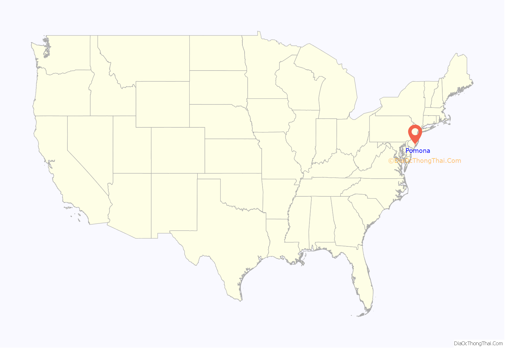
Pomona location map. Where is Pomona CDP?
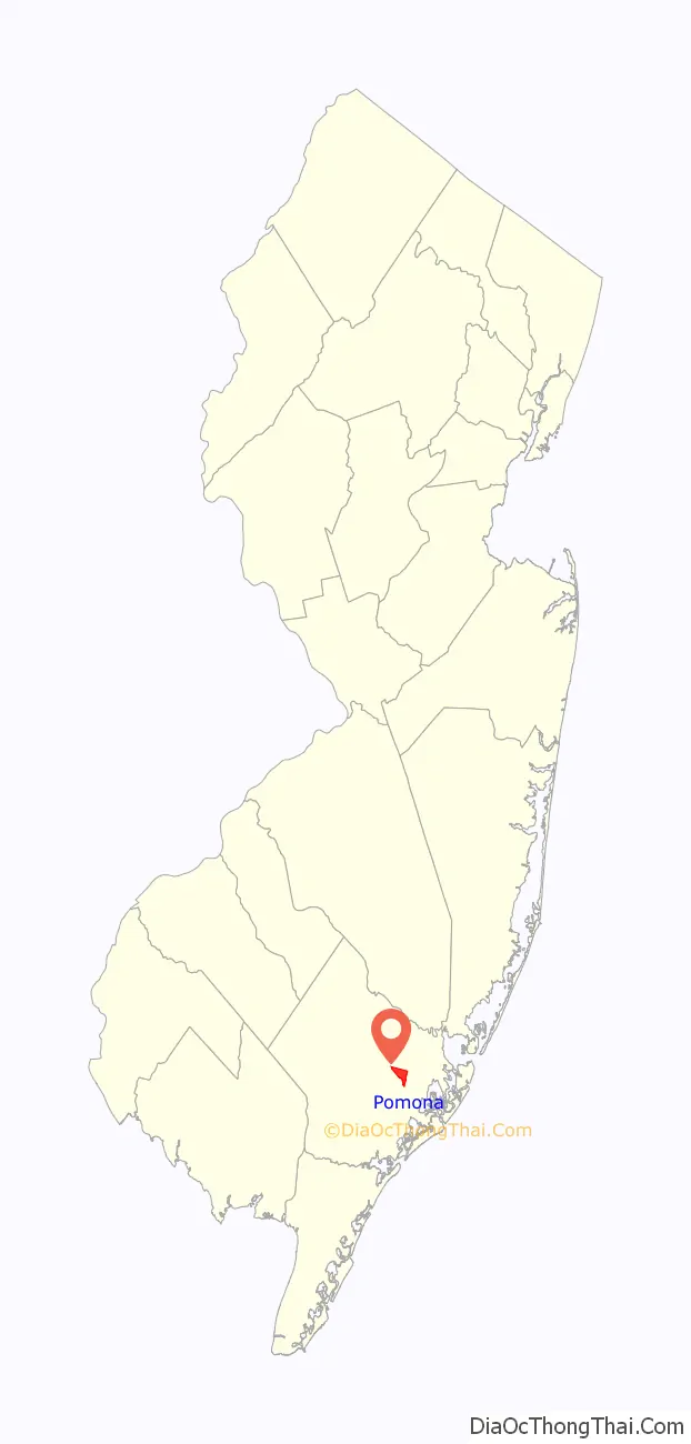
Pomona Road Map
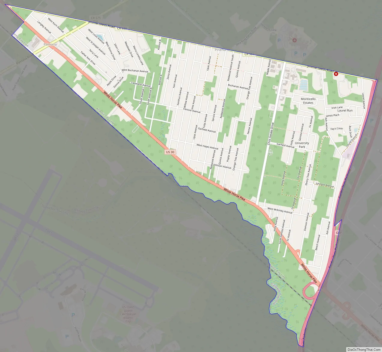
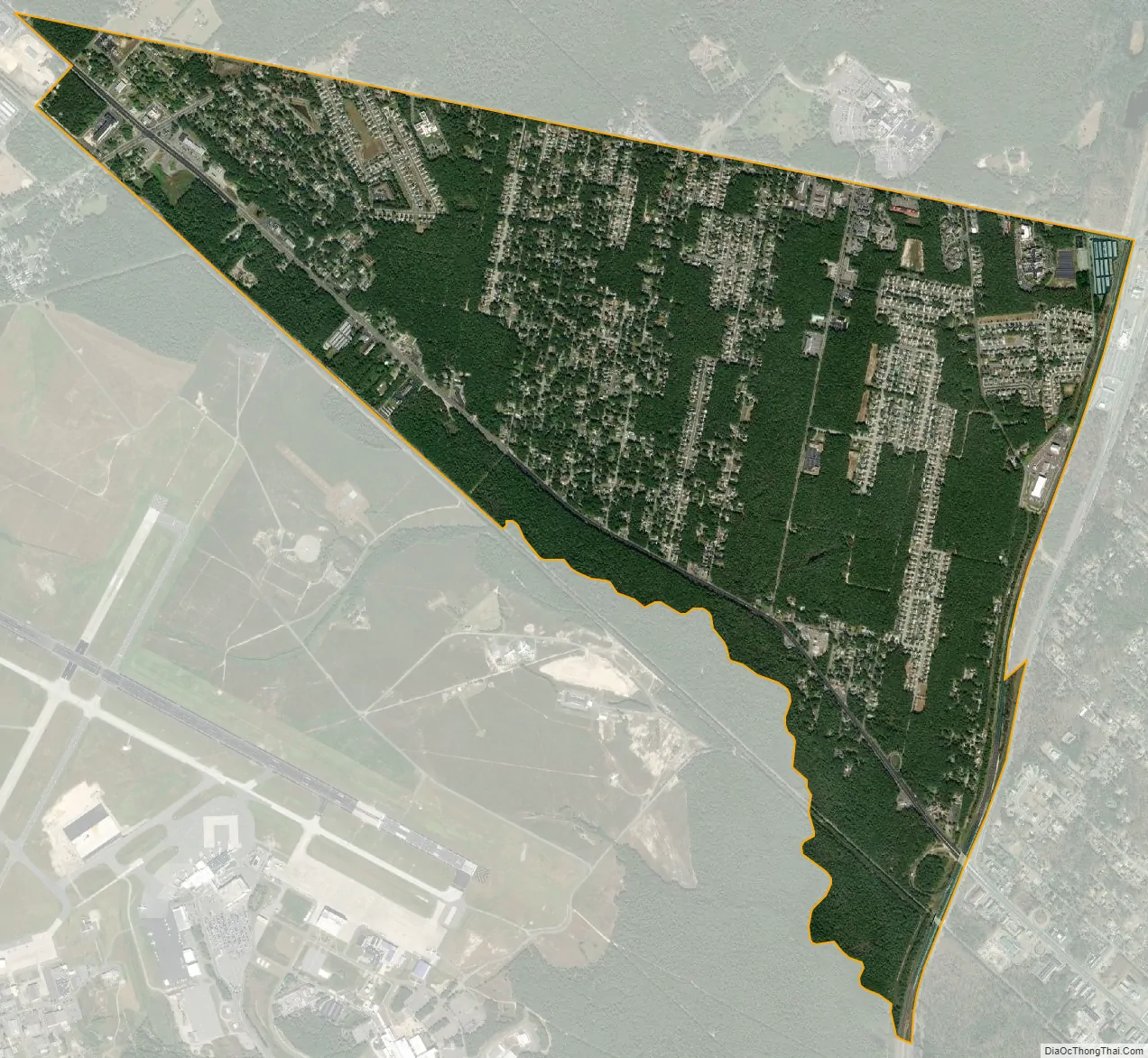
Pomona city Satellite Map
Geography
According to the U.S. Census Bureau, the Pomona CDP had a total area of 2.797 square miles (7.244 km), all of which was land.
See also
Map of New Jersey State and its subdivision: Map of other states:- Alabama
- Alaska
- Arizona
- Arkansas
- California
- Colorado
- Connecticut
- Delaware
- District of Columbia
- Florida
- Georgia
- Hawaii
- Idaho
- Illinois
- Indiana
- Iowa
- Kansas
- Kentucky
- Louisiana
- Maine
- Maryland
- Massachusetts
- Michigan
- Minnesota
- Mississippi
- Missouri
- Montana
- Nebraska
- Nevada
- New Hampshire
- New Jersey
- New Mexico
- New York
- North Carolina
- North Dakota
- Ohio
- Oklahoma
- Oregon
- Pennsylvania
- Rhode Island
- South Carolina
- South Dakota
- Tennessee
- Texas
- Utah
- Vermont
- Virginia
- Washington
- West Virginia
- Wisconsin
- Wyoming