Rahway (/ˈrɔːweɪ/) is a city in southern Union County, in the U.S. state of New Jersey. A bedroom community of New York City, it is centrally located in the Rahway Valley region, in the New York metropolitan area. The city is 15 miles (24 km) southwest of Manhattan and 5 miles (8.0 km) west of Staten Island.
Built on the navigable Rahway River, it was an industrial and artisanal craft city for much of its history. The city has increasingly reinvented itself in recent years as a diverse regional hub for the arts.
As of the 2020 United States census, the city’s population was 29,556, an increase of 2,210 (+8.1%) from the 2010 census count of 27,346, which in turn reflected an increase of 846 (+3.2%) from the 26,500 counted in the 2000 census.
| Name: | Rahway city |
|---|---|
| LSAD Code: | 25 |
| LSAD Description: | city (suffix) |
| State: | New Jersey |
| County: | Union County |
| Incorporated: | April 19, 1858 |
| Elevation: | 23 ft (7 m) |
| Total Area: | 4.04 sq mi (10.47 km²) |
| Land Area: | 3.90 sq mi (10.09 km²) |
| Water Area: | 0.14 sq mi (0.38 km²) 3.59% |
| Total Population: | 29,556 |
| Population Density: | 7,586.2/sq mi (2,929.0/km²) |
| ZIP code: | 07065 |
| Area code: | 732 |
| FIPS code: | 3461530 |
| GNISfeature ID: | 0885363 |
| Website: | www.cityofrahway.com |
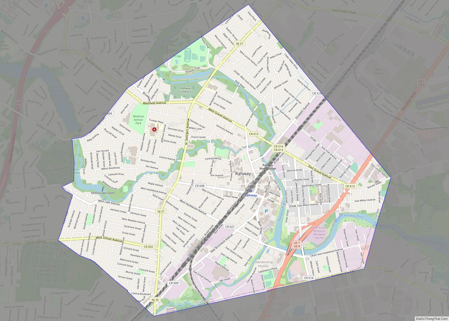
Online Interactive Map
Click on ![]() to view map in "full screen" mode.
to view map in "full screen" mode.
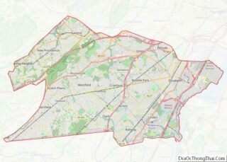
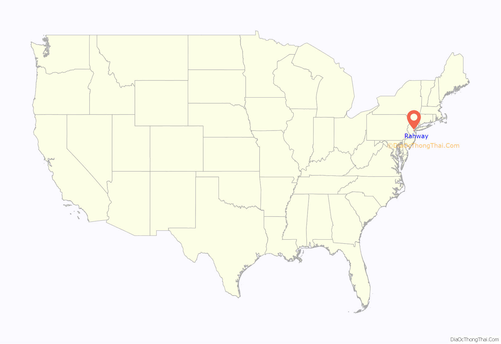
Rahway location map. Where is Rahway city?
History
Indigenous presence
Rahway and the surrounding area were once the home of the Lenni Lenape Native Americans, and tradition states that the city was named after Rahwack (or Ra-wa-rah), a local tribal chief.
English colonization
Formal European colonization began in 1664 with the purchase by the English from the Lenape of the Elizabethtown Tract, which encompassed lands from the mouth of the Raritan River and included all of present-day Union County as well as parts of Somerset, Middlesex, Morris and Essex counties. The early settlers of Elizabethtown and Woodbridge were the founders of Rahway which began as outlying acreage and plantations. The Seventeenth Century Clark House is one of the oldest buildings in the state.
By the 18th century, Rahway consisted of four distinct communities: Upper Rahway, Bridge Town (or Lower Rahway), Leesville, and Milton.
Revolutionary War and the Battle of Spanktown
Rahway saw action during the American Revolutionary War because of its proximity to Staten Island, Elizabethtown and Perth Amboy. In January 1777, rebels were victorious against the British in the Battle of Spanktown, which resulted in the death of some 100 British troops. The battle was named this after Rahway’s original name given to it by the first settlers, Spanktown, which is said to have been chosen “because an early settler publicly took his spouse across his knee and chastised her”. Spanktown was mentioned in Revolutionary War military dispatches from January 5, 1777, through March 14, 1782.
The Merchants’ and Drovers’ Tavern is located at the corner of St. Georges and Westfield Avenues. The earliest buildings at the site date to 1795 and the property remains one of Rahway’s most prominent historical landmarks. George Washington visited Rahway during his travel to New York City prior to his presidential inauguration in 1789. A marker across the street from the tavern reads:
Following the Revolution, Rahway became the home of the first national mint to create a coin bearing the inscription E pluribus unum. A United States Post Office established in Rahway was one of only six in the entire state in 1791.
Various historical place markers in town document Rahway Revolutionary War history.
Stagecoach era and corporate growth
Rahway grew due to its location along the major stagecoach and railroad lines between New York City and Philadelphia, Pennsylvania. The navigable Rahway River, which flows through the city, also aided the city’s commercial growth.
As immigrants from Britain, Ireland and Germany streamed into what was then Rahway Township in the 1850s, Rahway became incorporated as a city by an act of the State Legislature on April 19, 1858, from portions of Rahway Township in Union and Woodbridge Township in Middlesex County. In 1860, the portion of Rahway that had been part of Middlesex County was transferred to Union. On March 13, 1861, the remainder of Rahway Township became part of Rahway City. Clark Township was formed from portions of the city on March 23, 1864.
The first municipal elections for the mayor and council were conducted on April 19, 1858, and the council held its first meeting on May 3, 1858. The city’s police department and its initial group of four constables were created at that first council meeting.
The city became home to dozens of major manufacturers, including the Regina Music Box Company, Wheatena, Mershon Bros. and, most importantly, Merck & Co., which was established in Rahway in 1903, when George W. Merck moved his small chemical company to Rahway from New York City.
Postwar era
The national decline in industry after World War II led to the closure of most of Rahway’s major manufacturing facilities (except for Merck) and a general deterioration of the city’s central business district.
Revitalization
Beginning in the late 1990s, the city launched a plan to revitalize the downtown area and authorized the construction of hundreds of new market-rate housing units, a hotel, art galleries and additional retail space.
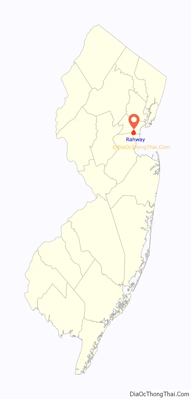
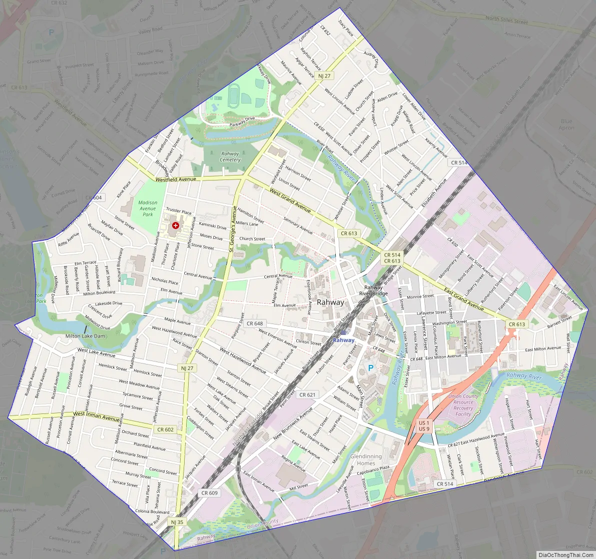
Rahway Road Map
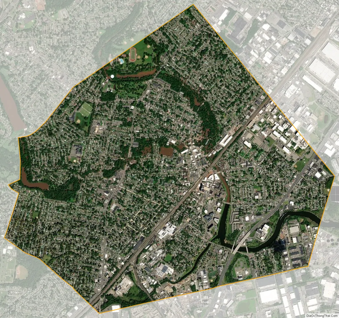
Rahway city Satellite Map
Geography
According to the United States Census Bureau, the city had a total area of 4.04 square miles (10.47 km), including 3.90 square miles (10.09 km) of land and 0.15 square miles (0.38 km) of water (3.59%).
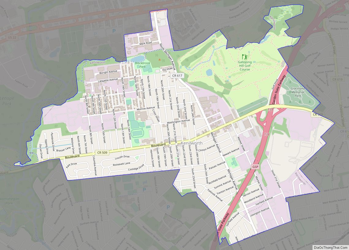
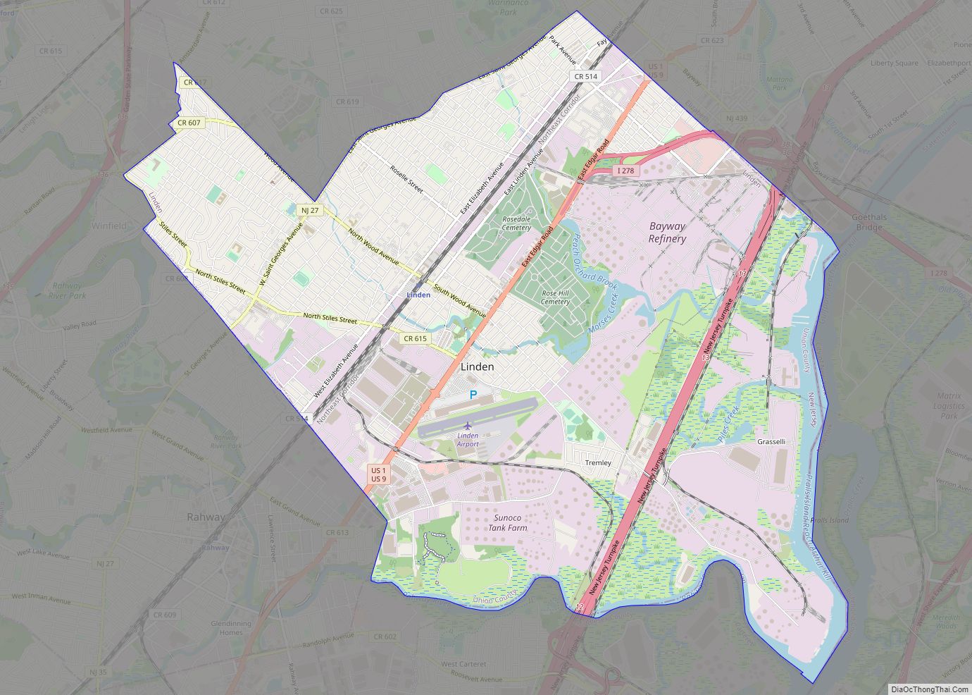
Rahway is bordered by the municipalities of Clark to the northwest and Linden to the northeast in Union County; and by Woodbridge Township to the south in Middlesex County.
The Rahway River travels through Rahway, entering from Clark at Rahway River Parkway. The river receives the waters of Robinsons Branch at Elizabeth Avenue between West Grand Avenue and West Main Street, and then receives the waters of the South Branch at East Hazlewood Avenue and Leesville Avenue. The river leaves Rahway at the city limits of Linden and Woodbridge before flowing into the Arthur Kill.
Unincorporated communities, localities and place names located partially or completely within the city include Inman Heights and North Rahway.
Climate
The climate in this area is characterized by hot, humid summers and generally mild to cool winters. According to the Köppen Climate Classification system, Rahway has a humid subtropical climate, abbreviated “Cfa” on climate maps.
See also
Map of New Jersey State and its subdivision: Map of other states:- Alabama
- Alaska
- Arizona
- Arkansas
- California
- Colorado
- Connecticut
- Delaware
- District of Columbia
- Florida
- Georgia
- Hawaii
- Idaho
- Illinois
- Indiana
- Iowa
- Kansas
- Kentucky
- Louisiana
- Maine
- Maryland
- Massachusetts
- Michigan
- Minnesota
- Mississippi
- Missouri
- Montana
- Nebraska
- Nevada
- New Hampshire
- New Jersey
- New Mexico
- New York
- North Carolina
- North Dakota
- Ohio
- Oklahoma
- Oregon
- Pennsylvania
- Rhode Island
- South Carolina
- South Dakota
- Tennessee
- Texas
- Utah
- Vermont
- Virginia
- Washington
- West Virginia
- Wisconsin
- Wyoming