Red Bank is a borough in Monmouth County, in the U.S. state of New Jersey. Incorporated in 1908, the community is on the Navesink River, the area’s original transportation route to the ocean and other ports. Red Bank is in the New York metropolitan area and is a commuter town of New York City. As of the 2020 United States census, the borough’s population was 12,936, an increase of 730 (+6.0%) from the 2010 census count of 12,206, which in turn reflected an increase of 362 (+3.1%) from the 11,844 counted in the 2000 census. In the 2020 census, Red Bank was the fourth-most-densely populated municipality in Monmouth County.
Red Bank was formed as a town on March 17, 1870, from parts of Shrewsbury Township. On February 14, 1879, Red Bank became Shrewsbury City, part of Shrewsbury Township; this lasted until May 15, 1879, when Red Bank regained its independence. On March 10, 1908, Red Bank was formed as a borough by an act of the New Jersey Legislature and was set off from Shrewsbury Township. The borough was named for the red soil along the Navesink River.
Downtown Red Bank is notable for its many local and well-known businesses including Garmany, Urban Outfitters, and Tiffany & Co. on and around Broad Street. Many annual events happen throughout the year, including the International Beer, Wine & Food Festival, a long-running sidewalk sale, a farmers’ market, an indie film festival, the Red Bank Guinness Oyster Festival, a Halloween parade, and a holiday town lighting.
| Name: | Red Bank borough |
|---|---|
| LSAD Code: | 21 |
| LSAD Description: | borough (suffix) |
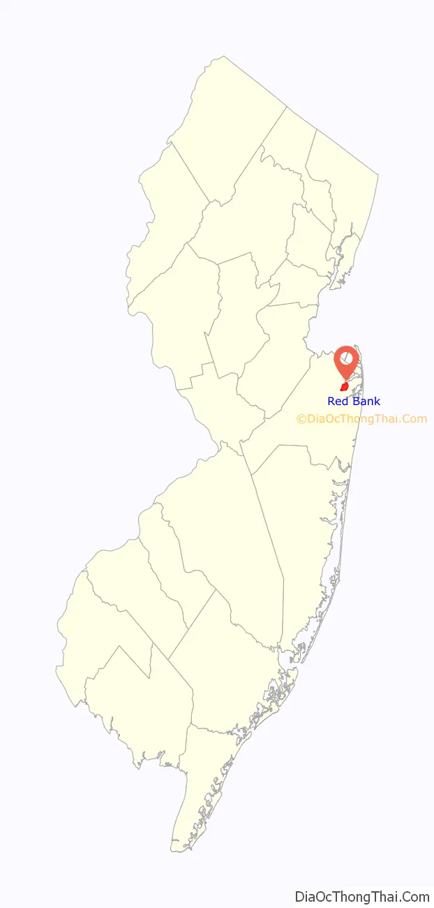
| State: | New Jersey |
| County: | Monmouth County |
| Incorporated: | March 17, 1870 (as town) |
| Elevation: | 43 ft (13 m) |
| Total Area: | 2.16 sq mi (5.58 km²) |
| Land Area: | 1.75 sq mi (4.52 km²) |
| Water Area: | 0.41 sq mi (1.06 km²) 18.98% |
| Total Population: | 12,936 |
| Population Density: | 7,408.9/sq mi (2,860.6/km²) |
| Area code: | 732 and 848 |
| FIPS code: | 3462430 |
| GNISfeature ID: | 0885366 |
| Website: | www.redbanknj.org |
Online Interactive Map
Click on ![]() to view map in "full screen" mode.
to view map in "full screen" mode.
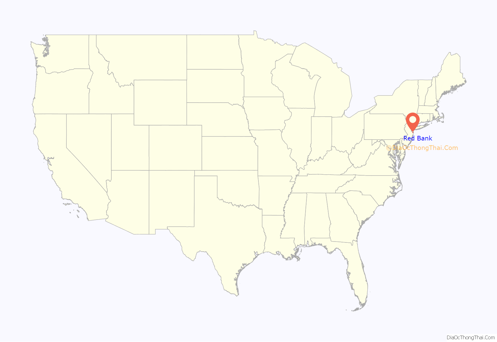
Red Bank location map. Where is Red Bank borough?
History
Red Bank has been occupied by indigenous peoples for thousands of years. The area of modern-day Red Bank was the territory of the Algonquian-speaking Lenape Native Americans, also called the Delaware by the English. The Lenape lived in the area between the Navesink River and the Shrewsbury River in an area they called Navarumsunk. The Native Americans traded freely with European settlers from England and the Dutch Republic in the mid-17th century, who purchased land in the area.
Originally part of “Shrewsbury Towne”, Red Bank was named in 1736, when Thomas Morford sold Joseph French “a lot of over three acres on the west side of the highway that goes to the red bank”. English colonists settled Red Bank beginning in the 17th century and it became a center for shipbuilding. Its population grew rapidly after 1809, when regularly scheduled passenger ships were established to serve the route to Manhattan.
By 1844, Red Bank had become a commercial and manufacturing center, focused on textiles, tanning, furs, and other goods for sale in Manhattan. With the dredging of the Navesink River about 1845, Red Bank became a port from which steamboats transported commuters to work in Manhattan. Red Bank grew in size as a result, and because the Raritan and Delaware Bay Railroad constructed a railway in the town in 1860.
In the 20th century, Red Bank was a strong cultural, economic, and political center in Monmouth County until it was hindered by the economic recession that began in 1987. During this time, its economy, based largely on retail commerce, was in decline, due to a real estate scandal. Local pundits and urban planners referred to the town as “Dead Bank”.
Beginning in approximately 1991, under the New Jersey Development and Redevelopment Law, the borough authorized the creation of the Red Bank RiverCenter to manage redevelopment in what was designated as a special improvement district. RiverCenter retains authority over the management and redevelopment of a defined central business district, which includes Broad Street from the post office to Marine Park and from Maple Avenue to one block east of Broad Street. A number of urban redevelopment projects have taken place, including improved signage, distinctive and pedestrian-friendly sidewalks and lighting, a coherent design plan for Main Street and other major thoroughfares, and improving the condition of parking lots with landscaping.
The district as originally proposed was larger, to include the commercial areas west of Maple Avenue, including the antique buildings, The Galleria, and Shrewsbury Avenue. But some property owners in this area opposed paying the special assessment. Plans for the larger district advanced but opposition became more rigorous. The proposed district was amended to exclude opponents, and the district that was adopted stops at Maple Avenue.
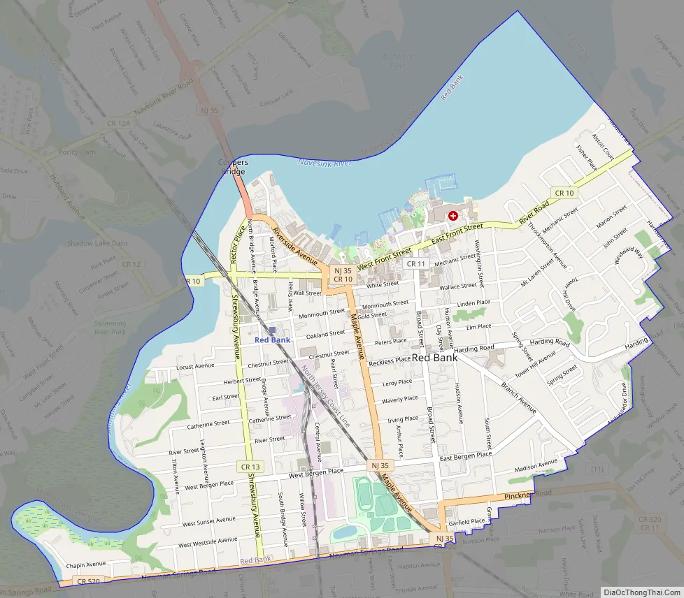
Red Bank Road Map
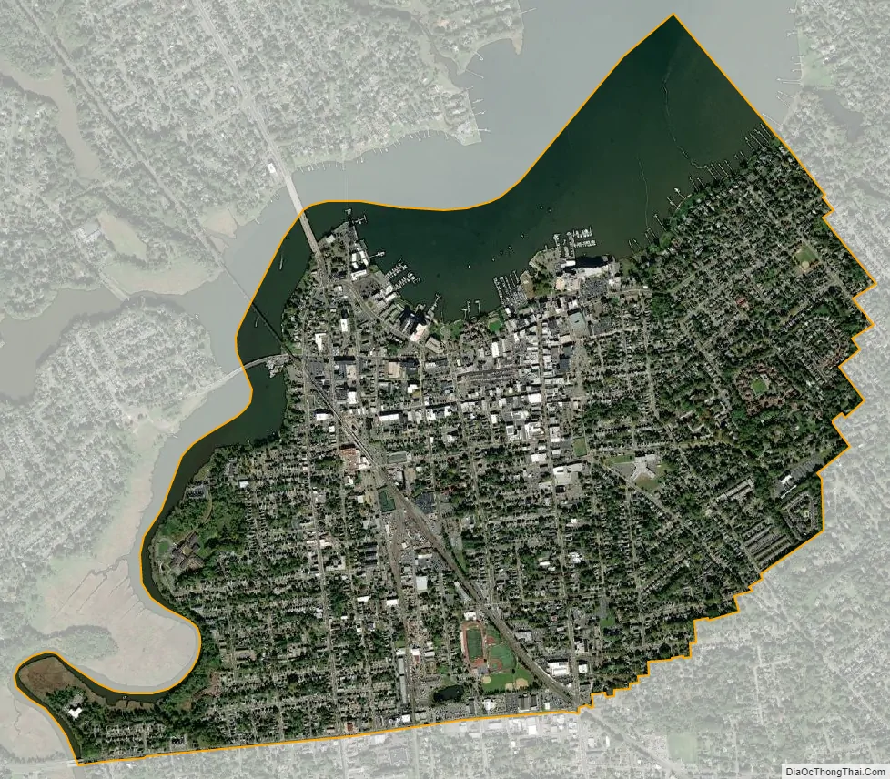
Red Bank city Satellite Map
Geography
According to the United States Census Bureau, the borough had an area of 2.16 square miles (5.58 km), including 1.75 square miles (4.52 km) of land and 0.41 square miles (1.06 km) of water (18.98%).
Red Bank is on the southern bank of the Navesink River in northern Monmouth County, New Jersey. It is about 24 miles (39 km) due south of the tip of Manhattan and about 25 nautical miles (46 km) to the tip of Manhattan if traveling by water along the Navesink River and through Raritan Bay.
Unincorporated communities, localities and place names partially or completely within the borough include Newmans Corner.
Red Bank is bordered by the Monmouth County municipalities of Fair Haven, Little Silver, Middletown Township, Shrewsbury and Tinton Falls.
Climate
Red Bank has a humid subtropical climate (Cfa).
See also
Map of New Jersey State and its subdivision: Map of other states:- Alabama
- Alaska
- Arizona
- Arkansas
- California
- Colorado
- Connecticut
- Delaware
- District of Columbia
- Florida
- Georgia
- Hawaii
- Idaho
- Illinois
- Indiana
- Iowa
- Kansas
- Kentucky
- Louisiana
- Maine
- Maryland
- Massachusetts
- Michigan
- Minnesota
- Mississippi
- Missouri
- Montana
- Nebraska
- Nevada
- New Hampshire
- New Jersey
- New Mexico
- New York
- North Carolina
- North Dakota
- Ohio
- Oklahoma
- Oregon
- Pennsylvania
- Rhode Island
- South Carolina
- South Dakota
- Tennessee
- Texas
- Utah
- Vermont
- Virginia
- Washington
- West Virginia
- Wisconsin
- Wyoming


