Riverdale is a borough in Morris County, in the U.S. state of New Jersey. As of the 2020 United States census, the borough’s population was 4,107, an increase of 548 (+15.4%) from the 2010 census count of 3,559, which in turn reflected an increase of 1,061 (+42.5%) from the 2,498 counted at the 2000 Census.
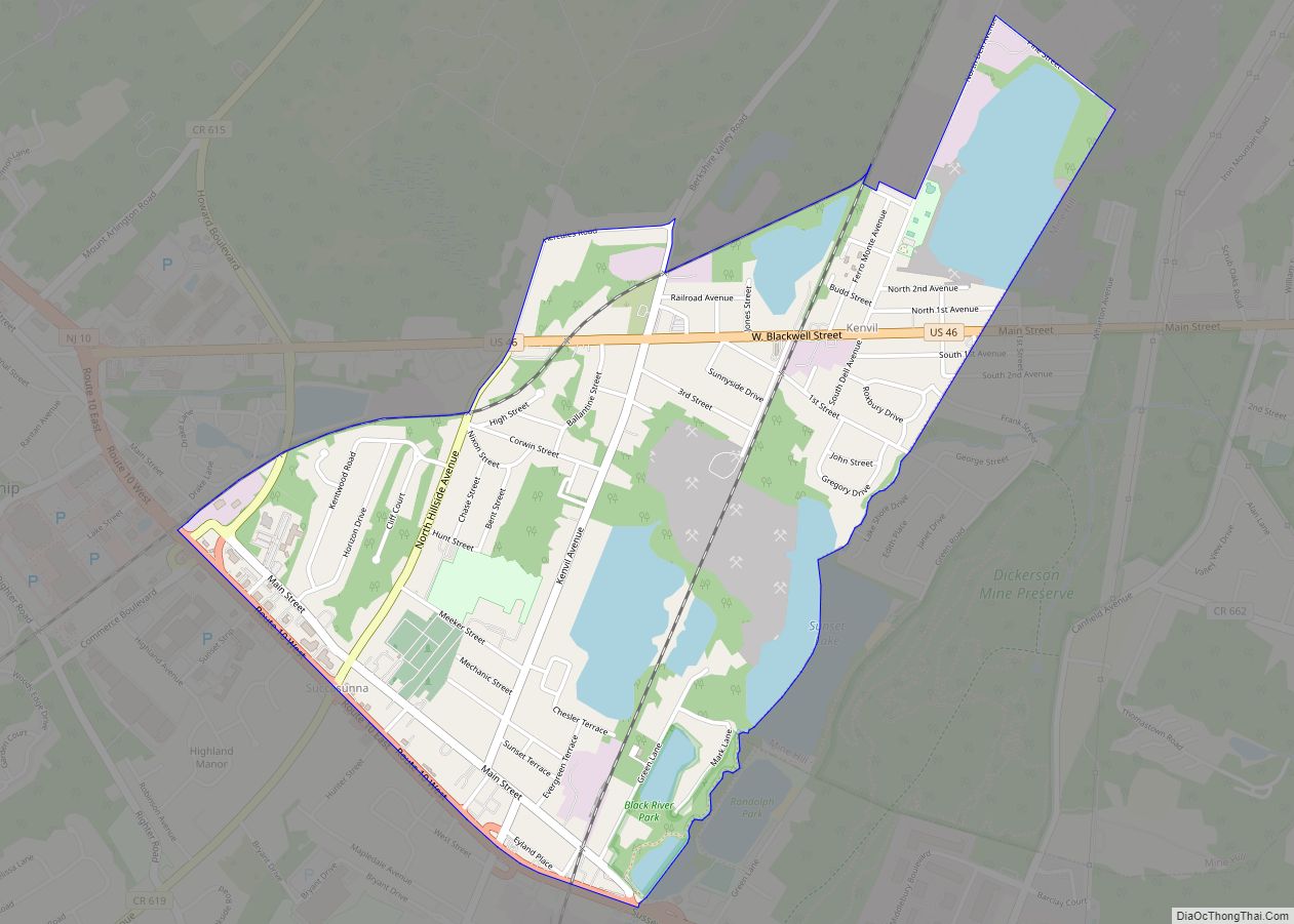
Riverdale is situated in the northeasternmost part of Morris County bordering Passaic County along the Pequannock and Pompton rivers.
| Name: | Riverdale borough |
|---|---|
| LSAD Code: | 21 |
| LSAD Description: | borough (suffix) |
| State: | New Jersey |
| County: | Morris County |
| Incorporated: | April 17, 1923 |
| Elevation: | 367 ft (112 m) |
| Total Area: | 2.07 sq mi (5.35 km²) |
| Land Area: | 2.03 sq mi (5.25 km²) |
| Water Area: | 0.04 sq mi (0.11 km²) 1.98% |
| Total Population: | 4,107 |
| Population Density: | 2,023.2/sq mi (781.2/km²) |
| ZIP code: | 07457 |
| Area code: | 973 |
| FIPS code: | 3463300 |
| GNISfeature ID: | 0885371 |
| Website: | www.riverdalenj.gov |
Online Interactive Map
Click on ![]() to view map in "full screen" mode.
to view map in "full screen" mode.
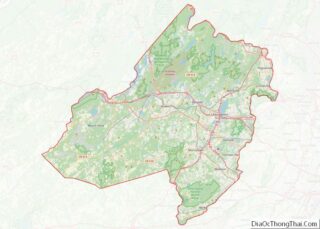
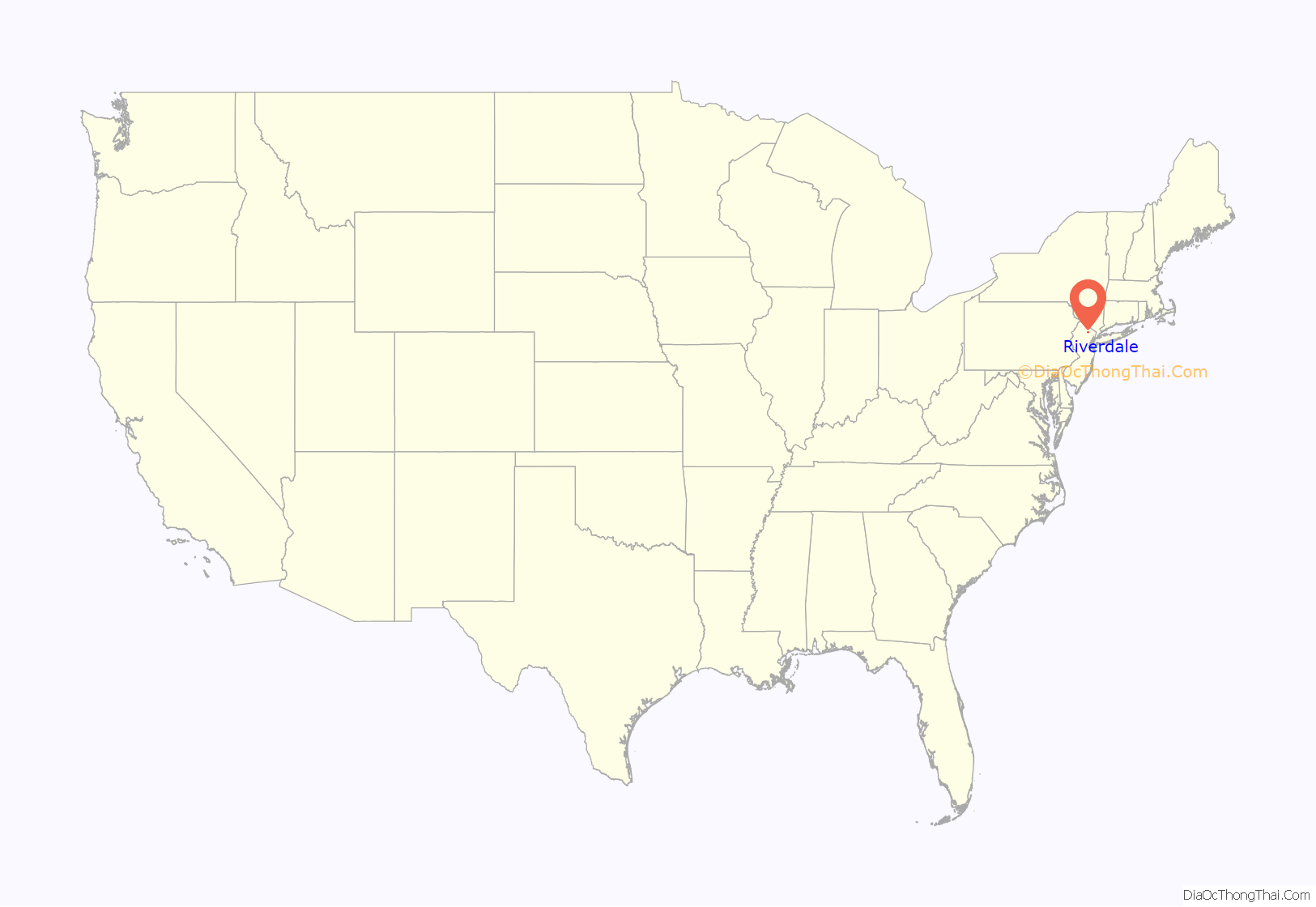
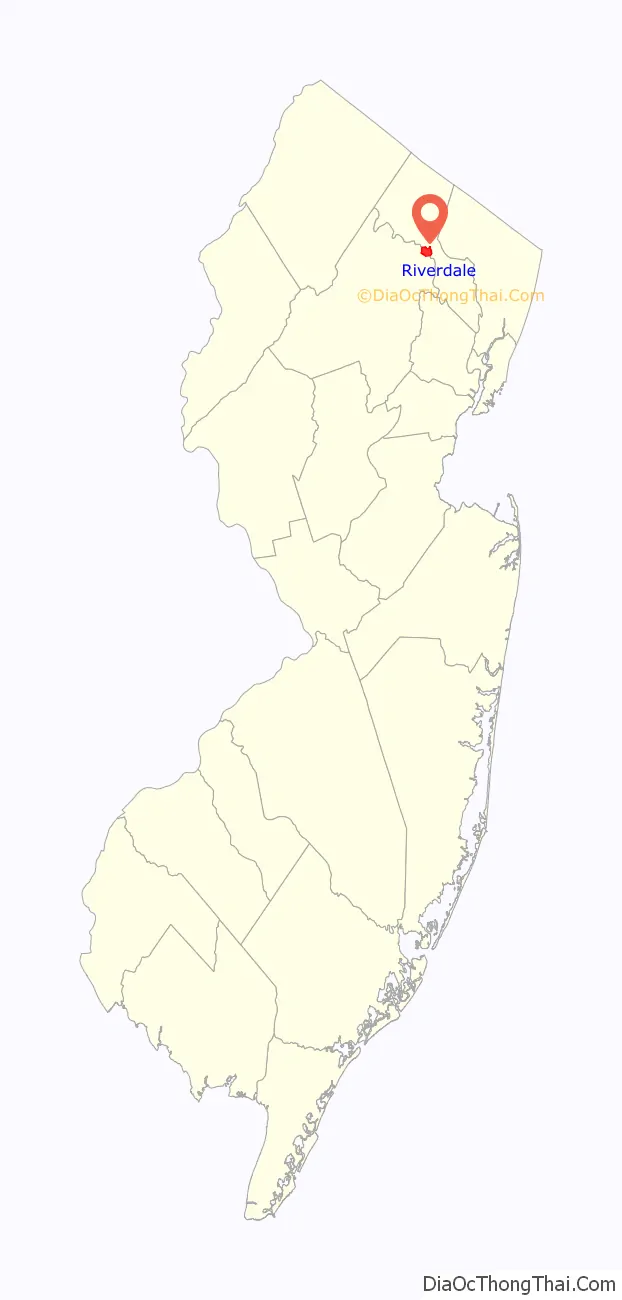
Riverdale location map. Where is Riverdale borough?
History
Riverdale was incorporated as a borough by an act of the New Jersey Legislature on March 12, 1923, from portions of Pequannock Township, subject to the results of a referendum passed on April 17, 1923.
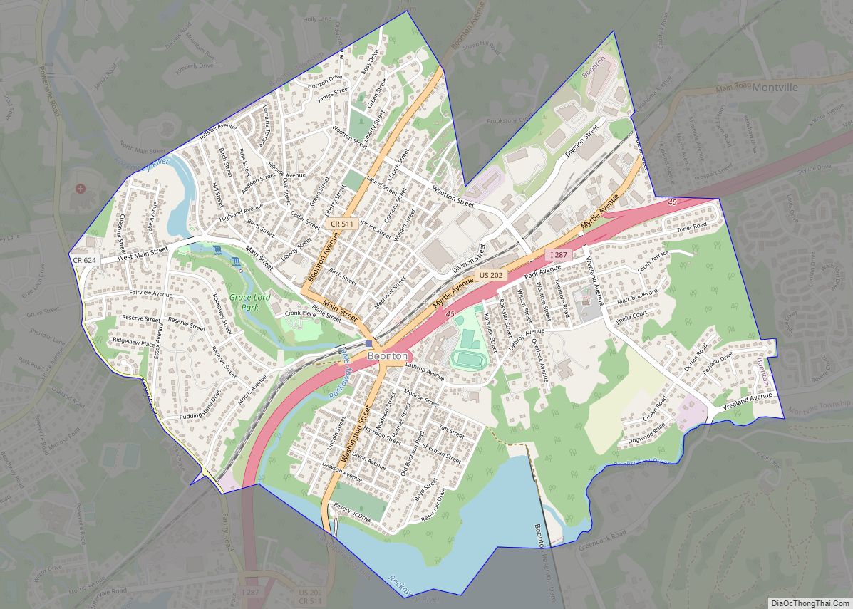
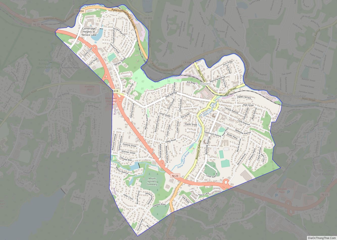
Riverdale Road Map

Riverdale city Satellite Map

Geography
According to the United States Census Bureau, the borough had a total area of 2.07 square miles (5.35 km), including 2.03 square miles (5.25 km) of land and 0.04 square miles (0.11 km) of water (1.98%).
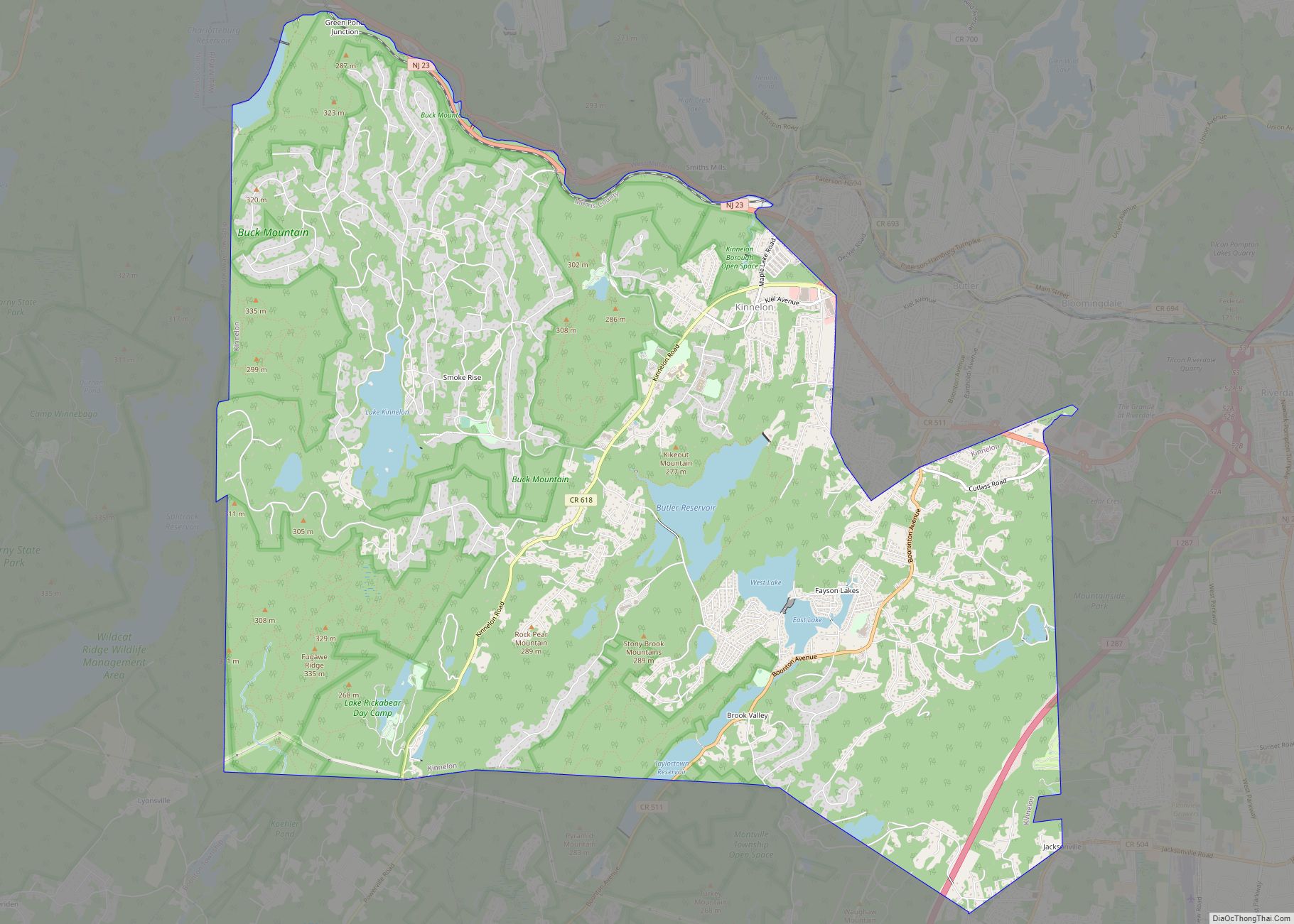
The borough is bordered by the municipalities of Butler and Kinnelon to the west and by Pequannock Township to the south, all in Morris County; and by Bloomingdale to the north and Pompton Lakes to the east in Passaic County.
See also
Map of New Jersey State and its subdivision: Map of other states:- Alabama
- Alaska
- Arizona
- Arkansas
- California
- Colorado
- Connecticut
- Delaware
- District of Columbia
- Florida
- Georgia
- Hawaii
- Idaho
- Illinois
- Indiana
- Iowa
- Kansas
- Kentucky
- Louisiana
- Maine
- Maryland
- Massachusetts
- Michigan
- Minnesota
- Mississippi
- Missouri
- Montana
- Nebraska
- Nevada
- New Hampshire
- New Jersey
- New Mexico
- New York
- North Carolina
- North Dakota
- Ohio
- Oklahoma
- Oregon
- Pennsylvania
- Rhode Island
- South Carolina
- South Dakota
- Tennessee
- Texas
- Utah
- Vermont
- Virginia
- Washington
- West Virginia
- Wisconsin
- Wyoming