Seaside Heights is a borough situated on the Jersey Shore, within Ocean County, in the U.S. state of New Jersey. As of the 2020 United States census, the borough’s population was 2,440, a decrease of 447 (−15.5%) from the 2010 census count of 2,887, which in turn had reflected a decline of 268 (−8.5%) from the 3,155 counted at the 2000 census. Seaside Heights is located on the Barnegat Peninsula, a long, narrow barrier peninsula that separates Barnegat Bay from the Atlantic Ocean. During the summer, the borough attracts a crowd largely under the age of 21, drawn to a community with boardwalk entertainment and one of the few shore communities with sizable numbers of apartments, attracting as many as 65,000 people who are often out until early morning visiting bars and restaurants.
Based on the results of a referendum held on March 25, 1913, Seaside Heights was incorporated as a borough by an act of the New Jersey Legislature on February 26, 1913, from portions of both Berkeley Township and Dover Township (now Toms River Township). The borough was named for its location on the Atlantic Ocean.
As a resort community, the beach, an amusement-oriented boardwalk, and numerous clubs and bars, make it a popular destination. Seaside Heights calls itself, “Your Home For Family Fun Since 1913!” The beach season runs from March to October, with the peak months being July and August, when the summer population explodes to as many as 30,000 to 65,000. Route 37 in Toms River is routinely gridlocked on Friday afternoons in the summer months as vacationers travel to the barrier islands. The community is also known as the location of the hit MTV show Jersey Shore, with the director of the borough’s business improvement district saying in 2010 that “we can’t even calculate the economic benefit” to Seaside Heights from the continued presence of the show.
| Name: | Seaside Heights borough |
|---|---|
| LSAD Code: | 21 |
| LSAD Description: | borough (suffix) |
| State: | New Jersey |
| County: | Ocean County |
| Incorporated: | February 26, 1913 |
| Elevation: | 3 ft (0.9 m) |
| Total Area: | 0.74 sq mi (1.92 km²) |
| Land Area: | 0.62 sq mi (1.60 km²) |
| Water Area: | 0.13 sq mi (0.32 km²) 16.89% |
| Total Population: | 2,440 |
| Population Density: | 3,952.9/sq mi (1,526.2/km²) |
| ZIP code: | 08751 |
| Area code: | 732 exchanges: 793, 830, 854 |
| FIPS code: | 3466450 |
| GNISfeature ID: | 0885390 |
| Website: | www.seaside-heightsnj.org |
Online Interactive Map
Click on ![]() to view map in "full screen" mode.
to view map in "full screen" mode.
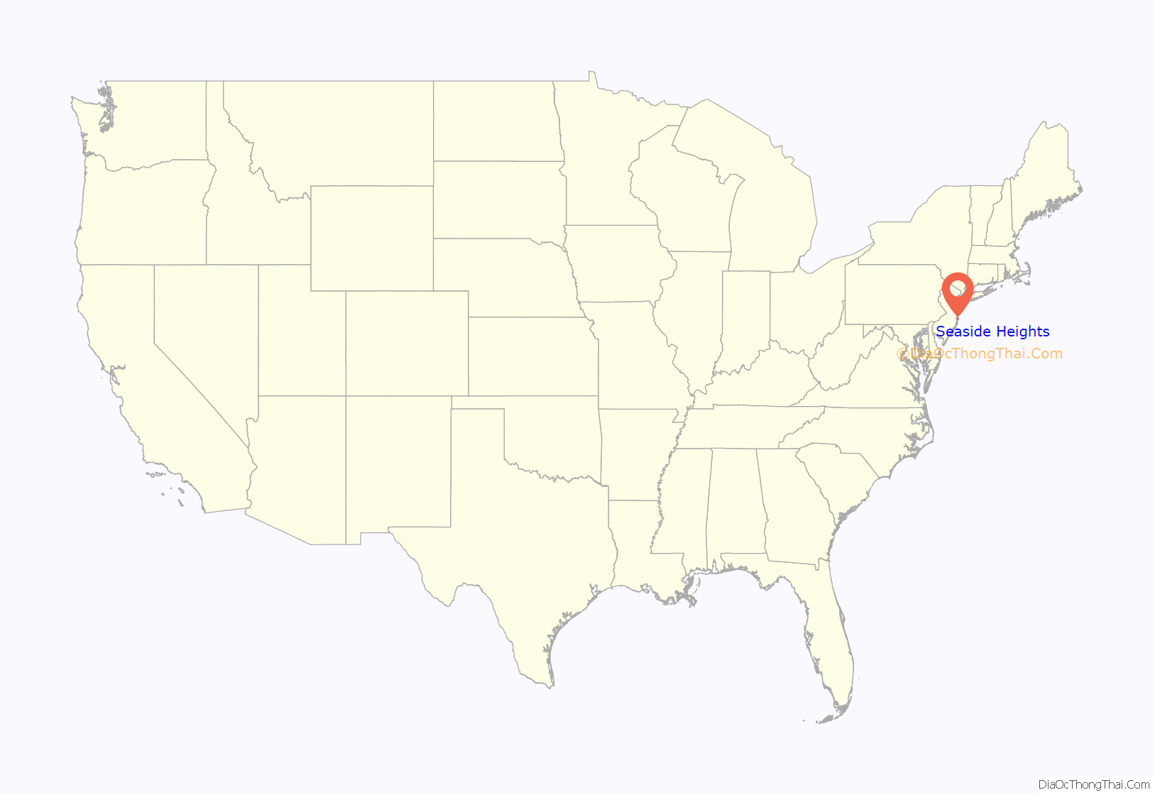
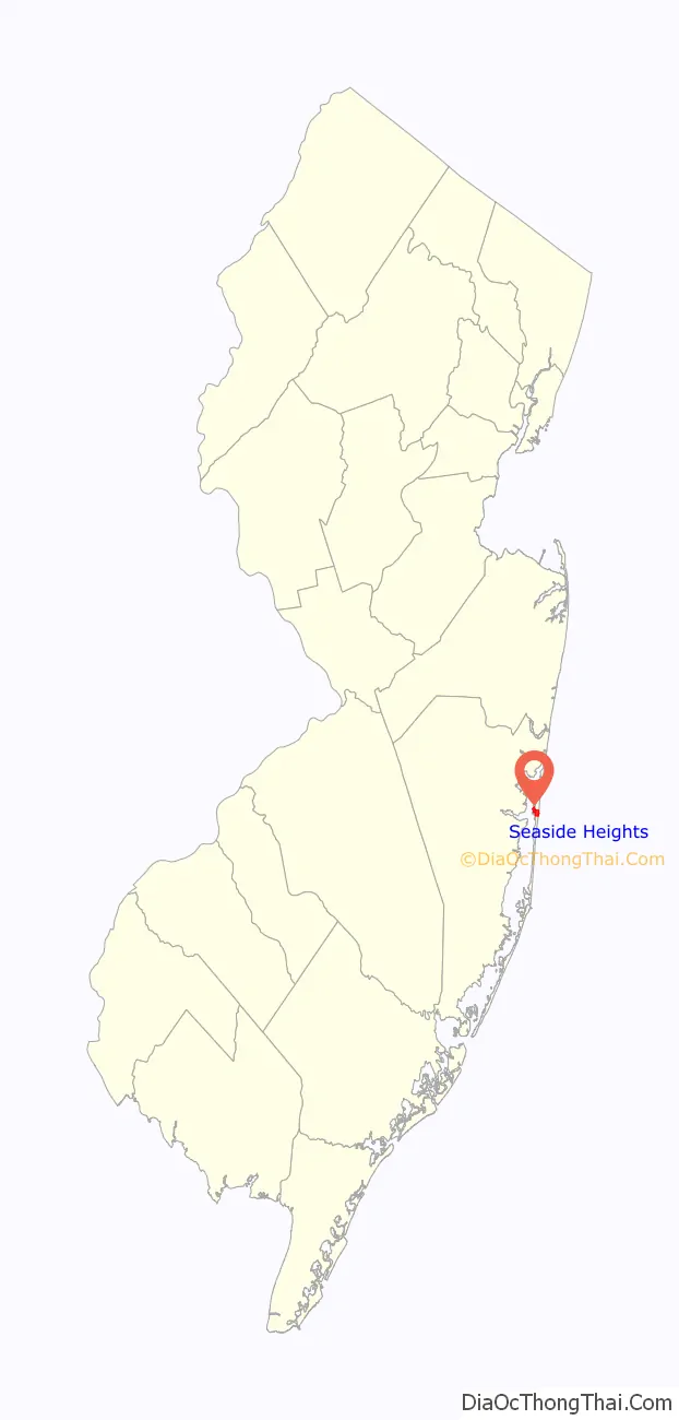
Seaside Heights location map. Where is Seaside Heights borough?
History
In 1915, Senate Amusement Company of Philadelphia planned to build an ocean-side attraction in Seaside Heights within feet of the border to Seaside Park. Their plan was to build a covered pier to house a carousel. The structure was built in 1915 under the direction of Joseph Vanderslice of Senate Amusement Company. Budget issues stalled the project in 1916, and the amusement ride and building was subsequently sold to Frank Freeman. The combination of the completion of the Toms River Bridge on October 23, 1914, and the DuPont Avenue carousel and boardwalk are what likely led to the 159% population growth shown between the 1920 and 1930 censuses in Seaside Heights.
Disasters
On June 9, 1955, a malfunctioning neon sign component caused a fire at a shop on the corner of Ocean Terrace and DuPont Avenue. The fire was driven by winds estimated at 50 miles per hour (80 km/h), blowing the fire south and engulfing the entire pier. The fire was stopped at Stockton Avenue due in part to the fact that the boardwalk and pier ended there. In what became known as Freeman’s Fire, a total of 85 buildings were destroyed with an estimated $4 million in damage.
Beginning on October 29, 2012, substantial portions of the boardwalk were damaged and much of the borough was flooded as a result of Hurricane Sandy. Both the Funtown Pier and Casino Pier suffered major damage, with sections of both piers torn apart by powerful storm surges and waves causing many of the rides to collapse into the ocean. With a curfew set at 4:00 pm to prevent looting, a New Year’s Eve party was held at the Beachcomber for hundreds of area residents at which the arrival of 2013 was celebrated at 3:00 in the afternoon. Casino Pier began cleanup attempts soon after, in an attempt to reopen in time for the summer 2013 season. The Star Jet roller coaster that fell into the water with the Casino Pier had become an attraction in itself. It was taken apart by a wrecker from Weeks Marine on May 14, 2013, just a short time after Prince Harry’s visit to the site the same day with Governor Chris Christie. Repairs to the boardwalk were completed on June 21, 2013, with New Jersey’s First Lady, Mary Pat Christie, hammering the nail into the final board of the project.
On September 12, 2013, a ten-alarm fire swept from the Funtown Pier northward. The fire is believed to have started under the boardwalk, below the Kohr’s Custard stand at the southern end of the pier. The wind pushed it northward, and fire crews were able to make a stand at Lincoln Avenue by tearing up the newly replaced boardwalk which had been destroyed less than a year before by Hurricane Sandy. Jack & Bill’s Bar and Kohr’s Custard were two businesses that were both destroyed in the 1955 and 2013 fires.
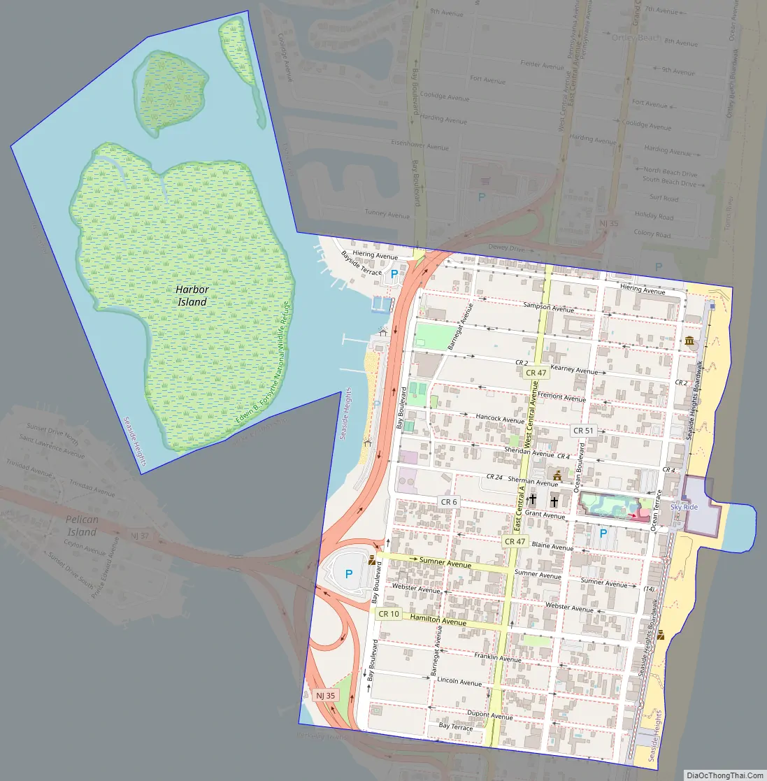
Seaside Heights Road Map
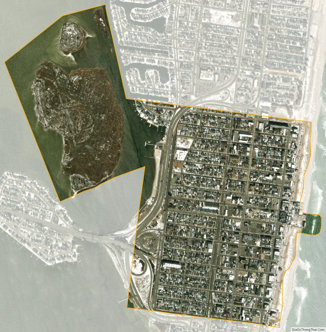
Seaside Heights city Satellite Map
Geography
According to the U.S. Census Bureau, the borough had a total area of 0.74 square miles (1.92 km), including 0.62 square miles (1.60 km) of land and 0.13 square miles (0.32 km) of water (16.89%).
Seaside Heights borders the Ocean County municipalities of Berkeley Township, Seaside Park and Toms River Township.
See also
Map of New Jersey State and its subdivision: Map of other states:- Alabama
- Alaska
- Arizona
- Arkansas
- California
- Colorado
- Connecticut
- Delaware
- District of Columbia
- Florida
- Georgia
- Hawaii
- Idaho
- Illinois
- Indiana
- Iowa
- Kansas
- Kentucky
- Louisiana
- Maine
- Maryland
- Massachusetts
- Michigan
- Minnesota
- Mississippi
- Missouri
- Montana
- Nebraska
- Nevada
- New Hampshire
- New Jersey
- New Mexico
- New York
- North Carolina
- North Dakota
- Ohio
- Oklahoma
- Oregon
- Pennsylvania
- Rhode Island
- South Carolina
- South Dakota
- Tennessee
- Texas
- Utah
- Vermont
- Virginia
- Washington
- West Virginia
- Wisconsin
- Wyoming


