Seaside Park is a borough in Ocean County, in the U.S. state of New Jersey. It is part of the Ocean City metropolitan statistical area. As of the 2020 United States census, the borough’s population was 1,436, a decrease of 143 (−9.1%) from the 2010 census count of 1,579, which in turn had reflected decline of 684 (−30.2%) from the 2,263 counted at the 2000 census. Seaside Park is situated on the Barnegat Peninsula, a long, narrow barrier peninsula that separates Barnegat Bay from the Atlantic Ocean.
| Name: | Seaside Park borough |
|---|---|
| LSAD Code: | 21 |
| LSAD Description: | borough (suffix) |
| State: | New Jersey |
| County: | Ocean County |
| Incorporated: | March 3, 1898 |
| Elevation: | 3 ft (0.9 m) |
| Total Area: | 0.81 sq mi (2.11 km²) |
| Land Area: | 0.66 sq mi (1.70 km²) |
| Water Area: | 0.16 sq mi (0.41 km²) 19.51% |
| Total Population: | 1,436 |
| Population Density: | 2,192.5/sq mi (846.5/km²) |
| ZIP code: | 08752 |
| Area code: | 732 Exchanges: 793, 830, 854 |
| FIPS code: | 3466480 |
| GNISfeature ID: | 885391 |
| Website: | www.seasideparknj.org |
Online Interactive Map
Click on ![]() to view map in "full screen" mode.
to view map in "full screen" mode.
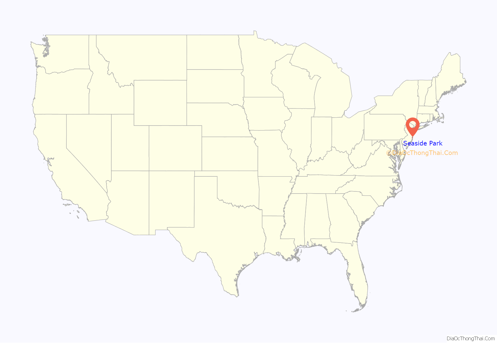
Seaside Park location map. Where is Seaside Park borough?

History
The first inhabitants of the barrier island were Lenape Native Americans who came in search of fish, crabs, clams, and scallops. They called this area “Seheyichbi,” meaning land bordering the ocean. The Atlantic Ocean provided more than food; these people began using shells in place of wooden beads as their form of currency. These Native Americans, who stayed during the summer and went inland for winter, were part of the principal Algonquian tribe that lived mainly on and around the North American Seaboard. The Algonquians in New Jersey called themselves “Lenni Lenape”, which means “original people.”
What is now Seaside Park was a section of Dover Township (now known as Toms River Township) until the creation of Berkeley Township in 1875. The area then became known as the Sea Side Park section of Berkeley Township. Over the next 25 years, lots were sold, houses and roads were built, and the population of Seaside Park began to grow.
On March 3, 1898, New Jersey Senate President Foster M. Voorhees, the acting governor of New Jersey, signed a bill incorporating “Sea Side Park” as an independent borough, created from portions of Berkeley Township. Originally, the town ran from 14th Avenue to North Avenue, about half its present size. An area known as the Berkeley Tract, north of the original area of the borough, was annexed on or about May 12, 1900. The borough was named for its location on the Atlantic Ocean.
As the community grew, the name of the borough lost a space. In 1914, a newly appointed municipal clerk wrote the name of the borough as “Seaside Park” in the council minutes, combining the first two words. This practice continues to this day.
While Sea Side Park was going through the process of being incorporated, the Senate Amusement Company of Philadelphia was working on plans to build an oceanside attraction in Seaside Heights within feet of the border to Sea Side Park. Their plan was to build a covered pier to house a carousel. The structure was built in 1915 under the direction of Joseph Vanderslice of Senate Amusement Company. Budget issues caused the business to not open in 1916, and the amusement ride and building was subsequently sold to Frank Freeman. The combination of the completion of the Toms River Bridge on October 23, 1914, and the DuPont Avenue carousel and boardwalk are what likely led to the 219% population growth shown between the 1910 and 1920 censuses in Sea Side Park.
Disasters
On June 9, 1955, a malfunctioning neon sign component caused a fire at a shop on the corner of Ocean Terrace and DuPont Avenue. The fire was driven by winds estimated at 50 miles per hour (80 km/h), blowing the fire south and engulfing the entire pier. The fire was stopped at Stockton Avenue due in part to the fact that the boardwalk and pier ended there. In what became known as Freeman’s Fire, a total of 85 buildings were destroyed with an estimated $4 million in damage from the conflagration.
On March 8, 1962, Seaside Park was affected by a nor’easter that had churned offshore for two days. The storm, which destroyed a large section of the borough’s boardwalk, is variously referred to as the Ash Wednesday Storm, the Five High Storm and the Great March Storm of 1962.
On September 12, 2013, a ten-alarm fire swept from the Funtown Pier northward. The fire is believed to have started under the boardwalk, below the Kohr’s Kustard stand at the southern end of the pier. The wind pushed it northward, and fire crews were able to make a stand at Lincoln Avenue by tearing up the newly replaced boardwalk which was destroyed less than a year before by Hurricane Sandy. Jack & Bill’s Bar and Kohr’s Kustard were two businesses that were destroyed in both the 1955 and 2013 fires.
On September 17, 2016, a suspected pipe bomb was placed in a trashcan and detonated, causing a small explosion, but no injuries or deaths. It is currently unclear who placed the bomb and under what motivation, but it is believed the bomb’s intended target was the Seaside Semper Five, a 5K run taking place in the surrounding area. The run had been delayed due to unforeseen circumstances regardless, but was canceled soon after details of the explosion became clear.
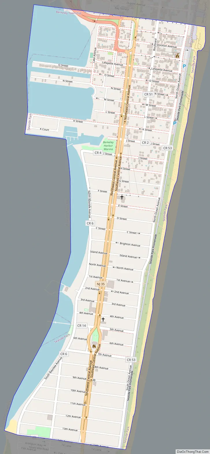
Seaside Park Road Map
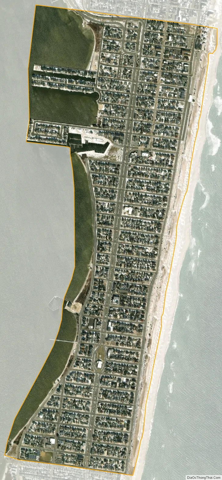
Seaside Park city Satellite Map
Geography
According to the United States Census Bureau, the borough had a total area of 0.81 square miles (2.11 km), including 0.66 square miles (1.70 km) of land and 0.16 square miles (0.41 km) of water (19.51%).
Unincorporated communities, localities and place names located partially or completely within the township include Berkeley.
The borough borders the Ocean County municipalities of Berkeley Township and Seaside Heights.
See also
Map of New Jersey State and its subdivision: Map of other states:- Alabama
- Alaska
- Arizona
- Arkansas
- California
- Colorado
- Connecticut
- Delaware
- District of Columbia
- Florida
- Georgia
- Hawaii
- Idaho
- Illinois
- Indiana
- Iowa
- Kansas
- Kentucky
- Louisiana
- Maine
- Maryland
- Massachusetts
- Michigan
- Minnesota
- Mississippi
- Missouri
- Montana
- Nebraska
- Nevada
- New Hampshire
- New Jersey
- New Mexico
- New York
- North Carolina
- North Dakota
- Ohio
- Oklahoma
- Oregon
- Pennsylvania
- Rhode Island
- South Carolina
- South Dakota
- Tennessee
- Texas
- Utah
- Vermont
- Virginia
- Washington
- West Virginia
- Wisconsin
- Wyoming


