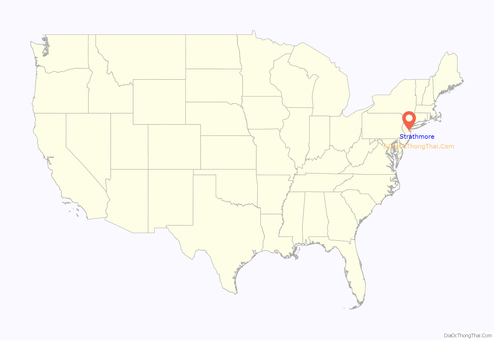
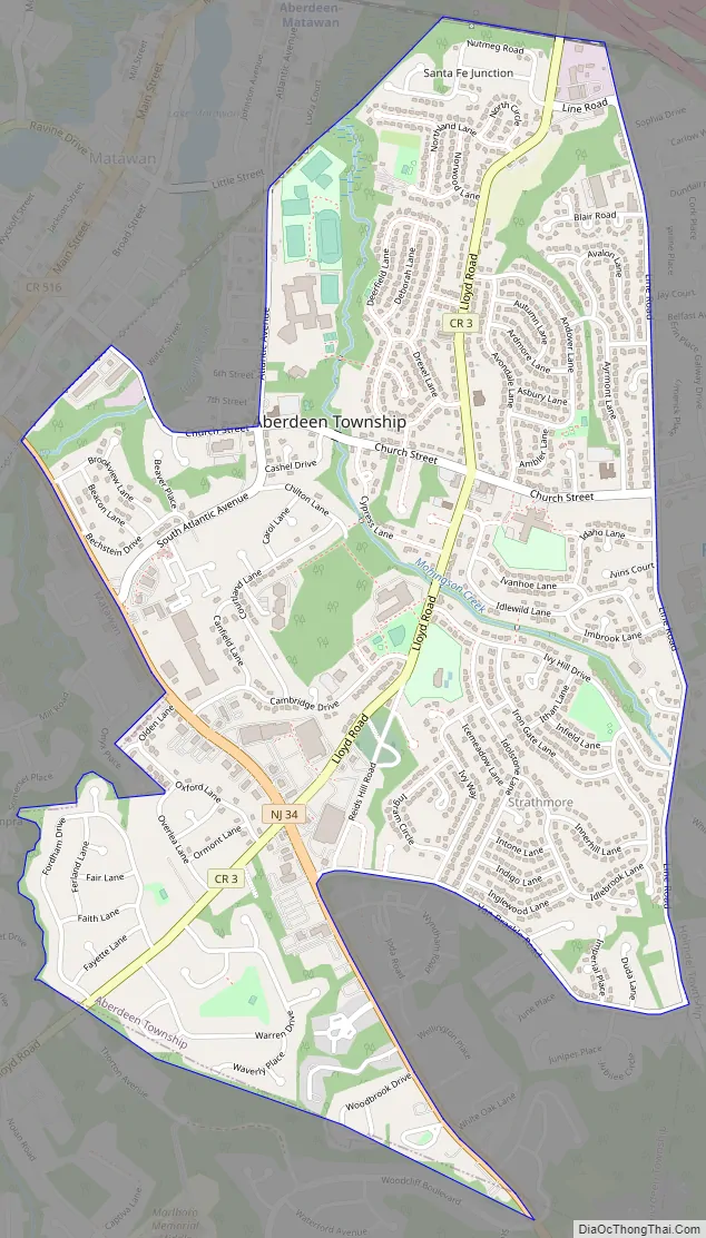
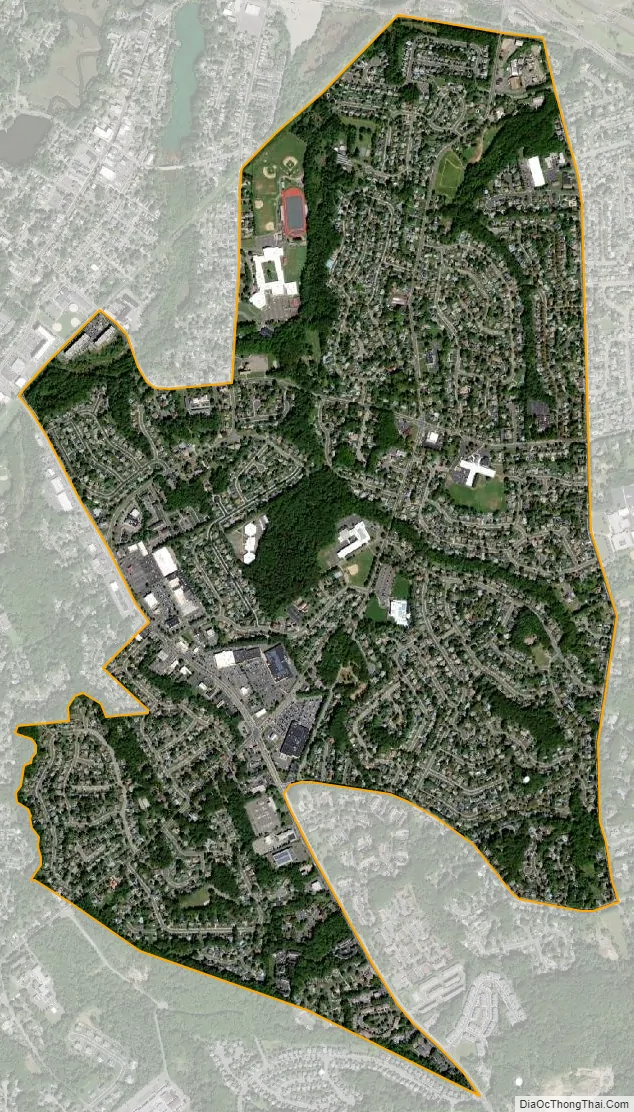
Strathmore is an unincorporated community and census-designated place (CDP) within Aberdeen Township, in Monmouth County, New Jersey, United States. At the 2010 census, the CDP’s population was 7,258.
| Name: | Strathmore CDP |
|---|---|
| LSAD Code: | 57 |
| LSAD Description: | CDP (suffix) |
| State: | New Jersey |
| County: | Monmouth County |
| Elevation: | 49 ft (15 m) |
| Total Area: | 2.02 sq mi (5.23 km²) |
| Land Area: | 1.97 sq mi (5.10 km²) |
| Water Area: | 0.05 sq mi (0.13 km²) 2.47% |
| Total Population: | 7,225 |
| Population Density: | 3,669.38/sq mi (1,417.11/km²) |
| ZIP code: | 07747 |
| Area code: | 732/848 |
| FIPS code: | 3471280 |
| GNISfeature ID: | 02390366 |
Online Interactive Map
Click on ![]() to view map in "full screen" mode.
to view map in "full screen" mode.
Strathmore location map. Where is Strathmore CDP?
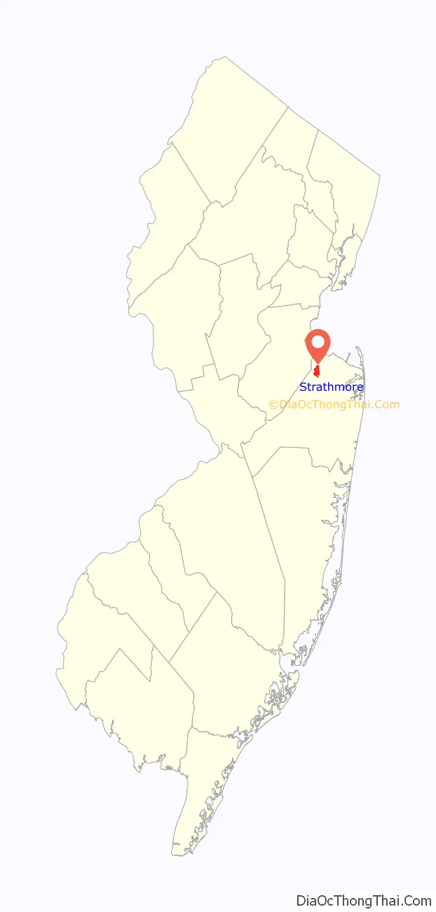
Strathmore Road Map
Strathmore city Satellite Map
Geography
According to the United States Census Bureau, the CDP had a total area of 2.021 square miles (5.235 km), including 1.971 square miles (5.105 km) of land and 0.050 square miles (0.1295 km) of water (2.47%).
See also
Map of New Jersey State and its subdivision: Map of other states:- Alabama
- Alaska
- Arizona
- Arkansas
- California
- Colorado
- Connecticut
- Delaware
- District of Columbia
- Florida
- Georgia
- Hawaii
- Idaho
- Illinois
- Indiana
- Iowa
- Kansas
- Kentucky
- Louisiana
- Maine
- Maryland
- Massachusetts
- Michigan
- Minnesota
- Mississippi
- Missouri
- Montana
- Nebraska
- Nevada
- New Hampshire
- New Jersey
- New Mexico
- New York
- North Carolina
- North Dakota
- Ohio
- Oklahoma
- Oregon
- Pennsylvania
- Rhode Island
- South Carolina
- South Dakota
- Tennessee
- Texas
- Utah
- Vermont
- Virginia
- Washington
- West Virginia
- Wisconsin
- Wyoming


