Jemez Springs (pronounced HEH-mes) is a village in Sandoval County, New Mexico, United States. The population was 250 at the 2010 census. Named for the nearby Pueblo of Jemez, the village is the site of Jemez State Monument and the headquarters of the Jemez Ranger District. The village and nearby locations in the Jemez Valley are the site of hot springs and several religious retreats.
| Name: | Jemez Springs village |
|---|---|
| LSAD Code: | 47 |
| LSAD Description: | village (suffix) |
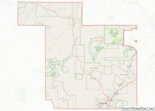
| State: | New Mexico |
| County: | Sandoval County |
| Elevation: | 6,237 ft (1,901 m) |
| Total Area: | 4.80 sq mi (12.43 km²) |
| Land Area: | 4.80 sq mi (12.43 km²) |
| Water Area: | 0.00 sq mi (0.00 km²) |
| Total Population: | 198 |
| Population Density: | 41.24/sq mi (15.92/km²) |
| ZIP code: | 87025 |
| Area code: | 575 |
| FIPS code: | 3535320 |
| GNISfeature ID: | 2413562 |
| Website: | www.jemezsprings.org |
Online Interactive Map
Click on ![]() to view map in "full screen" mode.
to view map in "full screen" mode.
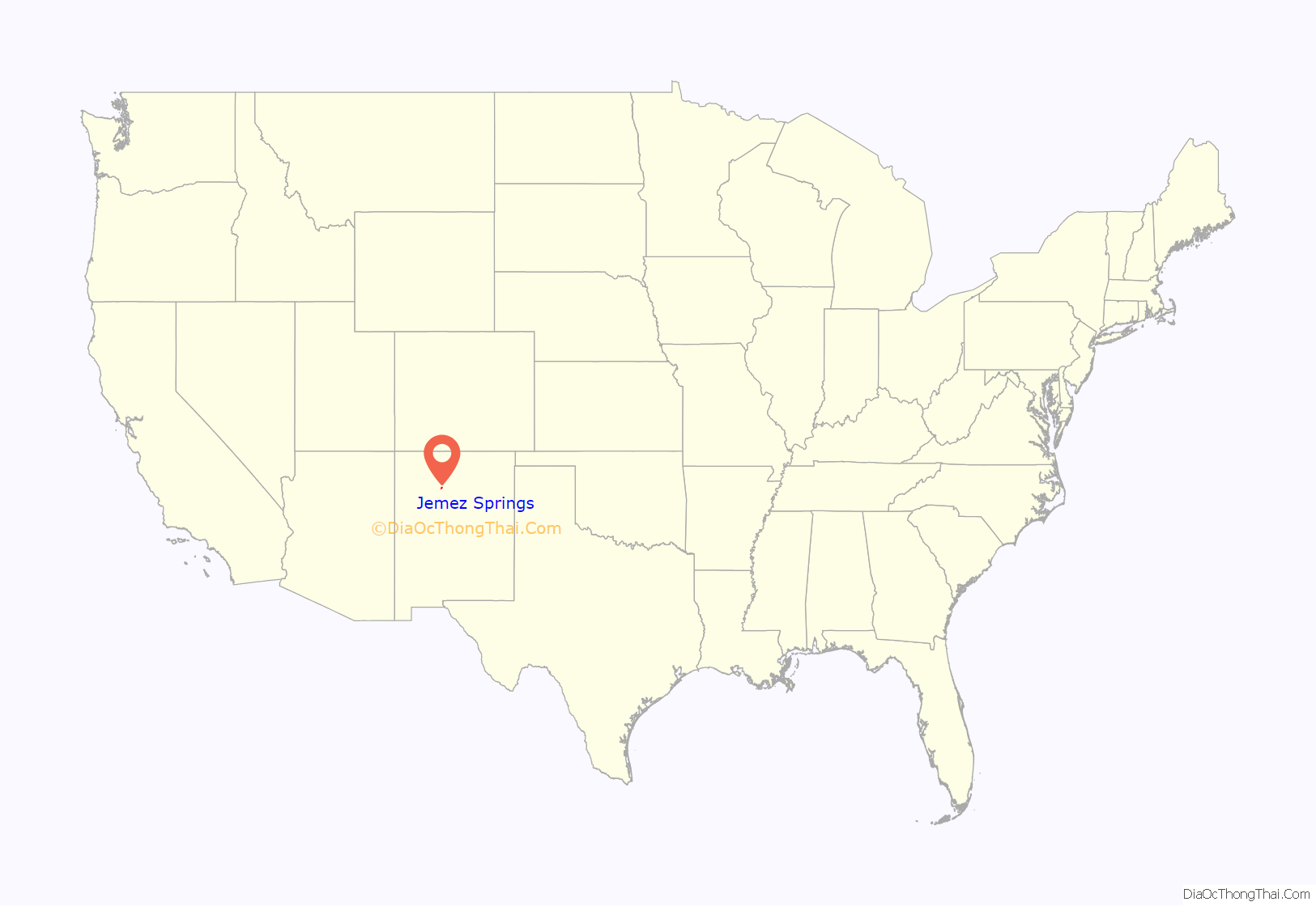
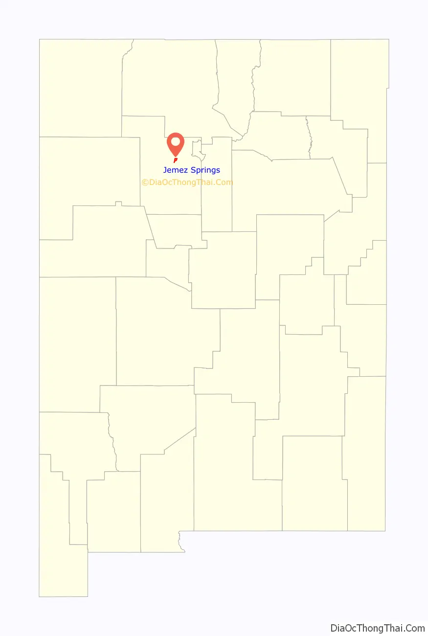
Jemez Springs location map. Where is Jemez Springs village?
History
The Jemez Valley is thought to have been inhabited for the last 4500 years. The Spaniards who visited the area beginning in 1540 reported multiple Native American pueblos (villages), in the valley. The Franciscan mission church San José de los Jemez was built just to the north of the current village in 1621 but was abandoned around the 1640s. Today the ruins are the site of Jemez State Monument. Following the Pueblo Revolt the Jemez people began converging at the current Pueblo of Jemez. In the nineteenth century the valley was given over to mostly agrarian and pastoral uses.
Jemez Springs’ post office opened in 1907. The village is named for the Pueblo of Jemez twelve miles to the south. The 1907 post office was preceded by one established in 1884 named Archuleta. The village’s current main bathhouse originates from this period.
In 1942, Jemez Springs was the second choice (after Oak City, Utah) for the location of the Los Alamos National Laboratory, the proposed Manhattan Project research laboratory, but Los Alamos was chosen instead.
In 1947 two Roman Catholic retreats were founded nearby, the Congregation of the Servants of the Paraclete and the Handmaids of the Precious Blood. The village was incorporated on December 5, 1955. Following enthusiasm from supporters of Kyozan Joshu Sasaki, the Bodhi Manda Zen Center was founded in 1972.
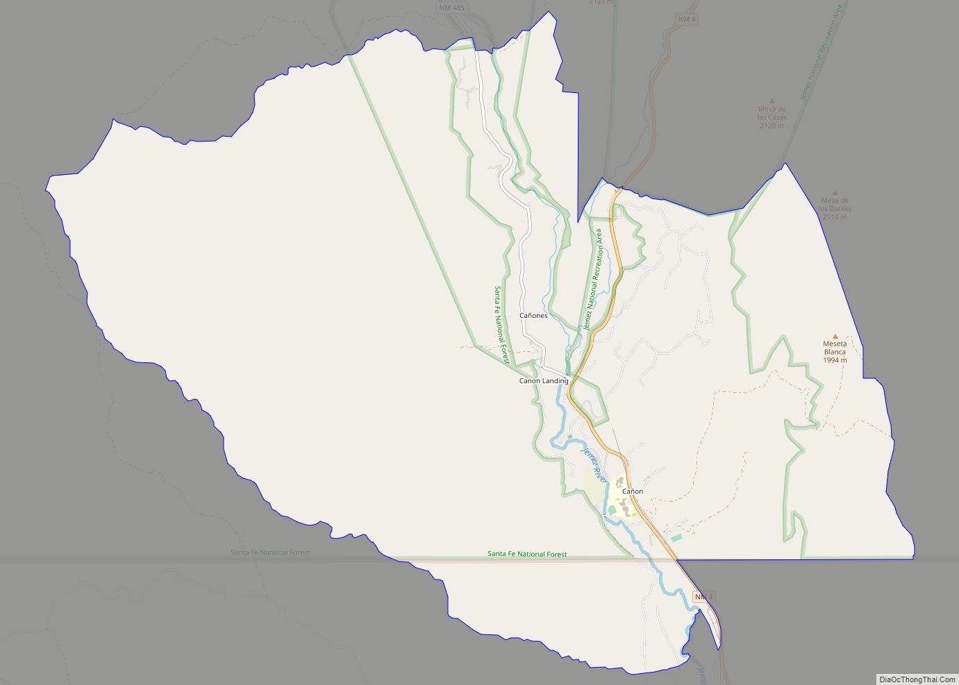
Jemez Springs Road Map
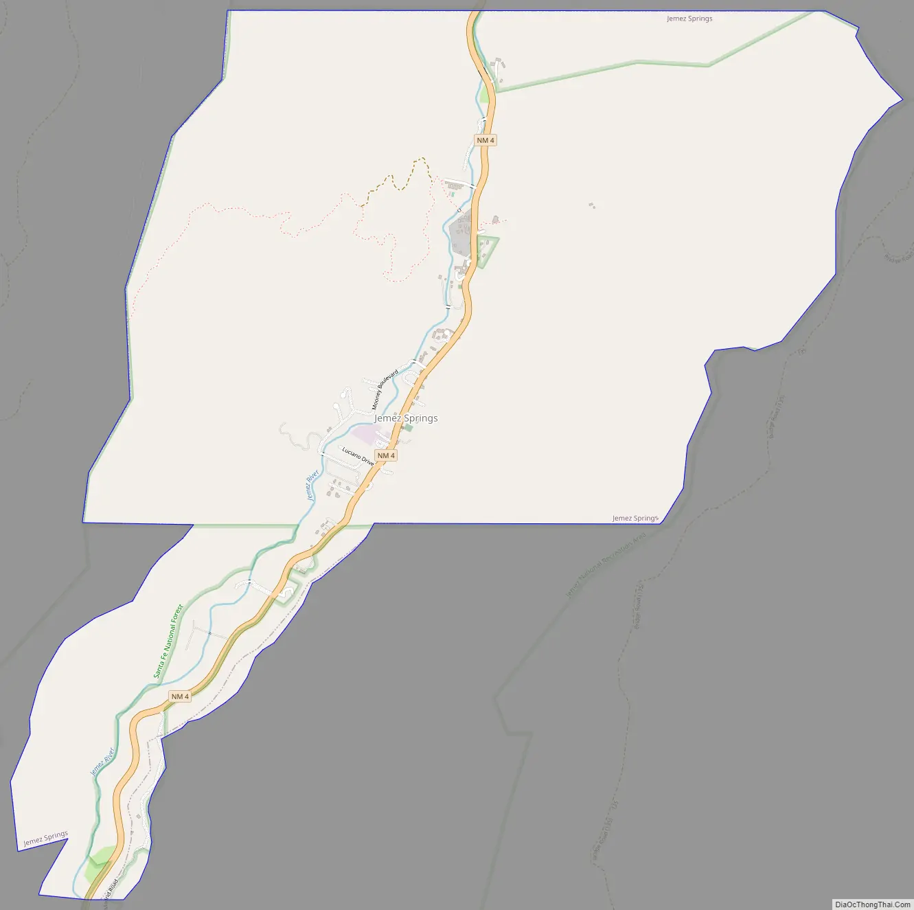
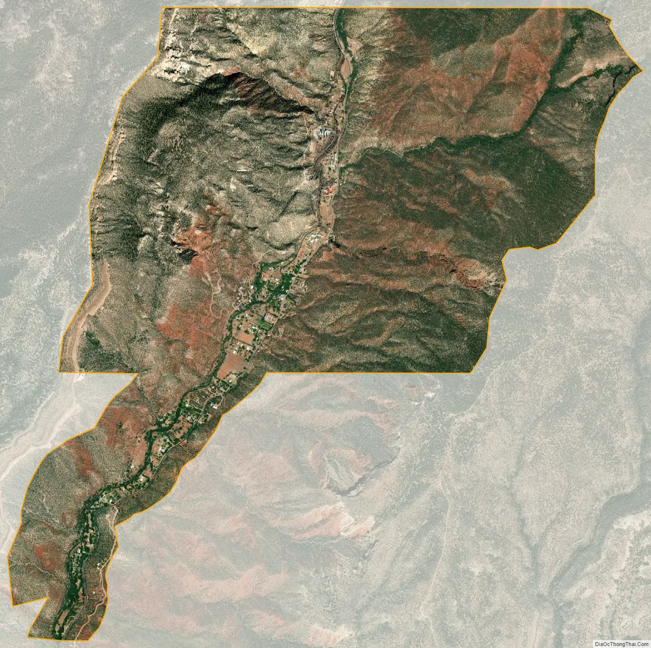
Jemez Springs city Satellite Map
Geography
Situated in the Jemez Mountains, Jemez Springs is located entirely within the Santa Fe National Forest. The village is sited on the Jemez River in the red rock San Diego Canyon. State Highway 4 passes through the settlement on the east bank of the Rio Grande tributary. Geothermal springs in and near the village feed the Jemez River. The village has a total area of 4.8 square miles (12 km), all land.
See also
Map of New Mexico State and its subdivision: Map of other states:- Alabama
- Alaska
- Arizona
- Arkansas
- California
- Colorado
- Connecticut
- Delaware
- District of Columbia
- Florida
- Georgia
- Hawaii
- Idaho
- Illinois
- Indiana
- Iowa
- Kansas
- Kentucky
- Louisiana
- Maine
- Maryland
- Massachusetts
- Michigan
- Minnesota
- Mississippi
- Missouri
- Montana
- Nebraska
- Nevada
- New Hampshire
- New Jersey
- New Mexico
- New York
- North Carolina
- North Dakota
- Ohio
- Oklahoma
- Oregon
- Pennsylvania
- Rhode Island
- South Carolina
- South Dakota
- Tennessee
- Texas
- Utah
- Vermont
- Virginia
- Washington
- West Virginia
- Wisconsin
- Wyoming