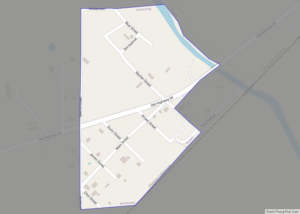
Armstrong is a town in Bryan County, Oklahoma, United States, along the Blue River. The population was 105 at the 2010 census, a 25.2 percent decrease from the figure of 141 recorded in 2000. The town was named for Frank C. Armstrong, a member of the Dawes Commission.
| Name: | Armstrong town |
|---|---|
| LSAD Code: | 43 |
| LSAD Description: | town (suffix) |
| State: | Oklahoma |
| County: | Bryan County |
| Elevation: | 581 ft (177 m) |
| Total Area: | 0.09 sq mi (0.23 km²) |
| Land Area: | 0.09 sq mi (0.23 km²) |
| Water Area: | 0.00 sq mi (0.00 km²) |
| Total Population: | 113 |
| Population Density: | 1,298.85/sq mi (502.22/km²) |
| FIPS code: | 4002750 |
| GNISfeature ID: | 1089697 |
Online Interactive Map
Click on ![]() to view map in "full screen" mode.
to view map in "full screen" mode.
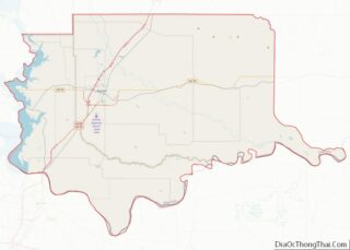
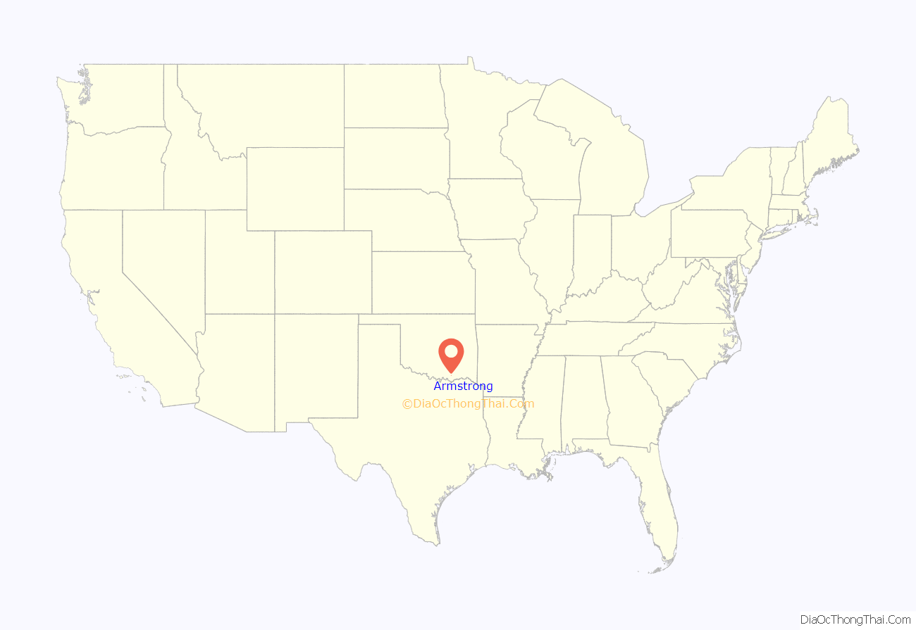
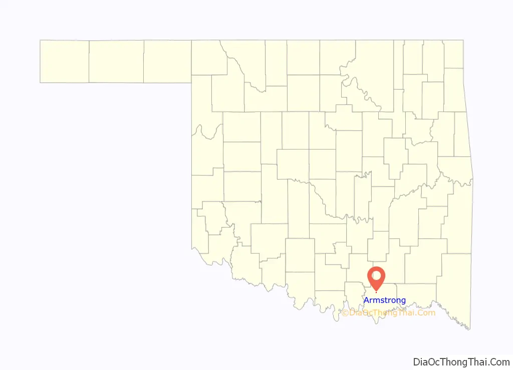
Armstrong location map. Where is Armstrong town?
History
The town of Armstrong began along the route of the Missouri-Kansas-Texas Railroad (Katy) in 1872. At the time of Armstrong’s founding it was located in Blue County of the Choctaw Nation. The town had a post office in 1882–3, but thereafter the mail was sent to Caddo. In 1896, another post office opened in Armstrong, but it was closed in 1920. The post office was located in the only grocery store, and the store owner was also the postmaster. In 1911, the population was 41.
The Oklahoma Office of the Game Warden (now the Department of Wildlife Conservation) established a fish hatchery in the town about 1916. Otherwise the town survived economically by serving small farms in the area and catering to the needs of sport fishermen who were attracted to the Blue River and nearby Lake Texoma, By 1980, the town had 133 residents. The population dropped to 122 in 1990, then rose to 141 in 2000. It dropped again, and was 105 in 2010.
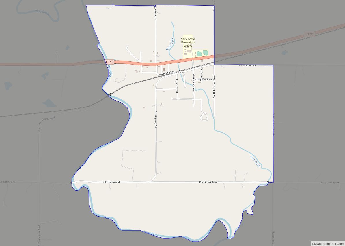
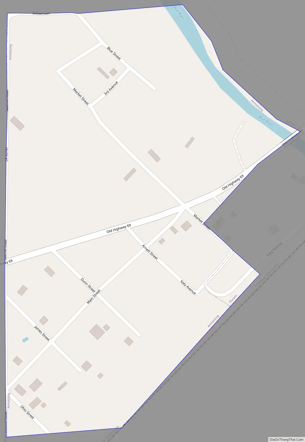
Armstrong Road Map
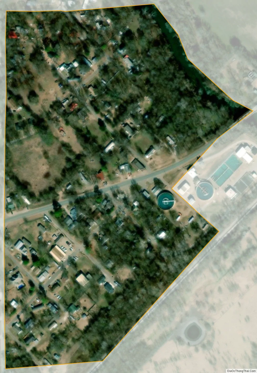
Armstrong city Satellite Map
Geography
Armstrong is located at 34°3′9″N 96°20′39″W / 34.05250°N 96.34417°W / 34.05250; -96.34417 (34.052530, -96.344193). It is 5 miles (8.0 km) north of Durant.
According to the United States Census Bureau, the town has a total area of 0.1 square miles (0.26 km), all land.
See also
Map of Oklahoma State and its subdivision:- Adair
- Alfalfa
- Atoka
- Beaver
- Beckham
- Blaine
- Bryan
- Caddo
- Canadian
- Carter
- Cherokee
- Choctaw
- Cimarron
- Cleveland
- Coal
- Comanche
- Cotton
- Craig
- Creek
- Custer
- Delaware
- Dewey
- Ellis
- Garfield
- Garvin
- Grady
- Grant
- Greer
- Harmon
- Harper
- Haskell
- Hughes
- Jackson
- Jefferson
- Johnston
- Kay
- Kingfisher
- Kiowa
- Latimer
- Le Flore
- Lincoln
- Logan
- Love
- Major
- Marshall
- Mayes
- McClain
- McCurtain
- McIntosh
- Murray
- Muskogee
- Noble
- Nowata
- Okfuskee
- Oklahoma
- Okmulgee
- Osage
- Ottawa
- Pawnee
- Payne
- Pittsburg
- Pontotoc
- Pottawatomie
- Pushmataha
- Roger Mills
- Rogers
- Seminole
- Sequoyah
- Stephens
- Texas
- Tillman
- Tulsa
- Wagoner
- Washington
- Washita
- Woods
- Woodward
- Alabama
- Alaska
- Arizona
- Arkansas
- California
- Colorado
- Connecticut
- Delaware
- District of Columbia
- Florida
- Georgia
- Hawaii
- Idaho
- Illinois
- Indiana
- Iowa
- Kansas
- Kentucky
- Louisiana
- Maine
- Maryland
- Massachusetts
- Michigan
- Minnesota
- Mississippi
- Missouri
- Montana
- Nebraska
- Nevada
- New Hampshire
- New Jersey
- New Mexico
- New York
- North Carolina
- North Dakota
- Ohio
- Oklahoma
- Oregon
- Pennsylvania
- Rhode Island
- South Carolina
- South Dakota
- Tennessee
- Texas
- Utah
- Vermont
- Virginia
- Washington
- West Virginia
- Wisconsin
- Wyoming