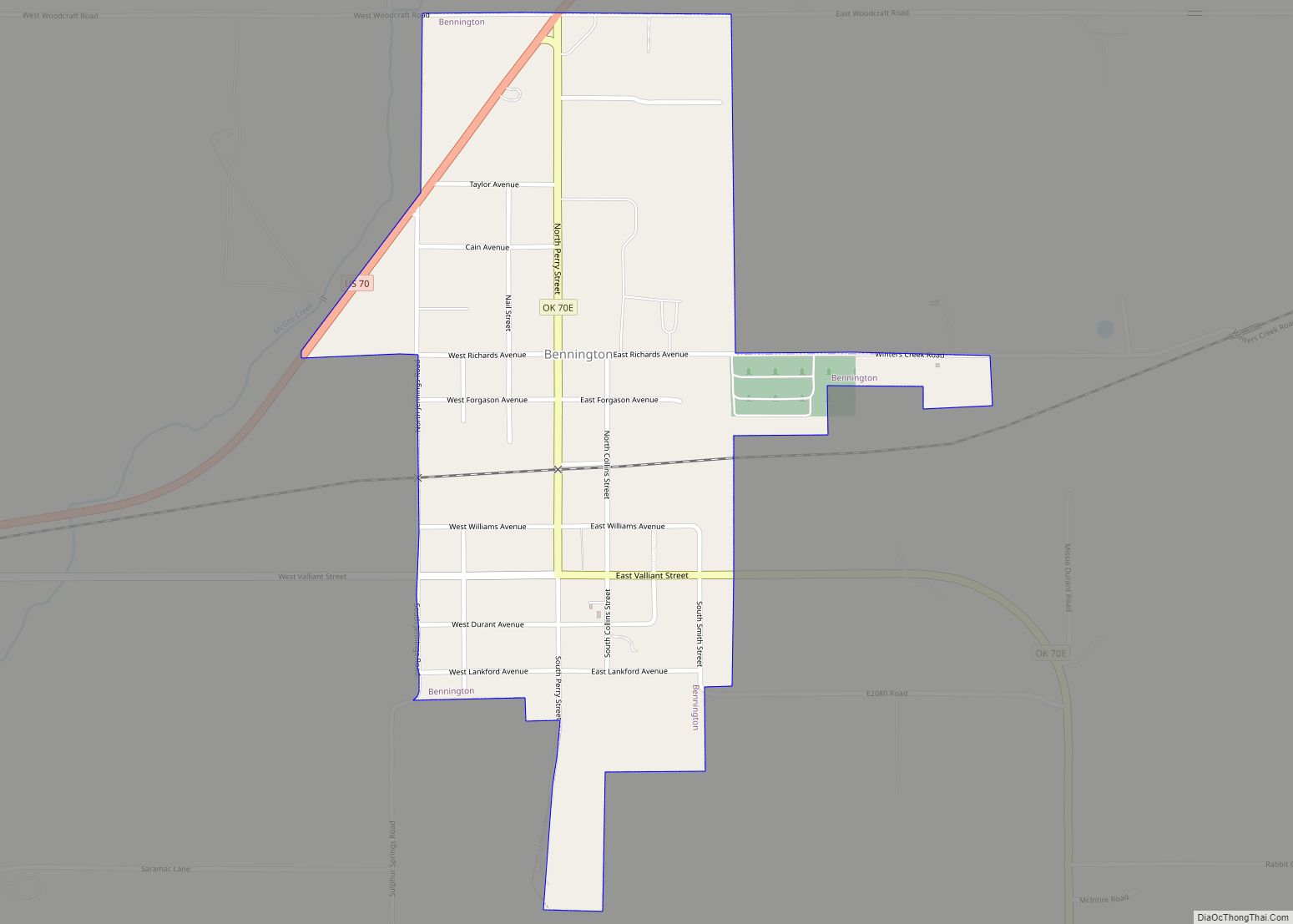
Bennington is a town in Bryan County, Oklahoma, United States. The population was 334 at the 2010 census.
| Name: | Bennington town |
|---|---|
| LSAD Code: | 43 |
| LSAD Description: | town (suffix) |
| State: | Oklahoma |
| County: | Bryan County |
| Elevation: | 627 ft (191 m) |
| Total Area: | 0.73 sq mi (1.90 km²) |
| Land Area: | 0.73 sq mi (1.90 km²) |
| Water Area: | 0.00 sq mi (0.00 km²) |
| Total Population: | 282 |
| Population Density: | 384.72/sq mi (148.55/km²) |
| ZIP code: | 74723 |
| Area code: | 580 |
| FIPS code: | 4005400 |
| GNISfeature ID: | 1090009 |
Online Interactive Map
Click on ![]() to view map in "full screen" mode.
to view map in "full screen" mode.
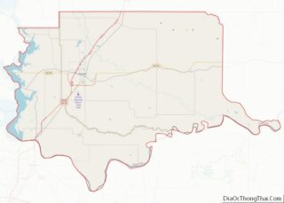
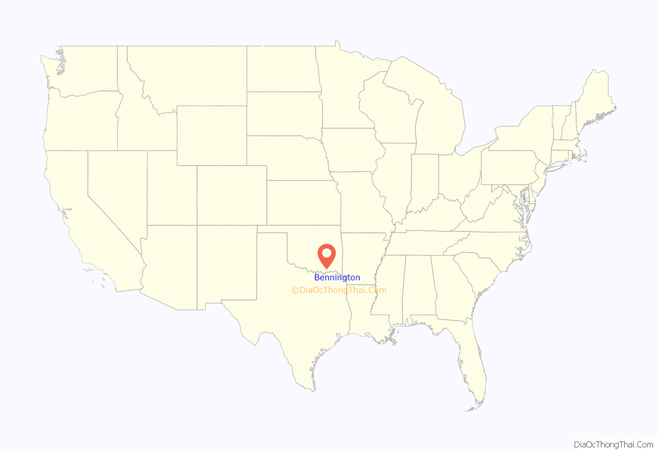
Bennington location map. Where is Bennington town?
History
In 1853, a Presbyterian minister named A. G. Lansing established Mount Pleasant Mission Station near present-day Matoy in the Choctaw Nation, Indian Territory. Lansing turned the mission operation over to Rev. Charles C. Copeland, who moved the mission a few miles farther south because the original site was in a boggy and remote location that was unhealthy. Copeland renamed the mission Bennington Mission Station, honoring his home town of Bennington, Vermont. A post office was established in 1873, but closed in 1878. It was reestablished in 1884. The peak population during this period was 45 people.
At the time of its founding, Bennington was located in Blue County of the Choctaw Nation. In 1886 that portion of the county, along with portions of Atoka County and Kiamitia County, joined to form Jackson County, with its county seat at Pigeon Roost, near present-day Boswell.
The Arkansas and Choctaw Railway built through the area in 1902, and missed Bennington by two miles. Some of the buildings were dragged down to the railroad line, where a new town was established in 1903 and grew quickly to 250 people in that year. The 1910 census showed the population had about doubled to 513, then peaked at 915 in 1920, before falling to 492 in 1930.
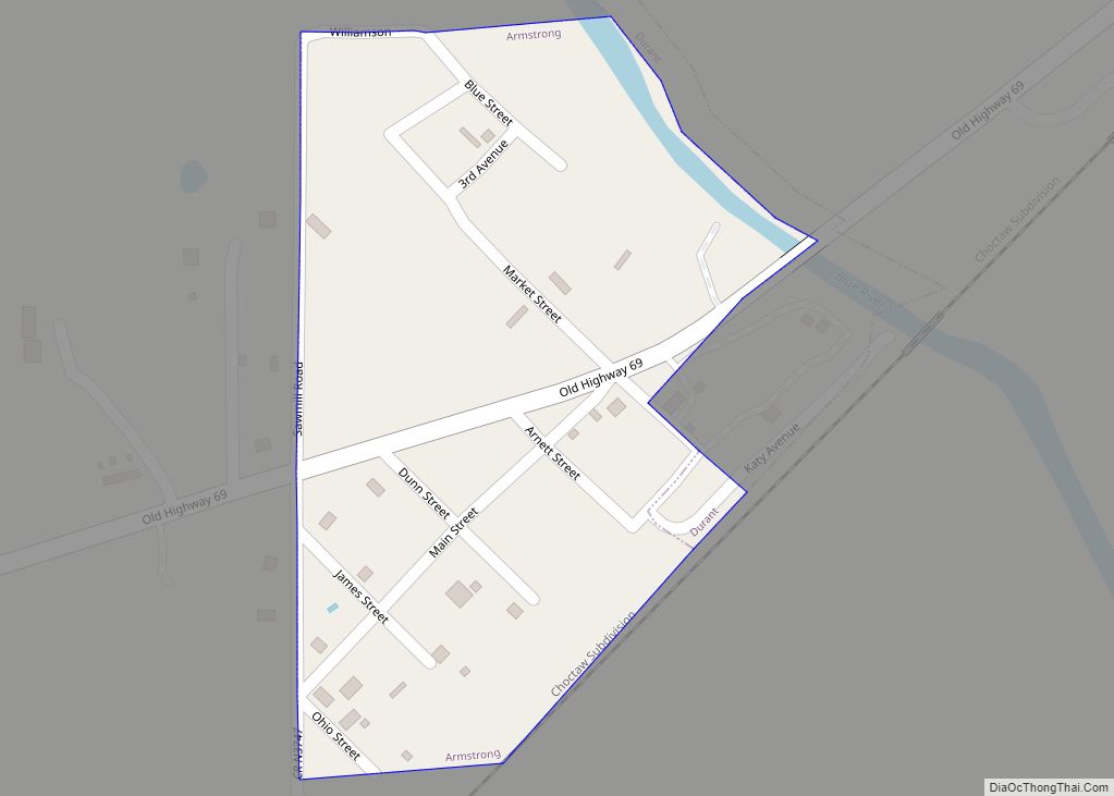
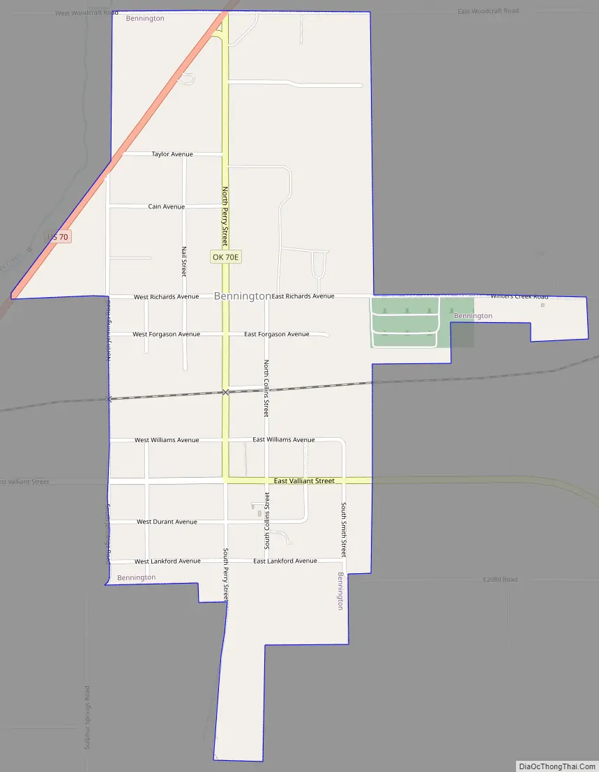
Bennington Road Map
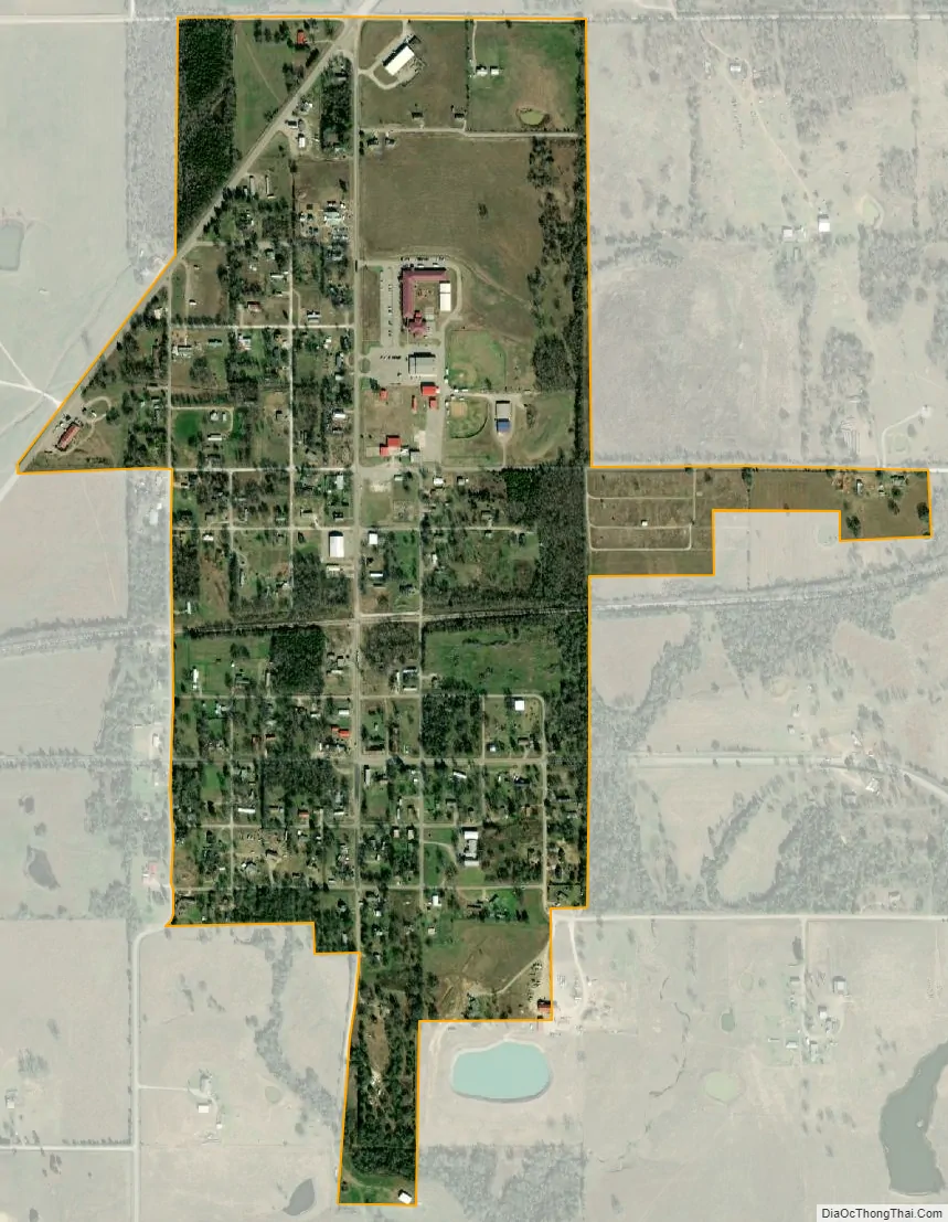
Bennington city Satellite Map
Geography
Bennington is located at 34°0′6″N 96°2′15″W / 34.00167°N 96.03750°W / 34.00167; -96.03750 (34.001540, -96.037608). It is 20 miles (32 km) east of Durant on County Road E2075.
According to the United States Census Bureau, the town has a total area of 0.6 square miles (1.6 km), all land.
See also
Map of Oklahoma State and its subdivision:- Adair
- Alfalfa
- Atoka
- Beaver
- Beckham
- Blaine
- Bryan
- Caddo
- Canadian
- Carter
- Cherokee
- Choctaw
- Cimarron
- Cleveland
- Coal
- Comanche
- Cotton
- Craig
- Creek
- Custer
- Delaware
- Dewey
- Ellis
- Garfield
- Garvin
- Grady
- Grant
- Greer
- Harmon
- Harper
- Haskell
- Hughes
- Jackson
- Jefferson
- Johnston
- Kay
- Kingfisher
- Kiowa
- Latimer
- Le Flore
- Lincoln
- Logan
- Love
- Major
- Marshall
- Mayes
- McClain
- McCurtain
- McIntosh
- Murray
- Muskogee
- Noble
- Nowata
- Okfuskee
- Oklahoma
- Okmulgee
- Osage
- Ottawa
- Pawnee
- Payne
- Pittsburg
- Pontotoc
- Pottawatomie
- Pushmataha
- Roger Mills
- Rogers
- Seminole
- Sequoyah
- Stephens
- Texas
- Tillman
- Tulsa
- Wagoner
- Washington
- Washita
- Woods
- Woodward
- Alabama
- Alaska
- Arizona
- Arkansas
- California
- Colorado
- Connecticut
- Delaware
- District of Columbia
- Florida
- Georgia
- Hawaii
- Idaho
- Illinois
- Indiana
- Iowa
- Kansas
- Kentucky
- Louisiana
- Maine
- Maryland
- Massachusetts
- Michigan
- Minnesota
- Mississippi
- Missouri
- Montana
- Nebraska
- Nevada
- New Hampshire
- New Jersey
- New Mexico
- New York
- North Carolina
- North Dakota
- Ohio
- Oklahoma
- Oregon
- Pennsylvania
- Rhode Island
- South Carolina
- South Dakota
- Tennessee
- Texas
- Utah
- Vermont
- Virginia
- Washington
- West Virginia
- Wisconsin
- Wyoming