Binger /ˈbɪŋɡər/ is a town in Caddo County, Oklahoma, United States. The population was 672 at the 2010 census. It is the headquarters of the Caddo Nation of Oklahoma, who were settled in the area during the 1870s.
| Name: | Binger town |
|---|---|
| LSAD Code: | 43 |
| LSAD Description: | town (suffix) |
| State: | Oklahoma |
| County: | Caddo County |
| Elevation: | 1,319 ft (402 m) |
| Total Area: | 0.86 sq mi (2.23 km²) |
| Land Area: | 0.86 sq mi (2.23 km²) |
| Water Area: | 0.00 sq mi (0.00 km²) |
| Total Population: | 438 |
| Population Density: | 507.53/sq mi (196.03/km²) |
| ZIP code: | 73009 |
| Area code: | 405 |
| FIPS code: | 4006200 |
| GNISfeature ID: | 1090145 |
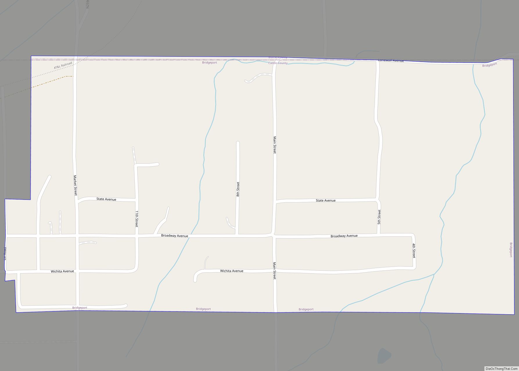
Online Interactive Map
Click on ![]() to view map in "full screen" mode.
to view map in "full screen" mode.
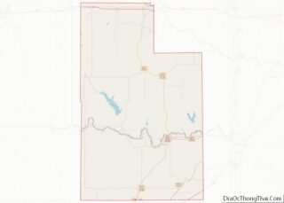
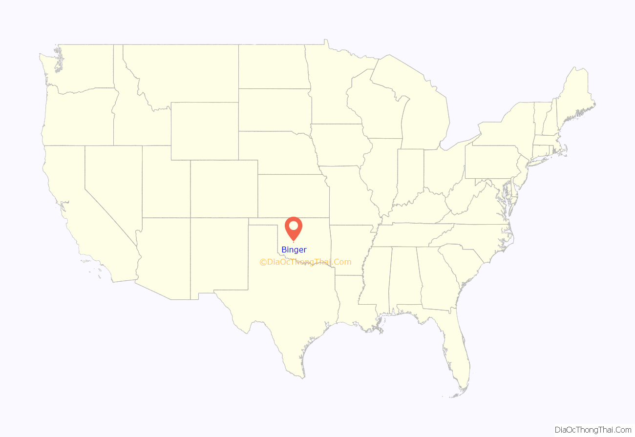
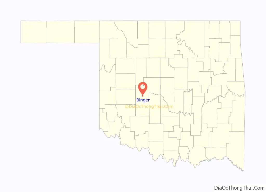
Binger location map. Where is Binger town?
History
Binger was established immediately after the opening of the Wichita-Caddo Reservation in August 1901, and organized by the Washita Valley Townsite Company. It was named for Binger Hermann, then Commissioner of the U. S. Land Office. A post office named Binger opened in November, 1901.
Binger’s early economy was based on agriculture in the surrounding area, and whose principal crops were peanuts and cotton. The Enid and Anadarko Railway constructed a line from Bridgeport to Anadarko via Binger in 1901-2. This railway was purchased by the Chicago, Rock Island and Pacific Railway in 1903, and was abandoned in 1939.
The Binger Journal, a weekly newspaper, began publication in 1902. Other early businesses included:the Newell Department Store, the First State Bank of Binger, the Binger Hotel, the L. A. Cross Lumber Company and the Deer Head Saloon. The population was 257 at the time of statehood in 1907, and increased to 280 in 1910.
According to the U.S. Census, the peak population was 849 in 1930, then dropped to 840 in 1940, and continuing to decline to 603 in 1960.
The Caddo Nation headquarters complex is located in Binger. It includes the Caddo Nation Heritage Museum, which opened in 2001.
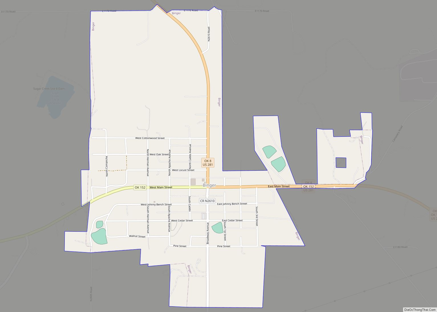
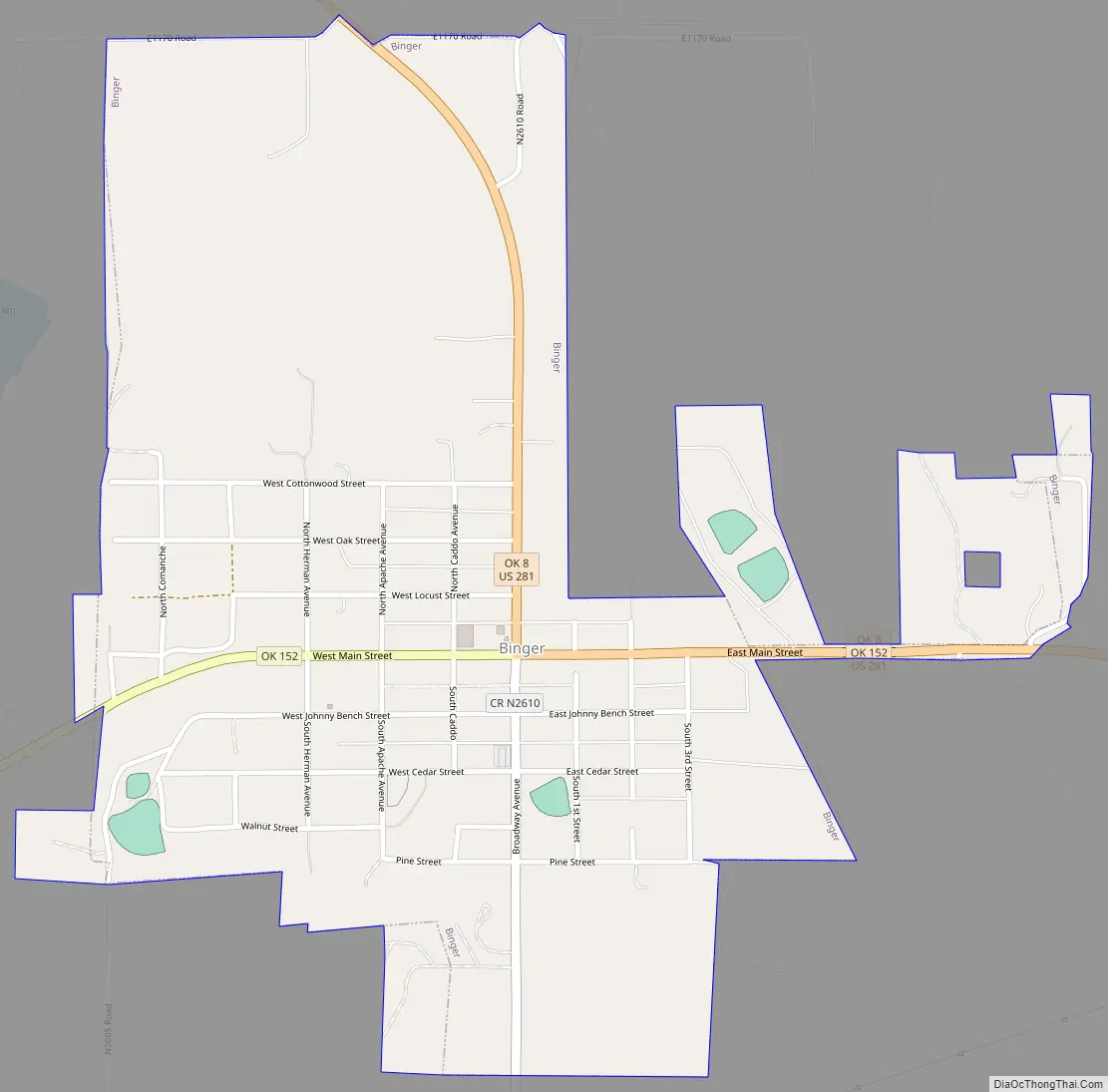
Binger Road Map
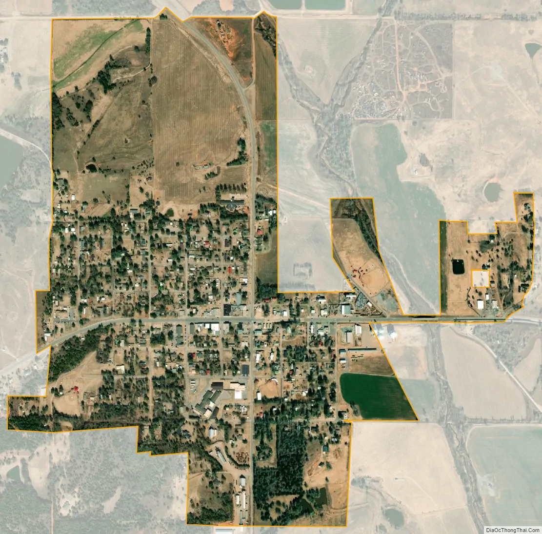
Binger city Satellite Map
Geography
Binger is located in northeast Caddo County at 35°18′32″N 98°20′28″W / 35.30889°N 98.34111°W / 35.30889; -98.34111 (35.309023, -98.341243). It is in the valley of Sugar Creek, a tributary of the Washita River, part of the Red River watershed.
U.S. Route 281 passes through the town, leading north 12 miles (19 km) to Hinton and 16 miles (26 km) to Interstate 40, and leading east, then south 20 miles (32 km) to Anadarko. Oklahoma State Highway 152 also passes through the town, leading west 36 miles (58 km) to New Cordell and east 56 miles (90 km) to the center of Oklahoma City.
According to the United States Census Bureau, the town of Binger has a total area of 0.87 square miles (2.26 km), all land.
See also
Map of Oklahoma State and its subdivision:- Adair
- Alfalfa
- Atoka
- Beaver
- Beckham
- Blaine
- Bryan
- Caddo
- Canadian
- Carter
- Cherokee
- Choctaw
- Cimarron
- Cleveland
- Coal
- Comanche
- Cotton
- Craig
- Creek
- Custer
- Delaware
- Dewey
- Ellis
- Garfield
- Garvin
- Grady
- Grant
- Greer
- Harmon
- Harper
- Haskell
- Hughes
- Jackson
- Jefferson
- Johnston
- Kay
- Kingfisher
- Kiowa
- Latimer
- Le Flore
- Lincoln
- Logan
- Love
- Major
- Marshall
- Mayes
- McClain
- McCurtain
- McIntosh
- Murray
- Muskogee
- Noble
- Nowata
- Okfuskee
- Oklahoma
- Okmulgee
- Osage
- Ottawa
- Pawnee
- Payne
- Pittsburg
- Pontotoc
- Pottawatomie
- Pushmataha
- Roger Mills
- Rogers
- Seminole
- Sequoyah
- Stephens
- Texas
- Tillman
- Tulsa
- Wagoner
- Washington
- Washita
- Woods
- Woodward
- Alabama
- Alaska
- Arizona
- Arkansas
- California
- Colorado
- Connecticut
- Delaware
- District of Columbia
- Florida
- Georgia
- Hawaii
- Idaho
- Illinois
- Indiana
- Iowa
- Kansas
- Kentucky
- Louisiana
- Maine
- Maryland
- Massachusetts
- Michigan
- Minnesota
- Mississippi
- Missouri
- Montana
- Nebraska
- Nevada
- New Hampshire
- New Jersey
- New Mexico
- New York
- North Carolina
- North Dakota
- Ohio
- Oklahoma
- Oregon
- Pennsylvania
- Rhode Island
- South Carolina
- South Dakota
- Tennessee
- Texas
- Utah
- Vermont
- Virginia
- Washington
- West Virginia
- Wisconsin
- Wyoming