Bixby is a city in Tulsa and Wagoner counties in the U.S. state of Oklahoma, and is a suburb of Tulsa. The population was 28,609 at the 2020 census and 20,884 in the 2010 census, an increase of 13.70 percent In 2010, Bixby became the 19th largest city in Oklahoma. It is nicknamed “The Garden Spot of Oklahoma” for its rich agrarian heritage. Though one of the fastest-growing communities in Oklahoma, it remains a sod-growing center and a popular location for purchasing fresh vegetables. The per capita income of $36,257 is the highest in the Tulsa Metropolitan area and is more than 50 percent higher than the state average. In 2009, CNN Money.com placed Bixby No. 67 on its list of 100 Best Places to Live.
| Name: | Bixby city |
|---|---|
| LSAD Code: | 25 |
| LSAD Description: | city (suffix) |
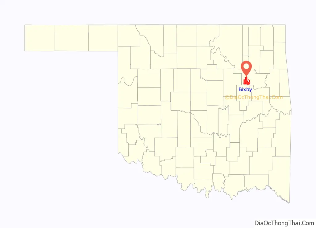
| State: | Oklahoma |
| County: | Tulsa County, Wagoner County |
| Elevation: | 600 ft (183 m) |
| Total Area: | 26.76 sq mi (69.30 km²) |
| Land Area: | 25.70 sq mi (66.57 km²) |
| Water Area: | 1.05 sq mi (2.73 km²) |
| Total Population: | 28,609 |
| Population Density: | 1,112.97/sq mi (429.73/km²) |
| ZIP code: | 74008 |
| FIPS code: | 4006400 |
| GNISfeature ID: | 1090185 |
| Website: | bixbyok.gov |
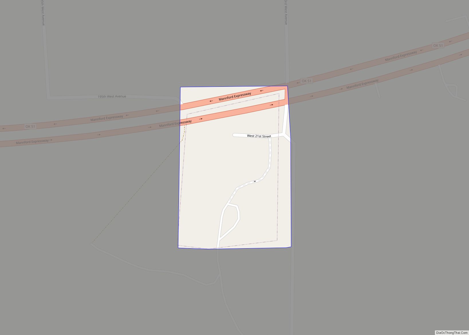
Online Interactive Map
Click on ![]() to view map in "full screen" mode.
to view map in "full screen" mode.
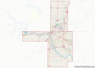
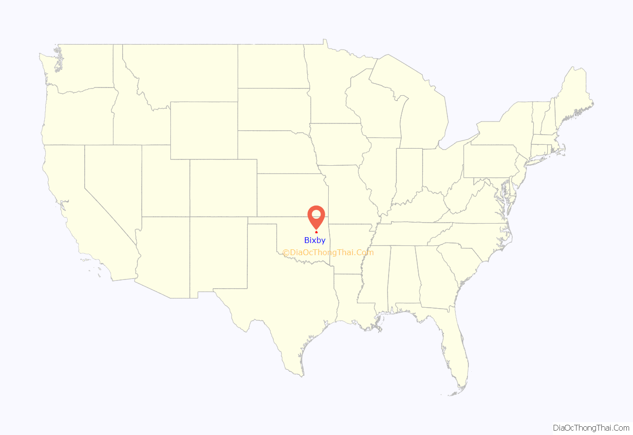
Bixby location map. Where is Bixby city?
History
Alexander Posey, a member of the Muscogee (Creek) Nation, and his family settled in the area now known as Bixby in the late 1800s. He founded a community that was initially known as “Posey on Posey Creek,” and included two saloons, a blacksmith shop, and a general store. The town became a government townsite with a post office in 1895. Located in the Muscogee (Creek) Nation, Indian Territory, Bixby was named in honor of Tams Bixby, a chairman of the Dawes Commission. The original 80-acre (32 ha) townsite plat was approved by the Dawes Commission in 1902. Many settlers were attracted to the area by the rich, though sometimes swampy river bottom land. In 1904 the Midland Valley Railroad laid tracks and built a depot about 1/2 mile north of the original town of Bixby. This created factions that briefly split Bixby into two towns. The new part of town was deliberately surveyed so that the new streets did not align with the existing ones. However, businesses in the original town soon moved to the new location and built permanent brick buildings there. Bixby incorporated as an independent, self-governing town in 1906, with a population of 400 and an area of 160 acres (0.25 sq mi). The first mayor, recorder and five aldermen were elected in February 1907. In 1911, a two-story brick schoolhouse was built on Main Street. Bixby Central Elementary is now near the original site. A traffic bridge was built over the Arkansas River in 1911, and for a time was said to be the longest bridge west of the Mississippi River.
Fry, a community located north of the original townsite but later annexed by Bixby, served the surrounding trade area when the only way to get across the Arkansas River was by way of the Shellenberger Ferry. Fry’s post office operated from 1896 until 1909.
The Bixby Bulletin, the town’s first newspaper, began publication in February 1905. It continued publication until 2005. A second paper, the Bixby Journal existed only from 1907 until 1910.
Bixby was impacted and enriched by the discovery of nearby natural gas deposits in 1905-1906 and oil fields in 1913, but farming remained the backbone of the community well into the 20th Century. Early farmers focused on production of cotton, wheat and alfalfa in the rich river bottom. During the 1930s, truck farming of vegetables slowly replaced those crops. In 1941, Bixby became an important regional center for shipping produce by railroads. It was at that time that Bixby was christened with its nickname “The Garden Spot of Oklahoma,” a designation still carried on the town seal and public vehicles. Cantaloupes, potatoes, radishes, squash, turnips, spinach and sweet corn were shipped from Bixby all over the U.S. In time, the majority of the truck farms were converted to the production of sod, typically Bermuda grass, or developed for residential and other purposes. Only a small percentage of Bixby residents now work in agriculture, but the town continues to celebrate its earthy roots with the yearly “Green Corn Festival” in June.
Another point of history commemorated by Bixby is the 1832 visit to the area by the famous American writer Washington Irving. Irving accompanied a U.S. Army exploration party on an excursion from Fort Gibson west onto the prairie and the lands occupied by the Osage and Pawnee tribes. He described his adventure in his book A Tour on the Prairies (1835). In it, he relates camping in a grove of large trees on the banks of the Arkansas River in what is present-day Bixby. The town has honored his visit by the creation of Washington Irving Park and Arboretum near the location. The park contains an amphitheatre stage patterned after the front facade of Irving’s home, Sunnyside, in Tarrytown, New York, as well as gates near the park entrance that are replicas of ones at Irving’s estate. A bronze statue of Washington Irving sits near the stage. Bixby Middle School drama students present a popular retelling of Irving’s The Legend of Sleepy Hollow in the park each October. The park is also the location of the heavily attended “Bixby BBQ & Music Festival” each May and the Bixby “Deutschesfest” in September.
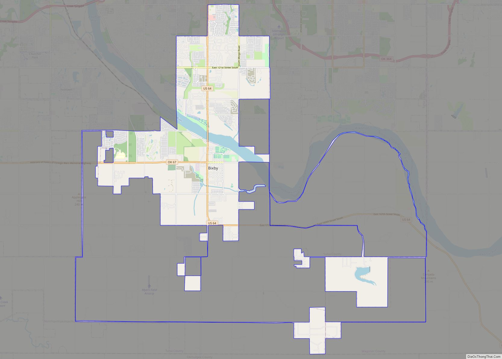
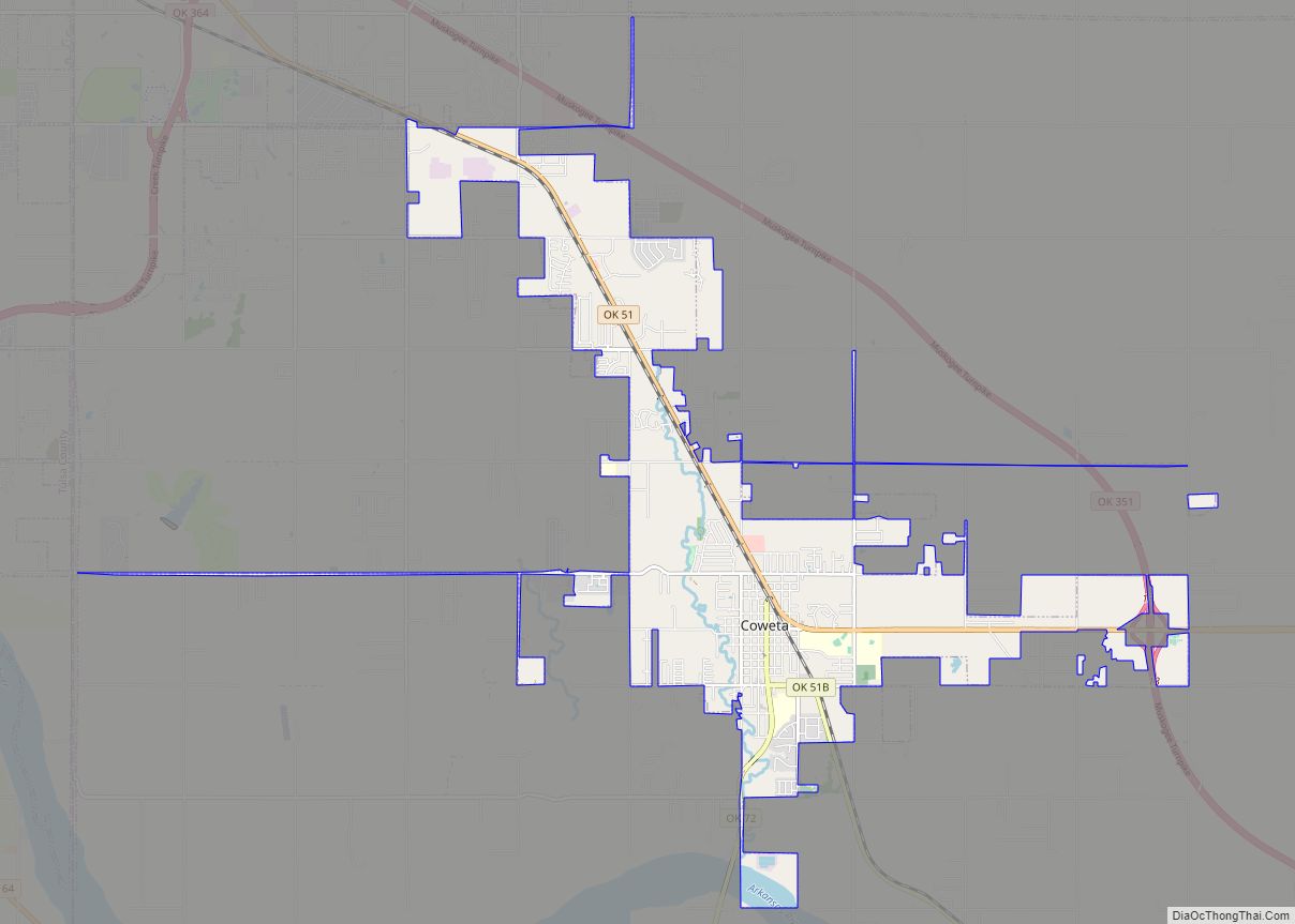
Bixby Road Map
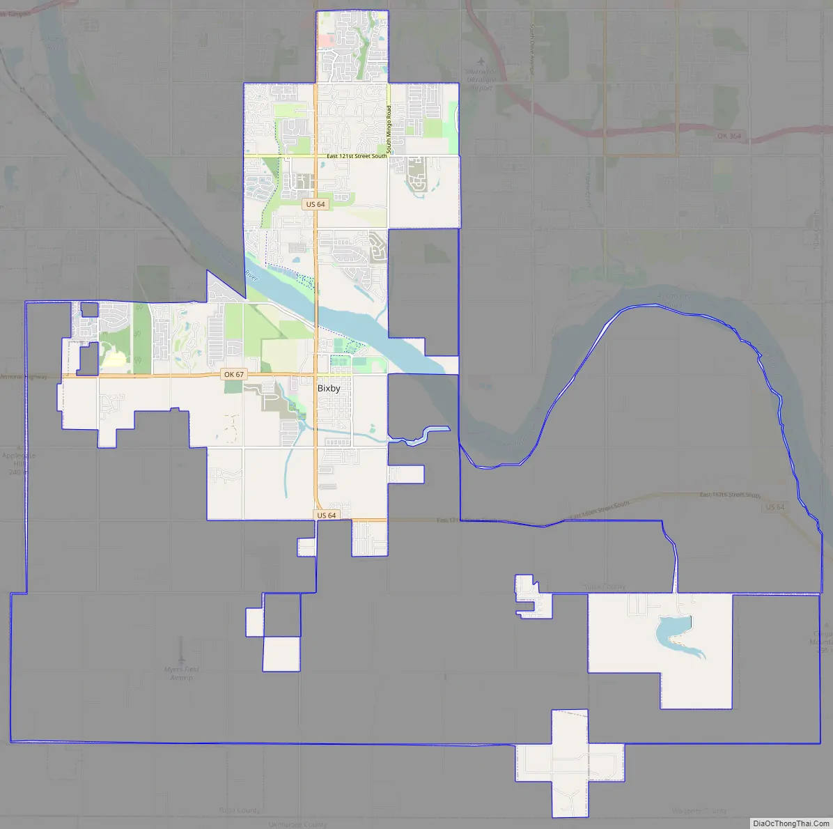
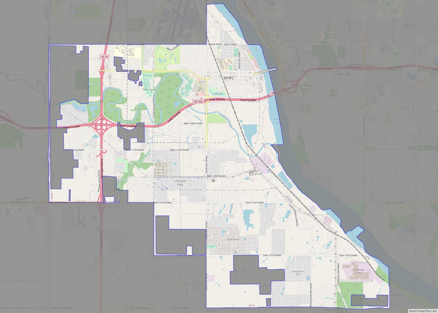
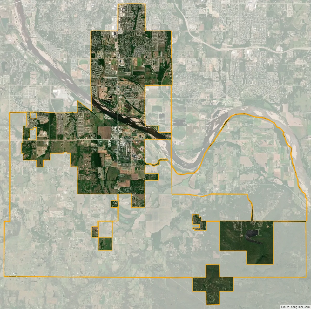
Bixby city Satellite Map
Geography
Bixby is located at 35°57′39″N 95°52′42″W / 35.96083°N 95.87833°W / 35.96083; -95.87833 (35.960898, −95.878258). According to the United States Census Bureau, the city has a total area of 25.1 square miles (65.0 km), of which 24.0 square miles (62.3 km) is land and 1.0 square mile (2.7 km) (4.15%) is water. The average elevation is 750 ft (230 m) above MSL. The town is bisected into north and south portions by the Arkansas River; the original town center is located south of the river.
See also
Map of Oklahoma State and its subdivision:- Adair
- Alfalfa
- Atoka
- Beaver
- Beckham
- Blaine
- Bryan
- Caddo
- Canadian
- Carter
- Cherokee
- Choctaw
- Cimarron
- Cleveland
- Coal
- Comanche
- Cotton
- Craig
- Creek
- Custer
- Delaware
- Dewey
- Ellis
- Garfield
- Garvin
- Grady
- Grant
- Greer
- Harmon
- Harper
- Haskell
- Hughes
- Jackson
- Jefferson
- Johnston
- Kay
- Kingfisher
- Kiowa
- Latimer
- Le Flore
- Lincoln
- Logan
- Love
- Major
- Marshall
- Mayes
- McClain
- McCurtain
- McIntosh
- Murray
- Muskogee
- Noble
- Nowata
- Okfuskee
- Oklahoma
- Okmulgee
- Osage
- Ottawa
- Pawnee
- Payne
- Pittsburg
- Pontotoc
- Pottawatomie
- Pushmataha
- Roger Mills
- Rogers
- Seminole
- Sequoyah
- Stephens
- Texas
- Tillman
- Tulsa
- Wagoner
- Washington
- Washita
- Woods
- Woodward
- Alabama
- Alaska
- Arizona
- Arkansas
- California
- Colorado
- Connecticut
- Delaware
- District of Columbia
- Florida
- Georgia
- Hawaii
- Idaho
- Illinois
- Indiana
- Iowa
- Kansas
- Kentucky
- Louisiana
- Maine
- Maryland
- Massachusetts
- Michigan
- Minnesota
- Mississippi
- Missouri
- Montana
- Nebraska
- Nevada
- New Hampshire
- New Jersey
- New Mexico
- New York
- North Carolina
- North Dakota
- Ohio
- Oklahoma
- Oregon
- Pennsylvania
- Rhode Island
- South Carolina
- South Dakota
- Tennessee
- Texas
- Utah
- Vermont
- Virginia
- Washington
- West Virginia
- Wisconsin
- Wyoming