Cimarron City is a town in Logan County, Oklahoma, United States. The population was 150 at the 2010 census, a 39.4 percent gain over the figure of 110 in 2000. It is part of the Oklahoma City Metropolitan Statistical Area. Cimarron City is a combination bedroom and retirement community.
| Name: | Cimarron City town |
|---|---|
| LSAD Code: | 43 |
| LSAD Description: | town (suffix) |
| State: | Oklahoma |
| County: | Logan County |
| Elevation: | 968 ft (295 m) |
| Total Area: | 1.79 sq mi (4.64 km²) |
| Land Area: | 1.69 sq mi (4.37 km²) |
| Water Area: | 0.11 sq mi (0.27 km²) |
| Total Population: | 155 |
| Population Density: | 91.93/sq mi (35.49/km²) |
| FIPS code: | 4014500 |
| GNISfeature ID: | 1699801 |
Online Interactive Map
Click on ![]() to view map in "full screen" mode.
to view map in "full screen" mode.
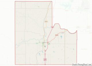
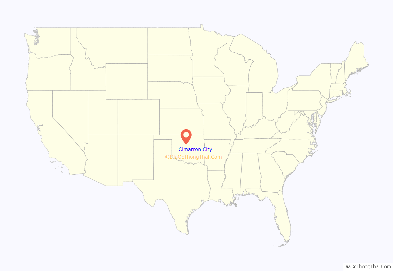
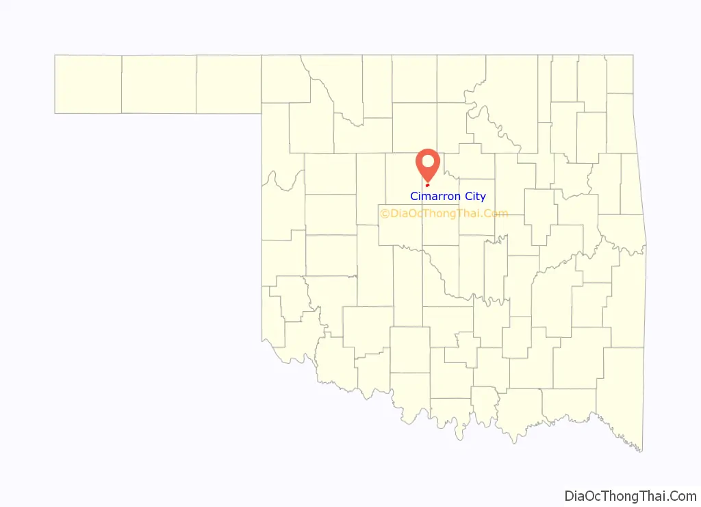
Cimarron City location map. Where is Cimarron City town?
History
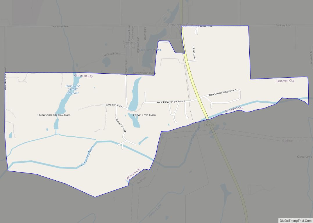
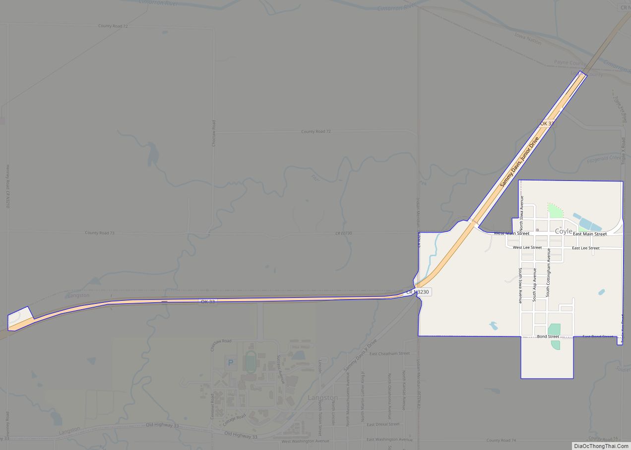
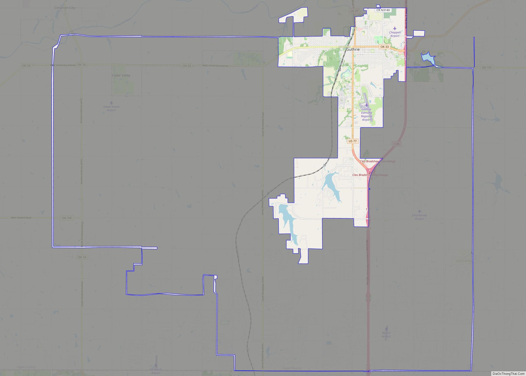
Cimarron City is a planned community that was founded in July 1973 by real estate developers. J. L. Swaim, a former Oklahoma resident residing in Chico, California, and real estate dealer Don McLaughlin, of Oklahoma City. Leon Spitz, an Oklahoma City engineer, designed the residential section. The community grew slowly, as homes were constructed for families and retirees who wanted to live amid a rural ambience. Residents who still work typically must commute to Oklahoma City, Guthrie, Edmond or Crescent. It incorporated in 1974, and was named for the Cimarron River, which flows through the southwestern part of the town.
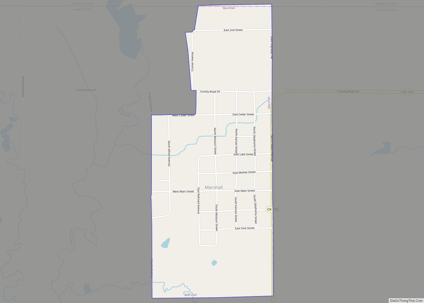
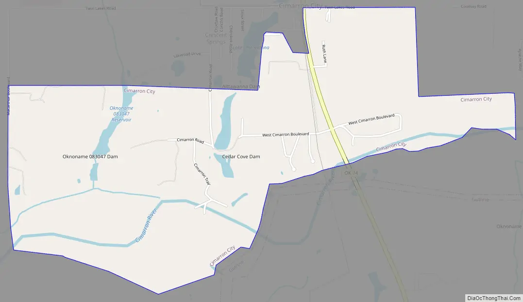
Cimarron City Road Map
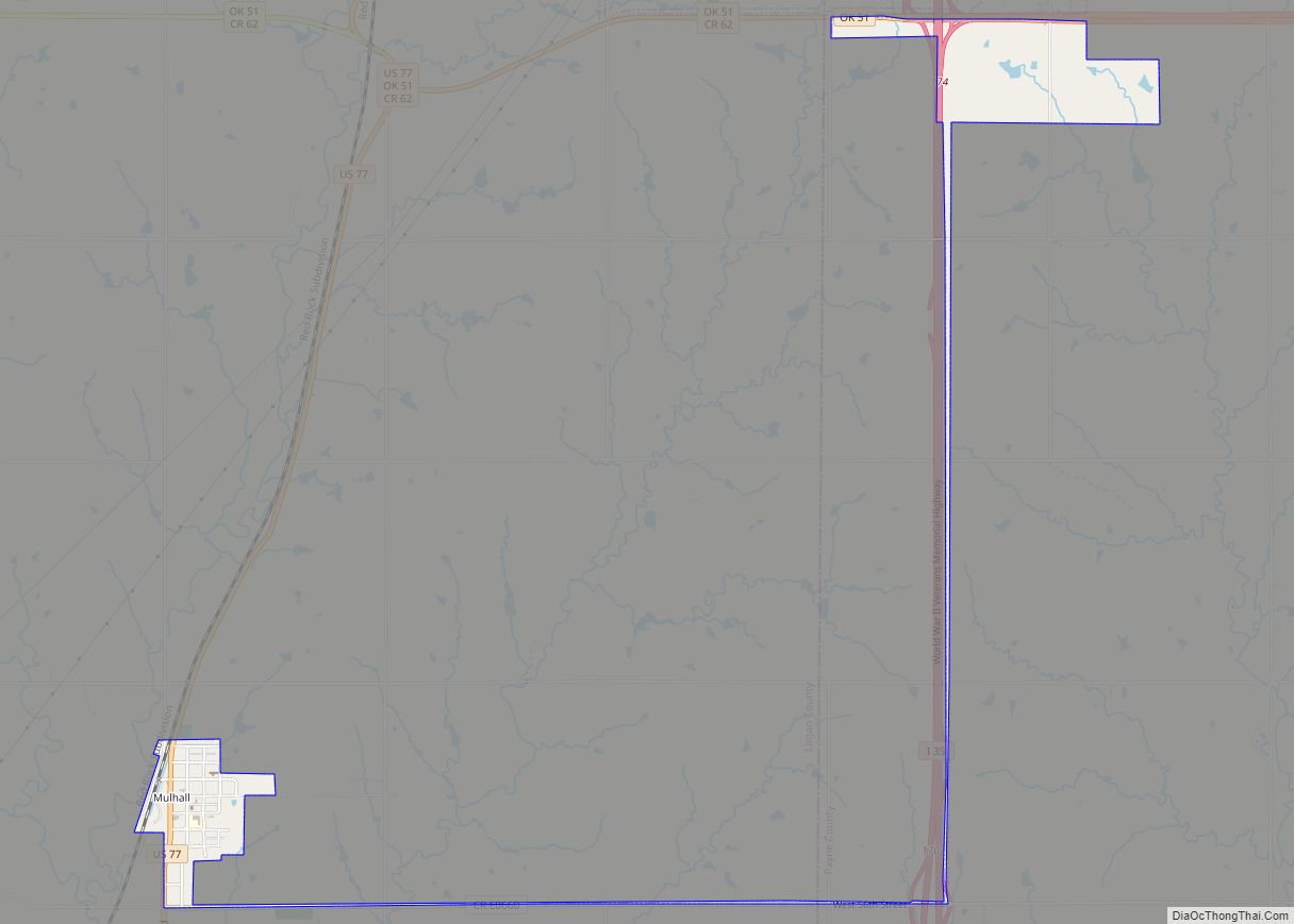
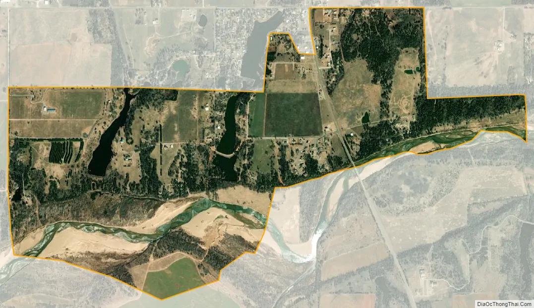
Cimarron City city Satellite Map
Geography
Cimarron City is located at 35°53′6″N 97°36′10″W / 35.88500°N 97.60278°W / 35.88500; -97.60278 (35.884999, −97.602874). The town lies 2 miles (3.2 km) south of Crescent and 10 miles (16 km) west of Guthrie.
According to the United States Census Bureau, the town has a total area of 1.7 square miles (4.4 km), of which, 1.6 square miles (4.1 km) of it is land and 0.1 square miles (0.26 km) of it (7.56%) is water.
See also
Map of Oklahoma State and its subdivision:- Adair
- Alfalfa
- Atoka
- Beaver
- Beckham
- Blaine
- Bryan
- Caddo
- Canadian
- Carter
- Cherokee
- Choctaw
- Cimarron
- Cleveland
- Coal
- Comanche
- Cotton
- Craig
- Creek
- Custer
- Delaware
- Dewey
- Ellis
- Garfield
- Garvin
- Grady
- Grant
- Greer
- Harmon
- Harper
- Haskell
- Hughes
- Jackson
- Jefferson
- Johnston
- Kay
- Kingfisher
- Kiowa
- Latimer
- Le Flore
- Lincoln
- Logan
- Love
- Major
- Marshall
- Mayes
- McClain
- McCurtain
- McIntosh
- Murray
- Muskogee
- Noble
- Nowata
- Okfuskee
- Oklahoma
- Okmulgee
- Osage
- Ottawa
- Pawnee
- Payne
- Pittsburg
- Pontotoc
- Pottawatomie
- Pushmataha
- Roger Mills
- Rogers
- Seminole
- Sequoyah
- Stephens
- Texas
- Tillman
- Tulsa
- Wagoner
- Washington
- Washita
- Woods
- Woodward
- Alabama
- Alaska
- Arizona
- Arkansas
- California
- Colorado
- Connecticut
- Delaware
- District of Columbia
- Florida
- Georgia
- Hawaii
- Idaho
- Illinois
- Indiana
- Iowa
- Kansas
- Kentucky
- Louisiana
- Maine
- Maryland
- Massachusetts
- Michigan
- Minnesota
- Mississippi
- Missouri
- Montana
- Nebraska
- Nevada
- New Hampshire
- New Jersey
- New Mexico
- New York
- North Carolina
- North Dakota
- Ohio
- Oklahoma
- Oregon
- Pennsylvania
- Rhode Island
- South Carolina
- South Dakota
- Tennessee
- Texas
- Utah
- Vermont
- Virginia
- Washington
- West Virginia
- Wisconsin
- Wyoming