Coalgate is a city in and the county seat of Coal County, Oklahoma, United States. The population was 1,967 at the 2010 census, a 1.9 percent decrease from the figure of 2,005 recorded in 2000. The town was founded in 1889 in the Choctaw Nation, Indian Territory as a coal mining camp named Liddle. The name changed to Coalgate on January 23, 1890.
| Name: | Coalgate city |
|---|---|
| LSAD Code: | 25 |
| LSAD Description: | city (suffix) |
| State: | Oklahoma |
| County: | Coal County |
| Elevation: | 610 ft (186 m) |
| Total Area: | 1.86 sq mi (4.81 km²) |
| Land Area: | 1.82 sq mi (4.70 km²) |
| Water Area: | 0.04 sq mi (0.10 km²) |
| Total Population: | 1,667 |
| Population Density: | 917.95/sq mi (354.41/km²) |
| ZIP code: | 74538 |
| Area code: | 580 |
| FIPS code: | 4015800 |
| GNISfeature ID: | 1091522 |
| Website: | www.cityofcoalgate.com |
Online Interactive Map
Click on ![]() to view map in "full screen" mode.
to view map in "full screen" mode.
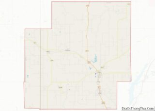
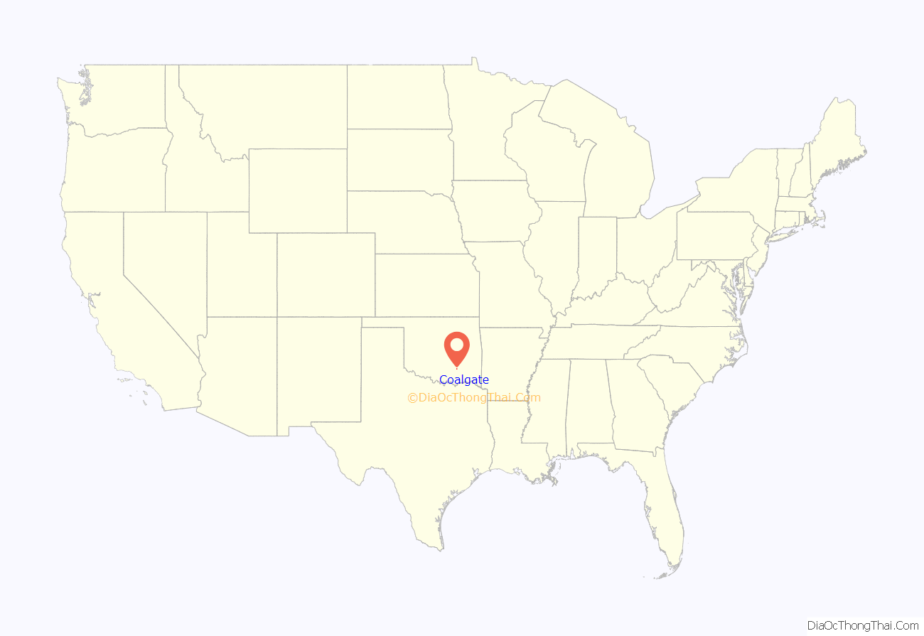
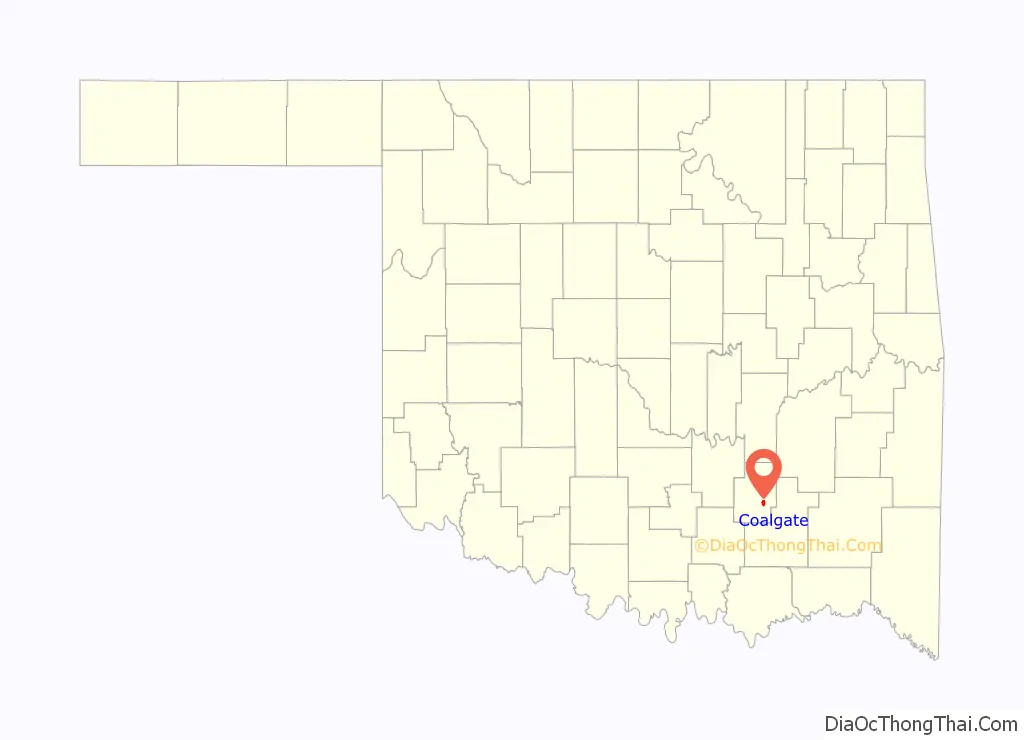
Coalgate location map. Where is Coalgate city?
History
Coalgate was founded in 1889 as a coal mining camp named Liddle in Atoka County, a territorial-era county in the Pushmataha District of the Choctaw Nation, Indian Territory. It was named for William “Bill” Liddle, a superintendent for the Atoka Coal and Mining Company, who had arrived in the fall of 1888 to locate a site for a new coal mine. The Southwestern Coal and Improvement Company, a subsidiary of the Missouri, Kansas and Texas Railway (MK&T) developed the site. A tent city sprung up, followed by company-built houses. Work on the mine started January 2, 1889, and the first shipment of coal left Liddle on April 17, 1889. The town name changed to Coalgate on January 23, 1890. The new name was taken from the steel gate or “coal gate” that separated the trains from the coal mines north of town. Coalgate incorporated under the laws of Arkansas on November 25, 1898. It was platted and approved by the Secretary of the Interior on December 16, 1903.
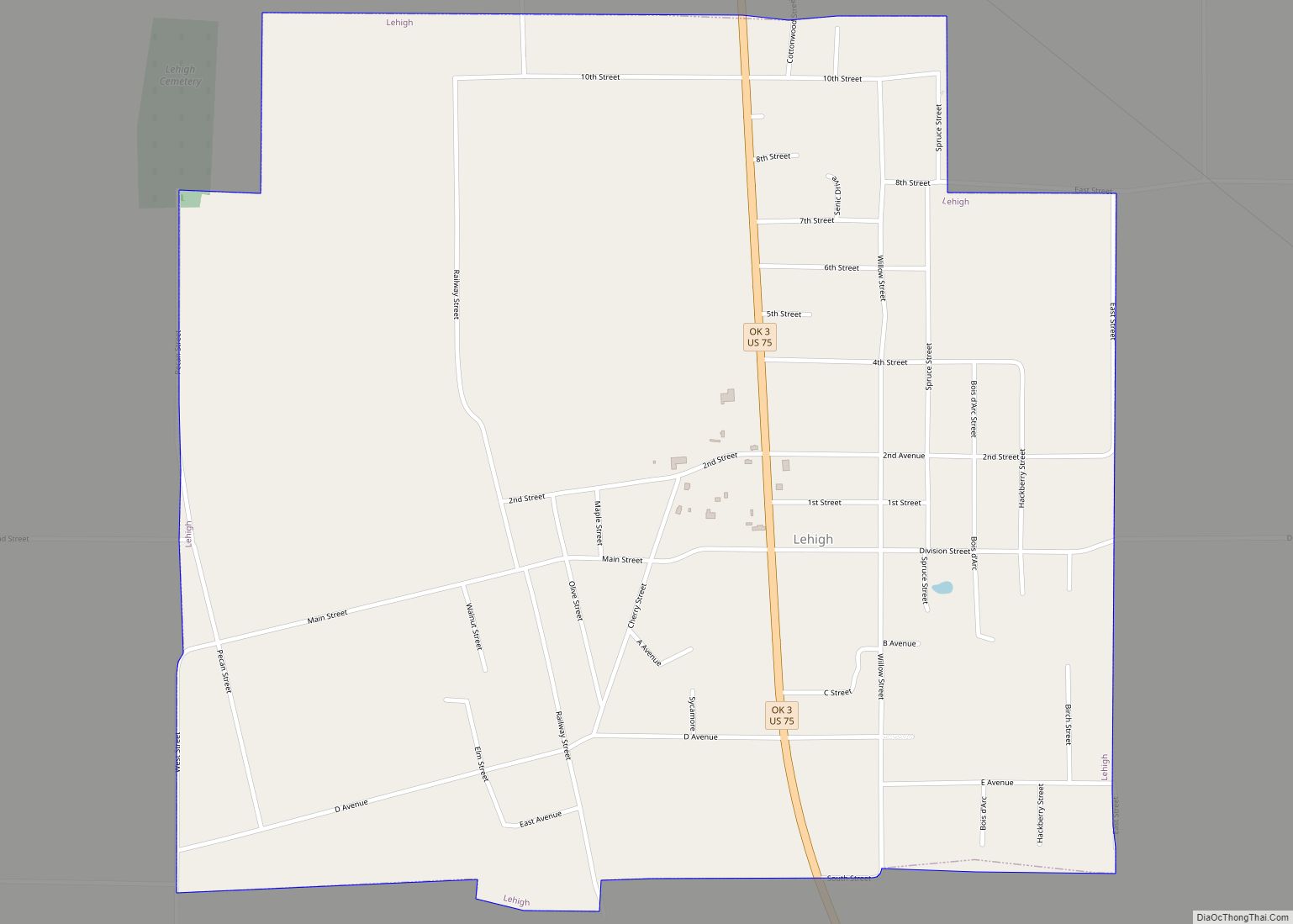
Coal County was created at statehood in 1907. Initially, Lehigh, Oklahoma was designated as county seat. However, a special election held on June 2, 1908 moved the seat to Coalgate. A new charter was approved on June 16, 1914.
Coalgate had grown to a population of 2,921 by statehood in 1907 and in one year the population had increased to 3,500. The city had at least 65 merchants plus carpenters, doctors, veterinarians, and as many as seven attorneys and three newspapers. The streets in the downtown area were bricked in 1912. In 1911, the weekly newspaper Coalgate Record Register was first published in Coalgate. Robinson Publishing Company took over publication of the newspaper in 1988. It has a circulation of 2,300.
Coalgate was the site of the very first bank closing performed by the State of Oklahoma when the International Bank of Coalgate was closed on May 21, 1908, and Herman C. Schultz, acting as an Assistant State Bank Commissioner, liquidated the bank, paying off all depositors in full and returning the excess to the bank’s shareholders.
During the May–June 1917 tornado outbreak sequence, at 4 p.m. on June 1, 1917, Coalgate was struck by an F4 tornado. The Westward school building and over 200 homes were destroyed. At least 11 people were killed.
The city prospered until the 1920s, when the coal mines closed because of worker strikes. Since this time agriculture and manufacturing have become the leading industries. From 1921 to 1923, local cotton crops were destroyed by a boll weevil infestation, and all five banks in the county closed. Coalgate’s population peaked at 3,009 at the 1920 census and has never recovered.
Coalgate survived the Great Depression, although many of its businesses did not. After President Franklin D. Roosevelt’s election, various Federal programs, such as the Civilian Conservation Corps (CCC), National Youth Administration (NYA), and Works Progress Administration (WPA), helped buoy the city’s struggling economy. The onset of World War II brought a temporary respite to the coal industry. However, these mines closed by 1958.
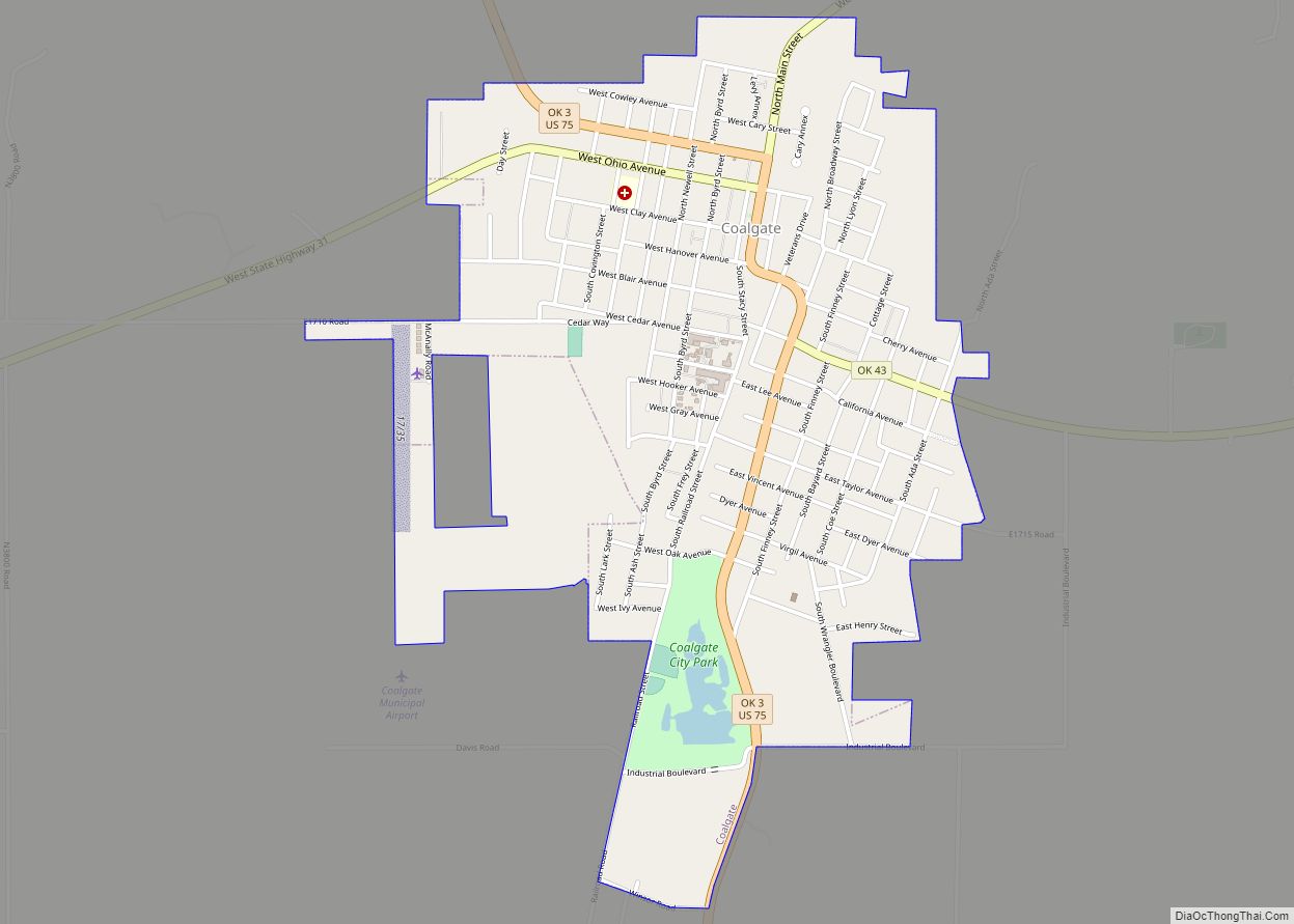
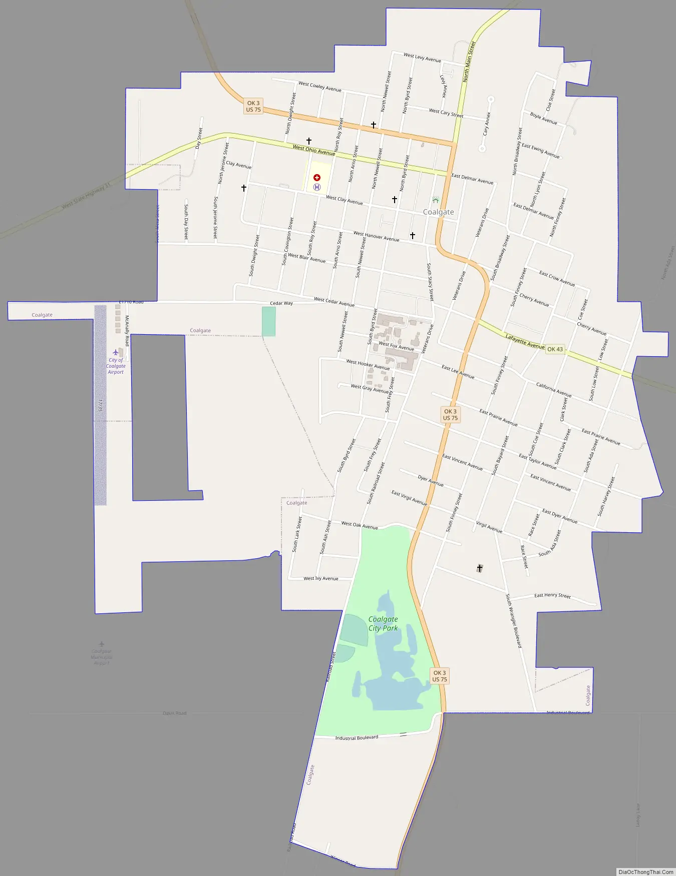
Coalgate Road Map
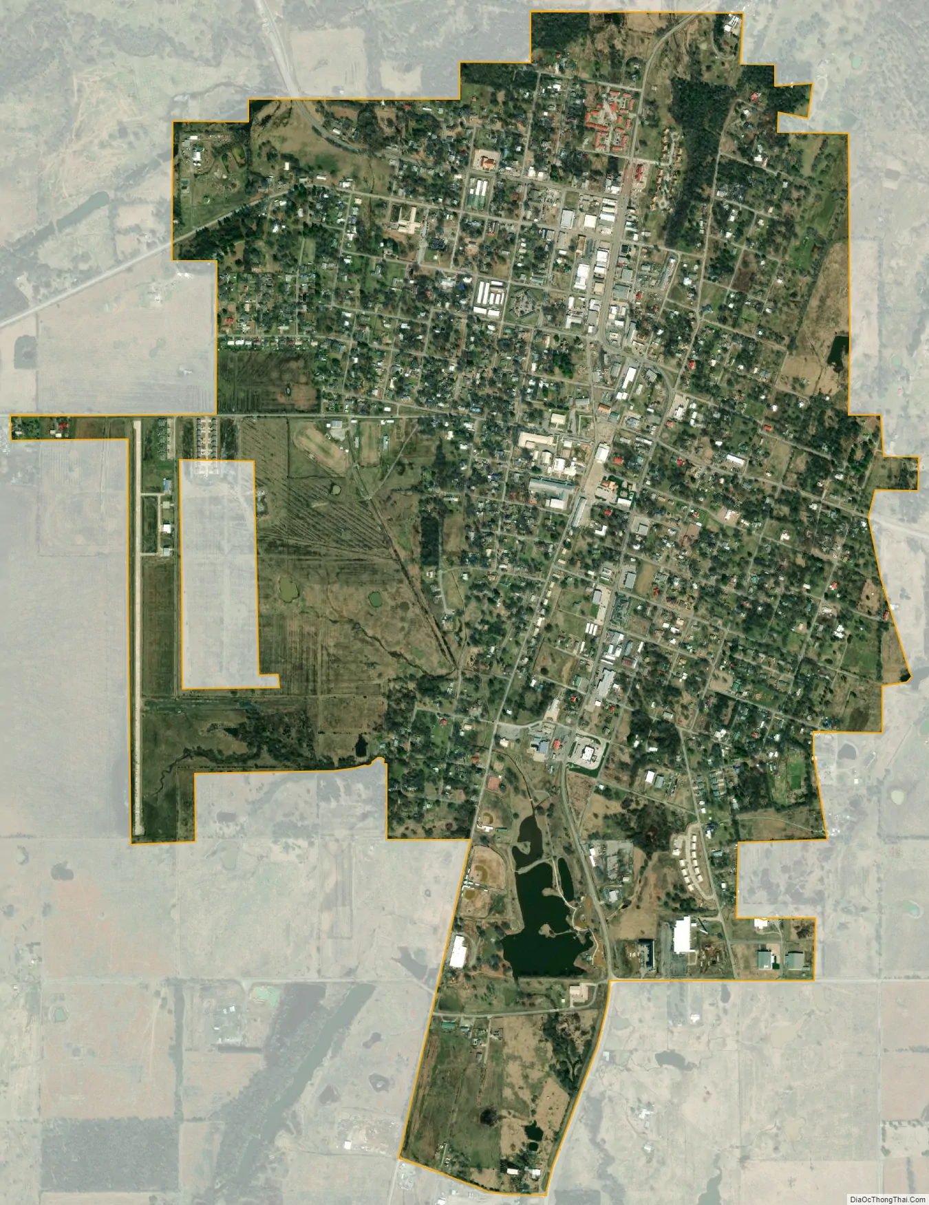
Coalgate city Satellite Map
Geography
Coalgate is located at 34°32′1″N 96°13′7″W / 34.53361°N 96.21861°W / 34.53361; -96.21861 (34.533662, -96.218727). According to the United States Census Bureau, the city has a total area of 1.6 square miles (4.1 km), of which 1.5 square miles (3.9 km) is land and 0.04 square miles (0.10 km) (1.27%) is water. The main streams are the Clear Boggy and Muddy Boggy creeks. The Ouachita Mountains begin in the eastern part of the county. The western section is mostly open prairie. Generally the county lies within the Sandstone Hills physiographic region.
See also
Map of Oklahoma State and its subdivision:- Adair
- Alfalfa
- Atoka
- Beaver
- Beckham
- Blaine
- Bryan
- Caddo
- Canadian
- Carter
- Cherokee
- Choctaw
- Cimarron
- Cleveland
- Coal
- Comanche
- Cotton
- Craig
- Creek
- Custer
- Delaware
- Dewey
- Ellis
- Garfield
- Garvin
- Grady
- Grant
- Greer
- Harmon
- Harper
- Haskell
- Hughes
- Jackson
- Jefferson
- Johnston
- Kay
- Kingfisher
- Kiowa
- Latimer
- Le Flore
- Lincoln
- Logan
- Love
- Major
- Marshall
- Mayes
- McClain
- McCurtain
- McIntosh
- Murray
- Muskogee
- Noble
- Nowata
- Okfuskee
- Oklahoma
- Okmulgee
- Osage
- Ottawa
- Pawnee
- Payne
- Pittsburg
- Pontotoc
- Pottawatomie
- Pushmataha
- Roger Mills
- Rogers
- Seminole
- Sequoyah
- Stephens
- Texas
- Tillman
- Tulsa
- Wagoner
- Washington
- Washita
- Woods
- Woodward
- Alabama
- Alaska
- Arizona
- Arkansas
- California
- Colorado
- Connecticut
- Delaware
- District of Columbia
- Florida
- Georgia
- Hawaii
- Idaho
- Illinois
- Indiana
- Iowa
- Kansas
- Kentucky
- Louisiana
- Maine
- Maryland
- Massachusetts
- Michigan
- Minnesota
- Mississippi
- Missouri
- Montana
- Nebraska
- Nevada
- New Hampshire
- New Jersey
- New Mexico
- New York
- North Carolina
- North Dakota
- Ohio
- Oklahoma
- Oregon
- Pennsylvania
- Rhode Island
- South Carolina
- South Dakota
- Tennessee
- Texas
- Utah
- Vermont
- Virginia
- Washington
- West Virginia
- Wisconsin
- Wyoming