Cole is a town in McClain County, Oklahoma, United States. The population was 624 at the 2020 census, up from 555 at the 2010 census.
| Name: | Cole town |
|---|---|
| LSAD Code: | 43 |
| LSAD Description: | town (suffix) |
| State: | Oklahoma |
| County: | McClain County |
| Elevation: | 1,145 ft (349 m) |
| Total Area: | 15.07 sq mi (39.03 km²) |
| Land Area: | 14.98 sq mi (38.80 km²) |
| Water Area: | 0.09 sq mi (0.23 km²) |
| Total Population: | 624 |
| Population Density: | 41.65/sq mi (16.08/km²) |
| FIPS code: | 4016200 |
| GNISfeature ID: | 1091565 |
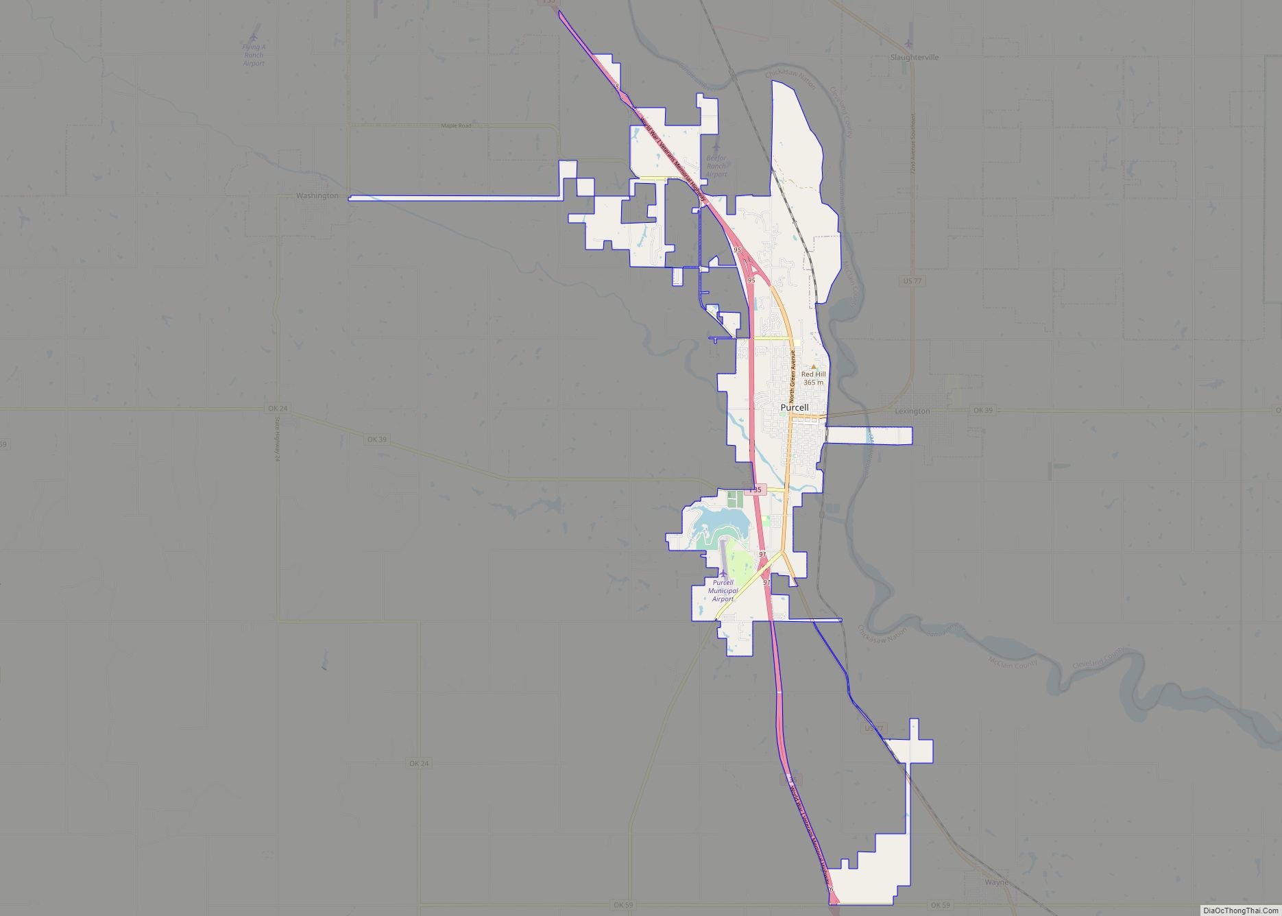
Online Interactive Map
Click on ![]() to view map in "full screen" mode.
to view map in "full screen" mode.
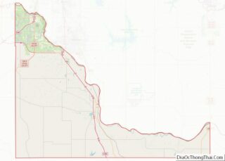
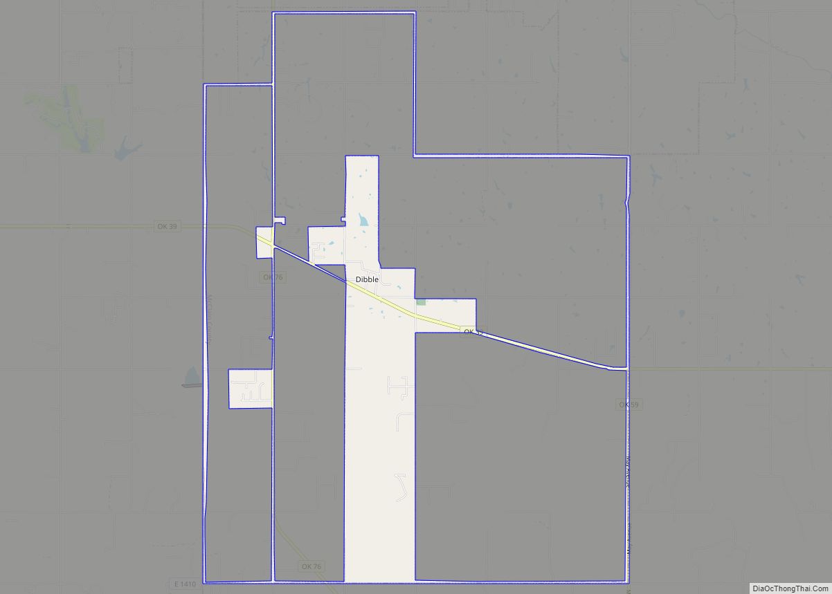
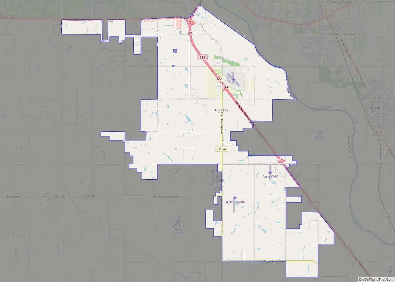
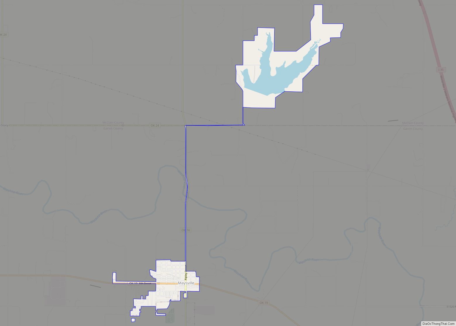
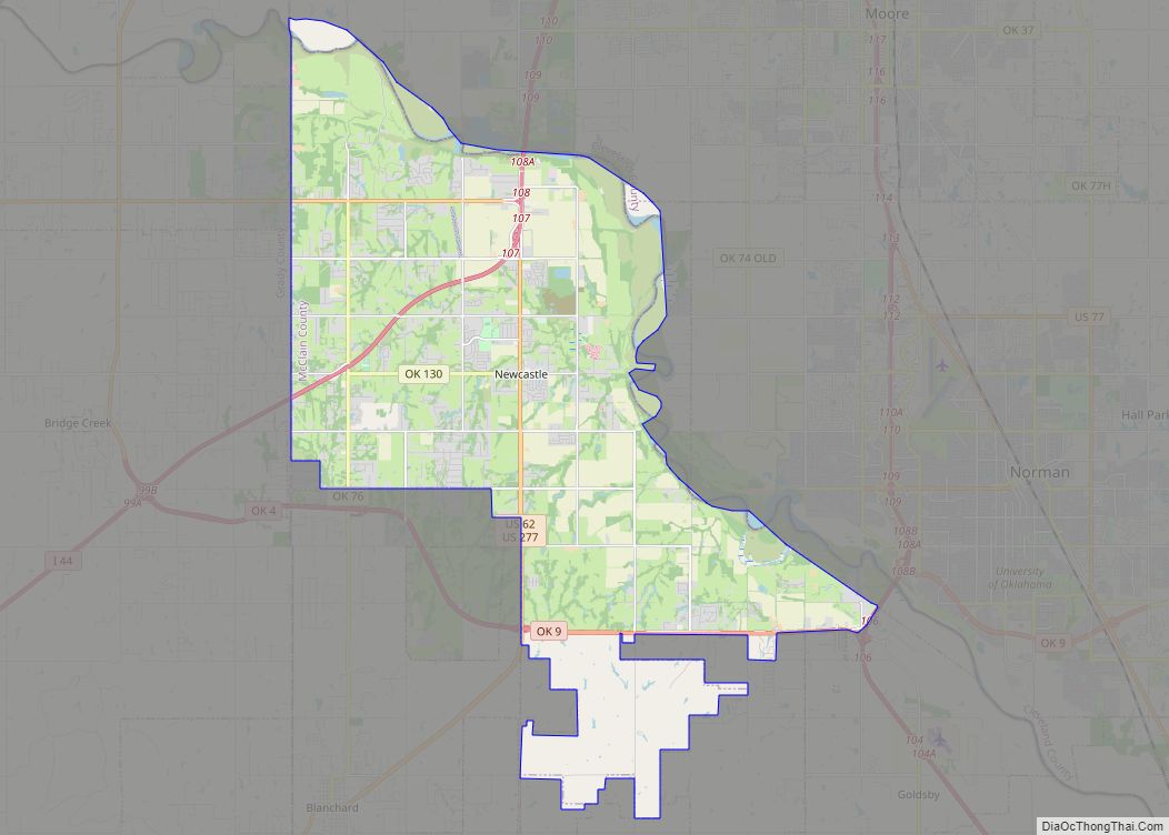
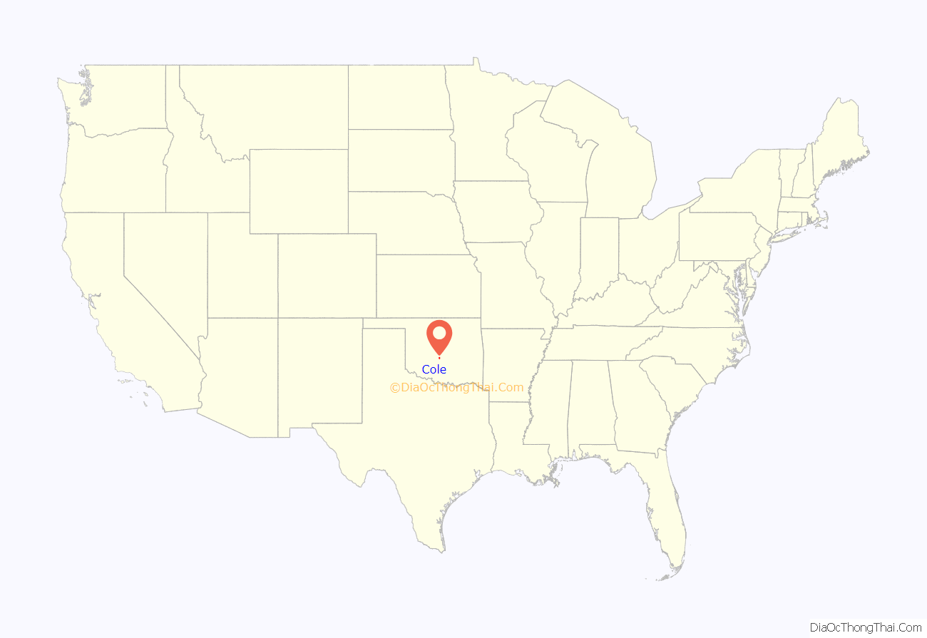
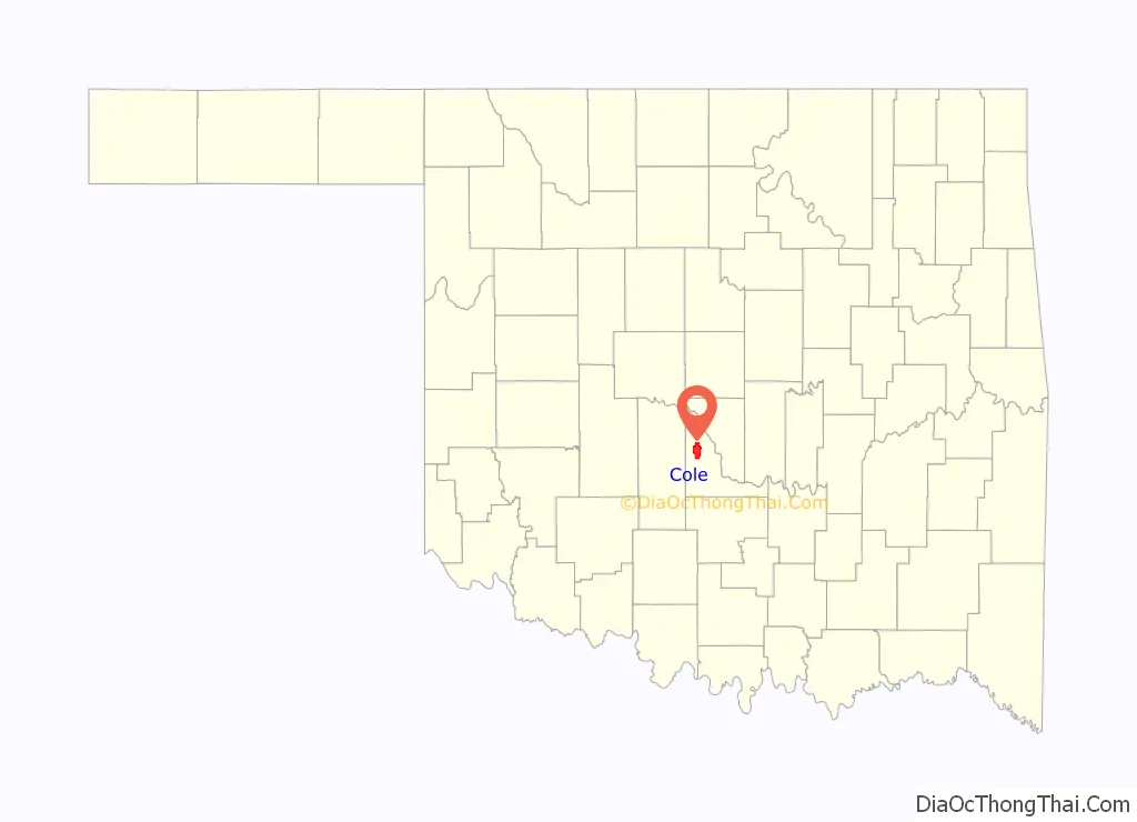
Cole location map. Where is Cole town?
History
Cole was founded on 10 acres (40,000 m) of land donated by Mrs. A. E. Cunningham and Judge Presley Cole. The town was named Cole after it was decided Cunningham was too long a name. Cole’s first post office, created in 1912, was in the Cunningham home, though it was moved later to Read’s General Merchandise Store.
The community was hit by an EF3 tornado on the evening of April 19, 2023, destroying multiple houses and killing one person.
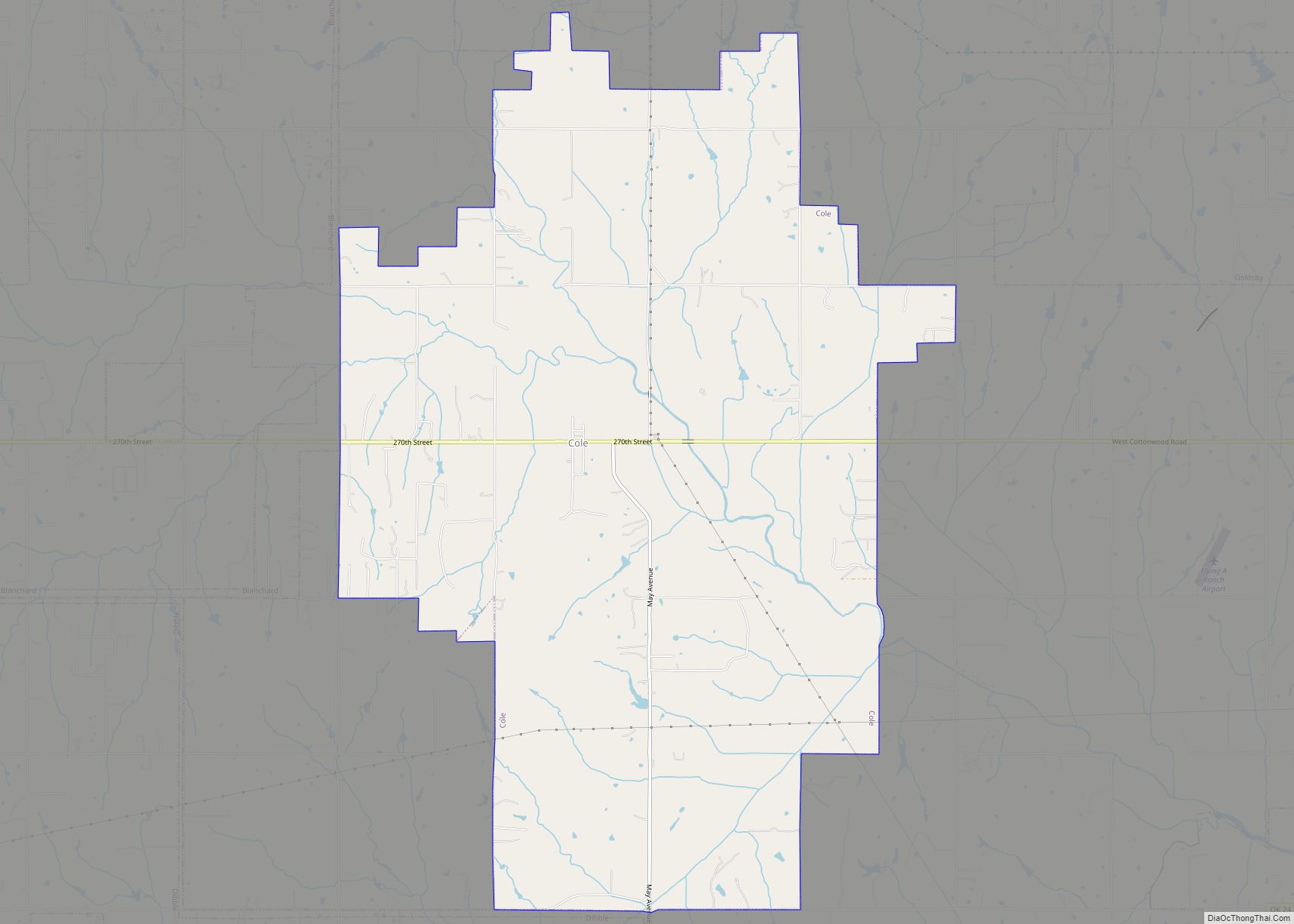
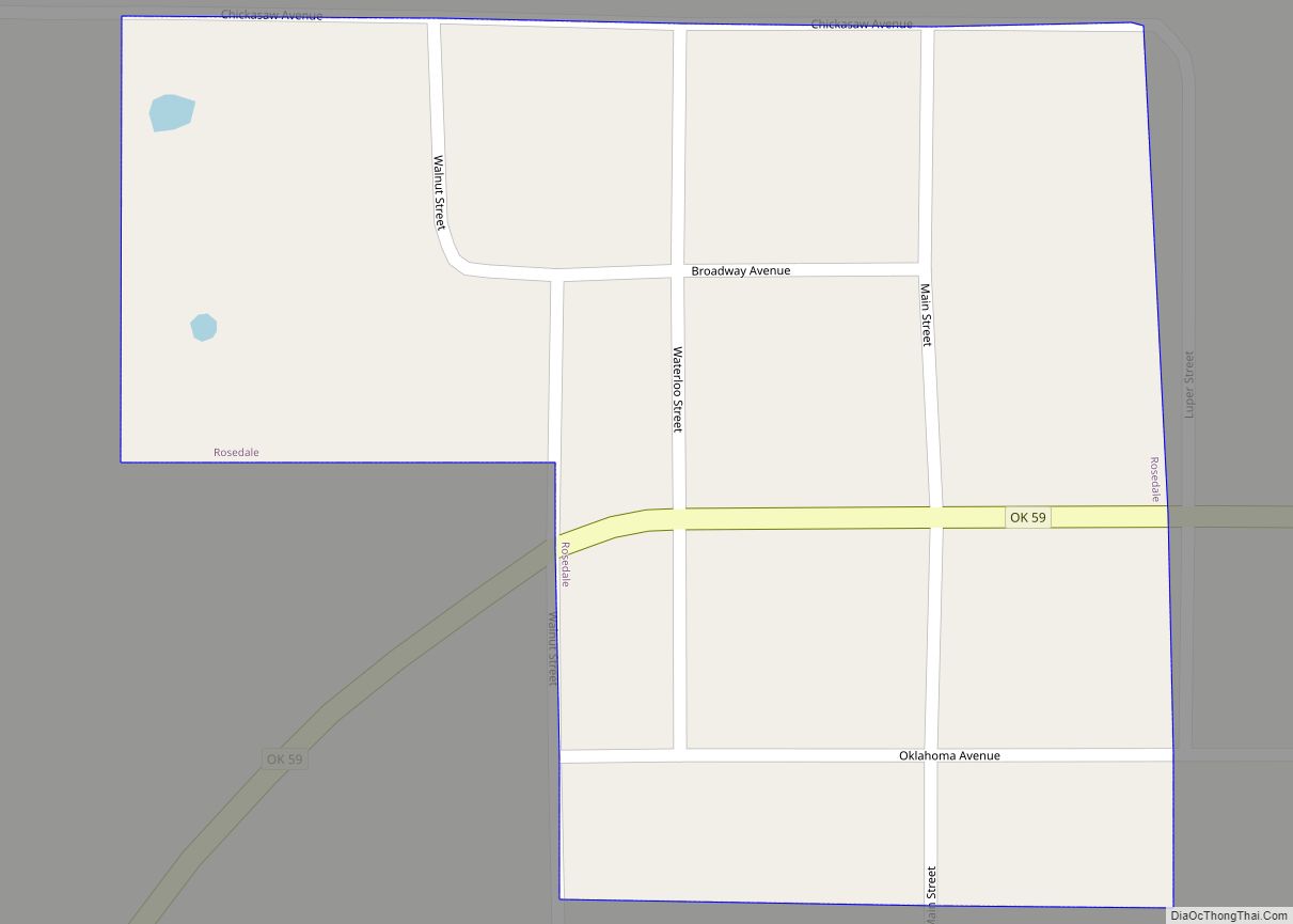
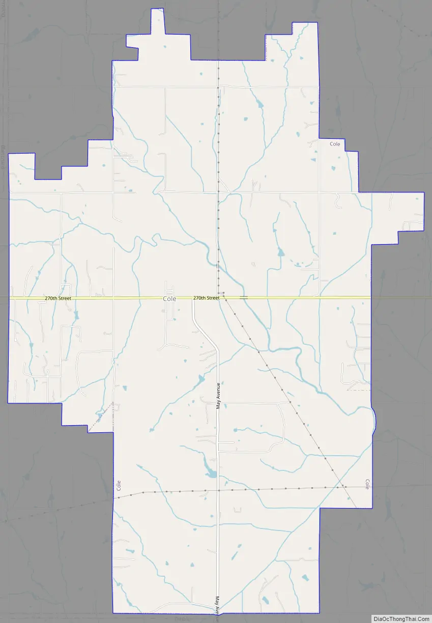
Cole Road Map
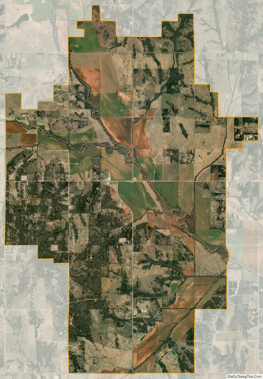
Cole city Satellite Map
Geography
Cole is located at 35°6′21″N 97°34′23″W / 35.10583°N 97.57306°W / 35.10583; -97.57306 (35.105921, -97.572964).
According to the United States Census Bureau, the town has a total area of 15.1 square miles (39 km), all land.
Cole is located along State Highway 74B.
See also
Map of Oklahoma State and its subdivision:- Adair
- Alfalfa
- Atoka
- Beaver
- Beckham
- Blaine
- Bryan
- Caddo
- Canadian
- Carter
- Cherokee
- Choctaw
- Cimarron
- Cleveland
- Coal
- Comanche
- Cotton
- Craig
- Creek
- Custer
- Delaware
- Dewey
- Ellis
- Garfield
- Garvin
- Grady
- Grant
- Greer
- Harmon
- Harper
- Haskell
- Hughes
- Jackson
- Jefferson
- Johnston
- Kay
- Kingfisher
- Kiowa
- Latimer
- Le Flore
- Lincoln
- Logan
- Love
- Major
- Marshall
- Mayes
- McClain
- McCurtain
- McIntosh
- Murray
- Muskogee
- Noble
- Nowata
- Okfuskee
- Oklahoma
- Okmulgee
- Osage
- Ottawa
- Pawnee
- Payne
- Pittsburg
- Pontotoc
- Pottawatomie
- Pushmataha
- Roger Mills
- Rogers
- Seminole
- Sequoyah
- Stephens
- Texas
- Tillman
- Tulsa
- Wagoner
- Washington
- Washita
- Woods
- Woodward
- Alabama
- Alaska
- Arizona
- Arkansas
- California
- Colorado
- Connecticut
- Delaware
- District of Columbia
- Florida
- Georgia
- Hawaii
- Idaho
- Illinois
- Indiana
- Iowa
- Kansas
- Kentucky
- Louisiana
- Maine
- Maryland
- Massachusetts
- Michigan
- Minnesota
- Mississippi
- Missouri
- Montana
- Nebraska
- Nevada
- New Hampshire
- New Jersey
- New Mexico
- New York
- North Carolina
- North Dakota
- Ohio
- Oklahoma
- Oregon
- Pennsylvania
- Rhode Island
- South Carolina
- South Dakota
- Tennessee
- Texas
- Utah
- Vermont
- Virginia
- Washington
- West Virginia
- Wisconsin
- Wyoming