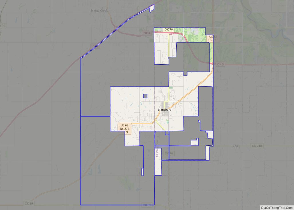
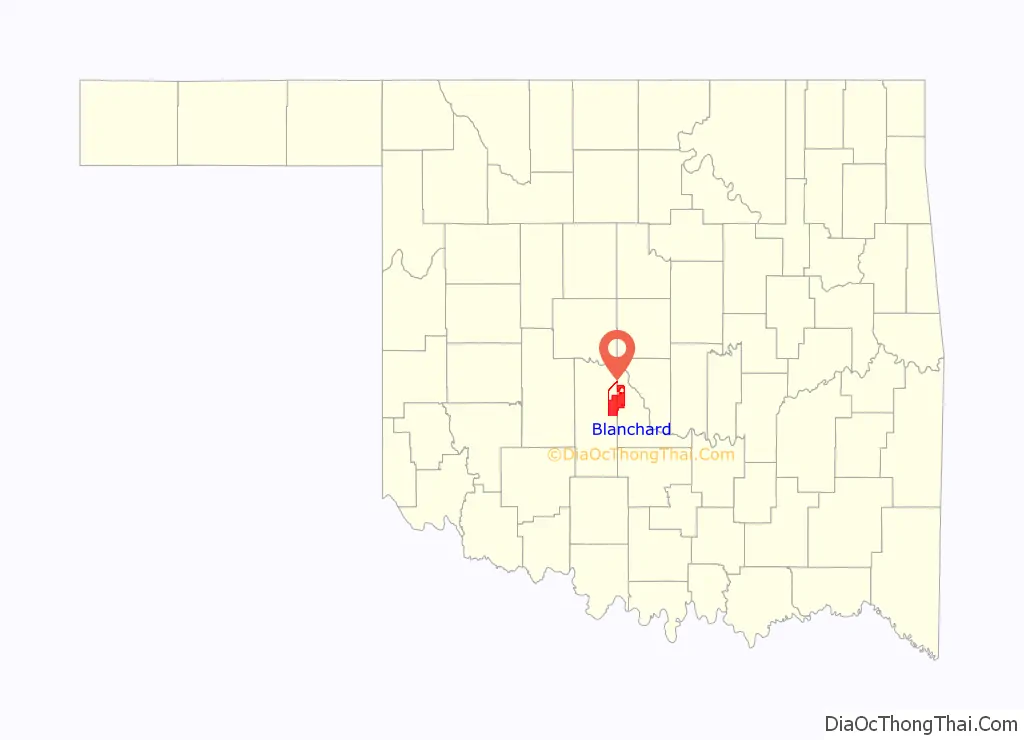
Blanchard is a city in McClain and Grady counties in the U.S. state of Oklahoma. The population was 8,879 at the 2020 census, up from 7,670 at the 2010 census. Blanchard is part of a rapidly growing area of northern McClain and Grady counties known as the “Tri-City Area” with Newcastle and Tuttle.
| Name: | Blanchard city |
|---|---|
| LSAD Code: | 25 |
| LSAD Description: | city (suffix) |
| State: | Oklahoma |
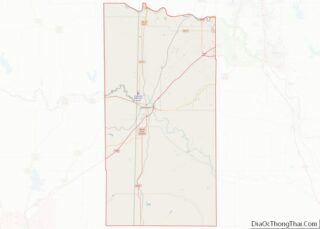
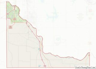
| County: | Grady County, McClain County |
| Elevation: | 1,270 ft (387 m) |
| Total Area: | 30.55 sq mi (79.14 km²) |
| Land Area: | 30.44 sq mi (78.85 km²) |
| Water Area: | 0.11 sq mi (0.29 km²) |
| Total Population: | 8,879 |
| Population Density: | 291.65/sq mi (112.61/km²) |
| ZIP code: | 73010 |
| Area code: | 405 |
| FIPS code: | 4006700 |
| GNISfeature ID: | 1090249 |
| Website: | cityofblanchard.us |
Online Interactive Map
Click on ![]() to view map in "full screen" mode.
to view map in "full screen" mode.
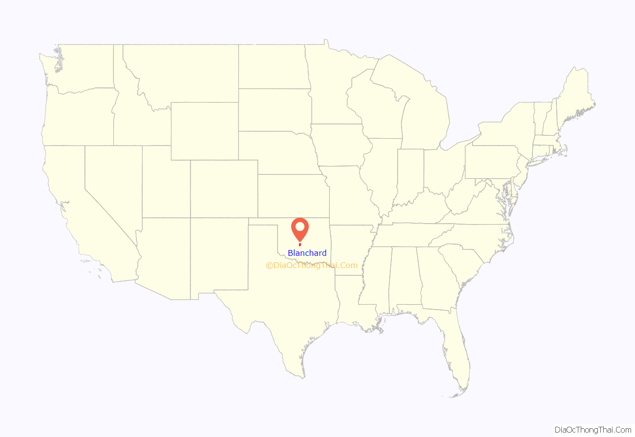
Blanchard location map. Where is Blanchard city?
History
The center of Blanchard is situated in Township 8 North, Range 4 West, Section 30 in northwestern McClain County. Named after William G. “Bill” Blanchard, the community was organized originally by the Canadian Valley Construction Company, which also planned to build a railroad. However, the company went into bankruptcy, and the railroad came under the control of the Oklahoma Central Railroad which also experienced financial problems. The Atchison, Topeka and Santa Fe Railway took over and completed the line.
The townsite was established by three lot sales beginning with the Canadian Valley Construction Company sale on September 19, 1906. The second sale was held on July 18, 1907, and final lots were sold on March 25, 1908, by the Blanchard Townsite Company. Within a year the town was described as having forty business establishments, including a state and a national bank, four blacksmith shops, three livery barns, two grain elevators, and a weekly newspaper.
Several incorporation dates are reported in various publications about the history of Blanchard, and the town offices as well. The most reliable source seems to be the Blanchard Record of October 25, 1907, which reported, “That Blanchard is now an incorporated town is realized by but a few of our citizens. The petition praying for incorporation was favorably acted upon at the [federal] courts at Chickasha [sic] last week. On or about November 19 notice of an election of officers will be given. In the meantime, candidates will be chosen.”
A population of 629 was reported by 1910, and 1,040 in 1930. The Blanchard post office charter was granted by the Post Office Department on December 19, 1906. Mail had previously been received at Womack. When Arthur H. “Art” and Bill Blanchard moved their store from Womack to the new townsite in 1906, they took the post office with them.
In 1909, the Northern District Court was established whereby McClain County was divided into two sections for legal matters for the convenience of the citizens. A courthouse was built in Blanchard, and the first case began on December 13, 1909. The district was disestablished in the late 1920s and combined with District One in Purcell, the county seat. At the turn of the 21st-century legal records could be found at Blanchard.
Blanchard Road Map

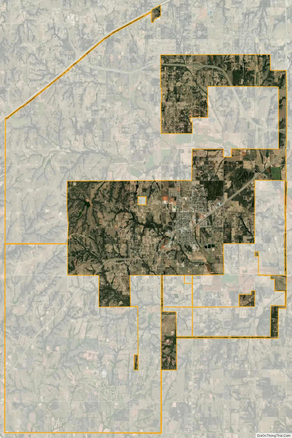
Blanchard city Satellite Map
Geography
Blanchard is located in northwestern McClain County at 35°8′56″N 97°39′2″W / 35.14889°N 97.65056°W / 35.14889; -97.65056 (35.148830, −97.650677). The city limits extend west into Grady County. According to the United States Census Bureau, the city has a total area of 32.9 square miles (85.3 km), of which 32.8 square miles (85.0 km) are land and 0.1 square miles (0.3 km), or 0.38%, are water.
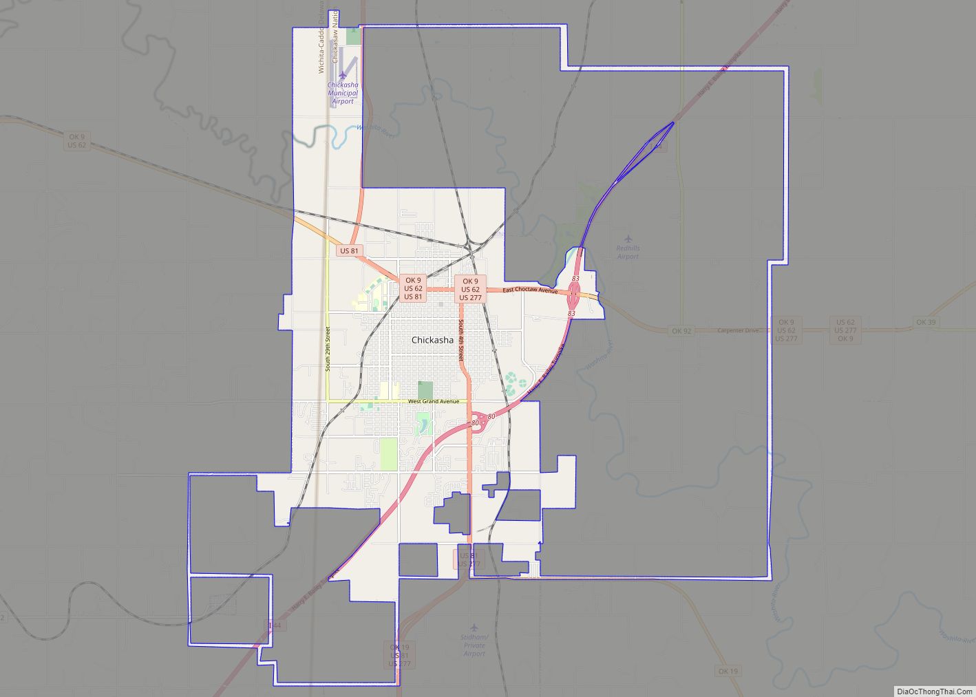
U.S. Route 62 passes through the center of town as 2nd Street, leading northeast 28 miles (45 km) to the center of Oklahoma City and southwest 18 miles (29 km) to Chickasha. Oklahoma State Highway 76 heads north out of town on Main Street, ending after 10 miles (16 km) in the northern part of Newcastle. Highway 76 leads south 23 miles (37 km) to Lindsay.
Blanchard consists of one square mile “core” of streets roughly laid out in a grid pattern, situated atop a gentle hill surrounded by newer development and agricultural areas within about a 4-mile (6 km) radius of the center. Central Blanchard, located in McClain County, consists of homes (about half built before 1960), several churches and a historic Main Street downtown area. The commercial downtown features antique shops, eating establishments, city services, senior center, and a fitness center.
On the periphery of the city center are schools, businesses, and modern housing subdivisions. These subdivisions tend to be low-density (typically one to 5-acre (20,000 m) lots.)
While Blanchard is often described as a commuter town with much of its workforce commuting to nearby Norman and Oklahoma City, local businesses are beginning to surge. As of 2008, local amenities included a supermarket, several restaurants, a public library, banks, a large building supply center, a new hardware store, and a large car dealership.
Residents of Blanchard tend to view it as a small-town environment with character and charm, but the rapid growth in the area has brought change. To keep the town from being swallowed by urban sprawl, a large annexation was effected in 2004 to provide Blanchard with a “buffer zone”. A Main Street beautification project is underway and infrastructure is being improved to handle the rise in population. In 2007, several older buildings in central Blanchard were removed to allow the widening of U.S. 62, yet the historic downtown commercial buildings were preserved.
See also
Map of Oklahoma State and its subdivision:- Adair
- Alfalfa
- Atoka
- Beaver
- Beckham
- Blaine
- Bryan
- Caddo
- Canadian
- Carter
- Cherokee
- Choctaw
- Cimarron
- Cleveland
- Coal
- Comanche
- Cotton
- Craig
- Creek
- Custer
- Delaware
- Dewey
- Ellis
- Garfield
- Garvin
- Grady
- Grant
- Greer
- Harmon
- Harper
- Haskell
- Hughes
- Jackson
- Jefferson
- Johnston
- Kay
- Kingfisher
- Kiowa
- Latimer
- Le Flore
- Lincoln
- Logan
- Love
- Major
- Marshall
- Mayes
- McClain
- McCurtain
- McIntosh
- Murray
- Muskogee
- Noble
- Nowata
- Okfuskee
- Oklahoma
- Okmulgee
- Osage
- Ottawa
- Pawnee
- Payne
- Pittsburg
- Pontotoc
- Pottawatomie
- Pushmataha
- Roger Mills
- Rogers
- Seminole
- Sequoyah
- Stephens
- Texas
- Tillman
- Tulsa
- Wagoner
- Washington
- Washita
- Woods
- Woodward
- Alabama
- Alaska
- Arizona
- Arkansas
- California
- Colorado
- Connecticut
- Delaware
- District of Columbia
- Florida
- Georgia
- Hawaii
- Idaho
- Illinois
- Indiana
- Iowa
- Kansas
- Kentucky
- Louisiana
- Maine
- Maryland
- Massachusetts
- Michigan
- Minnesota
- Mississippi
- Missouri
- Montana
- Nebraska
- Nevada
- New Hampshire
- New Jersey
- New Mexico
- New York
- North Carolina
- North Dakota
- Ohio
- Oklahoma
- Oregon
- Pennsylvania
- Rhode Island
- South Carolina
- South Dakota
- Tennessee
- Texas
- Utah
- Vermont
- Virginia
- Washington
- West Virginia
- Wisconsin
- Wyoming