Collinsville is a city in Rogers and Tulsa counties in the U.S. state of Oklahoma, and a part of the Tulsa, Oklahoma Metropolitan Statistical Area. It was named for Dr. A. H. Collins, an engineer and surveyor who first surveyed the land that became this community. The population was 5,606 according to the 2010 census, an increase of 37.5 percent over the figure of 4,077 recorded in 2000.
| Name: | Collinsville city |
|---|---|
| LSAD Code: | 25 |
| LSAD Description: | city (suffix) |
| State: | Oklahoma |
| County: | Rogers County, Tulsa County |
| Incorporated: | 1899 |
| Elevation: | 640 ft (195 m) |
| Total Area: | 8.23 sq mi (21.32 km²) |
| Land Area: | 8.16 sq mi (21.13 km²) |
| Water Area: | 0.07 sq mi (0.19 km²) |
| Total Population: | 7,881 |
| Population Density: | 966.05/sq mi (373.00/km²) |
| ZIP code: | 74021 |
| Area code: | 539/918 |
| FIPS code: | 4016350 |
| GNISfeature ID: | 1091582 |
| Website: | http://www.cityofcollinsville.com/ |
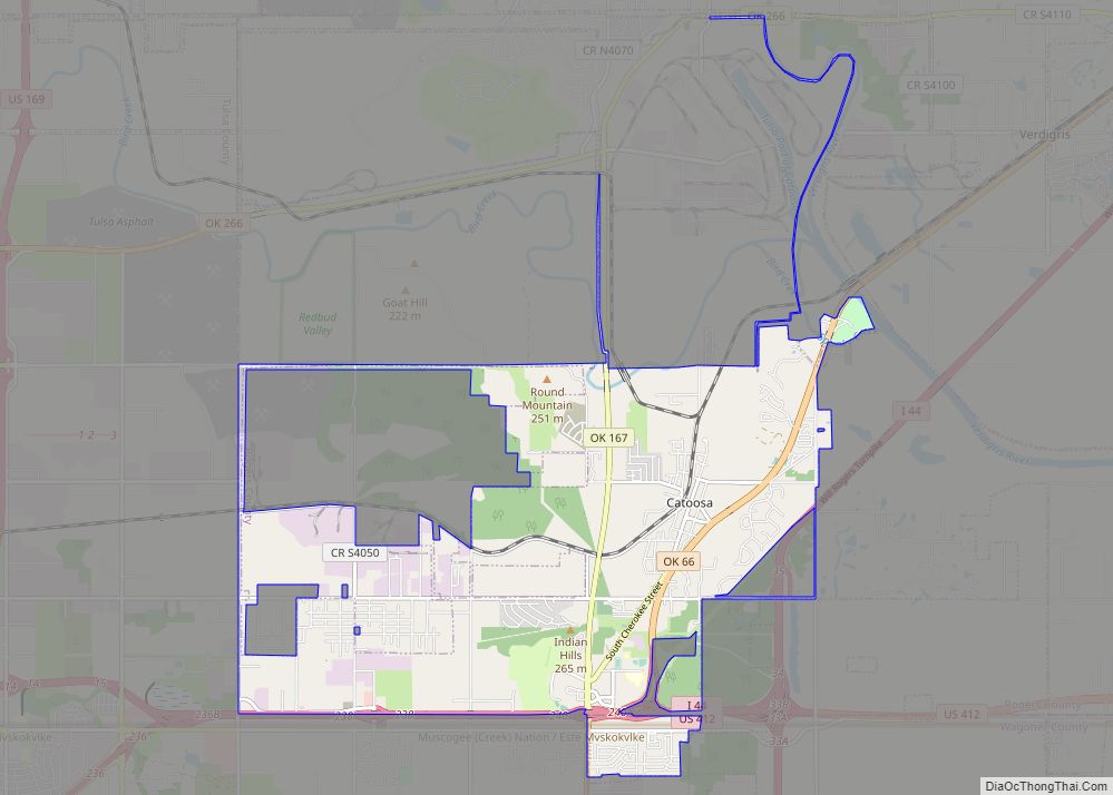
Online Interactive Map
Click on ![]() to view map in "full screen" mode.
to view map in "full screen" mode.
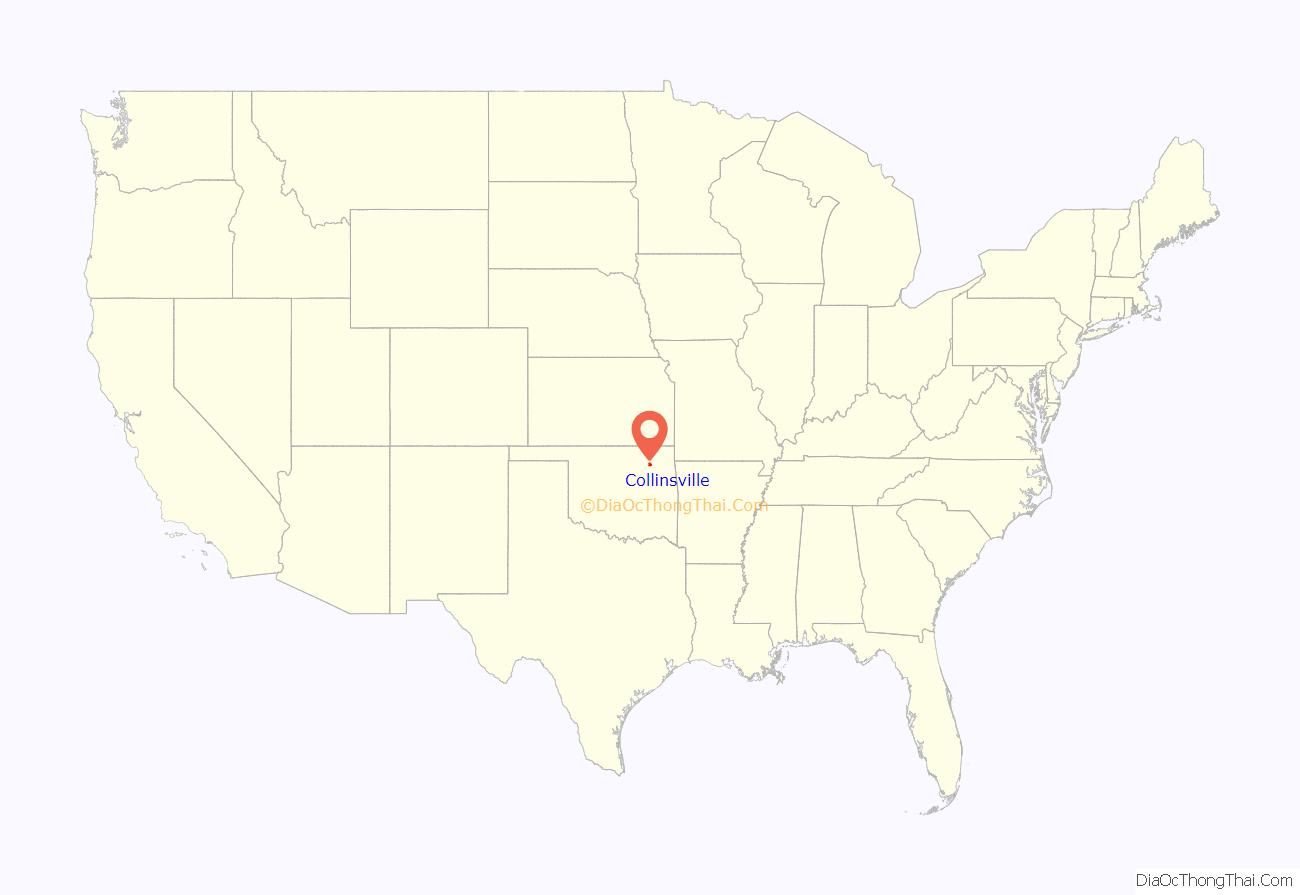
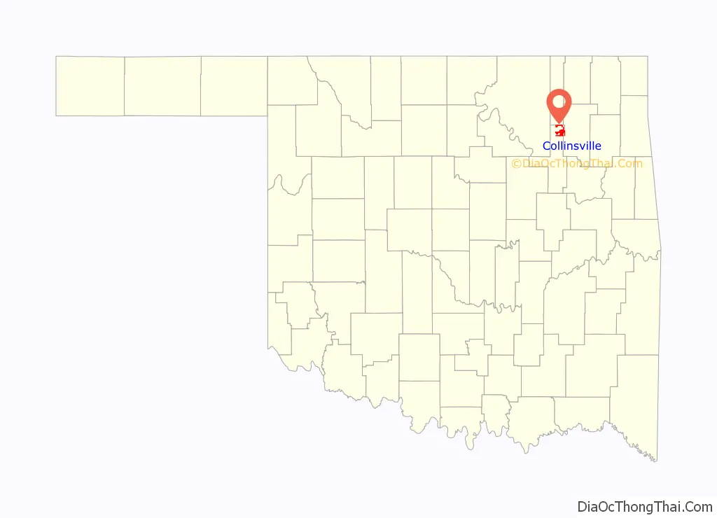
Collinsville location map. Where is Collinsville city?
History
Dr. A. H. Collins, the town namesake, established a post office on May 28, 1897. Henry P. Cook was the first postmaster. Then it became known as either Collins or Collins Post Office. The name officially became Collinsville by June 1898 and it incorporated as a city in April 1899. The population in 1900 was 376.
The Atchison, Topeka and Santa Fe routed its line from Kansas to Owasso, approximately one mile west of Collinsville in 1899, to avoid crossing an additional stream. An earlier community, known as Eli, had developed southeast but moved all their buildings closer to the railroad. The buildings were moved on rollers in 1899 and 1900.
Collinsville originally was located in Rogers County. In 1918, the residents voted to be annexed by Tulsa County, in order to be nearer a county seat. It was only 20 miles (32 km) north of Tulsa.
An abundant supply of sulfur-free coal lay near the surface, which attracted fifteen hundred to two thousand miners. Oil and gas production and zinc smelting boomed briefly during the first two decades of the 20th century. The local population swelled to around eight thousand people. But the population swiftly declined as these businesses ceased. By 1930, there were 2,249 residents. Since the 1920s, the economy has been based primarily on agriculture. Several dairies are located in Collinsville, many delivering products to Tulsa. In 1948, Oklahoma Agricultural and Mechanical University (now Oklahoma State University) named Collinsville “the Dairy Capital of Oklahoma.”
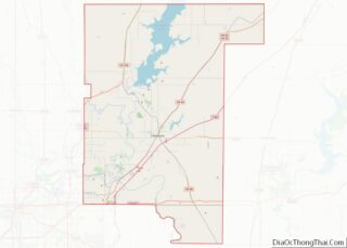
Collinsville Road Map
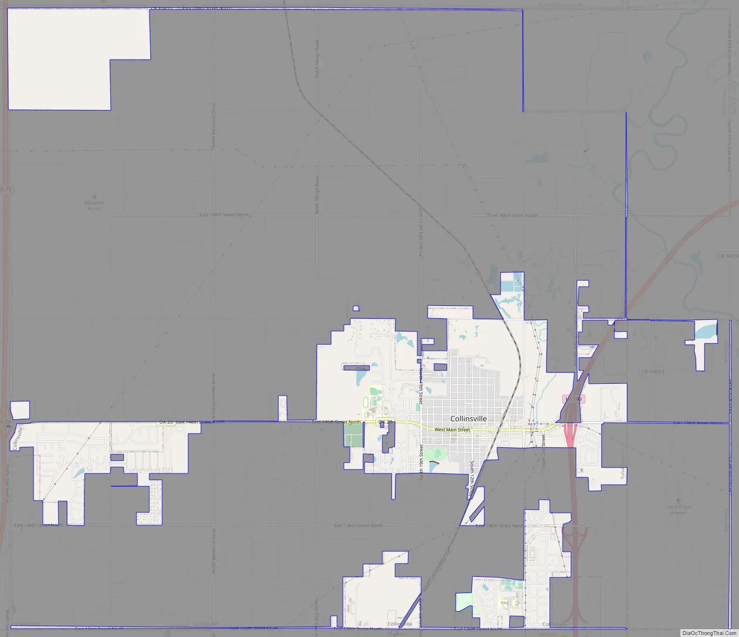
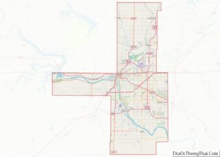
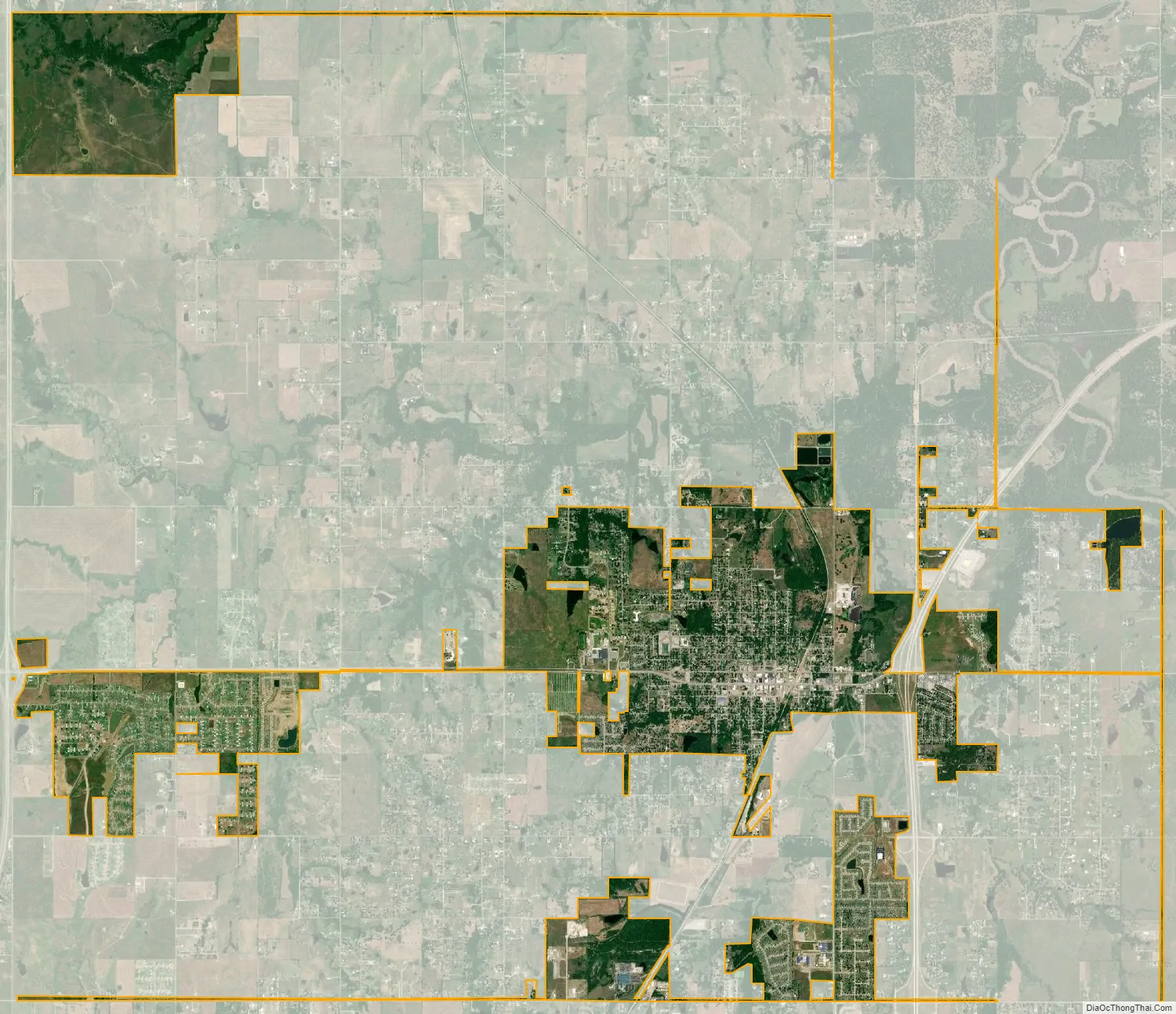
Collinsville city Satellite Map
Geography
Collinsville is approximately 20 mi north of Tulsa, and lies within a triangle formed by the Caney River, Verdigris River and Bird Creek. According to the United States Census Bureau, the city has a total area of 6.0 square miles (15.5 km), of which 5.9 square miles (15.4 km) is land and 0.1 square mile (0.2 km) (1.17%) is water.
See also
Map of Oklahoma State and its subdivision:- Adair
- Alfalfa
- Atoka
- Beaver
- Beckham
- Blaine
- Bryan
- Caddo
- Canadian
- Carter
- Cherokee
- Choctaw
- Cimarron
- Cleveland
- Coal
- Comanche
- Cotton
- Craig
- Creek
- Custer
- Delaware
- Dewey
- Ellis
- Garfield
- Garvin
- Grady
- Grant
- Greer
- Harmon
- Harper
- Haskell
- Hughes
- Jackson
- Jefferson
- Johnston
- Kay
- Kingfisher
- Kiowa
- Latimer
- Le Flore
- Lincoln
- Logan
- Love
- Major
- Marshall
- Mayes
- McClain
- McCurtain
- McIntosh
- Murray
- Muskogee
- Noble
- Nowata
- Okfuskee
- Oklahoma
- Okmulgee
- Osage
- Ottawa
- Pawnee
- Payne
- Pittsburg
- Pontotoc
- Pottawatomie
- Pushmataha
- Roger Mills
- Rogers
- Seminole
- Sequoyah
- Stephens
- Texas
- Tillman
- Tulsa
- Wagoner
- Washington
- Washita
- Woods
- Woodward
- Alabama
- Alaska
- Arizona
- Arkansas
- California
- Colorado
- Connecticut
- Delaware
- District of Columbia
- Florida
- Georgia
- Hawaii
- Idaho
- Illinois
- Indiana
- Iowa
- Kansas
- Kentucky
- Louisiana
- Maine
- Maryland
- Massachusetts
- Michigan
- Minnesota
- Mississippi
- Missouri
- Montana
- Nebraska
- Nevada
- New Hampshire
- New Jersey
- New Mexico
- New York
- North Carolina
- North Dakota
- Ohio
- Oklahoma
- Oregon
- Pennsylvania
- Rhode Island
- South Carolina
- South Dakota
- Tennessee
- Texas
- Utah
- Vermont
- Virginia
- Washington
- West Virginia
- Wisconsin
- Wyoming