Cowlington is a town in LeFlore County, Oklahoma. It is part of the Fort Smith metropolitan area. The population was 155 at the time of the 2010 census, a gain of 16.5 percent over the figure of 133 recorded in 2000.
| Name: | Cowlington town |
|---|---|
| LSAD Code: | 43 |
| LSAD Description: | town (suffix) |
| State: | Oklahoma |
| County: | Le Flore County |
| Elevation: | 469 ft (143 m) |
| Total Area: | 0.91 sq mi (2.36 km²) |
| Land Area: | 0.91 sq mi (2.36 km²) |
| Water Area: | 0.00 sq mi (0.00 km²) |
| Total Population: | 109 |
| Population Density: | 119.52/sq mi (46.16/km²) |
| FIPS code: | 4017850 |
| GNISfeature ID: | 1102933 |
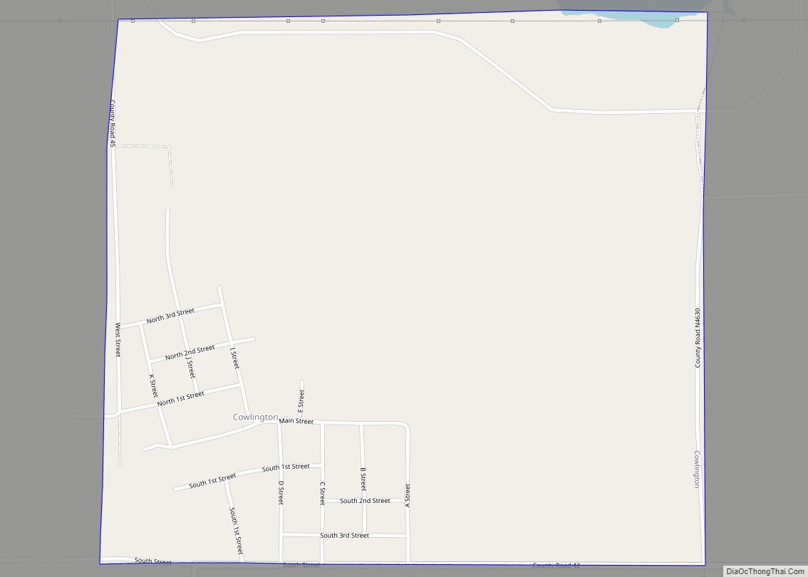
Online Interactive Map
Click on ![]() to view map in "full screen" mode.
to view map in "full screen" mode.
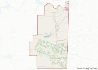
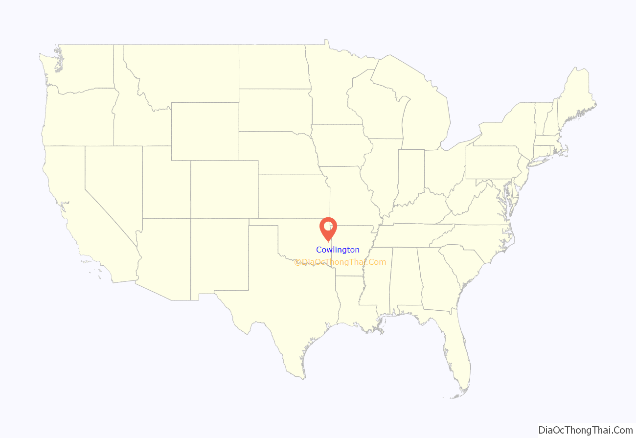
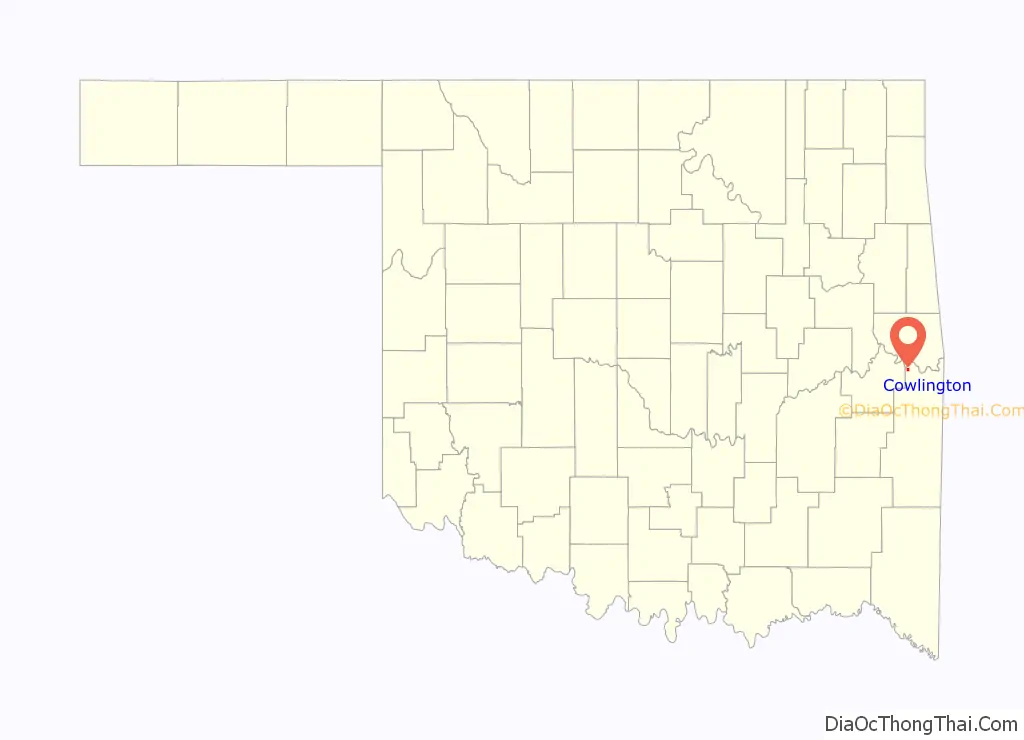
Cowlington location map. Where is Cowlington town?
History
The fertile soil of the Arkansas River bottom land, in which the present town of Cowlington is located, attracted settlement as soon as the Choctaw tribe migrated to Indian Territory. Many of these inhabitants fled during the American Civil War, returning only when hostilities had ceased. White men also came after the war and began leasing land. Among these were Coke and Fowler Cowling. A settlement formed that was informally known as Short Mountain. A post office named Cowlington, to honor the Cowling family, opened in the community in 1884.
At the time of its founding, Cowlington was located in the Moshulatubbee District of the Choctaw Nation.
Cowlington’s economy was largely based on agricultural services. Area production included wheat, potatoes, cotton, and livestock. The town prospered because of its access to the steamboat trade on the river. Two floods along the Arkansas River, in 1898 and 1904, devastated the local economy, but the town recovered each time. However, railroads built lines through LeFlore County in the late 1800s, and began to supplant the steamboats. Fowler Cowlington tried to convince some of the railroads to build a track through Cowlington, but failed in this effort. More residents began to move away. {{efn|Even Fowler Cowlington decided to sell his land and moved to Pittsburg County, Oklahoma. The onset of the Great Depression caused many other people to move away, as well.
Construction of the Robert S. Kerr Lock and Dam between 1964 and 1970 coincided with a large increase in Cowlington’s population to a high of 751 residents at the 1970 U. S. Census. Tourism became a significant portion of the local economy, although the population declined again after construction was completed.
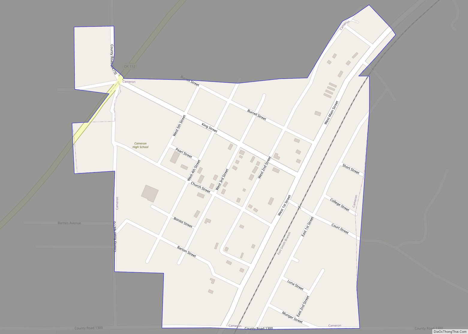
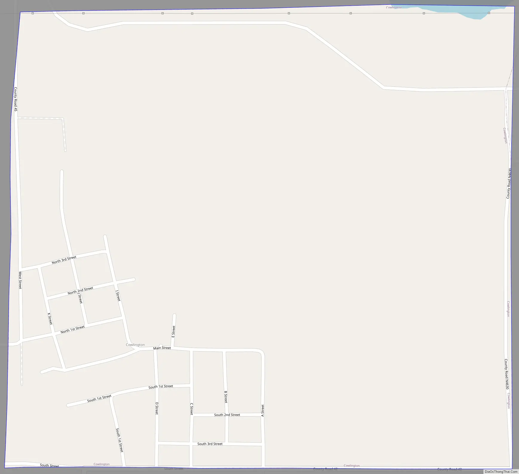
Cowlington Road Map
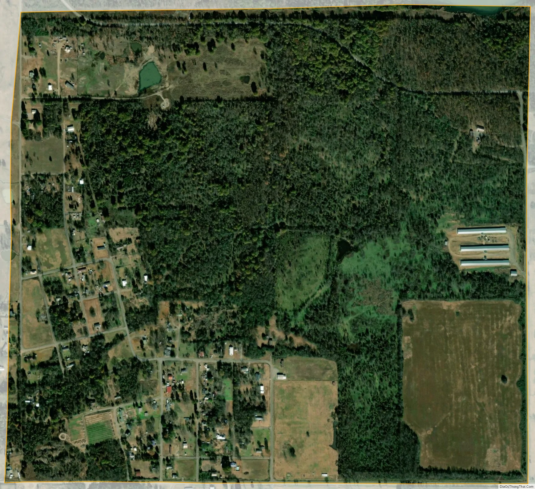
Cowlington city Satellite Map
Geography
Cowlington is located at 35°18′26″N 94°47′29″W / 35.30722°N 94.79139°W / 35.30722; -94.79139 (35.307146, -94.791413). It is 2 miles (3.2 km) south of Robert S. Kerr Lock and Dam (part of the McClellan-Kerr Arkansas River Navigation System). The town is also 10.5 miles (16.9 km) south of Sallisaw.
According to the United States Census Bureau, the town has a total area of 0.9 square miles (2.3 km), all land.
See also
Map of Oklahoma State and its subdivision:- Adair
- Alfalfa
- Atoka
- Beaver
- Beckham
- Blaine
- Bryan
- Caddo
- Canadian
- Carter
- Cherokee
- Choctaw
- Cimarron
- Cleveland
- Coal
- Comanche
- Cotton
- Craig
- Creek
- Custer
- Delaware
- Dewey
- Ellis
- Garfield
- Garvin
- Grady
- Grant
- Greer
- Harmon
- Harper
- Haskell
- Hughes
- Jackson
- Jefferson
- Johnston
- Kay
- Kingfisher
- Kiowa
- Latimer
- Le Flore
- Lincoln
- Logan
- Love
- Major
- Marshall
- Mayes
- McClain
- McCurtain
- McIntosh
- Murray
- Muskogee
- Noble
- Nowata
- Okfuskee
- Oklahoma
- Okmulgee
- Osage
- Ottawa
- Pawnee
- Payne
- Pittsburg
- Pontotoc
- Pottawatomie
- Pushmataha
- Roger Mills
- Rogers
- Seminole
- Sequoyah
- Stephens
- Texas
- Tillman
- Tulsa
- Wagoner
- Washington
- Washita
- Woods
- Woodward
- Alabama
- Alaska
- Arizona
- Arkansas
- California
- Colorado
- Connecticut
- Delaware
- District of Columbia
- Florida
- Georgia
- Hawaii
- Idaho
- Illinois
- Indiana
- Iowa
- Kansas
- Kentucky
- Louisiana
- Maine
- Maryland
- Massachusetts
- Michigan
- Minnesota
- Mississippi
- Missouri
- Montana
- Nebraska
- Nevada
- New Hampshire
- New Jersey
- New Mexico
- New York
- North Carolina
- North Dakota
- Ohio
- Oklahoma
- Oregon
- Pennsylvania
- Rhode Island
- South Carolina
- South Dakota
- Tennessee
- Texas
- Utah
- Vermont
- Virginia
- Washington
- West Virginia
- Wisconsin
- Wyoming