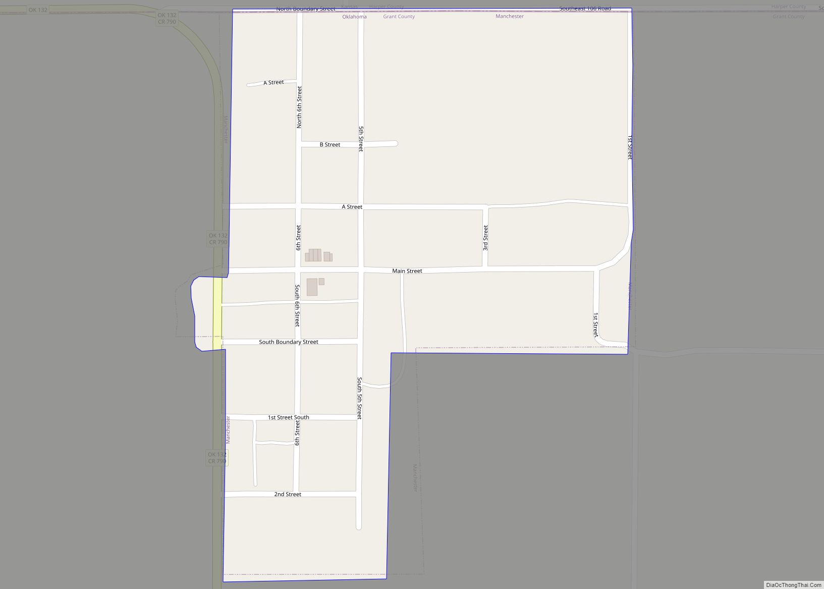
Deer Creek is a town in Grant County, Oklahoma, United States. The population was 130 at the 2010 census, an 11.6 percent decrease from the figure of 147 in 2000. It was named for a nearby stream, which is a tributary of the Salt Fork of the Arkansas River.
| Name: | Deer Creek town |
|---|---|
| LSAD Code: | 43 |
| LSAD Description: | town (suffix) |
| State: | Oklahoma |
| County: | Grant County |
| Elevation: | 1,089 ft (332 m) |
| Total Area: | 0.14 sq mi (0.37 km²) |
| Land Area: | 0.14 sq mi (0.37 km²) |
| Water Area: | 0.00 sq mi (0.00 km²) |
| Total Population: | 78 |
| Population Density: | 549.30/sq mi (211.35/km²) |
| ZIP code: | 74636 |
| Area code: | 580 |
| FIPS code: | 4019650 |
| GNISfeature ID: | 1092001 |
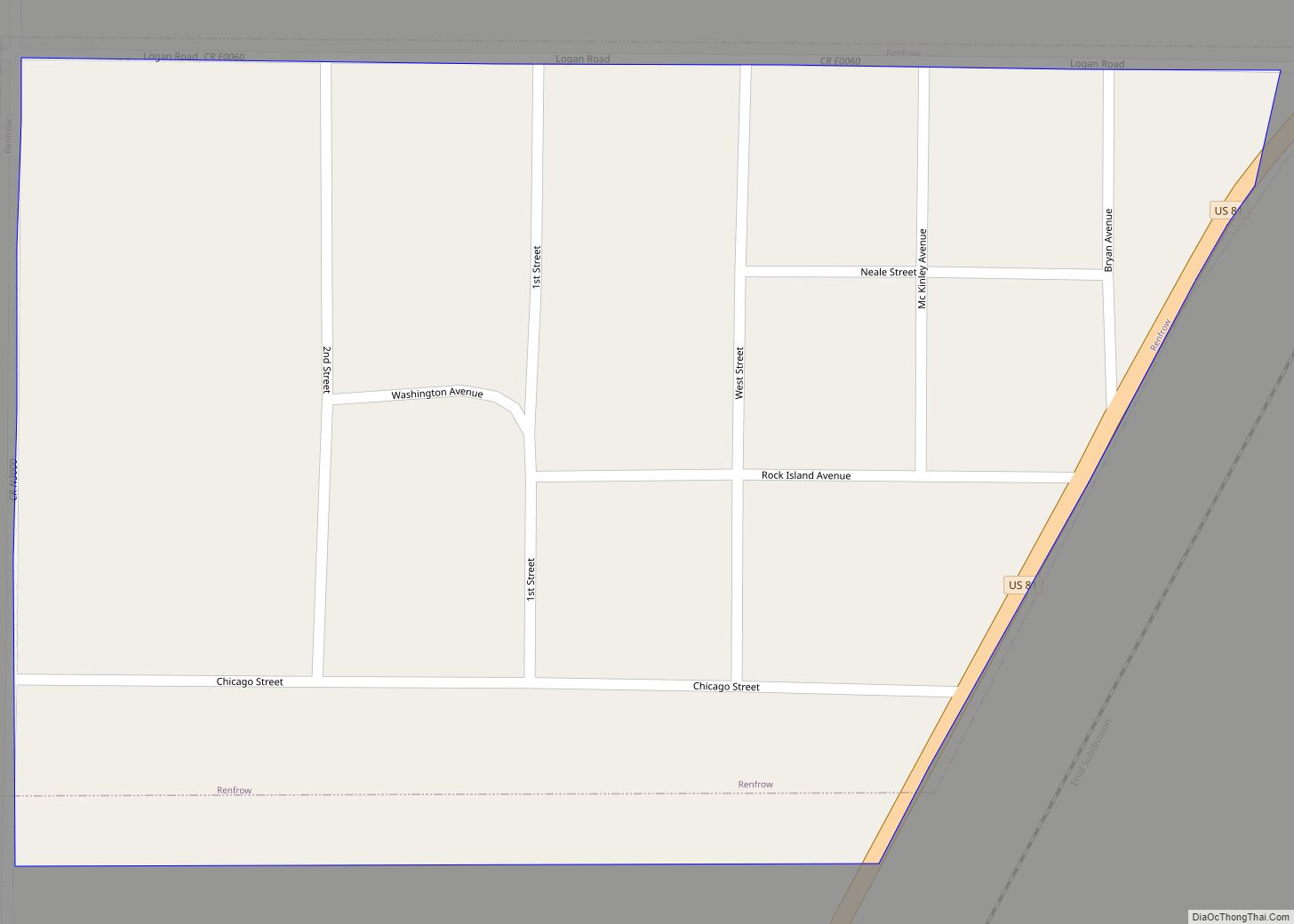
Online Interactive Map
Click on ![]() to view map in "full screen" mode.
to view map in "full screen" mode.
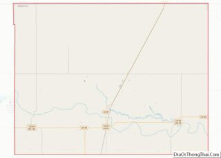
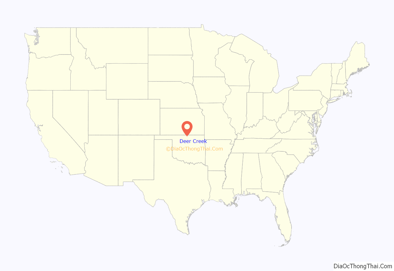
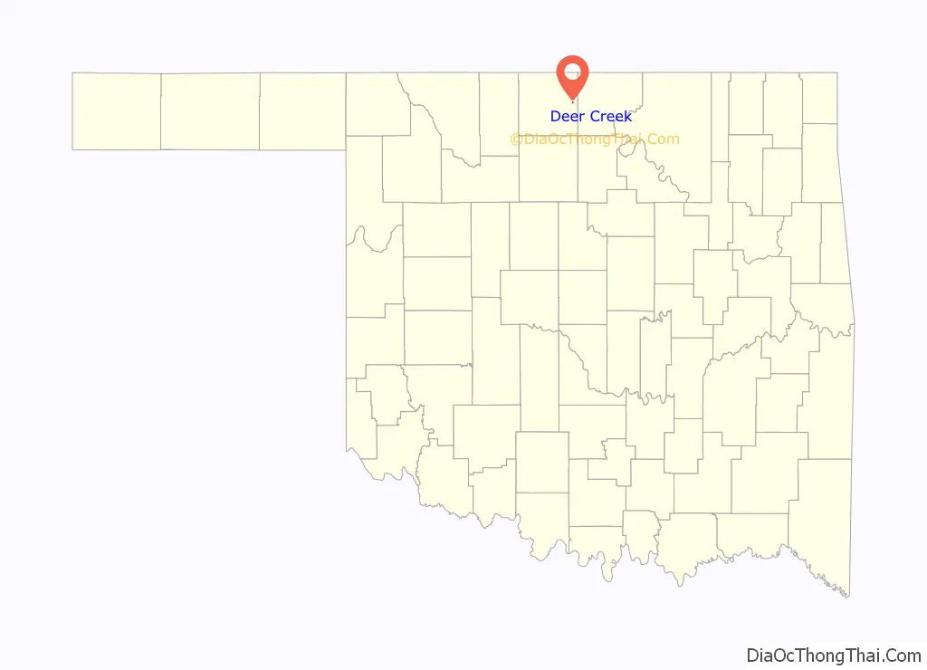
Deer Creek location map. Where is Deer Creek town?
History
The community began March 14, 1898, when W. A. Bradford, president of the Gulf Railroad bought 160 acres (0.65 km) of land to establish a town along the route his railroad planned to use for a rail line between Medford and Blackwell, Oklahoma. The line was constructed in 1897-1898. On February 27, 1899, the post office at the nearby community of Orie was moved to Deer Creek.
The Deer Creek Mennonites organized on August 27, 1899, and opened a church in 1902. Soon, other denominations began meeting in the home of Elijah Franklin Webster, with a Methodist minister leading the service. The Christian and Methodist church buildings were constructed by 1909.
The first producing oil and gas wells in the area were drilled in the early 1920s, causing a brief boom. Deer Creek’s population peaked at 312 in 1930. A prolonged population decline reached 124 in 1990. Except for one co-operative, most businesses had closed by 1998. There has been a small population increase in the 21st Century.
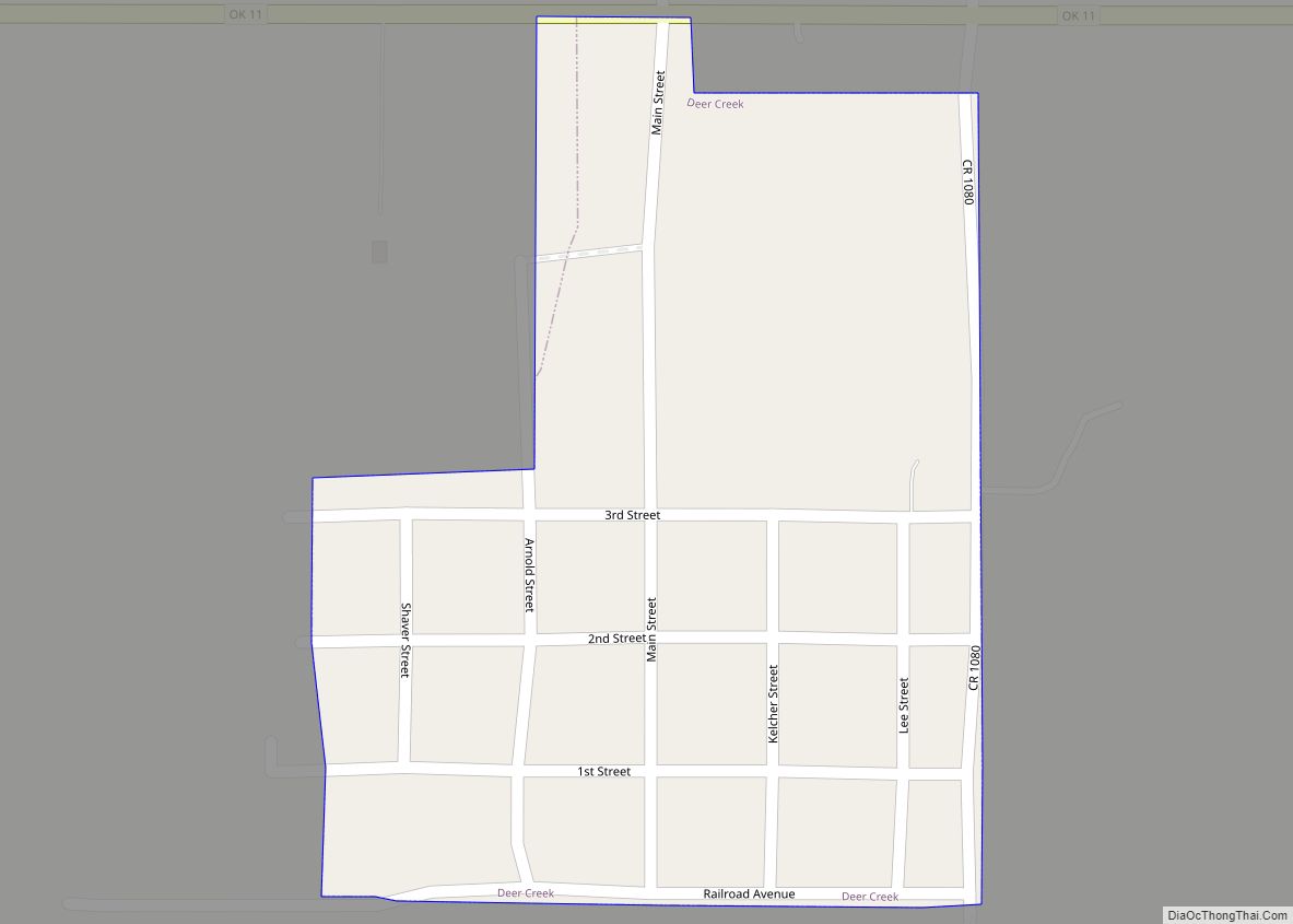
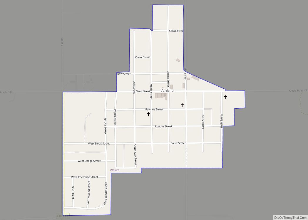
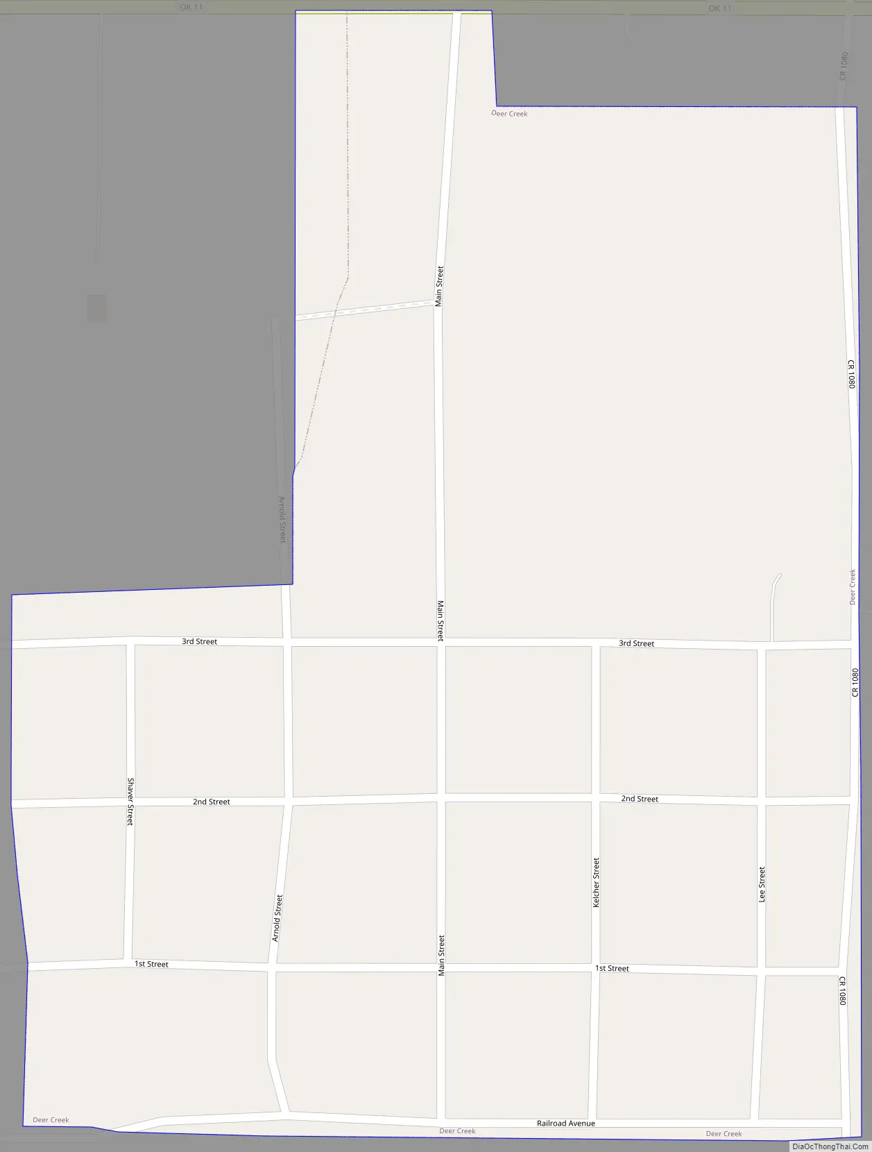
Deer Creek Road Map
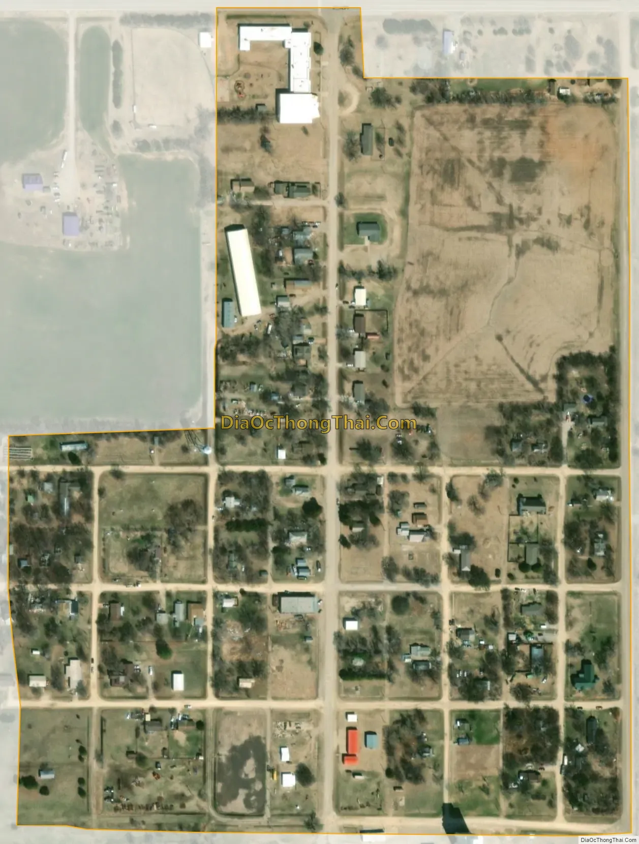
Deer Creek city Satellite Map
Geography
Deer Creek is located 12 miles (19 km) east of Medford on Oklahoma State Highway 11. Deer Creek flows past approximately one mile east of the community.
According to the United States Census Bureau, the town has a total area of 0.1 square miles (0.26 km), all land.
See also
Map of Oklahoma State and its subdivision:- Adair
- Alfalfa
- Atoka
- Beaver
- Beckham
- Blaine
- Bryan
- Caddo
- Canadian
- Carter
- Cherokee
- Choctaw
- Cimarron
- Cleveland
- Coal
- Comanche
- Cotton
- Craig
- Creek
- Custer
- Delaware
- Dewey
- Ellis
- Garfield
- Garvin
- Grady
- Grant
- Greer
- Harmon
- Harper
- Haskell
- Hughes
- Jackson
- Jefferson
- Johnston
- Kay
- Kingfisher
- Kiowa
- Latimer
- Le Flore
- Lincoln
- Logan
- Love
- Major
- Marshall
- Mayes
- McClain
- McCurtain
- McIntosh
- Murray
- Muskogee
- Noble
- Nowata
- Okfuskee
- Oklahoma
- Okmulgee
- Osage
- Ottawa
- Pawnee
- Payne
- Pittsburg
- Pontotoc
- Pottawatomie
- Pushmataha
- Roger Mills
- Rogers
- Seminole
- Sequoyah
- Stephens
- Texas
- Tillman
- Tulsa
- Wagoner
- Washington
- Washita
- Woods
- Woodward
- Alabama
- Alaska
- Arizona
- Arkansas
- California
- Colorado
- Connecticut
- Delaware
- District of Columbia
- Florida
- Georgia
- Hawaii
- Idaho
- Illinois
- Indiana
- Iowa
- Kansas
- Kentucky
- Louisiana
- Maine
- Maryland
- Massachusetts
- Michigan
- Minnesota
- Mississippi
- Missouri
- Montana
- Nebraska
- Nevada
- New Hampshire
- New Jersey
- New Mexico
- New York
- North Carolina
- North Dakota
- Ohio
- Oklahoma
- Oregon
- Pennsylvania
- Rhode Island
- South Carolina
- South Dakota
- Tennessee
- Texas
- Utah
- Vermont
- Virginia
- Washington
- West Virginia
- Wisconsin
- Wyoming