Eldon is an unincorporated community and census-designated place (CDP) in Cherokee County, Oklahoma, United States. The population was 368 at the 2010 census, a loss of 62.3 percent from 991 at the 2000 census, due largely to shrinkage of the CDP boundaries. It lies east of Tahlequah at the junction of U.S. Highway 62 and State Highway 51. The Eldon Post Office existed from March 20, 1911, until May 30, 1936. The community is said to have been named for Eldon, Illinois.
| Name: | Eldon CDP |
|---|---|
| LSAD Code: | 57 |
| LSAD Description: | CDP (suffix) |
| State: | Oklahoma |
| County: | Cherokee County |
| Elevation: | 794 ft (242 m) |
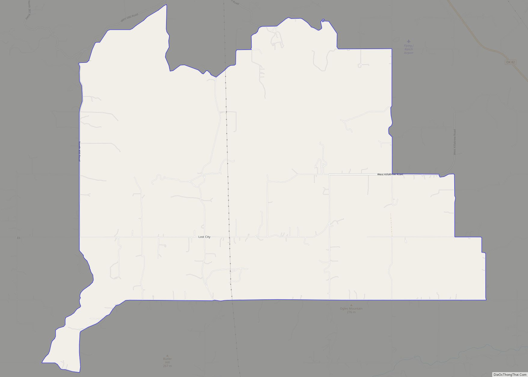
| Total Area: | 9.15 sq mi (23.69 km²) |
| Land Area: | 8.96 sq mi (23.21 km²) |
| Water Area: | 0.18 sq mi (0.48 km²) |
| Total Population: | 347 |
| Population Density: | 38.72/sq mi (14.95/km²) |
| FIPS code: | 4023300 |
| GNISfeature ID: | 1100385 |
Online Interactive Map
Click on ![]() to view map in "full screen" mode.
to view map in "full screen" mode.
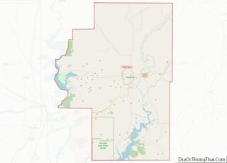
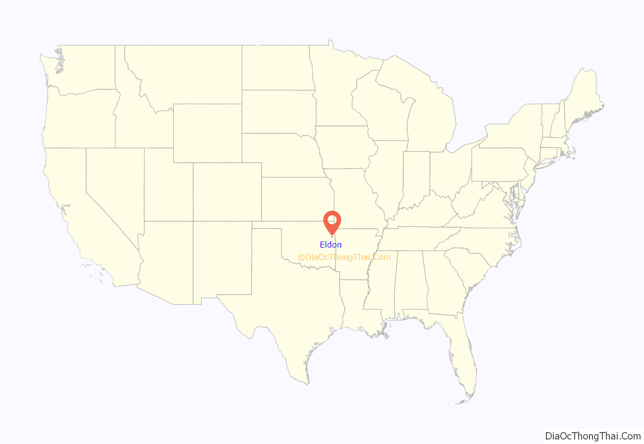
Eldon location map. Where is Eldon CDP?
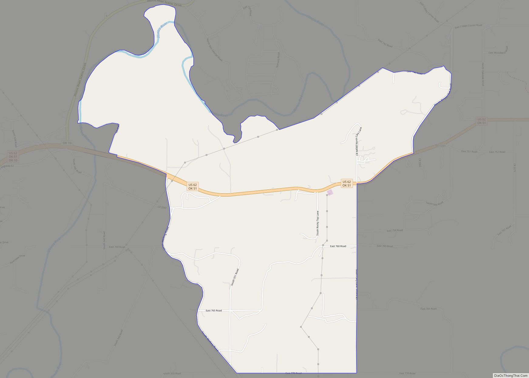
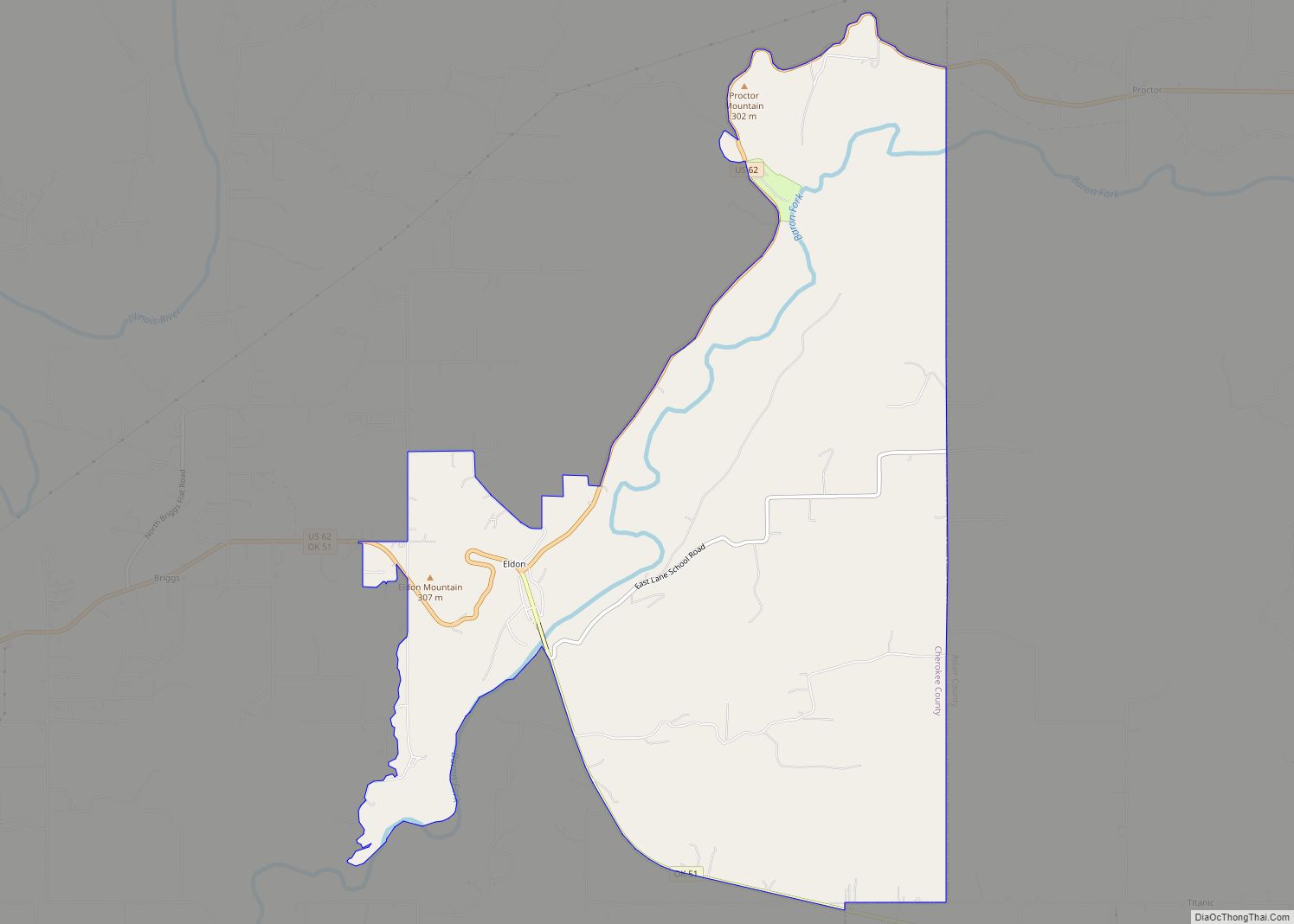
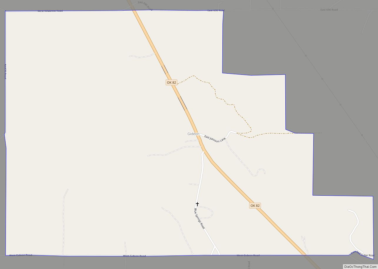
Eldon Road Map
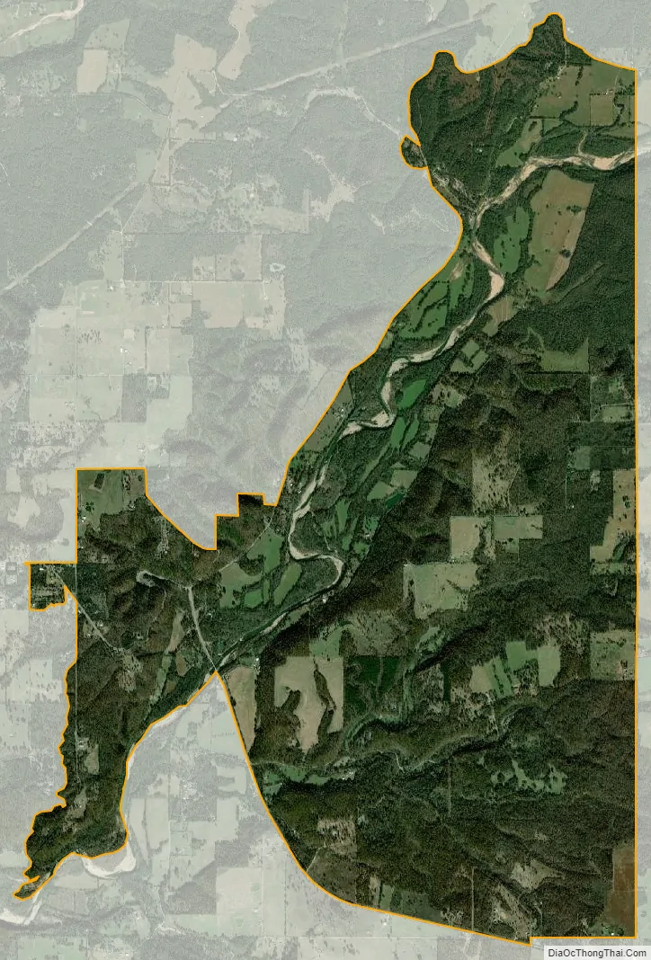
Eldon city Satellite Map
Geography
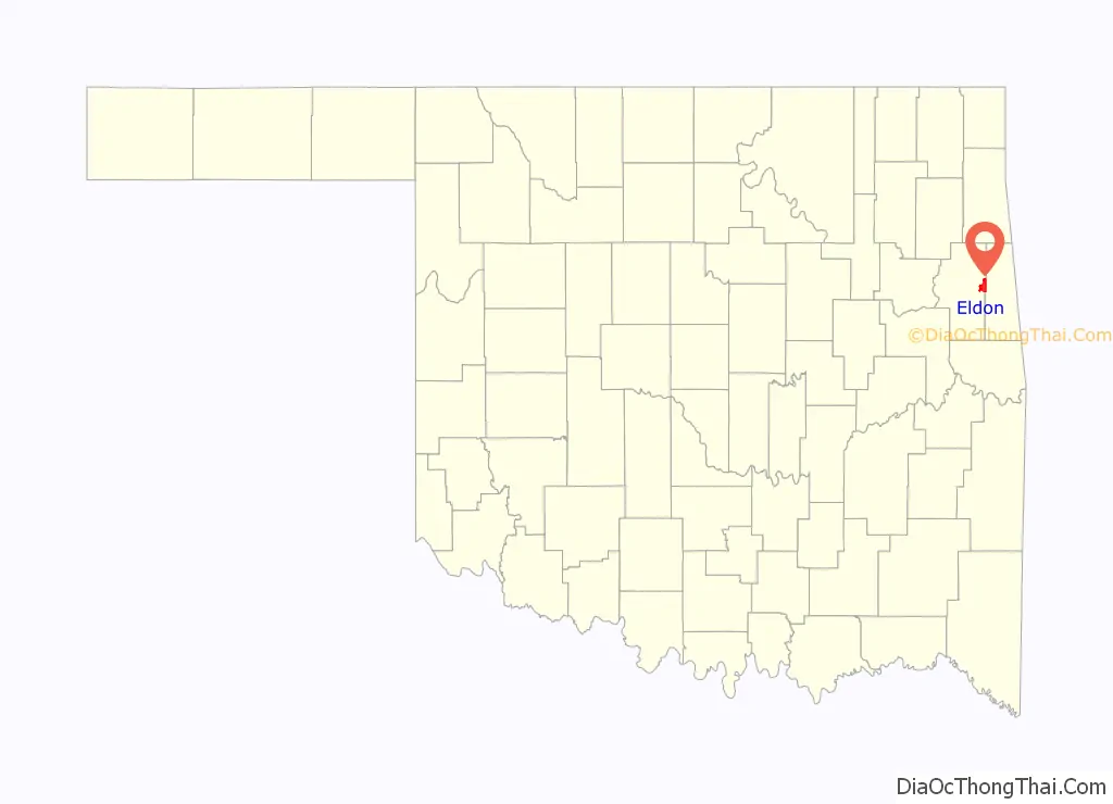
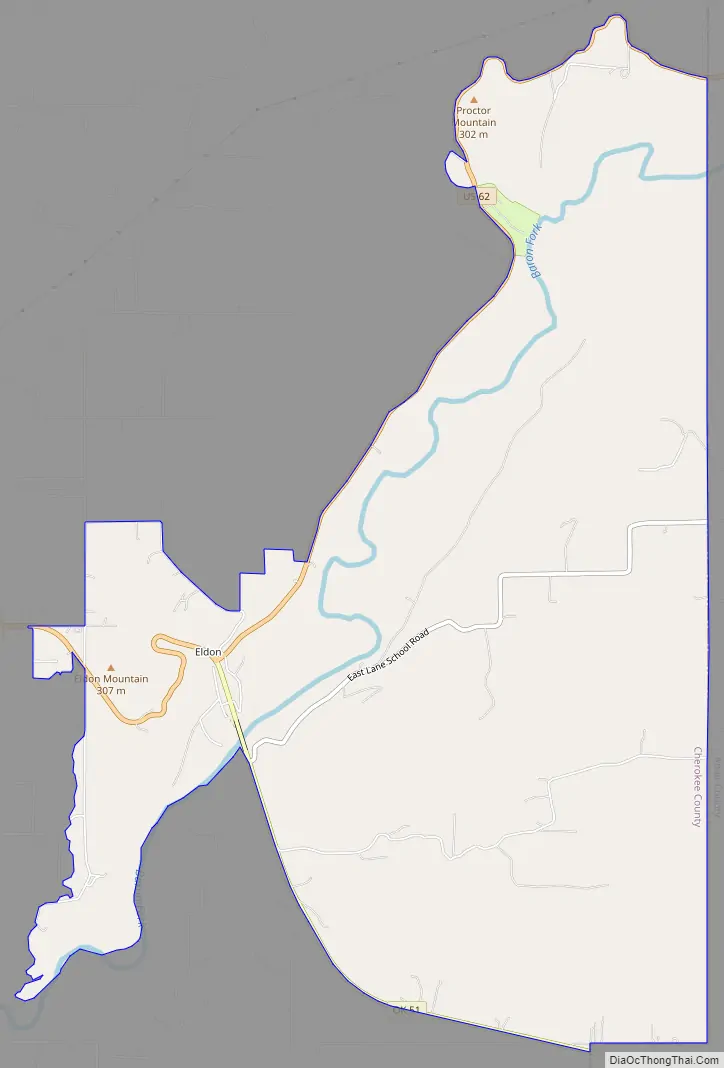
Eldon is located along the eastern edge of Cherokee County at 35°55′49″N 94°50′39″W / 35.93028°N 94.84417°W / 35.93028; -94.84417 (35.930319, -94.844083), in the valley of the Baron Fork of the Illinois River. U.S. Route 62 leads west 8 miles (13 km) to Tahlequah and east 20 miles (32 km) to Westville near the Arkansas border. State Highway 51 leads southeast from Eldon 16 miles (26 km) to Stilwell.
Eldon is bordered to the south by the CDP of Welling and to the east by Adair County.
According to the United States Census Bureau, the Eldon CDP has a total area of 9.2 square miles (23.7 km), of which 9.0 square miles (23.4 km) is land and 0.15 square miles (0.4 km), or 1.50%, is water. The Census Bureau reduced the area recorded as Eldon to its current boundaries from 18.5 square miles (48 km) as of the 2000 census.
See also
Map of Oklahoma State and its subdivision:- Adair
- Alfalfa
- Atoka
- Beaver
- Beckham
- Blaine
- Bryan
- Caddo
- Canadian
- Carter
- Cherokee
- Choctaw
- Cimarron
- Cleveland
- Coal
- Comanche
- Cotton
- Craig
- Creek
- Custer
- Delaware
- Dewey
- Ellis
- Garfield
- Garvin
- Grady
- Grant
- Greer
- Harmon
- Harper
- Haskell
- Hughes
- Jackson
- Jefferson
- Johnston
- Kay
- Kingfisher
- Kiowa
- Latimer
- Le Flore
- Lincoln
- Logan
- Love
- Major
- Marshall
- Mayes
- McClain
- McCurtain
- McIntosh
- Murray
- Muskogee
- Noble
- Nowata
- Okfuskee
- Oklahoma
- Okmulgee
- Osage
- Ottawa
- Pawnee
- Payne
- Pittsburg
- Pontotoc
- Pottawatomie
- Pushmataha
- Roger Mills
- Rogers
- Seminole
- Sequoyah
- Stephens
- Texas
- Tillman
- Tulsa
- Wagoner
- Washington
- Washita
- Woods
- Woodward
- Alabama
- Alaska
- Arizona
- Arkansas
- California
- Colorado
- Connecticut
- Delaware
- District of Columbia
- Florida
- Georgia
- Hawaii
- Idaho
- Illinois
- Indiana
- Iowa
- Kansas
- Kentucky
- Louisiana
- Maine
- Maryland
- Massachusetts
- Michigan
- Minnesota
- Mississippi
- Missouri
- Montana
- Nebraska
- Nevada
- New Hampshire
- New Jersey
- New Mexico
- New York
- North Carolina
- North Dakota
- Ohio
- Oklahoma
- Oregon
- Pennsylvania
- Rhode Island
- South Carolina
- South Dakota
- Tennessee
- Texas
- Utah
- Vermont
- Virginia
- Washington
- West Virginia
- Wisconsin
- Wyoming