Kaw City is a city in eastern Kay County, Oklahoma, United States. The population was 375 at the 2010 census, an increase of 1 percent from the figure of 372 in 2000. Kaw City was named for the Kanza Indians, called the Kaw by locals.
| Name: | Kaw City city |
|---|---|
| LSAD Code: | 25 |
| LSAD Description: | city (suffix) |
| State: | Oklahoma |
| County: | Kay County |
| Elevation: | 1,010 ft (310 m) |
| Total Area: | 6.12 sq mi (15.85 km²) |
| Land Area: | 3.01 sq mi (7.80 km²) |
| Water Area: | 3.11 sq mi (8.05 km²) |
| Total Population: | 325 |
| Population Density: | 107.94/sq mi (41.68/km²) |
| ZIP code: | 74641 |
| Area code: | 580 |
| FIPS code: | 4038800 |
| GNISfeature ID: | 1094296 |
| Website: | www.kawnation.com |
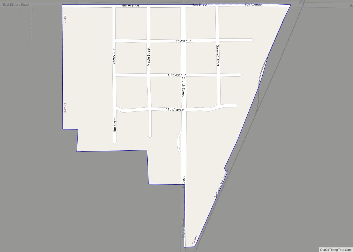
Online Interactive Map
Click on ![]() to view map in "full screen" mode.
to view map in "full screen" mode.
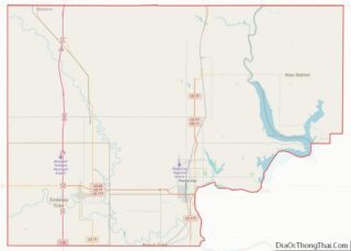
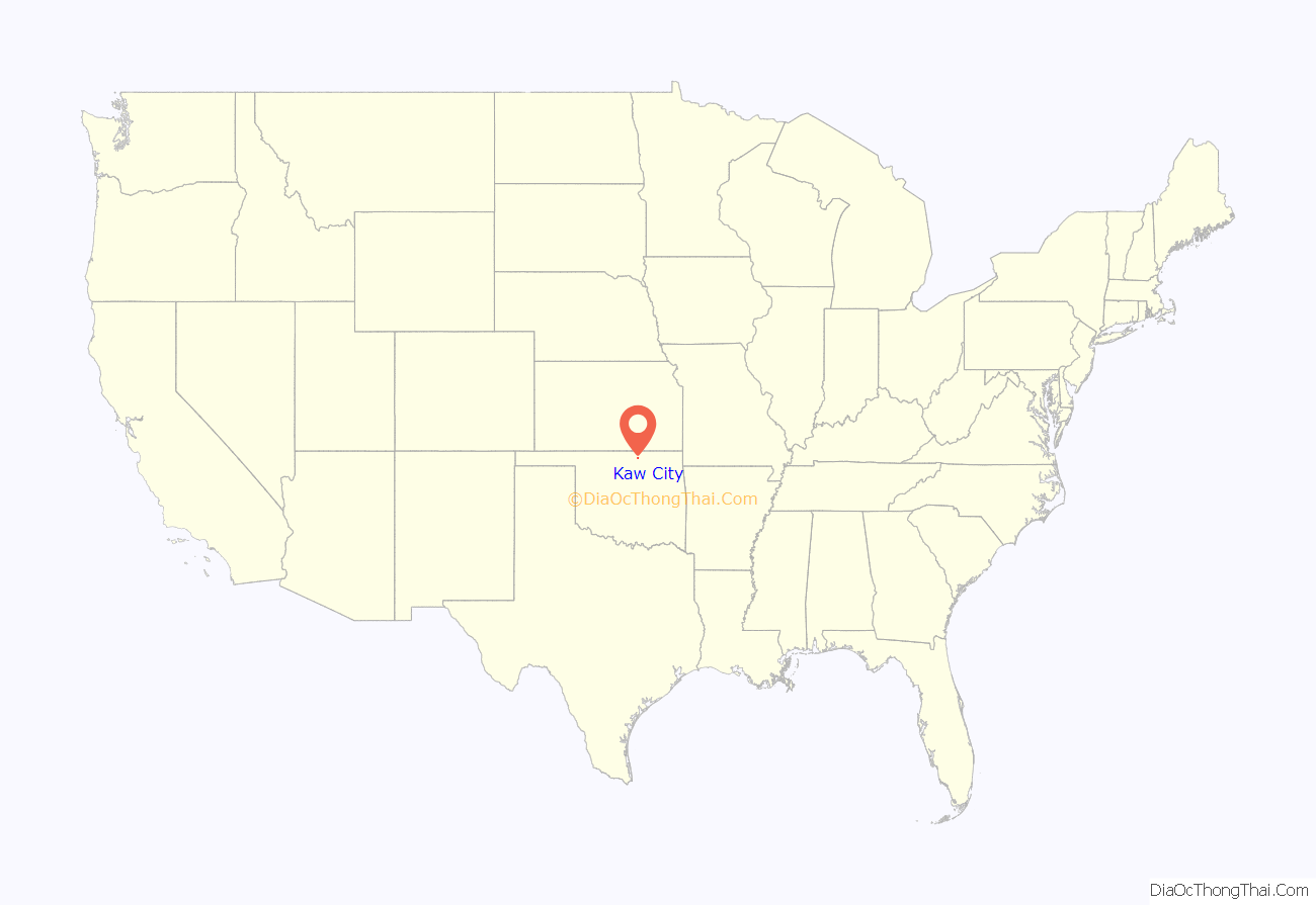
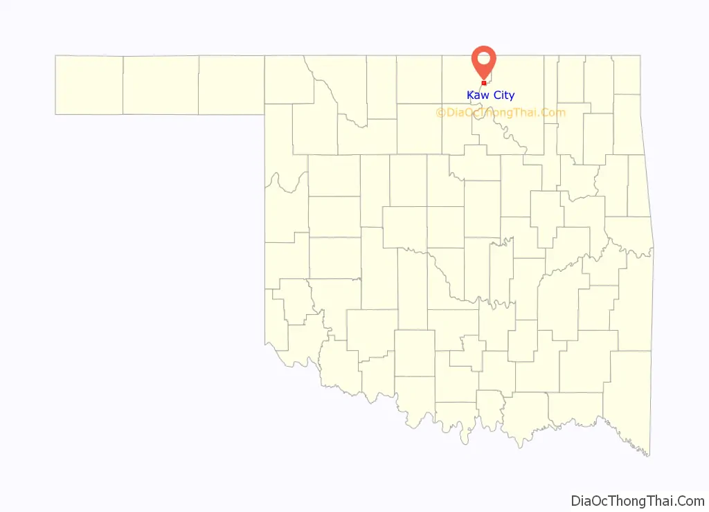
Kaw City location map. Where is Kaw City city?
History
In 1902, the original Kaw City was founded, prior to Oklahoma statehood, as a farming community in the fertile oxbow bend of the Arkansas River. Kaw City was across the river from the Kaw Indian reservation and the Kaw Agency. By statehood in 1907, it had 486 inhabitants. Although the original town site is now inundated by the waters of Kaw Lake, the old town was quite a busy place.
It became a booming oil town in 1919, when ‘black gold’ was discovered in nearby Kay County and the present Osage Nation reservation. The population jumped from 627 in 1920 to 1,001 in 1930. It even had a very popular four-story hotel filled with one of the world’s rarest art collections. Laura A. Clubb, owner of the collection and wife of a local rancher, later donated her collection to Philbrook Art Museum.
The majority of the town was overcome by a (weather-related) flood in 1923, and then devastated again by the Great Depression.
In the late 1960s, the Army Corps of Engineers constructed Kaw Dam on the Arkansas River just south of the original Kaw City site. It then went underwater permanently in 1976, when the gates of the Kaw Dam closed and turned that particular area of the Arkansas River into Kaw Lake. Dave Morgan, a banker and oilman in nearby Blackwell, Oklahoma loaned the town the money it needed to move two miles to the west, up on a hill by the town’s cemetery. The first house was built in the summer of 1969 and first mail delivery was on June 26, 1972. Many buildings in Kaw City, including the old Santa Fe Railroad Depot which is now the Kaw City Museum, were moved to the town’s present location, on high ground near the lake. The Santa Fe Railroad Depot is listed on the National Register of Historic Places. The depot is one of only two listed structures that have been moved from their original locations elsewhere in Oklahoma, the other being Will Rogers Homestead near Claremore, which was also moved to make way for a lake. When the water in the lake is exceptionally low, some of the foundations of the old structures can still be seen just above the water.
The Kaw City Cemetery (all headstones and the majority of the caskets) were also moved and given a separate section within Ponca City’s IOOF cemetery, west of Conoco just south of Highway 60. The Kaw Indian cemetery located across the Arkansas river in Washunga was moved to Newkirk, Oklahoma.
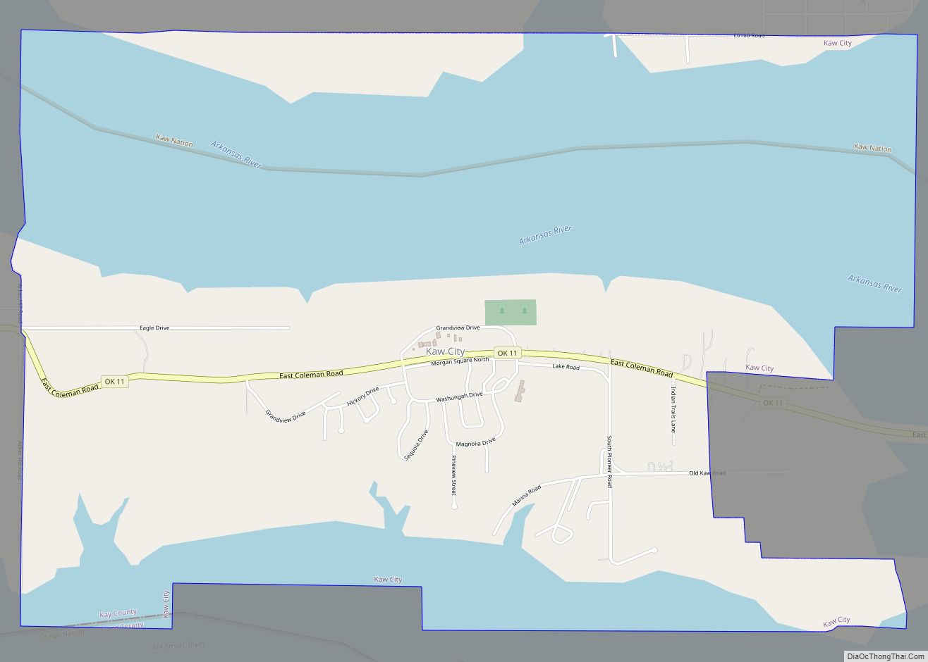
Kaw City Road Map
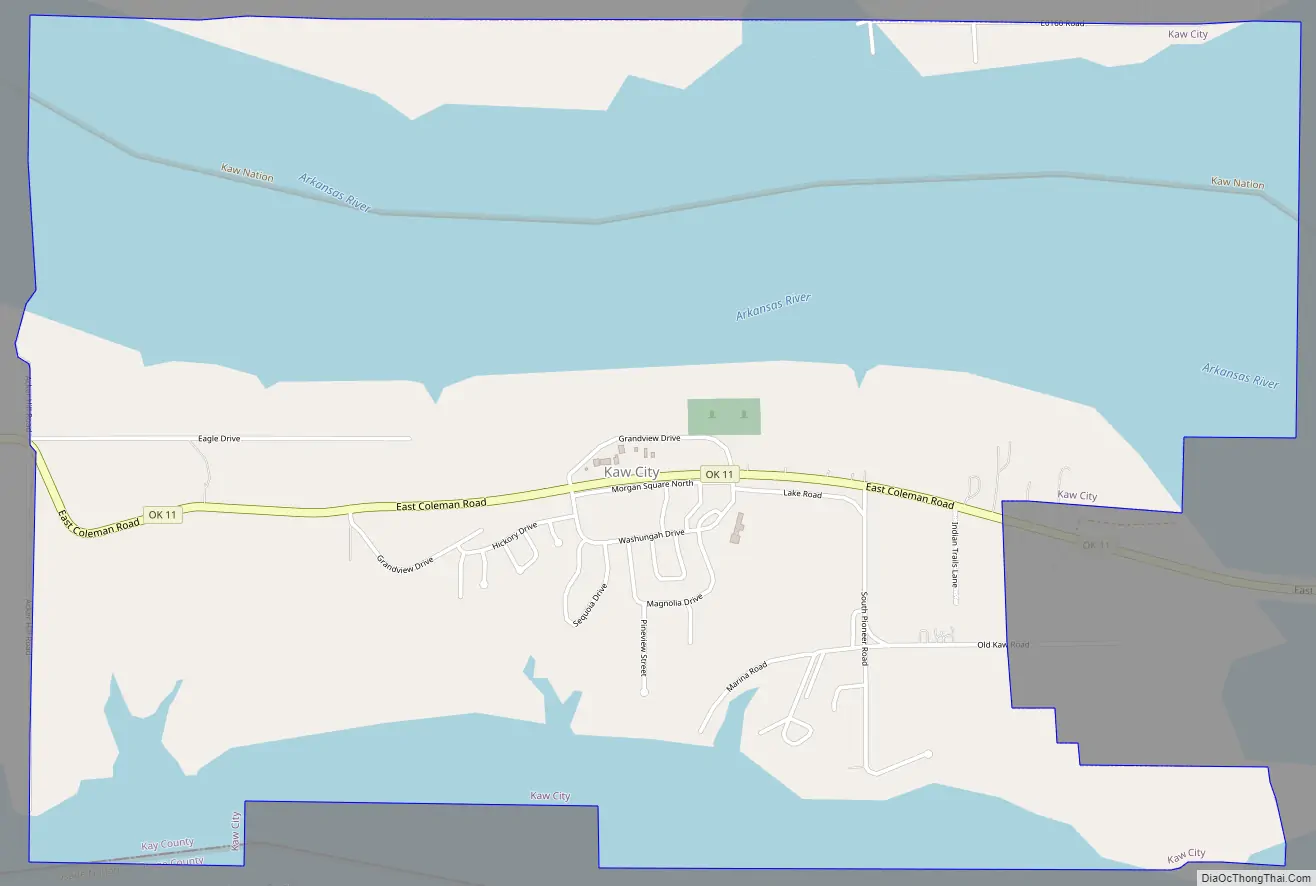
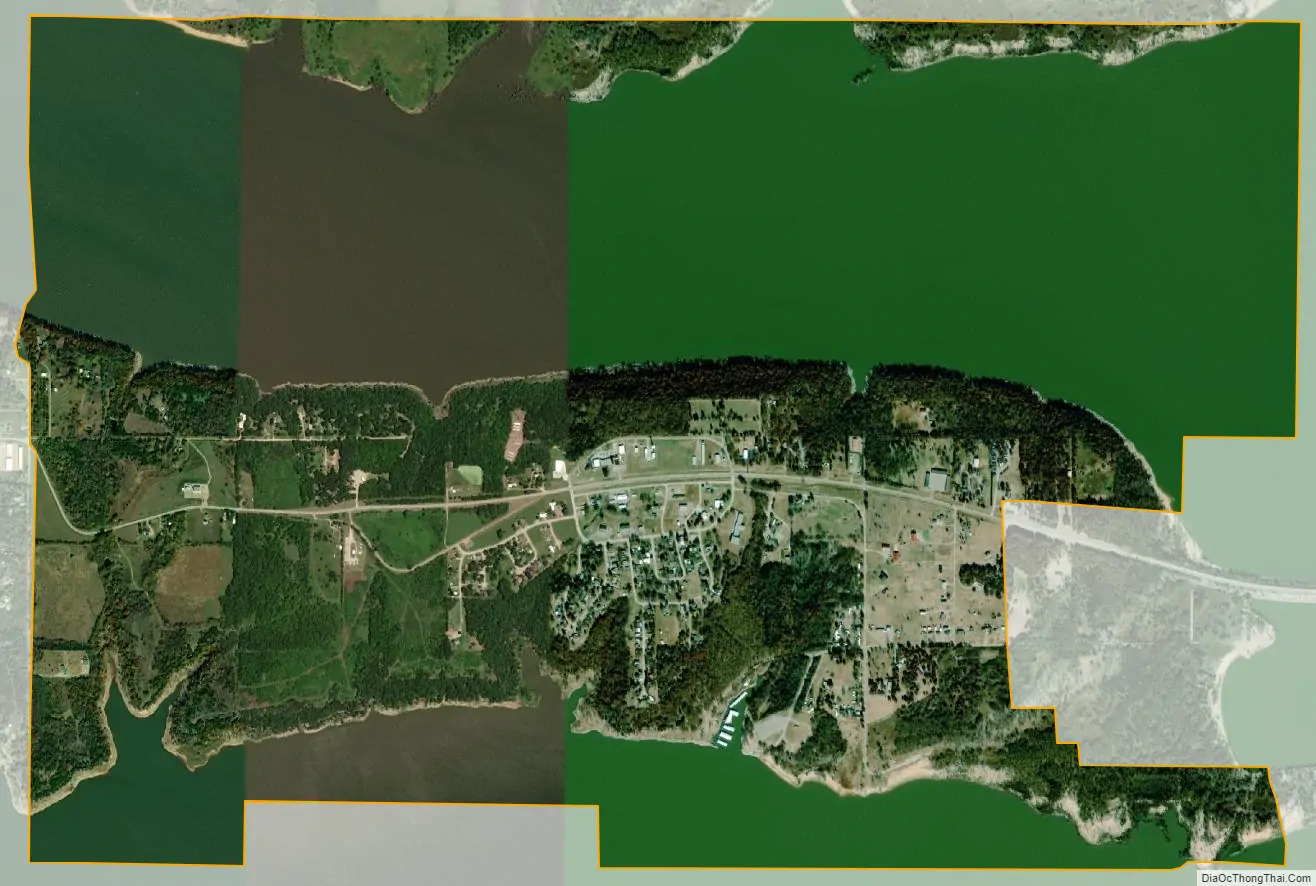
Kaw City city Satellite Map
Geography
Kaw City is located on a peninsula extending into the Kaw Lake impoundment of the Arkansas River. Washunga lies to the north across the lake. Oklahoma State Highway 11 passes through the community.
According to the United States Census Bureau, the city has a total area of 5.5 square miles (14 km), of which 2.7 square miles (7.0 km) is land and 2.8 square miles (7.3 km) (51.26%) is water.
See also
Map of Oklahoma State and its subdivision:- Adair
- Alfalfa
- Atoka
- Beaver
- Beckham
- Blaine
- Bryan
- Caddo
- Canadian
- Carter
- Cherokee
- Choctaw
- Cimarron
- Cleveland
- Coal
- Comanche
- Cotton
- Craig
- Creek
- Custer
- Delaware
- Dewey
- Ellis
- Garfield
- Garvin
- Grady
- Grant
- Greer
- Harmon
- Harper
- Haskell
- Hughes
- Jackson
- Jefferson
- Johnston
- Kay
- Kingfisher
- Kiowa
- Latimer
- Le Flore
- Lincoln
- Logan
- Love
- Major
- Marshall
- Mayes
- McClain
- McCurtain
- McIntosh
- Murray
- Muskogee
- Noble
- Nowata
- Okfuskee
- Oklahoma
- Okmulgee
- Osage
- Ottawa
- Pawnee
- Payne
- Pittsburg
- Pontotoc
- Pottawatomie
- Pushmataha
- Roger Mills
- Rogers
- Seminole
- Sequoyah
- Stephens
- Texas
- Tillman
- Tulsa
- Wagoner
- Washington
- Washita
- Woods
- Woodward
- Alabama
- Alaska
- Arizona
- Arkansas
- California
- Colorado
- Connecticut
- Delaware
- District of Columbia
- Florida
- Georgia
- Hawaii
- Idaho
- Illinois
- Indiana
- Iowa
- Kansas
- Kentucky
- Louisiana
- Maine
- Maryland
- Massachusetts
- Michigan
- Minnesota
- Mississippi
- Missouri
- Montana
- Nebraska
- Nevada
- New Hampshire
- New Jersey
- New Mexico
- New York
- North Carolina
- North Dakota
- Ohio
- Oklahoma
- Oregon
- Pennsylvania
- Rhode Island
- South Carolina
- South Dakota
- Tennessee
- Texas
- Utah
- Vermont
- Virginia
- Washington
- West Virginia
- Wisconsin
- Wyoming