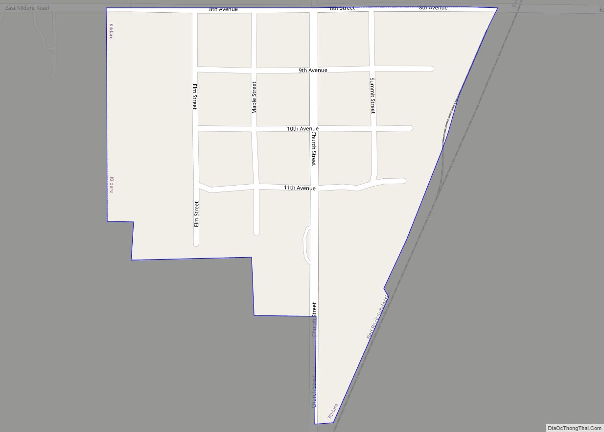
Kildare is a town in Kay County, Oklahoma, United States. The population was 100 at the 2010 census, an 8.7 percent increase from the figure of 92 in 2000.
| Name: | Kildare town |
|---|---|
| LSAD Code: | 43 |
| LSAD Description: | town (suffix) |
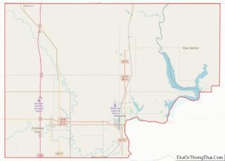
| State: | Oklahoma |
| County: | Kay County |
| Elevation: | 1,125 ft (343 m) |
| Total Area: | 0.14 sq mi (0.35 km²) |
| Land Area: | 0.14 sq mi (0.35 km²) |
| Water Area: | 0.00 sq mi (0.00 km²) |
| Total Population: | 86 |
| Population Density: | 632.35/sq mi (244.64/km²) |
| FIPS code: | 4039800 |
| GNISfeature ID: | 1094374 |
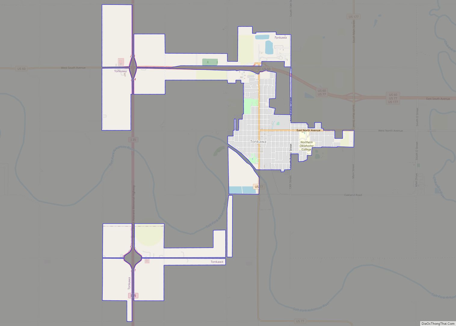
Online Interactive Map
Click on ![]() to view map in "full screen" mode.
to view map in "full screen" mode.
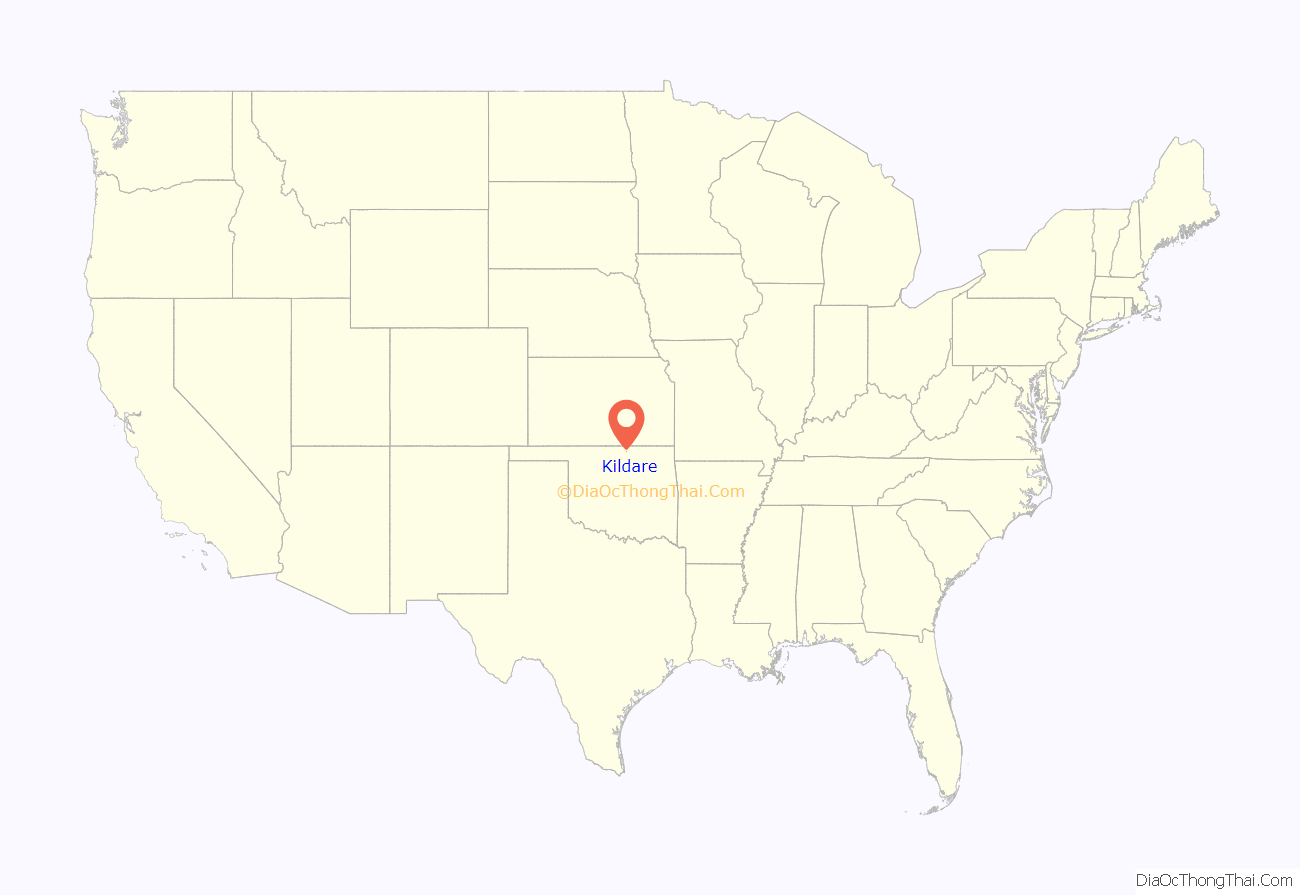
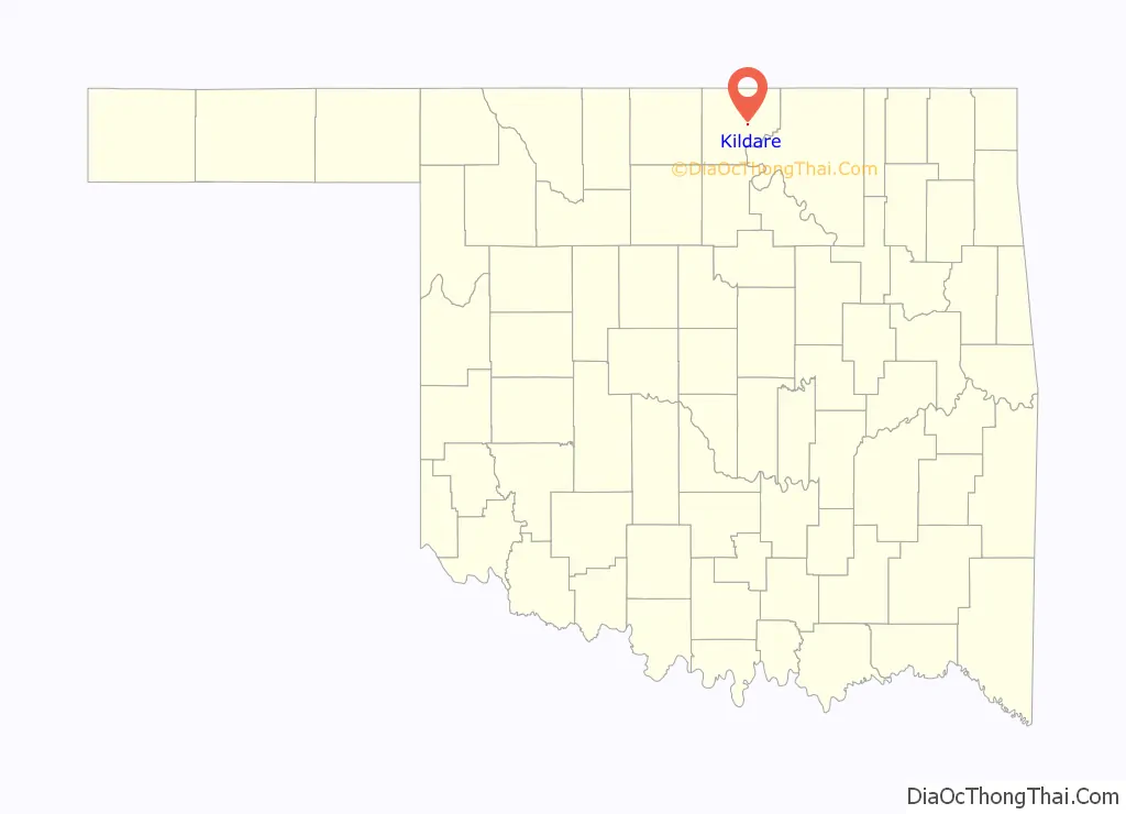
Kildare location map. Where is Kildare town?
History
According to the Encyclopedia of Oklahoma History and Culture, the Atchison, Topeka and Santa Fe Railroad built a section house, agent’s cottage, a tool house and a depot at the future site of Kildare in 1892, a year before the opening of the Cherokee Outlet to settlers.
The railroad said it sold eight thousand tickets to Kildare for September 16, 1893, the opening day of the Cherokee Strip land run. Kildare boomed almost overnight. A post office was established on October 24, 1893. The town was incorporated by the Territorial Legislature on March 2, 1905. However, the lack of water limited its future. The highest population ever recorded in the U. S. census was 216 in 1910. Three times fires destroyed the business district, and fewer businesses rebuilt each time.
It was named after County Kildare in Ireland.
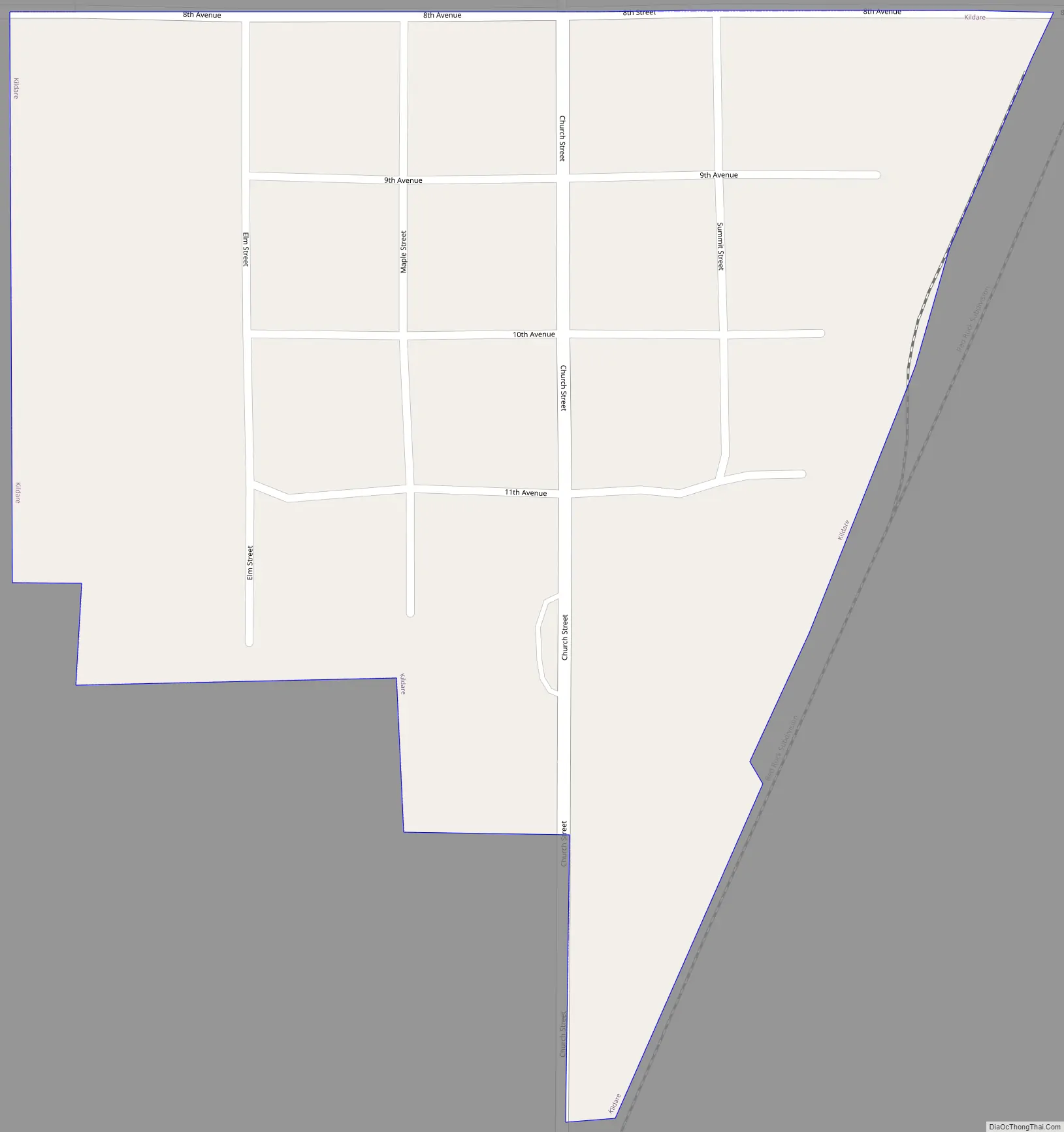
Kildare Road Map
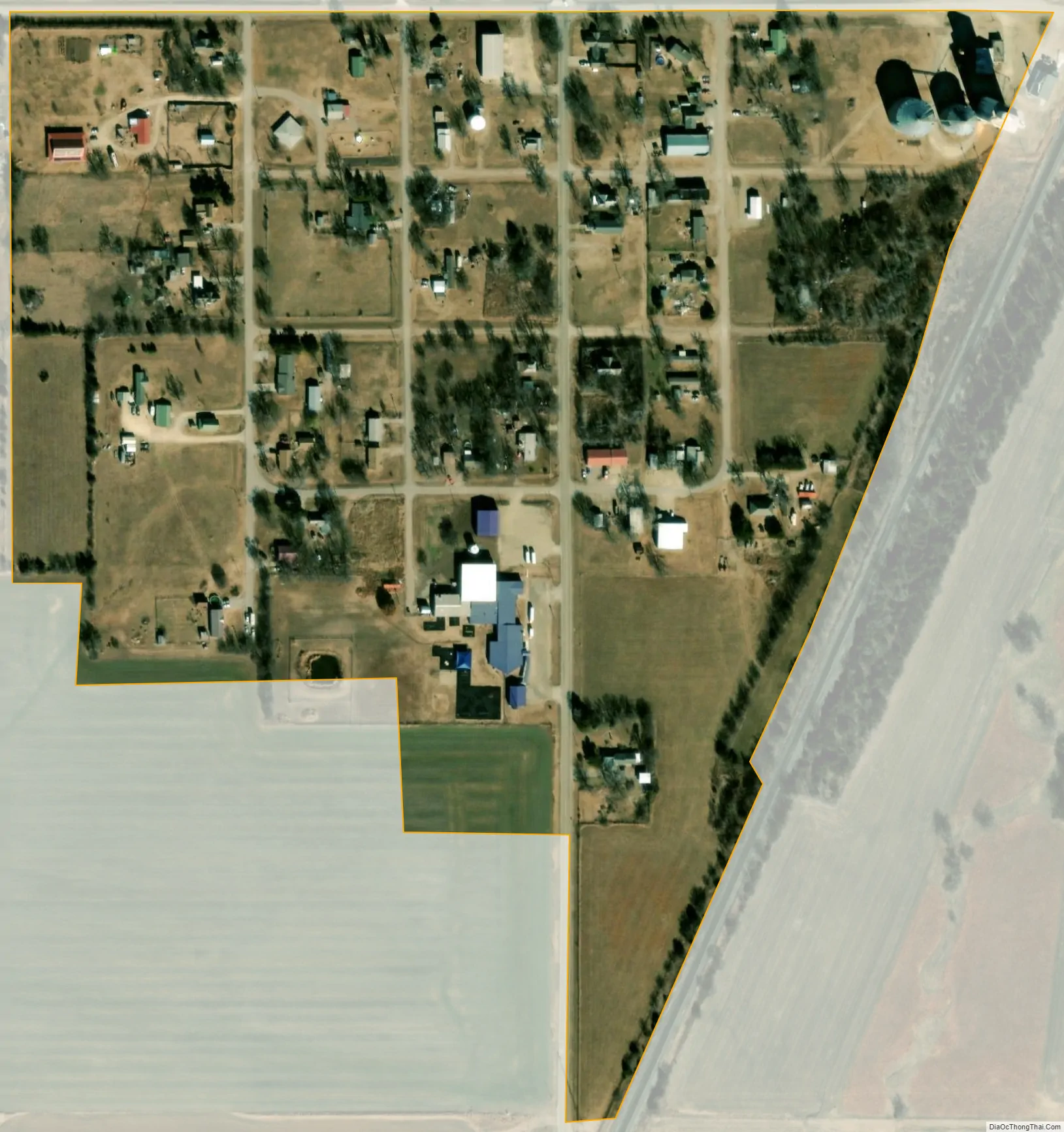
Kildare city Satellite Map
Geography
Kildare is located at 36°48′30″N 97°3′0″W / 36.80833°N 97.05000°W / 36.80833; -97.05000. According to the United States Census Bureau, the town has a total area of 0.2 square miles (0.52 km), all land.
See also
Map of Oklahoma State and its subdivision:- Adair
- Alfalfa
- Atoka
- Beaver
- Beckham
- Blaine
- Bryan
- Caddo
- Canadian
- Carter
- Cherokee
- Choctaw
- Cimarron
- Cleveland
- Coal
- Comanche
- Cotton
- Craig
- Creek
- Custer
- Delaware
- Dewey
- Ellis
- Garfield
- Garvin
- Grady
- Grant
- Greer
- Harmon
- Harper
- Haskell
- Hughes
- Jackson
- Jefferson
- Johnston
- Kay
- Kingfisher
- Kiowa
- Latimer
- Le Flore
- Lincoln
- Logan
- Love
- Major
- Marshall
- Mayes
- McClain
- McCurtain
- McIntosh
- Murray
- Muskogee
- Noble
- Nowata
- Okfuskee
- Oklahoma
- Okmulgee
- Osage
- Ottawa
- Pawnee
- Payne
- Pittsburg
- Pontotoc
- Pottawatomie
- Pushmataha
- Roger Mills
- Rogers
- Seminole
- Sequoyah
- Stephens
- Texas
- Tillman
- Tulsa
- Wagoner
- Washington
- Washita
- Woods
- Woodward
- Alabama
- Alaska
- Arizona
- Arkansas
- California
- Colorado
- Connecticut
- Delaware
- District of Columbia
- Florida
- Georgia
- Hawaii
- Idaho
- Illinois
- Indiana
- Iowa
- Kansas
- Kentucky
- Louisiana
- Maine
- Maryland
- Massachusetts
- Michigan
- Minnesota
- Mississippi
- Missouri
- Montana
- Nebraska
- Nevada
- New Hampshire
- New Jersey
- New Mexico
- New York
- North Carolina
- North Dakota
- Ohio
- Oklahoma
- Oregon
- Pennsylvania
- Rhode Island
- South Carolina
- South Dakota
- Tennessee
- Texas
- Utah
- Vermont
- Virginia
- Washington
- West Virginia
- Wisconsin
- Wyoming