Mannford is a city in Creek County in the northeastern part of the U.S. state of Oklahoma. In 2010, the population was 3,076, up from 2,095 at the 2000 census. The city sits next to Keystone Lake and claims to be the “Striped Bass Capital of the World”.
| Name: | Mannford town |
|---|---|
| LSAD Code: | 43 |
| LSAD Description: | town (suffix) |
| State: | Oklahoma |
| County: | Creek County, Pawnee County, Tulsa County |
| Elevation: | 755 ft (230 m) |
| Total Area: | 9.68 sq mi (25.06 km²) |
| Land Area: | 7.54 sq mi (19.52 km²) |
| Water Area: | 2.14 sq mi (5.54 km²) |
| Total Population: | 3,262 |
| Population Density: | 432.74/sq mi (167.08/km²) |
| ZIP code: | 74044 |
| Area code: | 539/918 |
| FIPS code: | 4046200 |
| GNISfeature ID: | 1100125 |
| Website: | cityofmannford.com |
Online Interactive Map
Click on ![]() to view map in "full screen" mode.
to view map in "full screen" mode.
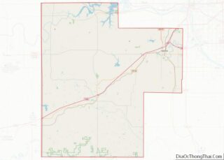
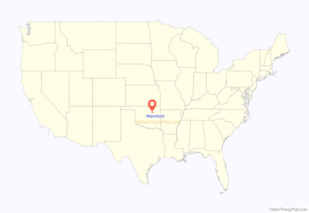
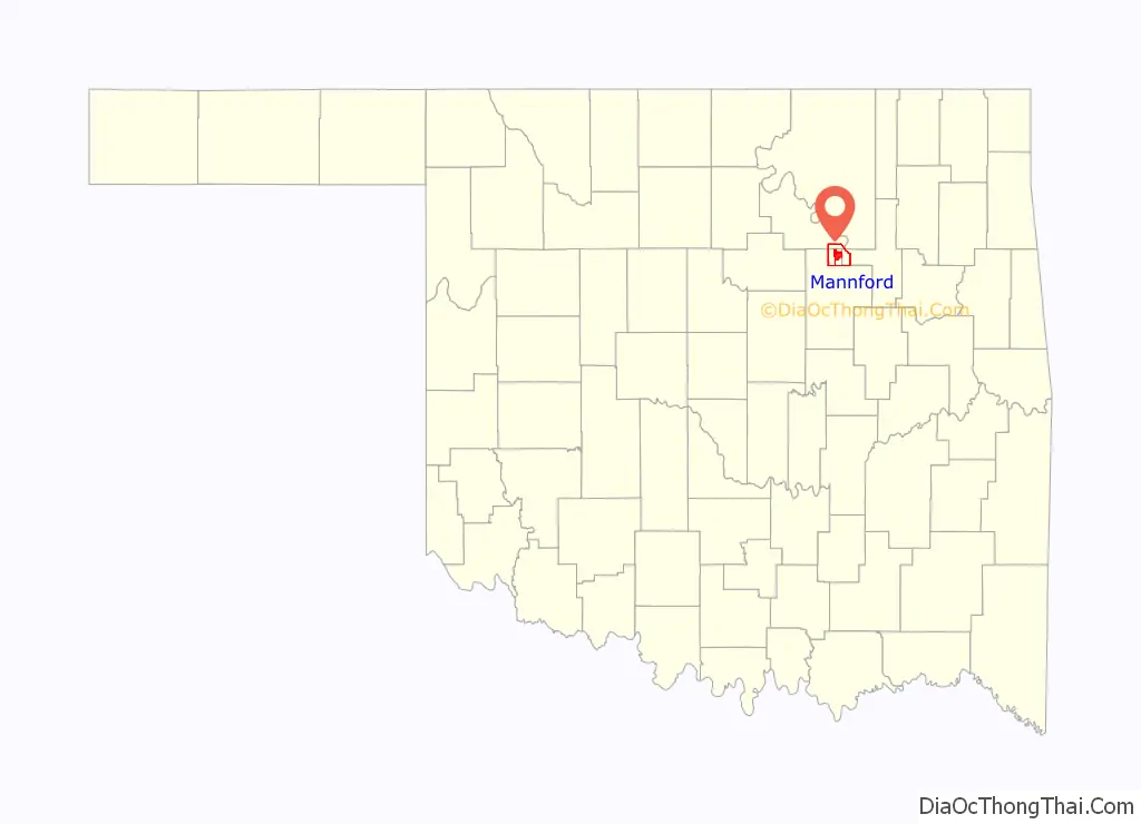
Mannford location map. Where is Mannford town?
History
The town name is derived from “Mann’s Ford”, a crossing of the Cimarron River where Tom and Hazel Mann had received a Creek allotment. The Arkansas Valley and Western Railroad (later the St. Louis and San Francisco Railroad (commonly called “Frisco”) built a line through this area in 1902–03, making it an important cattle shipping point. A post office was established April 11, 1903.
When the Army Corps of Engineers began making plans for flood control that would flood the town of Mannford, citizens formed a plan to relocate several miles southeast of the original site. The move was completed in 1963.
On August 3, 2012, a wildfire started several miles south of Mannford. Carried by strong south winds and extremely dry vegetation, the fire pushed up into the Mannford area and caused evacuations of the town. The fire burned over 78 square miles (200 km), edging into the town and destroying dozens of buildings.
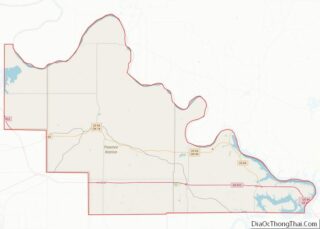
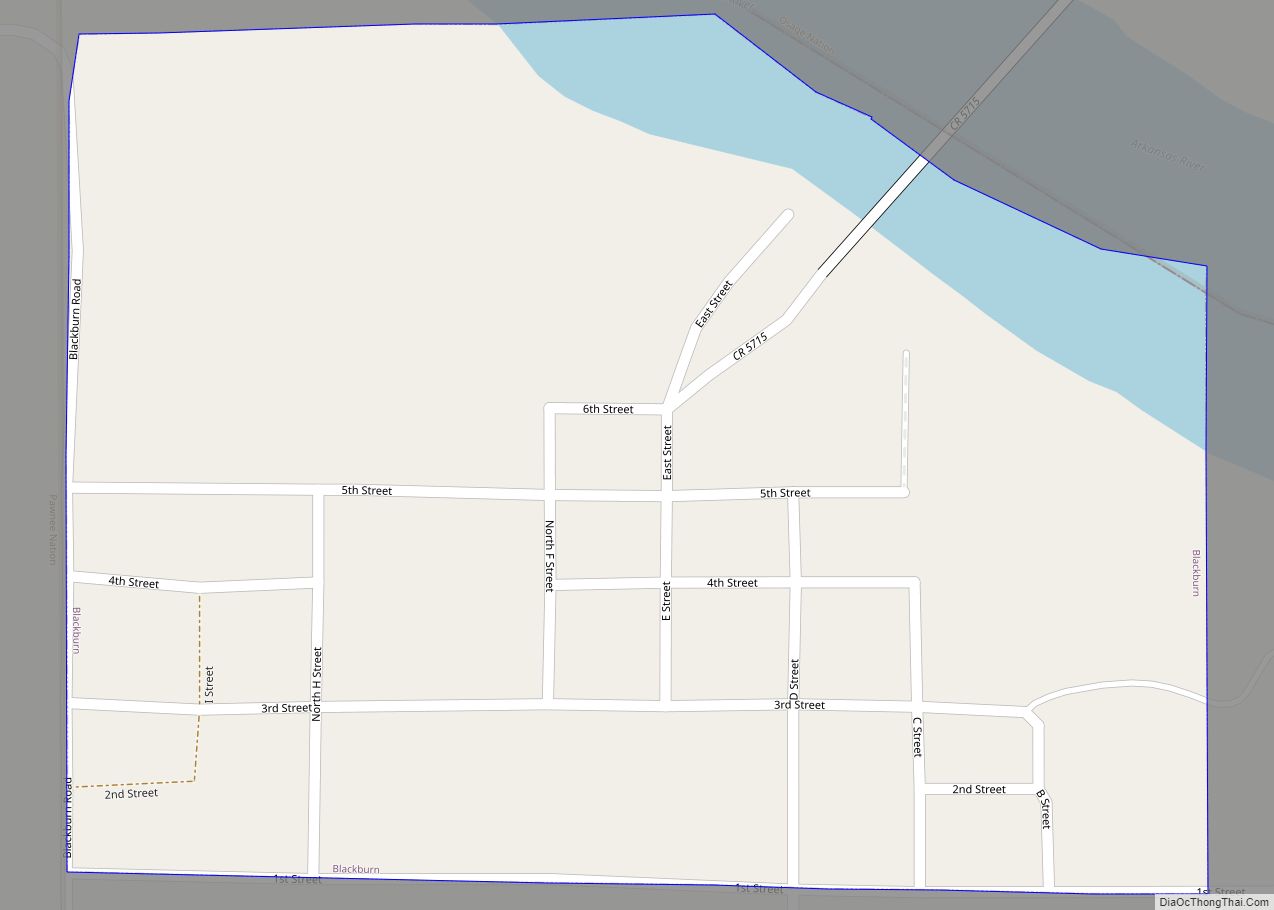
Mannford Road Map
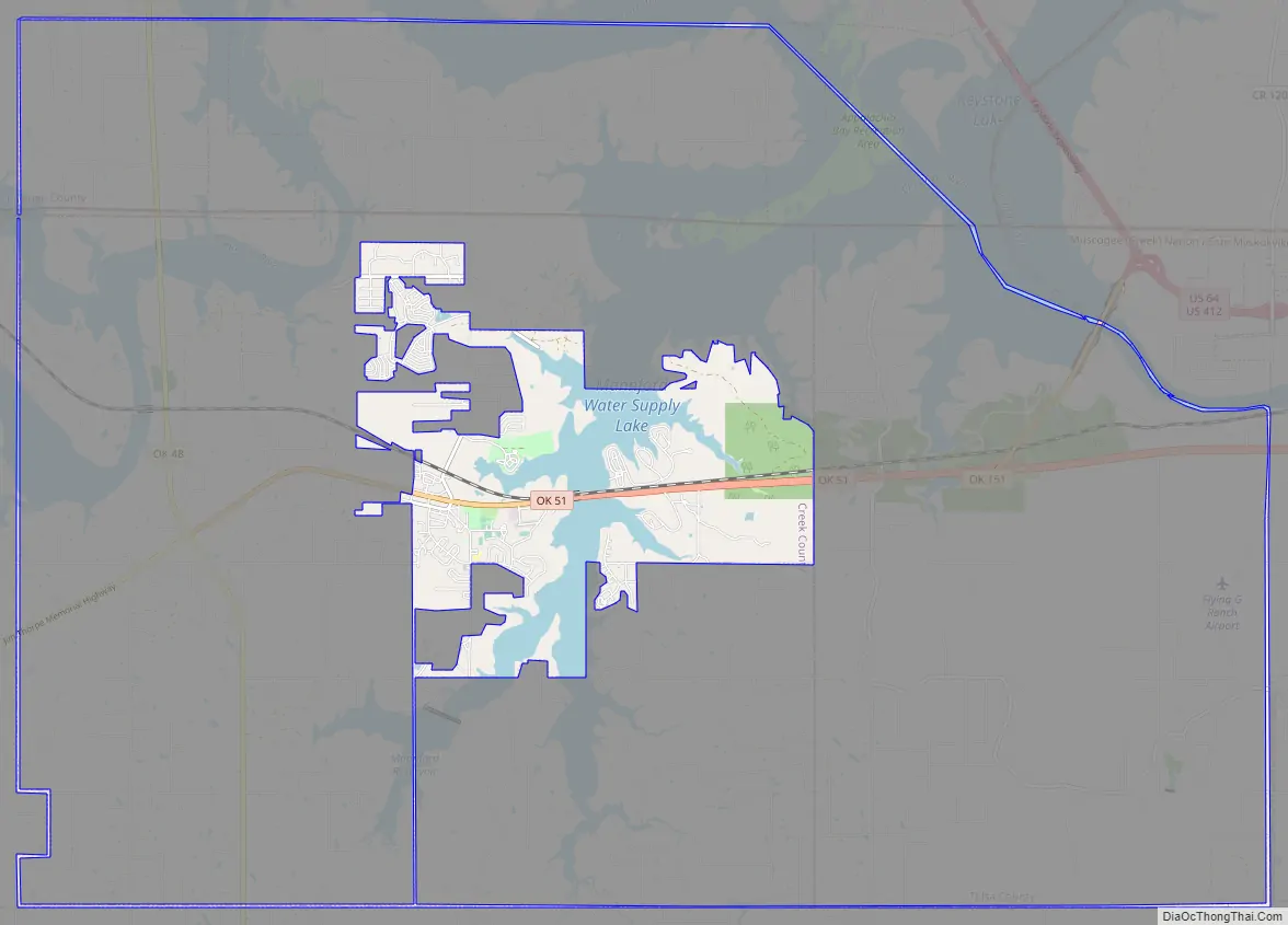
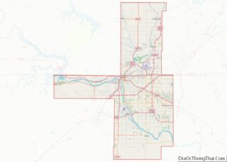
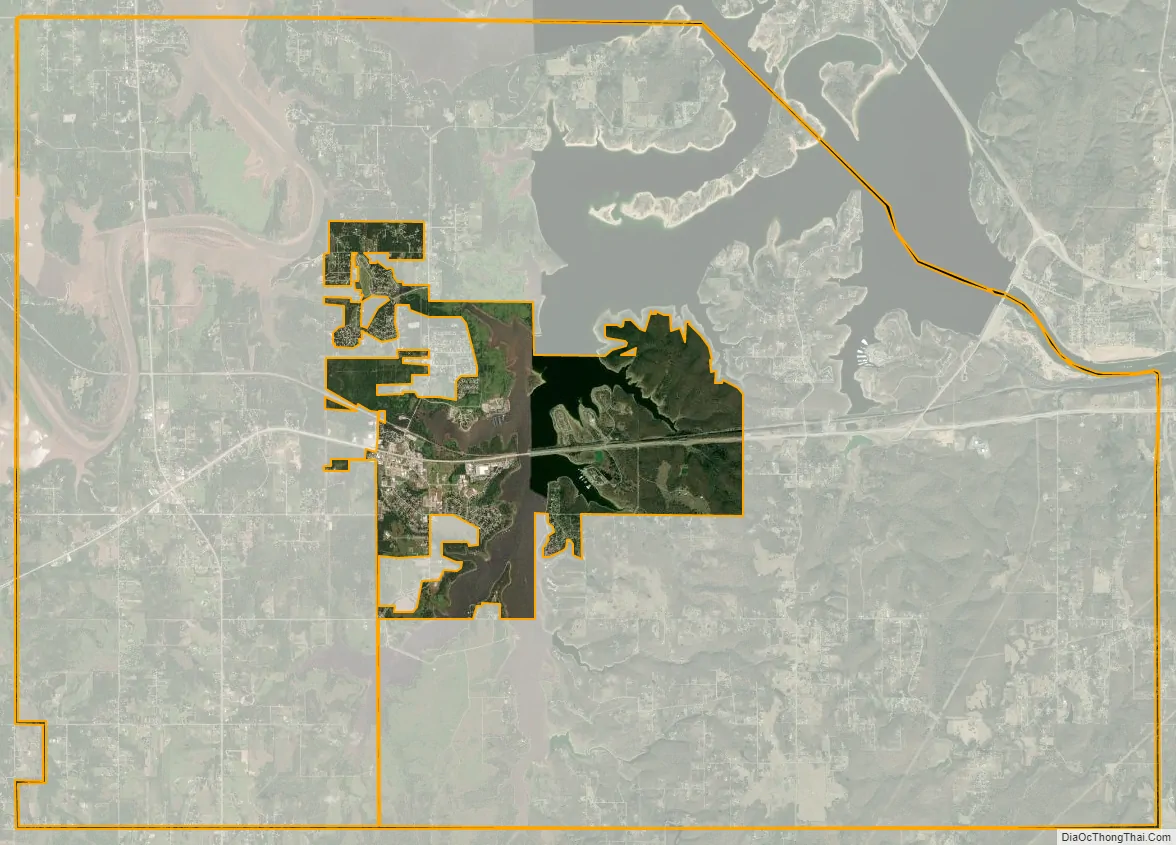
Mannford city Satellite Map
Geography
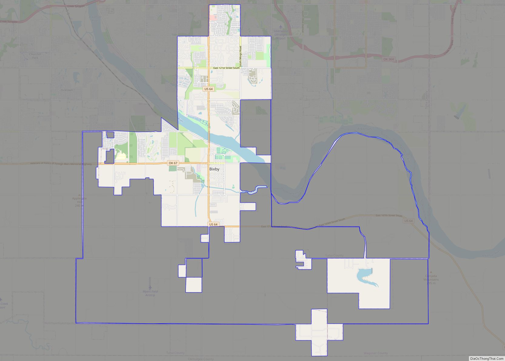
Mannford is 22 miles (35 km) west of Tulsa on State Highway 51. It is situated on both sides of a southwest arm of Keystone Lake, a reservoir on the Arkansas and Cimarron rivers. Most of the developed part of the town is on the west side of the lake arm, which fills the valley of Salt Creek.
According to the United States Census Bureau, the town has a total area of 8.9 square miles (23.0 km), of which 6.9 square miles (17.8 km) is land and 2.0 square miles (5.2 km), or 22.53%, is water.
See also
Map of Oklahoma State and its subdivision:- Adair
- Alfalfa
- Atoka
- Beaver
- Beckham
- Blaine
- Bryan
- Caddo
- Canadian
- Carter
- Cherokee
- Choctaw
- Cimarron
- Cleveland
- Coal
- Comanche
- Cotton
- Craig
- Creek
- Custer
- Delaware
- Dewey
- Ellis
- Garfield
- Garvin
- Grady
- Grant
- Greer
- Harmon
- Harper
- Haskell
- Hughes
- Jackson
- Jefferson
- Johnston
- Kay
- Kingfisher
- Kiowa
- Latimer
- Le Flore
- Lincoln
- Logan
- Love
- Major
- Marshall
- Mayes
- McClain
- McCurtain
- McIntosh
- Murray
- Muskogee
- Noble
- Nowata
- Okfuskee
- Oklahoma
- Okmulgee
- Osage
- Ottawa
- Pawnee
- Payne
- Pittsburg
- Pontotoc
- Pottawatomie
- Pushmataha
- Roger Mills
- Rogers
- Seminole
- Sequoyah
- Stephens
- Texas
- Tillman
- Tulsa
- Wagoner
- Washington
- Washita
- Woods
- Woodward
- Alabama
- Alaska
- Arizona
- Arkansas
- California
- Colorado
- Connecticut
- Delaware
- District of Columbia
- Florida
- Georgia
- Hawaii
- Idaho
- Illinois
- Indiana
- Iowa
- Kansas
- Kentucky
- Louisiana
- Maine
- Maryland
- Massachusetts
- Michigan
- Minnesota
- Mississippi
- Missouri
- Montana
- Nebraska
- Nevada
- New Hampshire
- New Jersey
- New Mexico
- New York
- North Carolina
- North Dakota
- Ohio
- Oklahoma
- Oregon
- Pennsylvania
- Rhode Island
- South Carolina
- South Dakota
- Tennessee
- Texas
- Utah
- Vermont
- Virginia
- Washington
- West Virginia
- Wisconsin
- Wyoming