Miami (/maɪˈæmə/ my-AM-ə) is a city in and county seat of Ottawa County, Oklahoma, United States, founded in 1891. Lead and zinc mining were established by 1918, causing the area’s economy to boom.
This area was part of Indian Territory. Miami is the capital of the federally recognized Miami Tribe of Oklahoma, after which it is named; the Modoc Tribe of Oklahoma, the Ottawa Tribe of Oklahoma, the Peoria Tribe of Indians, and the Shawnee Tribe. As of the 2020 census, the population was 12,969.
| Name: | Miami city |
|---|---|
| LSAD Code: | 25 |
| LSAD Description: | city (suffix) |
| State: | Oklahoma |
| County: | Ottawa County |
| Elevation: | 797 ft (243 m) |
| Total Area: | 11.18 sq mi (28.96 km²) |
| Land Area: | 11.10 sq mi (28.74 km²) |
| Water Area: | 0.09 sq mi (0.22 km²) |
| Total Population: | 12,969 |
| Population Density: | 1,168.80/sq mi (451.27/km²) |
| ZIP code: | 74354-74355 |
| Area code: | 539/918 |
| FIPS code: | 4048000 |
| GNISfeature ID: | 1095343 |
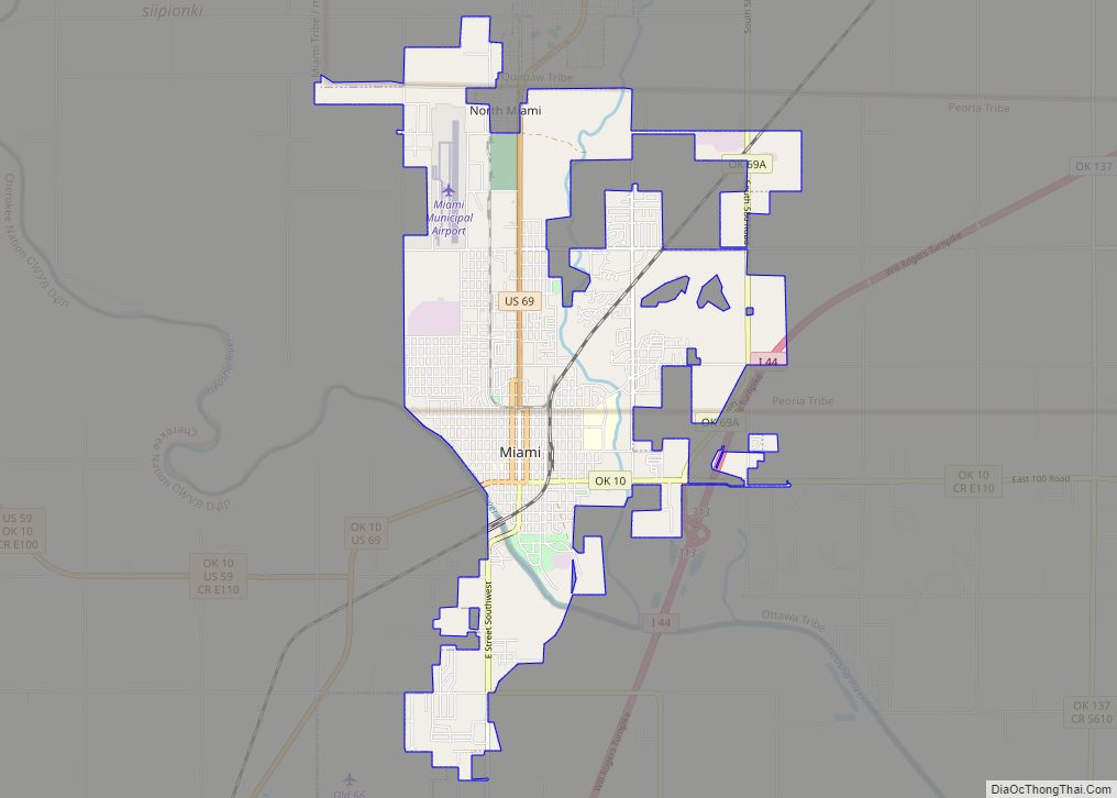
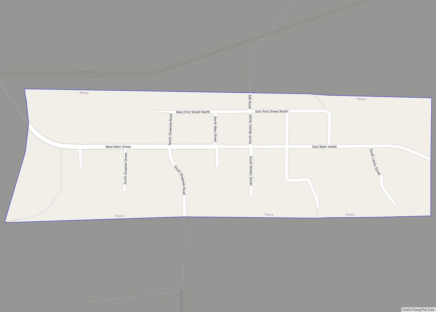
Online Interactive Map
Click on ![]() to view map in "full screen" mode.
to view map in "full screen" mode.
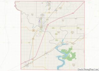
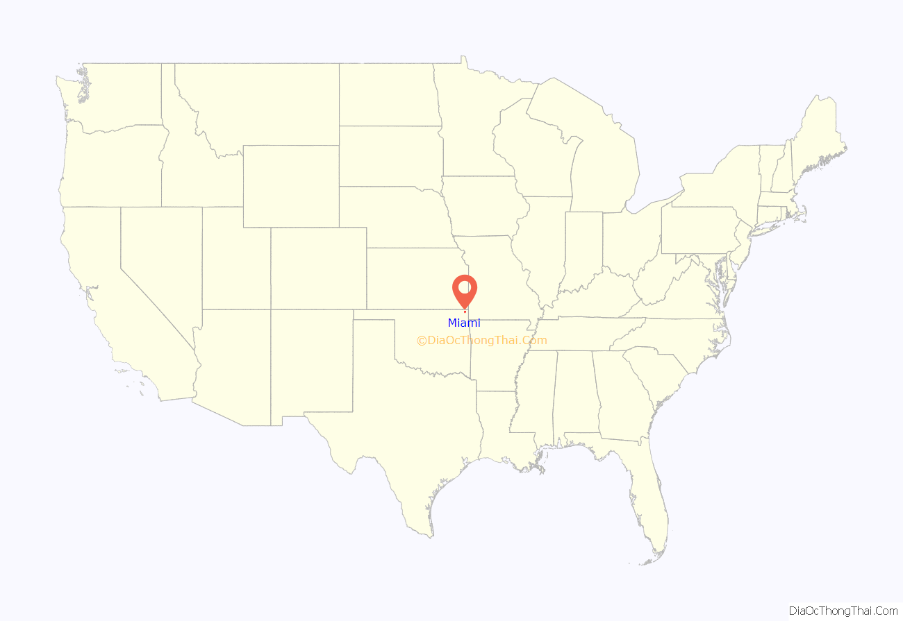
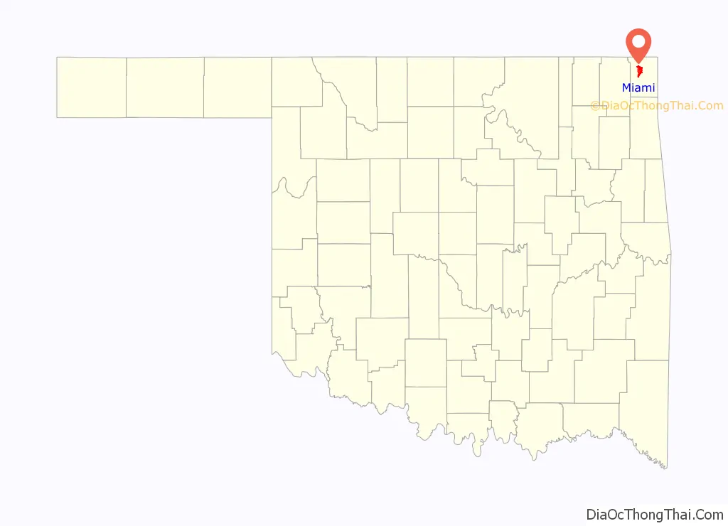
Miami location map. Where is Miami city?
History
The city was founded in an unusual way, compared to other towns established in Indian Territory. Per the Encyclopedia of Oklahoma History and Culture “… it was settled in a business-like way by men of vision who looked into the future and saw possibilities. It didn’t just grow. It was carefully planned.”
W. C. Lykins petitioned the U.S. Congress to pass legislation on March 3, 1891, to establish the town. He met with Thomas F. Richardville, chief of the Miami Tribe of Oklahoma, who agreed to meet in turn with the U.S. Indian Commission and the Ottawa Tribe.
That meeting resulted in Congress authorizing the secretary of the United States Department of the Interior to approve the townsite purchase from the Ottawa. Lykins, Richardville and Manford Pooler, chief of the Ottawa, are identified in historical accounts as “fathers of Miami.” Lykins’ company, the Miami Town Company, bought 588 acres (238 ha) of land from the Ottawa for ten dollars an acre. On June 25–26, 1891 they held an auction of lots. In 1895, Miami incorporated and had more than 800 residents.
The discovery of rich deposits of lead and zinc under Quapaw land a few miles north caused Miami to boom. In 1907, at the time of statehood, its population was 1,893. As mining increased and more mills were built, the population more than tripled to 6,802 by 1920.
Miami was on the route of the Jefferson Highway established in 1915, with that international road running more than 2,300 miles (3,700 km) from Winnipeg, Manitoba in Canada across the border and to New Orleans, Louisiana. US Route 66 in Oklahoma also passed through Miami. An historic section of the Route 66 roadbed is marked in Miami.
It is the capital of the Miami Tribe of Oklahoma, after which it is named; the Modoc Tribe of Oklahoma, Ottawa Tribe of Oklahoma, Peoria Tribe of Indians, and Shawnee Tribe.
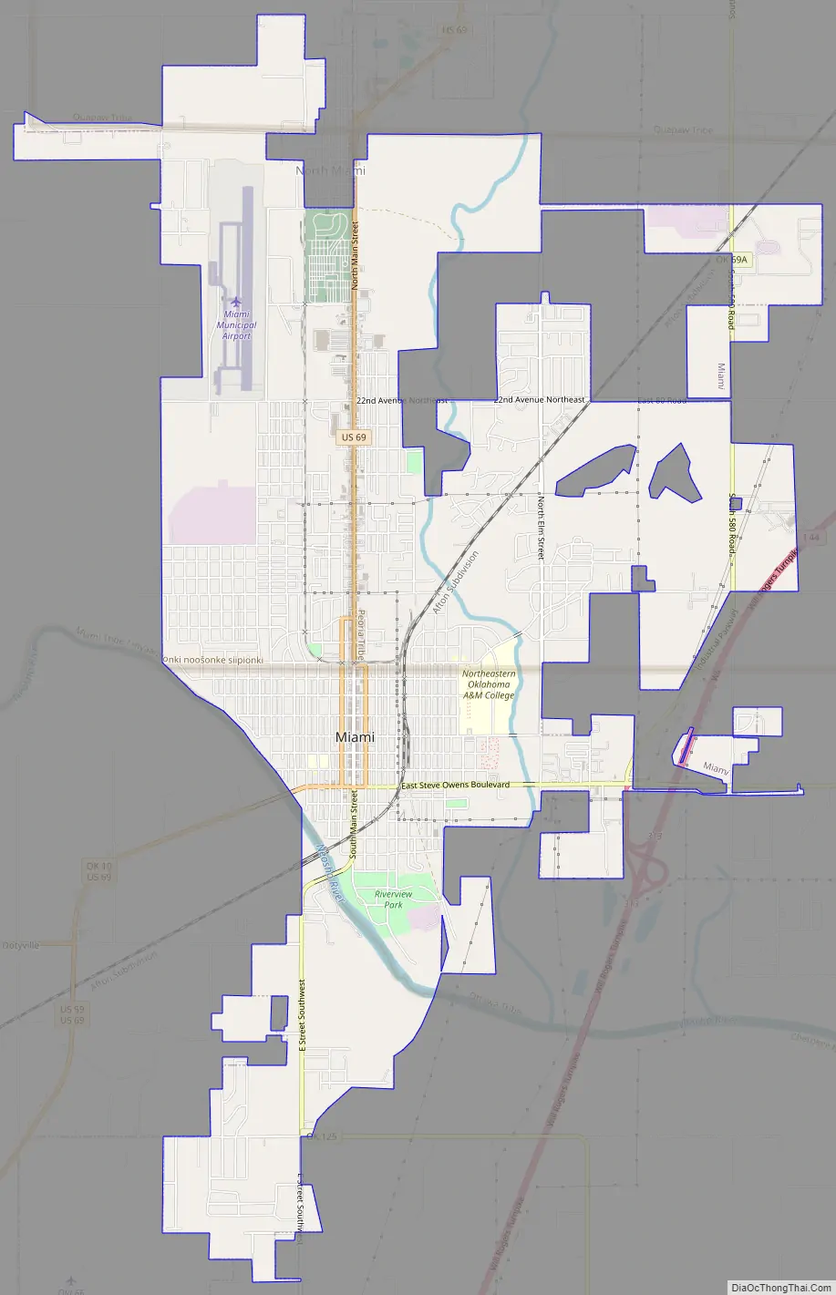
Miami Road Map
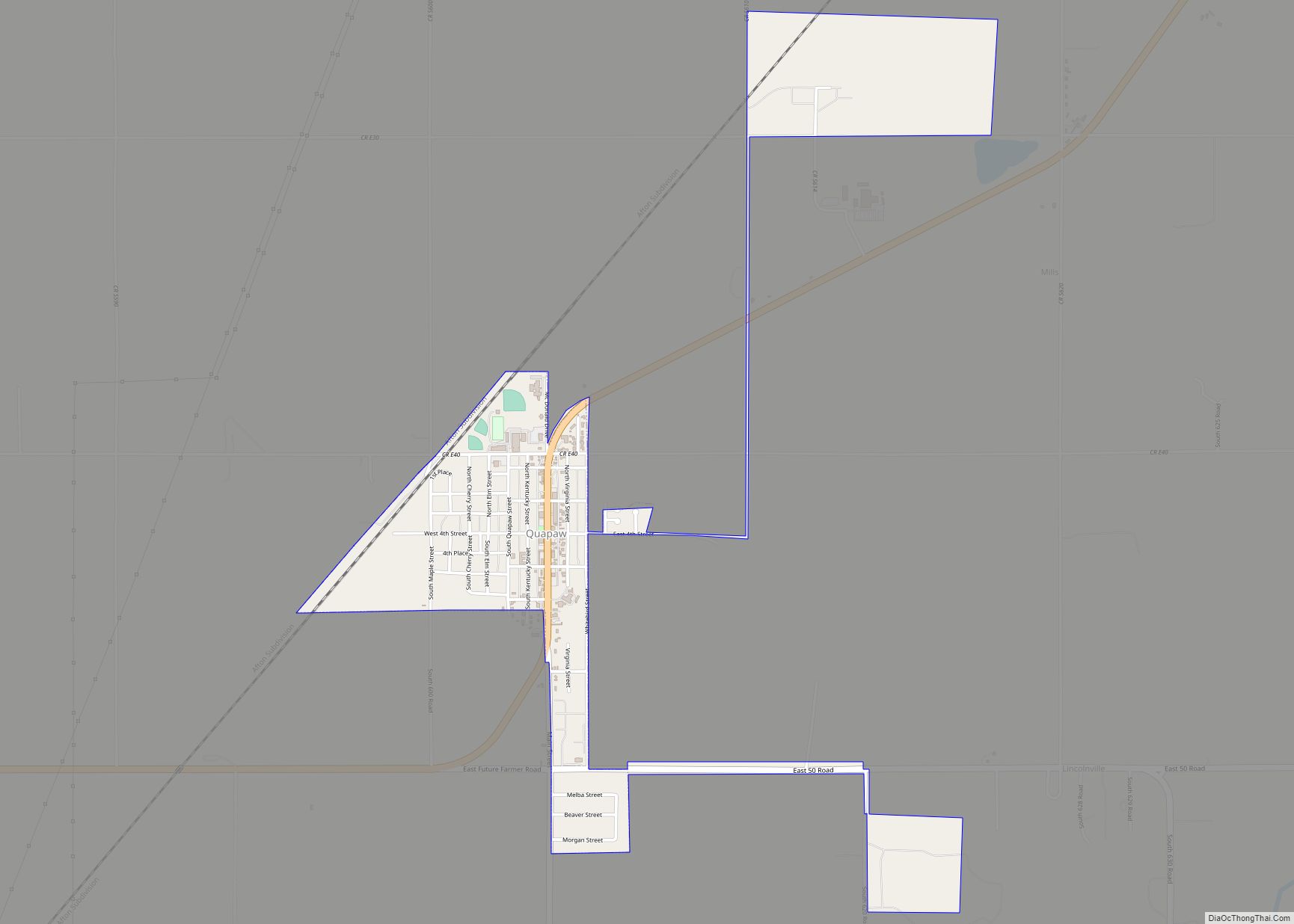
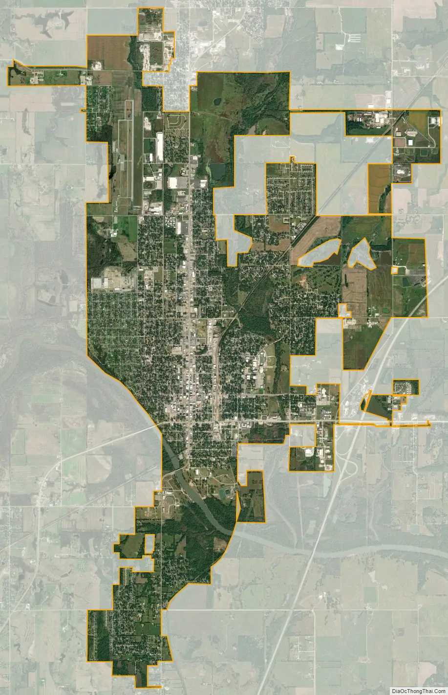
Miami city Satellite Map
Geography
Miami is located near 36°53′1″N 94°52′34″W / 36.88361°N 94.87611°W / 36.88361; -94.87611 (36.883539, −94.876018). According to the United States Census Bureau, the city has a total area of 9.8 square miles (25 km), of which 0.1 square miles (0.26 km) (0.82%) is covered by water.
Flooding
Miami is located on the Neosho River, and was severely affected by the Great Flood of 1951. The town has flooded more than two dozen times since the 1990s, most recently during the 2019 Arkansas River floods. Town residents and neighboring Native American groups have objected to maintaining high water levels on the river at Pensacola Dam and its popular vacation area, Grand Lake, on the grounds that when water backs up downstream, it can increase Miami’s flooding problems.
See also
Map of Oklahoma State and its subdivision:- Adair
- Alfalfa
- Atoka
- Beaver
- Beckham
- Blaine
- Bryan
- Caddo
- Canadian
- Carter
- Cherokee
- Choctaw
- Cimarron
- Cleveland
- Coal
- Comanche
- Cotton
- Craig
- Creek
- Custer
- Delaware
- Dewey
- Ellis
- Garfield
- Garvin
- Grady
- Grant
- Greer
- Harmon
- Harper
- Haskell
- Hughes
- Jackson
- Jefferson
- Johnston
- Kay
- Kingfisher
- Kiowa
- Latimer
- Le Flore
- Lincoln
- Logan
- Love
- Major
- Marshall
- Mayes
- McClain
- McCurtain
- McIntosh
- Murray
- Muskogee
- Noble
- Nowata
- Okfuskee
- Oklahoma
- Okmulgee
- Osage
- Ottawa
- Pawnee
- Payne
- Pittsburg
- Pontotoc
- Pottawatomie
- Pushmataha
- Roger Mills
- Rogers
- Seminole
- Sequoyah
- Stephens
- Texas
- Tillman
- Tulsa
- Wagoner
- Washington
- Washita
- Woods
- Woodward
- Alabama
- Alaska
- Arizona
- Arkansas
- California
- Colorado
- Connecticut
- Delaware
- District of Columbia
- Florida
- Georgia
- Hawaii
- Idaho
- Illinois
- Indiana
- Iowa
- Kansas
- Kentucky
- Louisiana
- Maine
- Maryland
- Massachusetts
- Michigan
- Minnesota
- Mississippi
- Missouri
- Montana
- Nebraska
- Nevada
- New Hampshire
- New Jersey
- New Mexico
- New York
- North Carolina
- North Dakota
- Ohio
- Oklahoma
- Oregon
- Pennsylvania
- Rhode Island
- South Carolina
- South Dakota
- Tennessee
- Texas
- Utah
- Vermont
- Virginia
- Washington
- West Virginia
- Wisconsin
- Wyoming