Afton is a town in northeast Oklahoma in Ottawa County, Oklahoma, United States. The population was 1,049 as of the 2010 census, with population growth stemming from the near abandonment of nearby towns of Cardin and Picher because of ground contamination sites by local mining quarries. The town may have been named for the Scottish River Afton.
| Name: | Afton town |
|---|---|
| LSAD Code: | 43 |
| LSAD Description: | town (suffix) |
| State: | Oklahoma |
| County: | Ottawa County |
| Elevation: | 787 ft (240 m) |
| Total Area: | 2.08 sq mi (5.39 km²) |
| Land Area: | 2.08 sq mi (5.39 km²) |
| Water Area: | 0.00 sq mi (0.00 km²) |
| Total Population: | 734 |
| Population Density: | 352.72/sq mi (136.15/km²) |
| ZIP code: | 74331 |
| FIPS code: | 4000600 |
| GNISfeature ID: | 1089546 |
| Website: | www.travelok.com/Afton |
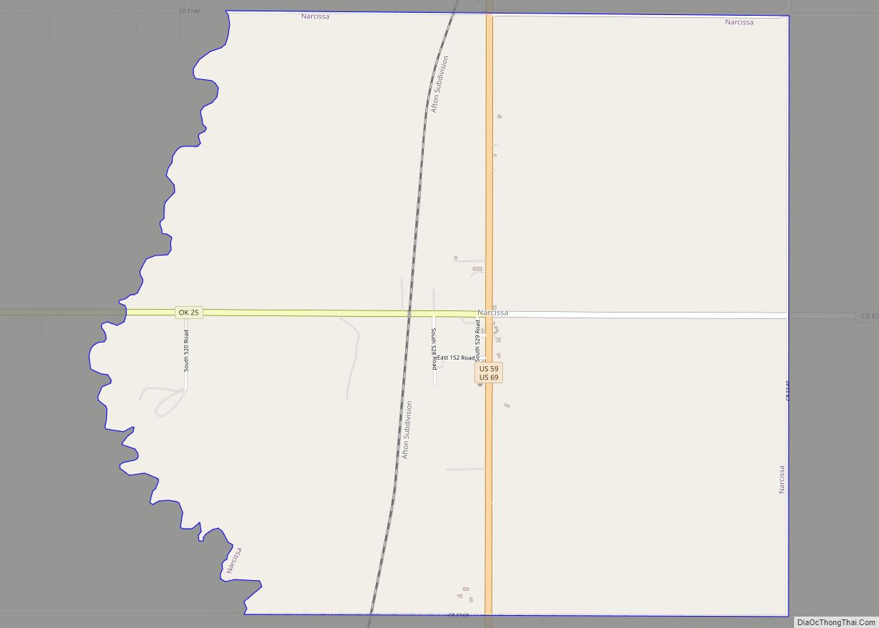
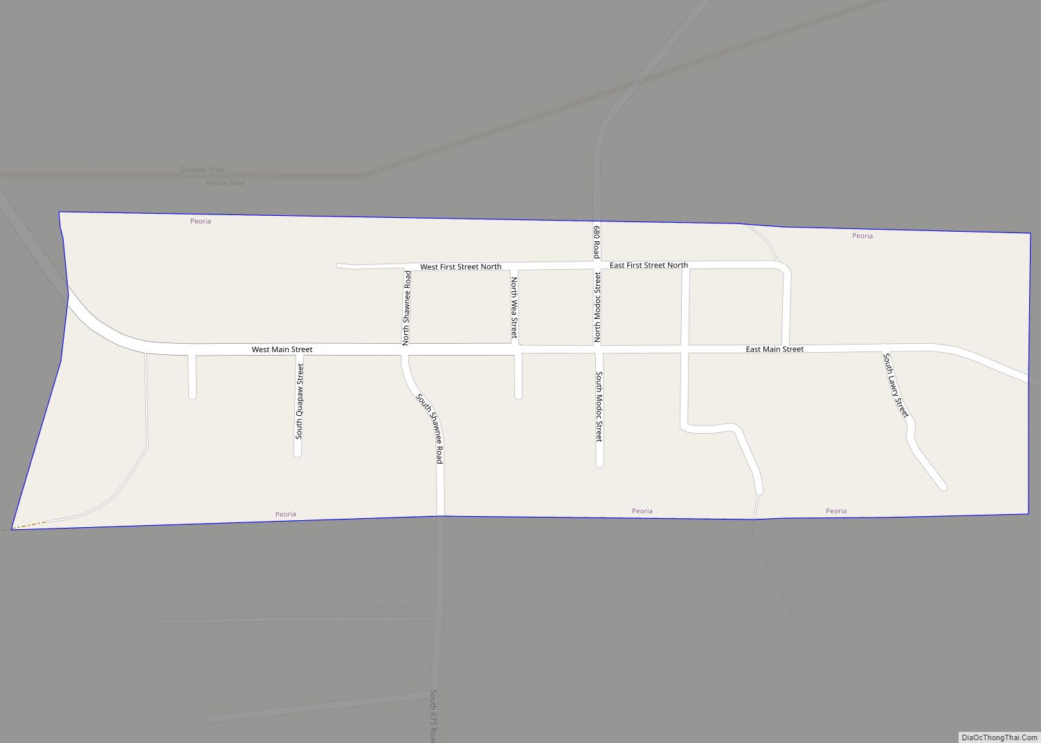
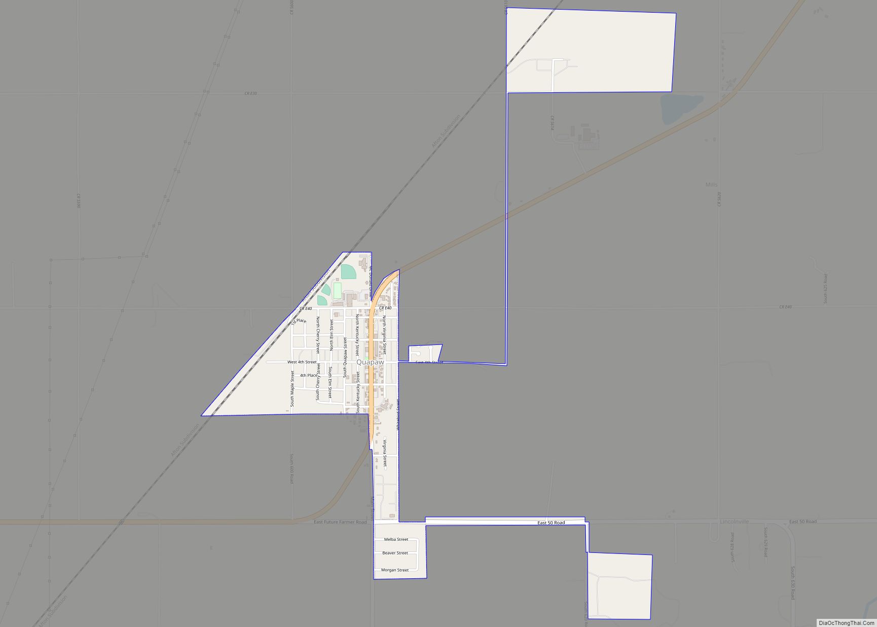
Online Interactive Map
Click on ![]() to view map in "full screen" mode.
to view map in "full screen" mode.
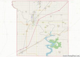
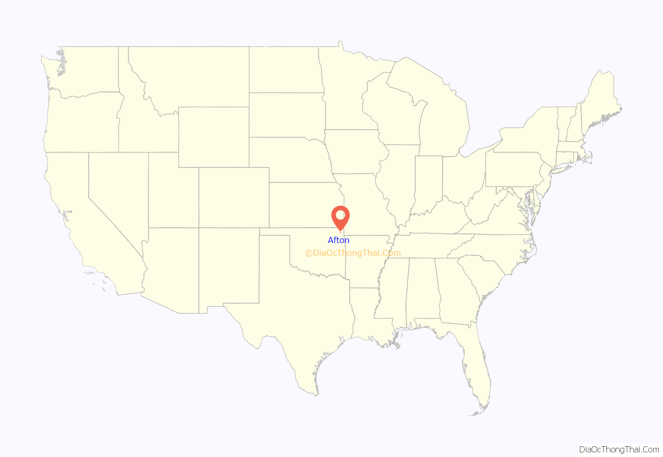
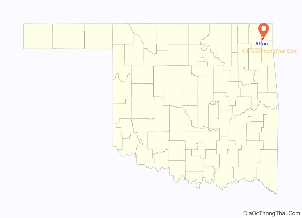
Afton location map. Where is Afton town?
History
Afton developed in this part of the Cherokee Nation in Indian Territory after the Atlantic and Pacific Railroad Company (later the St. Louis and San Francisco Railway, or Frisco) built tracks through the area to Vinita in 1871. According to Oklahoma historian George Shirk, a Scottish railroad surveyor, Anton Aires, named the town Afton after his daughter. Others have claimed the name comes from Robert Burns’s poem, “Flow Gently Sweet Afton.” Both Afton Aires’ name and the Burns’poem honor the River Afton in Scotland.
A post office was established in Afton during 1886. The 1900 census showed a population of 606. In 1901, the Kansas City, Fort Scott and Memphis Railroad, which soon became part of the Frisco system, constructed another line through the town, creating a shorter route to Kansas City, and causing another spurt of population growth. The town became a Frisco division point and shipping center for the surrounding agricultural area.{{efn/Agriculture mainly featured wheat, corn, hay and livestock.}} In 1910, Afton’s population was 1,276; the town had two schools, a waterworks, two hotels, two banks, a brick and tile plant, a creamery, a newspaper, mills and grain elevators. The population peaked at 1,518 in 1920, but a depression after World War I caused a drop to 1,219 in 1930.
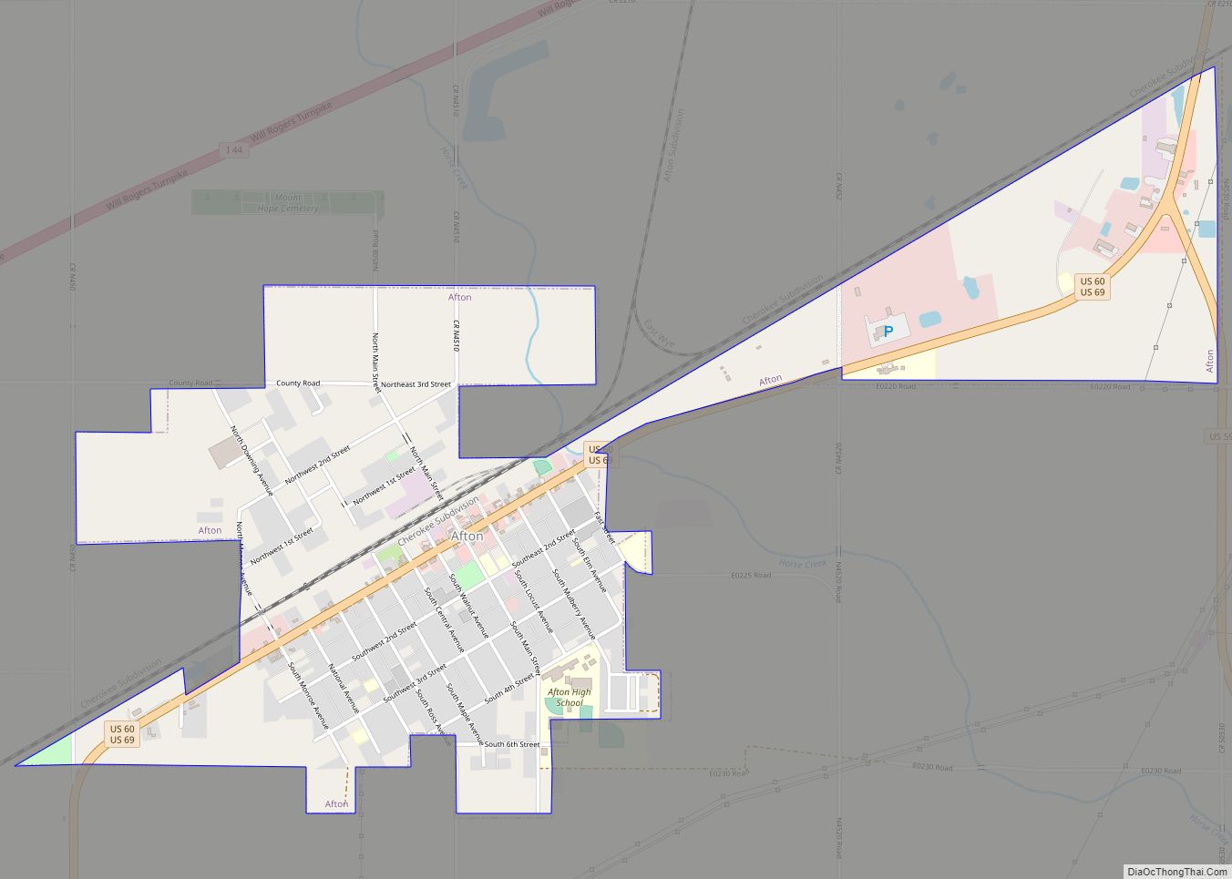
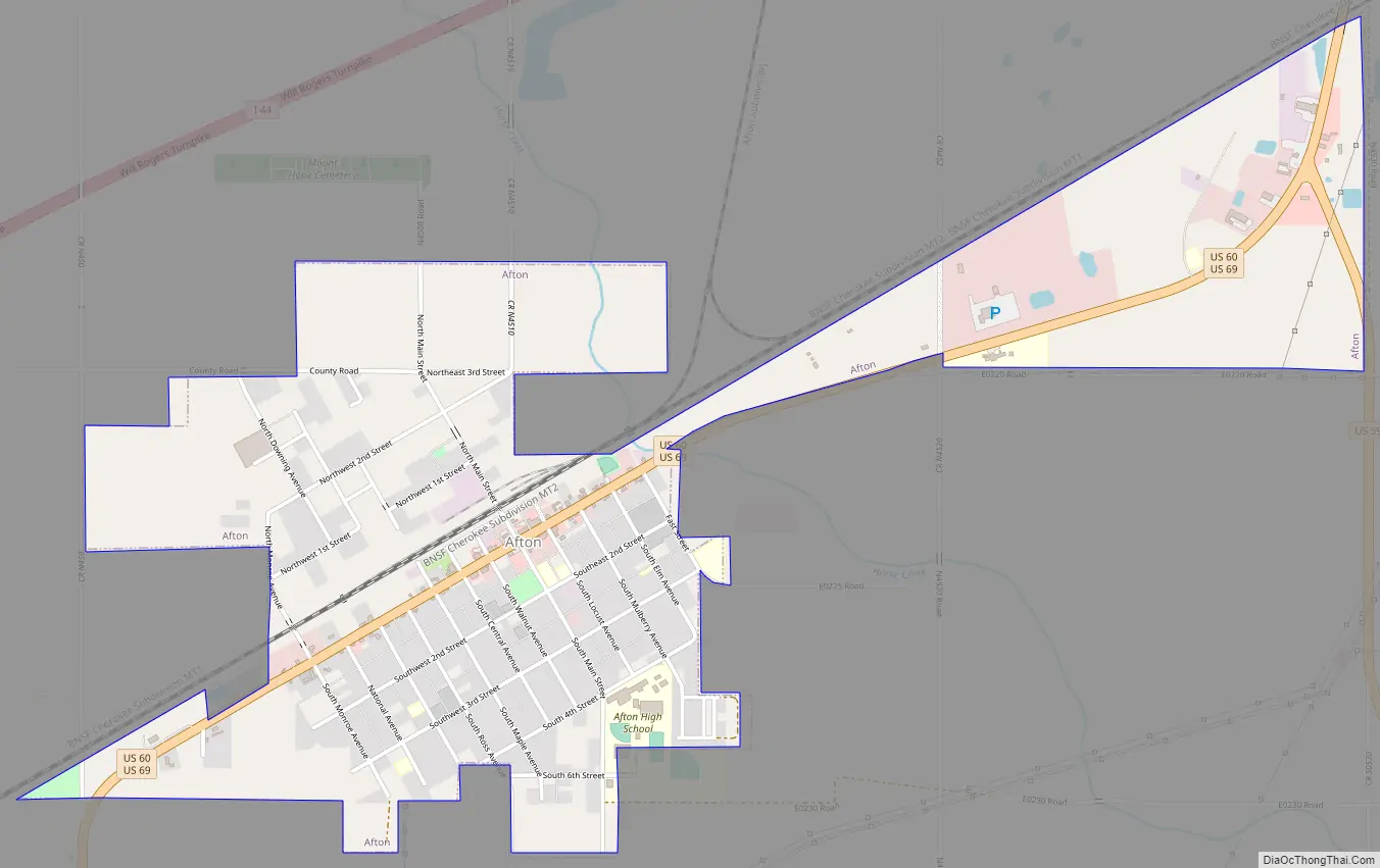
Afton Road Map
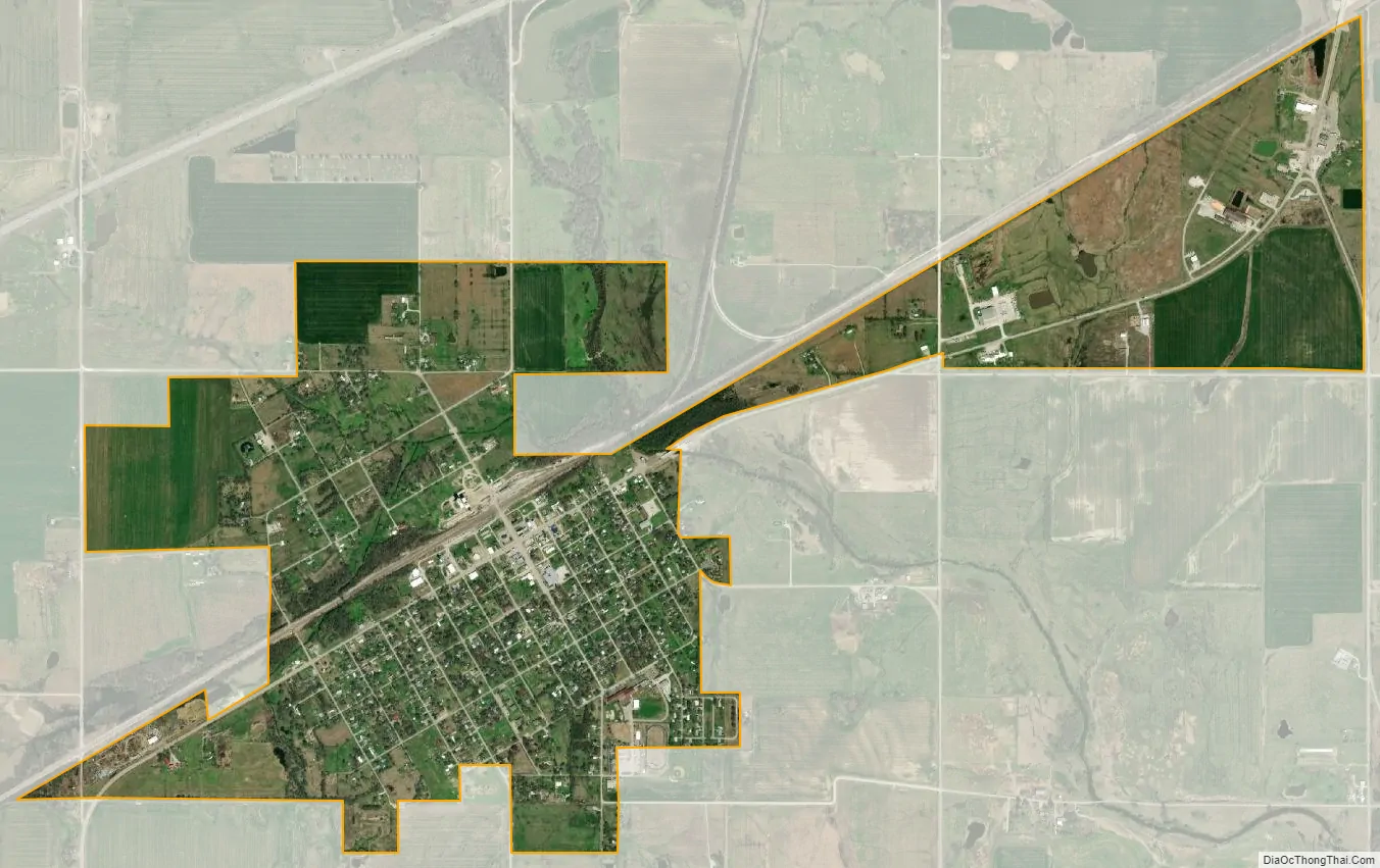
Afton city Satellite Map
Geography
Afton is located at 36°41′31″N 94°57′50″W / 36.69194°N 94.96389°W / 36.69194; -94.96389 (36.691845, -94.964024).
According to the United States Census Bureau, the town has a total area of 1.6 square miles (4.1 km), all land.
Originally a farming and railroad community, Afton is located on the historic Route 66. Route 66 was bypassed by I-44 in 1957. Businesses which formerly served US 66 travellers in the town’s heyday included the Palmer Hotel, Rogers’ Motel, Rest Haven Motel, Green Acres Motel and Avon Motor Court, Baker’s Cafe, Clint’s Cafe, Smith Store and Barrett’s Food Store, Mack’s Place and Fred’s 66 Bar.
There was a museum in a former D-X filling station, built in 1937 and restored in 1999 to house Packard and U.S. Route 66 memorabilia. The museum was closed and the building is now vacant. The Palmer Hotel building burned down in 2019.
See also
Map of Oklahoma State and its subdivision:- Adair
- Alfalfa
- Atoka
- Beaver
- Beckham
- Blaine
- Bryan
- Caddo
- Canadian
- Carter
- Cherokee
- Choctaw
- Cimarron
- Cleveland
- Coal
- Comanche
- Cotton
- Craig
- Creek
- Custer
- Delaware
- Dewey
- Ellis
- Garfield
- Garvin
- Grady
- Grant
- Greer
- Harmon
- Harper
- Haskell
- Hughes
- Jackson
- Jefferson
- Johnston
- Kay
- Kingfisher
- Kiowa
- Latimer
- Le Flore
- Lincoln
- Logan
- Love
- Major
- Marshall
- Mayes
- McClain
- McCurtain
- McIntosh
- Murray
- Muskogee
- Noble
- Nowata
- Okfuskee
- Oklahoma
- Okmulgee
- Osage
- Ottawa
- Pawnee
- Payne
- Pittsburg
- Pontotoc
- Pottawatomie
- Pushmataha
- Roger Mills
- Rogers
- Seminole
- Sequoyah
- Stephens
- Texas
- Tillman
- Tulsa
- Wagoner
- Washington
- Washita
- Woods
- Woodward
- Alabama
- Alaska
- Arizona
- Arkansas
- California
- Colorado
- Connecticut
- Delaware
- District of Columbia
- Florida
- Georgia
- Hawaii
- Idaho
- Illinois
- Indiana
- Iowa
- Kansas
- Kentucky
- Louisiana
- Maine
- Maryland
- Massachusetts
- Michigan
- Minnesota
- Mississippi
- Missouri
- Montana
- Nebraska
- Nevada
- New Hampshire
- New Jersey
- New Mexico
- New York
- North Carolina
- North Dakota
- Ohio
- Oklahoma
- Oregon
- Pennsylvania
- Rhode Island
- South Carolina
- South Dakota
- Tennessee
- Texas
- Utah
- Vermont
- Virginia
- Washington
- West Virginia
- Wisconsin
- Wyoming