Rattan is a town in Pushmataha County, Oklahoma, United States. The population was 276 at the 2020 census.
| Name: | Rattan town |
|---|---|
| LSAD Code: | 43 |
| LSAD Description: | town (suffix) |
| State: | Oklahoma |
| County: | Pushmataha County |
| Elevation: | 466 ft (142 m) |
| Total Area: | 3.99 sq mi (10.34 km²) |
| Land Area: | 3.95 sq mi (10.24 km²) |
| Water Area: | 0.04 sq mi (0.10 km²) |
| Total Population: | 276 |
| Population Density: | 69.80/sq mi (26.95/km²) |
| ZIP code: | 74562 |
| Area code: | 580 |
| FIPS code: | 4061950 |
| GNISfeature ID: | 1097052 |
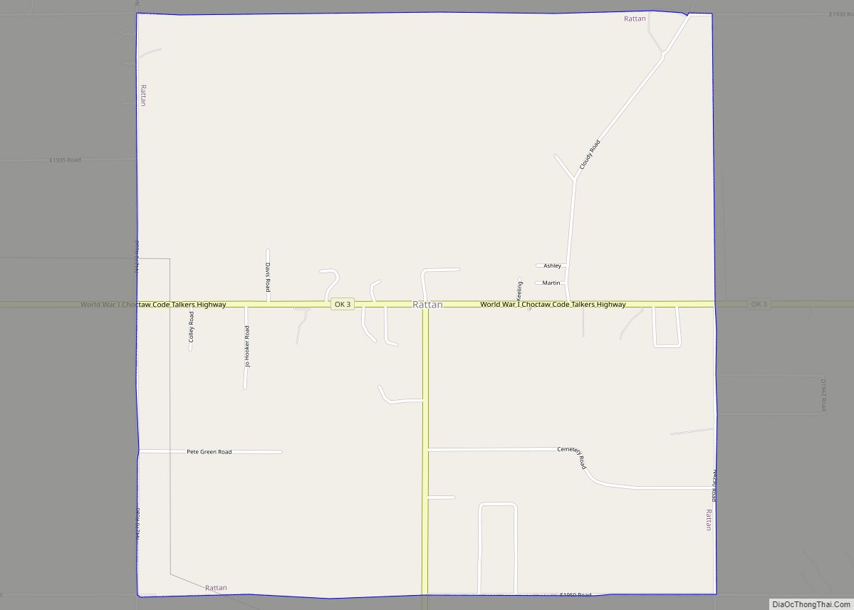
Online Interactive Map
Click on ![]() to view map in "full screen" mode.
to view map in "full screen" mode.
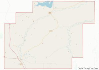
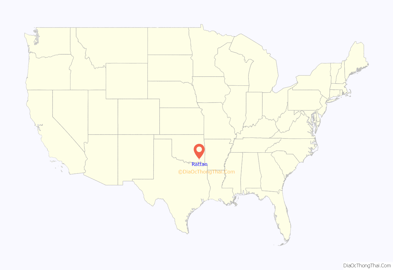
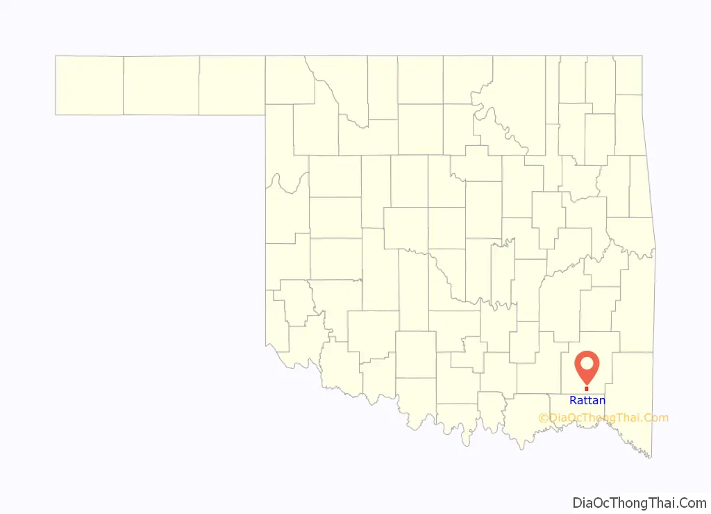
Rattan location map. Where is Rattan town?
History
Established in approximately 1910, Rattan was named for Rattan, Texas, from which a number of its early white settlers came.
Rattan, Texas—located in Delta County, twenty-one miles southwest of Paris, Texas—was named for local postal officer Clarence V. Rattan in 1893. Following Oklahoma’s statehood in 1907 a number of Delta County families relocated to the new Pushmataha County, among them Akins, Akards, and Helms. The Delta County family (or families) apparently establishing itself in Rattan has not been identified.
Originally overshadowed by the nearby white settlement of Belzoni, Oklahoma, Rattan did not become economically successful enough to merit its own United States Post Office until December 12, 1910, with its first postmaster being Moses A. Fleming. Belzoni’s success as a farming hub sapped Rattan of much of its potential vitality, and it was not until the former’s decline that Rattan emerged as the population center of southeastern area of the county.
Prior to establishment of its post office with the name “Rattan”, the area was called Sulphur Springs, Indian Territory. Sulphur Springs, located 3/4 mile south-southeast of the highway intersection of OK 3 and OK 93 in present-day Rattan, was county seat of Cedar County, Choctaw Nation. It was established by the Choctaws’ Doaksville Constitution of 1860 and, in the manner of most Choctaw county seats, served a part-time role as legal and political center. It was never a sizeable permanent settlement and boasted almost no mercantile or retail stores.
County court met on the first Monday of each month and was called Probate Court, even though it was more similar to modern-day county court proceedings than a modern probate court. The court met in a large log house, constructed of long, straight logs, serving as both an Indian Methodist church and court house. The Cedar County Court House was torn down by white settlers sometime after Oklahoma’s statehood in 1907, after which it ceased serving any legal use. The Court House was located about 200 yards north of the Sulphur Springs and 1/4 mile due west of Rattan Cemetery.
Sulphur Springs took its name from several sulphur springs located in the vicinity. A number of Choctaw families living around the Cedar County Court House used them as well as visitors to court.
The improved Ft. Smith to Ft. Towson military road of 1839 passed along the east side of Rattan (at the water tower and Howard’s Cafe, 1.02 miles east of the OK 93 junction with OK 3) after crossing the “Seven Devils” on its way southeast to Spencer Academy and Doaksville. This wagon road was heavily used by the U.S. Army from 1839–48, and remained the main road through Cedar County until the Frisco railroad was completed in 1887 from Ft. Smith through Antlers to Paris, Texas. The initial U.S. land survey of the area was conducted in 1896. T4S, R18E shows Rock Creek, the Court House and the military road.
Natural resources were key to Rattan’s early growth. Many of its settlers were farmers. Timber, logged in the Kiamichi Mountains north of the community, also fueled growth. A number of logging trams, or railroad lines, were built into the mountains and large camps of loggers and their dependents lived along the tracks for months on end. These mobile, rolling communities were sizeable enough to feature small schools, physicians offices, and general stores. Most of their residents lived in railroad cars which traveled along with the work crews as they logged deeper into the mountains.
Rattan became the Great Depression-era recipient of a handsome public school built by the Works Progress Administration. Constructed of native stone brought from nearby fields, it continues in use today.
During the 1990s Rattan incorporated as a town, and now offers basic public services.
School students from Rattan made news headlines during 2000 as they initiated a series of events with international repercussions. During World War II the Moyers area was the site of two lethal air crashes. British pilots operating from a Royal Air Force base in Texas crashed into White Rock Mountain and Big Mountain, killing four crew men. Two planes were destroyed. A third plane crash-landed successfully a few miles northwest at Jumbo.
These events had receded from memory and were generally forgotten until a history class in the Rattan Public School began pursuing information about them. Their research led them to commemorate the events. On February 20, 2000 the AT6 Monument was dedicated in the fliers’ honor at the crash site on Big Mountain. Over 1,000 people attended the ceremony, and the story of it and Rattan’s intrepid young scholars was carried by the British Broadcasting Corporation and many newspapers around the world.
At this writing Rattan features a café, two or three stores, and several churches. Many residents shop in Antlers, Oklahoma and Hugo, Oklahoma—particularly in the large Wal-Mart store located in the latter town.
More information on Rattan, Sulphur Springs, the AT6 Monument, and the Kiamichi River valley may be found in the Pushmataha County Historical Society.
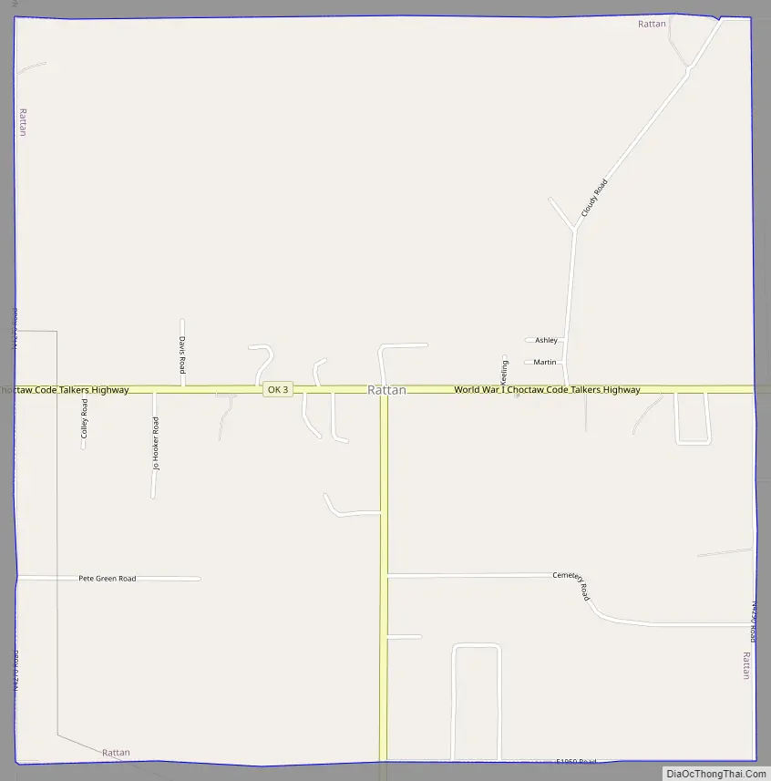
Rattan Road Map
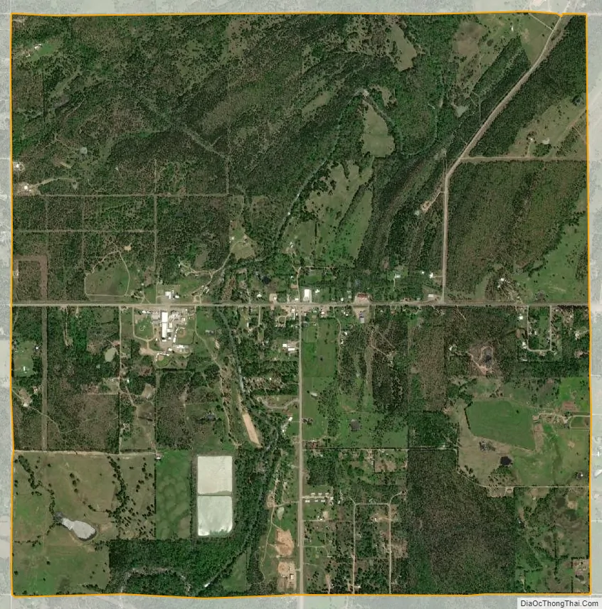
Rattan city Satellite Map
Geography
Rattan is located in southern Pushmataha County at the intersection of Oklahoma routes 3 and 93. Rock Creek flows past just west of the community center and Hugo Lake lies to the south in adjacent Choctaw County. The southwest end of the Ouachita Mountains lies to the north.
According to the United States Census Bureau, the town has a total area of 4.0 square miles (10 km), all land.
See also
Map of Oklahoma State and its subdivision:- Adair
- Alfalfa
- Atoka
- Beaver
- Beckham
- Blaine
- Bryan
- Caddo
- Canadian
- Carter
- Cherokee
- Choctaw
- Cimarron
- Cleveland
- Coal
- Comanche
- Cotton
- Craig
- Creek
- Custer
- Delaware
- Dewey
- Ellis
- Garfield
- Garvin
- Grady
- Grant
- Greer
- Harmon
- Harper
- Haskell
- Hughes
- Jackson
- Jefferson
- Johnston
- Kay
- Kingfisher
- Kiowa
- Latimer
- Le Flore
- Lincoln
- Logan
- Love
- Major
- Marshall
- Mayes
- McClain
- McCurtain
- McIntosh
- Murray
- Muskogee
- Noble
- Nowata
- Okfuskee
- Oklahoma
- Okmulgee
- Osage
- Ottawa
- Pawnee
- Payne
- Pittsburg
- Pontotoc
- Pottawatomie
- Pushmataha
- Roger Mills
- Rogers
- Seminole
- Sequoyah
- Stephens
- Texas
- Tillman
- Tulsa
- Wagoner
- Washington
- Washita
- Woods
- Woodward
- Alabama
- Alaska
- Arizona
- Arkansas
- California
- Colorado
- Connecticut
- Delaware
- District of Columbia
- Florida
- Georgia
- Hawaii
- Idaho
- Illinois
- Indiana
- Iowa
- Kansas
- Kentucky
- Louisiana
- Maine
- Maryland
- Massachusetts
- Michigan
- Minnesota
- Mississippi
- Missouri
- Montana
- Nebraska
- Nevada
- New Hampshire
- New Jersey
- New Mexico
- New York
- North Carolina
- North Dakota
- Ohio
- Oklahoma
- Oregon
- Pennsylvania
- Rhode Island
- South Carolina
- South Dakota
- Tennessee
- Texas
- Utah
- Vermont
- Virginia
- Washington
- West Virginia
- Wisconsin
- Wyoming