Rock Island is a town in Le Flore County, Oklahoma, United States. It is part of the Fort Smith, Arkansas-Oklahoma Metropolitan Statistical Area. The population was 646 at the 2010 census, a decline of 8.9 percent from the figure of 709 recorded in 2000.
| Name: | Rock Island town |
|---|---|
| LSAD Code: | 43 |
| LSAD Description: | town (suffix) |
| State: | Oklahoma |
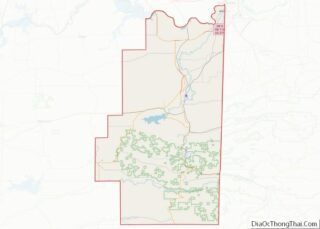
| County: | Le Flore County |
| Elevation: | 499 ft (152 m) |
| Total Area: | 12.23 sq mi (31.68 km²) |
| Land Area: | 12.17 sq mi (31.53 km²) |
| Water Area: | 0.06 sq mi (0.16 km²) |
| Total Population: | 717 |
| Population Density: | 58.90/sq mi (22.74/km²) |
| FIPS code: | 4063600 |
| GNISfeature ID: | 1097351 |
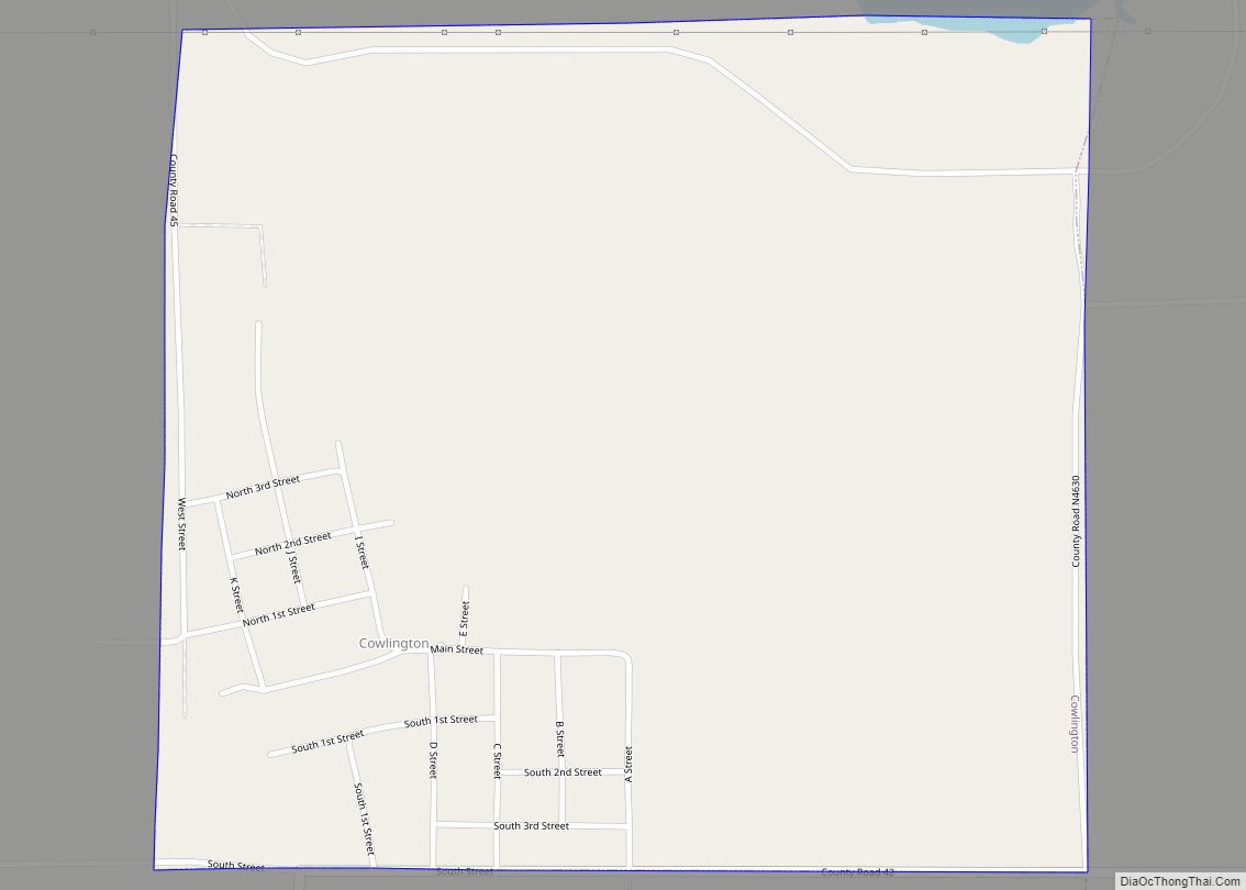
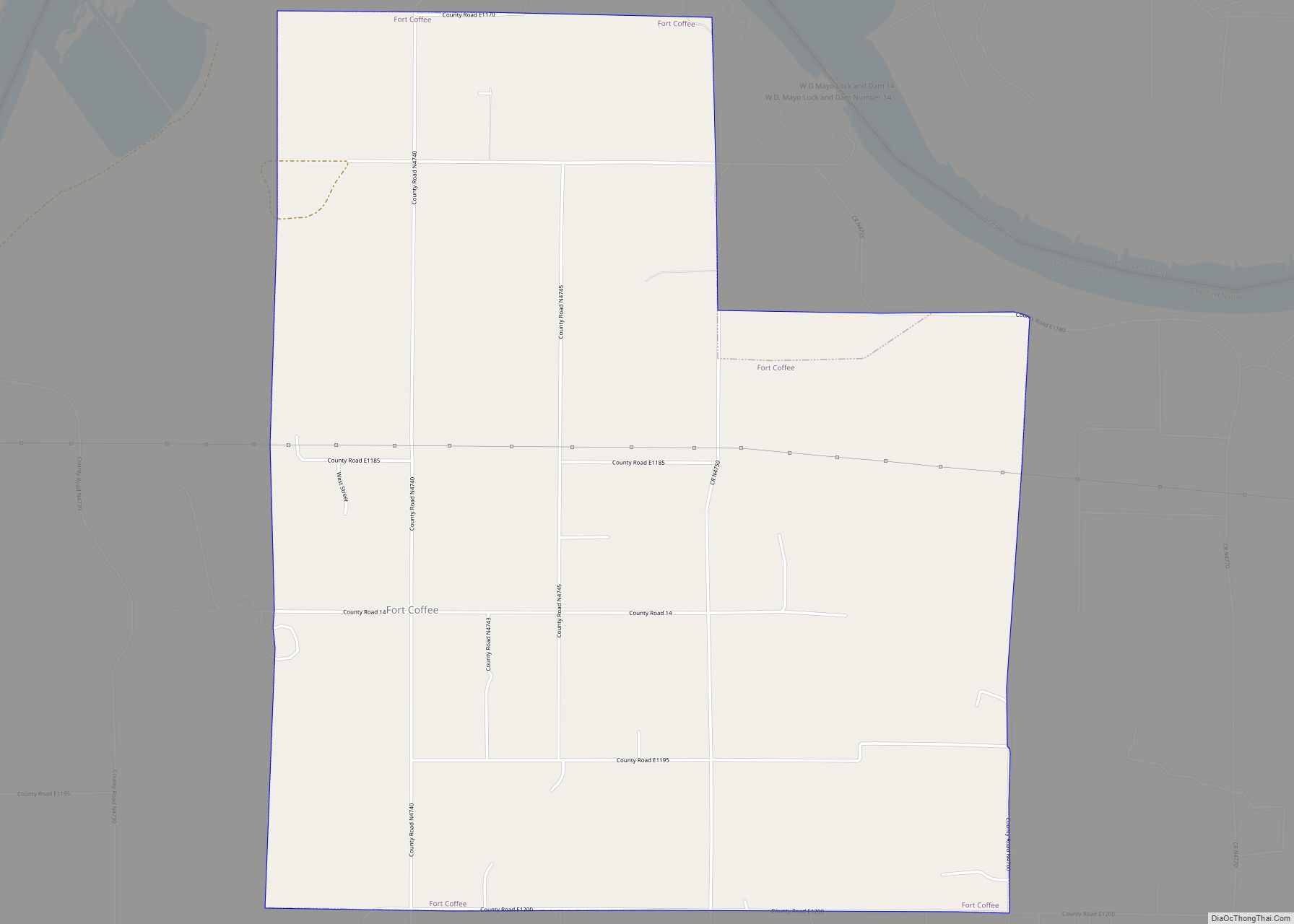
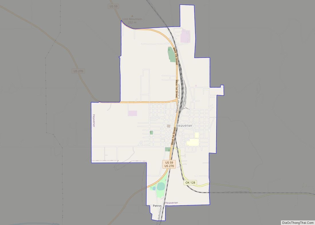
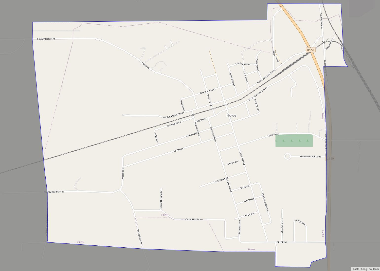
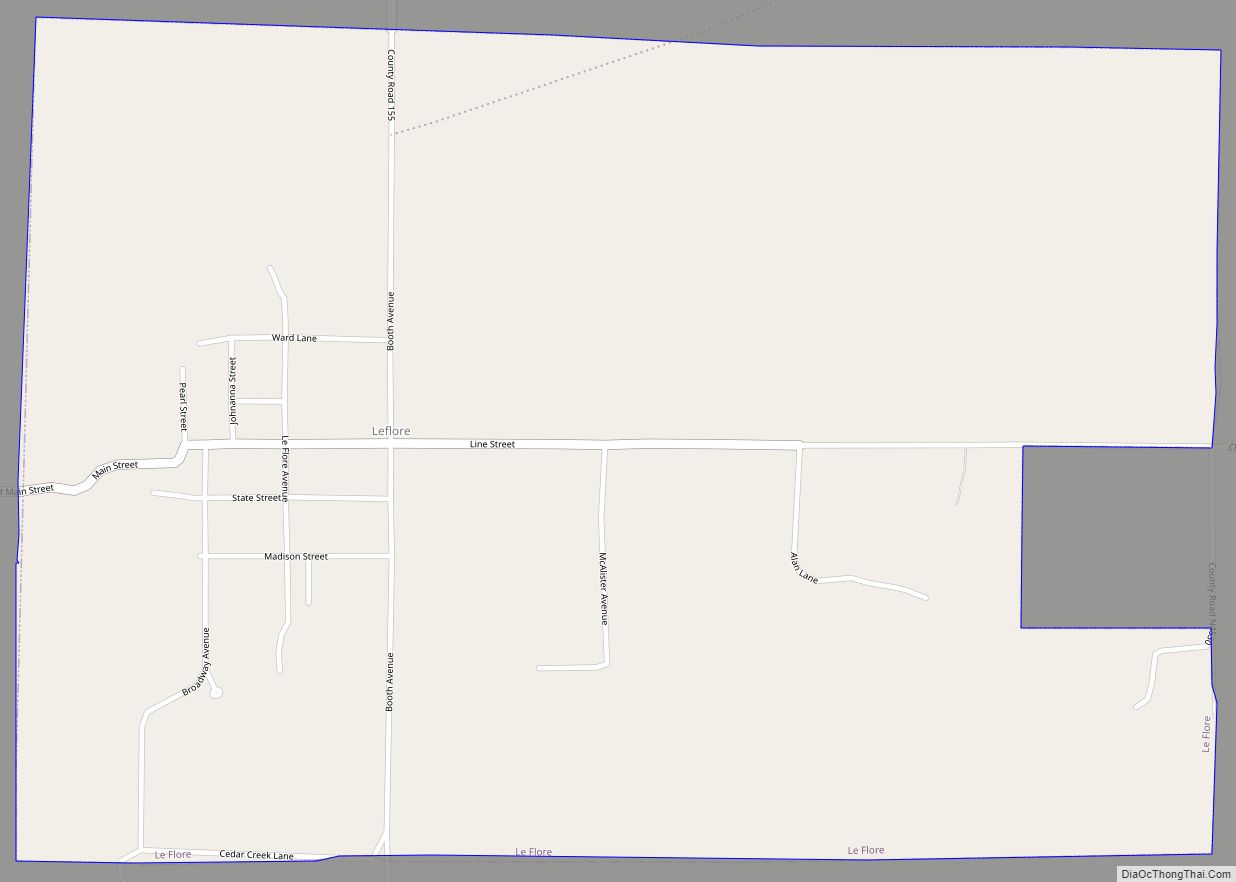
Online Interactive Map
Click on ![]() to view map in "full screen" mode.
to view map in "full screen" mode.
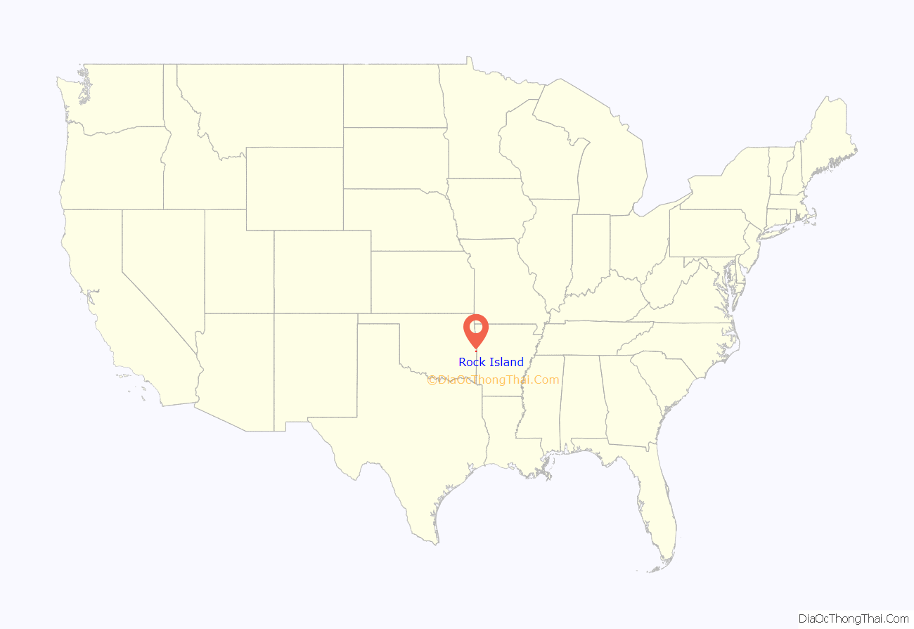
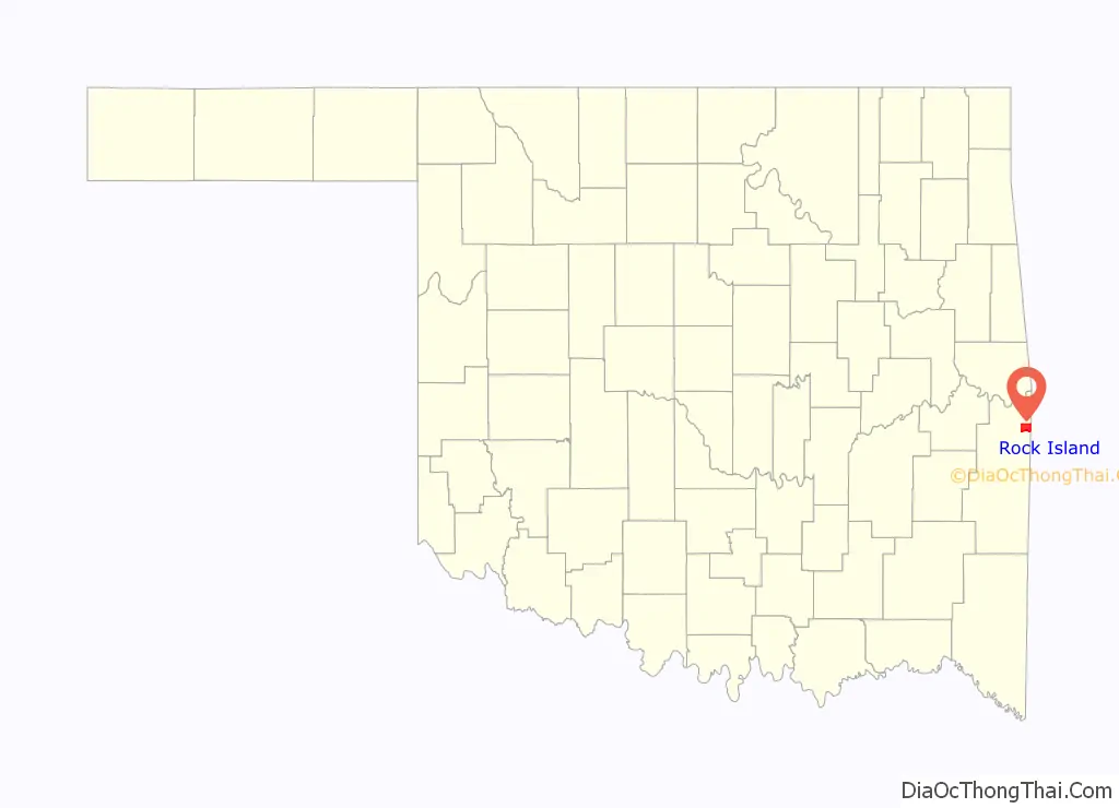
Rock Island location map. Where is Rock Island town?
History
The Fort Smith and Southern Railway built a north–south line through what is now Le Flore County in 1886; the line was sold the next year to the St. Louis and San Francisco Railroad (“the Frisco”). In 1903–04 the Midland Valley Railroad laid an east-west line. The settlement originally known as Maney Junction developed at the crossing of these railroads.
A post office was established as Rock Island, Indian Territory on February 1, 1905. It was presumably named for Rock Island, Illinois. At the time of its founding, the community was located in Skullyville County, part of the Moshulatubbee District of the Choctaw Nation.
Rock Island started the process of incorporation in 1989, but the County Commissioners did not approve the incorporation until 2004.
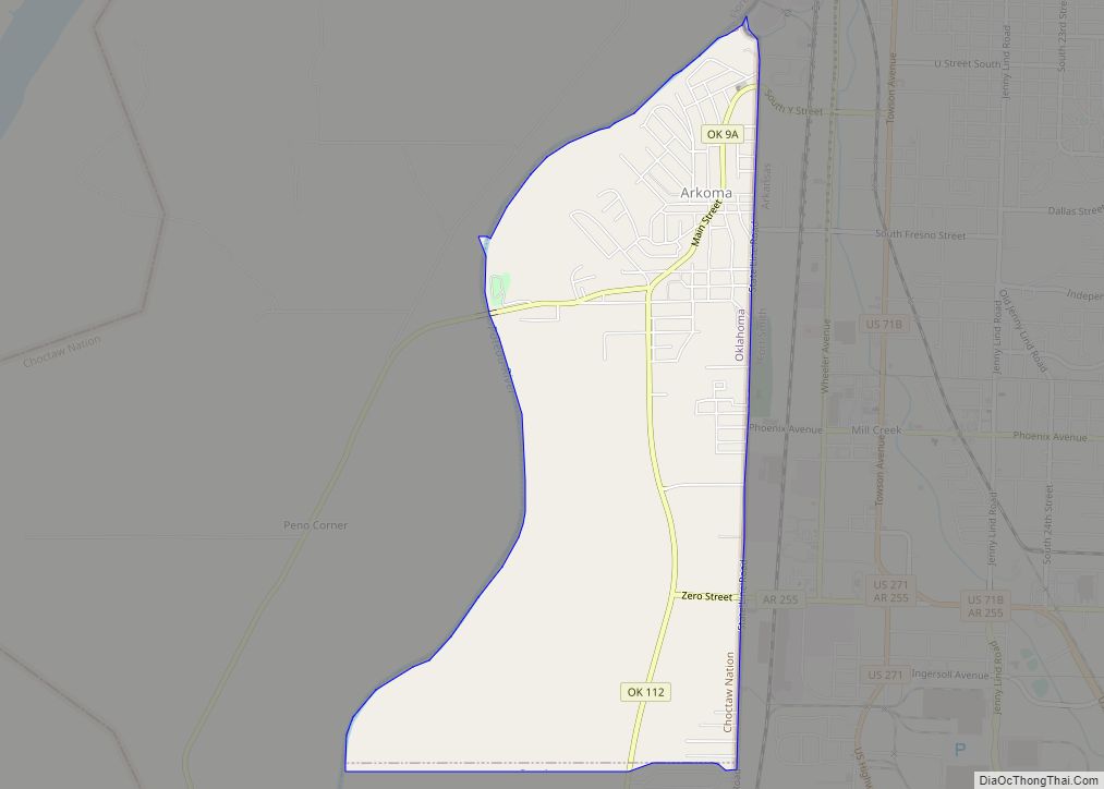
Rock Island Road Map
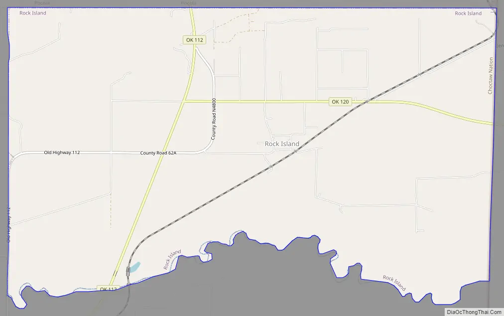
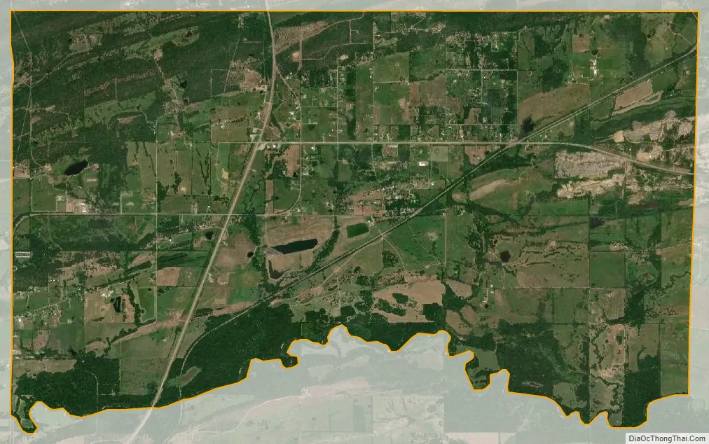
Rock Island city Satellite Map
Geography
Rock Island is located at 35°10′58″N 94°28′37″W / 35.18278°N 94.47694°W / 35.18278; -94.47694 (35.182759, -94.477029). It is 13 miles (21 km) northeast of Poteau.
The town sits on Oklahoma State Highway 112 at the western terminus of Oklahoma State Highway 120.
According to the United States Census Bureau, the town has a total area of 12.2 square miles (32 km), of which 12.1 square miles (31 km) is land and 0.1 square miles (0.26 km) (0.66%) is water.
See also
Map of Oklahoma State and its subdivision:- Adair
- Alfalfa
- Atoka
- Beaver
- Beckham
- Blaine
- Bryan
- Caddo
- Canadian
- Carter
- Cherokee
- Choctaw
- Cimarron
- Cleveland
- Coal
- Comanche
- Cotton
- Craig
- Creek
- Custer
- Delaware
- Dewey
- Ellis
- Garfield
- Garvin
- Grady
- Grant
- Greer
- Harmon
- Harper
- Haskell
- Hughes
- Jackson
- Jefferson
- Johnston
- Kay
- Kingfisher
- Kiowa
- Latimer
- Le Flore
- Lincoln
- Logan
- Love
- Major
- Marshall
- Mayes
- McClain
- McCurtain
- McIntosh
- Murray
- Muskogee
- Noble
- Nowata
- Okfuskee
- Oklahoma
- Okmulgee
- Osage
- Ottawa
- Pawnee
- Payne
- Pittsburg
- Pontotoc
- Pottawatomie
- Pushmataha
- Roger Mills
- Rogers
- Seminole
- Sequoyah
- Stephens
- Texas
- Tillman
- Tulsa
- Wagoner
- Washington
- Washita
- Woods
- Woodward
- Alabama
- Alaska
- Arizona
- Arkansas
- California
- Colorado
- Connecticut
- Delaware
- District of Columbia
- Florida
- Georgia
- Hawaii
- Idaho
- Illinois
- Indiana
- Iowa
- Kansas
- Kentucky
- Louisiana
- Maine
- Maryland
- Massachusetts
- Michigan
- Minnesota
- Mississippi
- Missouri
- Montana
- Nebraska
- Nevada
- New Hampshire
- New Jersey
- New Mexico
- New York
- North Carolina
- North Dakota
- Ohio
- Oklahoma
- Oregon
- Pennsylvania
- Rhode Island
- South Carolina
- South Dakota
- Tennessee
- Texas
- Utah
- Vermont
- Virginia
- Washington
- West Virginia
- Wisconsin
- Wyoming