Savanna is a town in Pittsburg County, Oklahoma, United States. The population was 686 at the 2010 census, a decline of 6.0 percent from the figure of 730 recorded in 2000. It is the hometown of former Harlem Globetrotter and 2014 NAIA Dunk Champion Tyler Inman.
| Name: | Savanna town |
|---|---|
| LSAD Code: | 43 |
| LSAD Description: | town (suffix) |
| State: | Oklahoma |
| County: | Pittsburg County |
| Elevation: | 735 ft (224 m) |
| Total Area: | 1.44 sq mi (3.73 km²) |
| Land Area: | 1.43 sq mi (3.71 km²) |
| Water Area: | 0.01 sq mi (0.02 km²) |
| Total Population: | 623 |
| Population Density: | 435.06/sq mi (168.03/km²) |
| ZIP code: | 74565 |
| Area code: | 539/918 |
| FIPS code: | 4065600 |
| GNISfeature ID: | 1097851 |
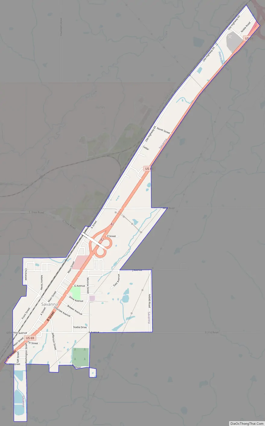
Online Interactive Map
Click on ![]() to view map in "full screen" mode.
to view map in "full screen" mode.
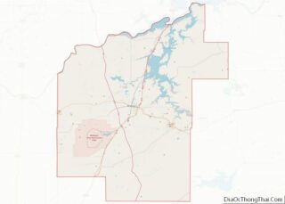
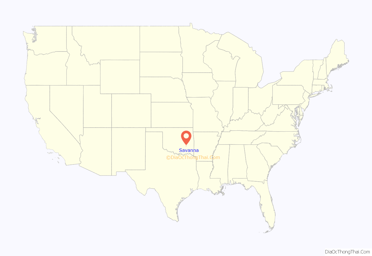
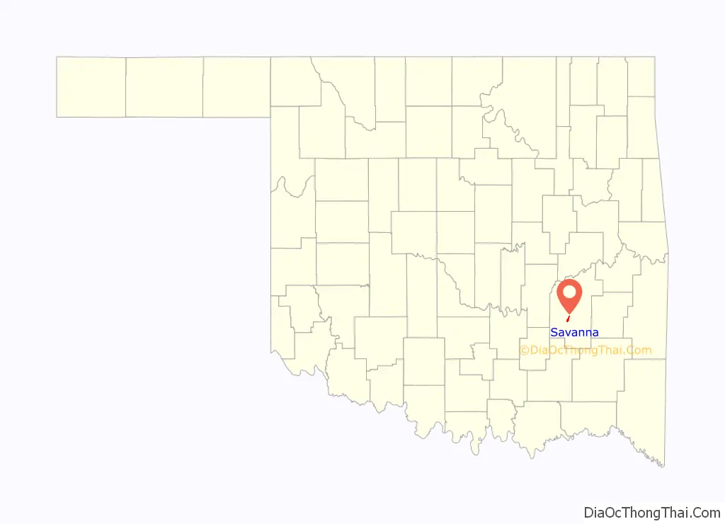
Savanna location map. Where is Savanna town?
History
Begun as a rural settlement in Tobucksy County, Choctaw Nation during the 1860s, the community’s economy was based on agriculture and cattle ranching. Coal mining became the most important economic activity during the 1870s.
A post office was established at Savanna, Indian Territory on May 5, 1876. The town owed its existence to the Missouri, Kansas and Texas Railroad, for which it was a station stop, and the new post office was named for the private railroad car used by Robert Stevens, general manager of the railroad.
As coal mining developed, the community became one of the largest in Indian Territory. The mining companies built rows of 2- and 3- bedroom houses for the families of the miners. In 1887, accidental explosions in Mines #1 and #2 killed 6 miners and 12 rescue personnel. The Savanna Coal Mining and Trading Company closed its mines and moved the houses it owned to Lehigh, Oklahoma. Some growth continued, and Savanna boasted 450 residents in 1911. The Savanna News began publishing in 1915, but went out of business before the end of the decade.
However, the demand for coal fell, as the country began shifting to oil and gas as preferred fuels. Coal mining never regained its former importance to Pittsburg County after WWI. Savanna’s boom essentially collapsed until after statehood came in 1907.
During World War II, the U.S. Navy constructed an ammunition production facility at McAlester. Many of Savanna’s work force went to work there. In 1960, the census reported a population of 620, which grew to 948 in 1990.
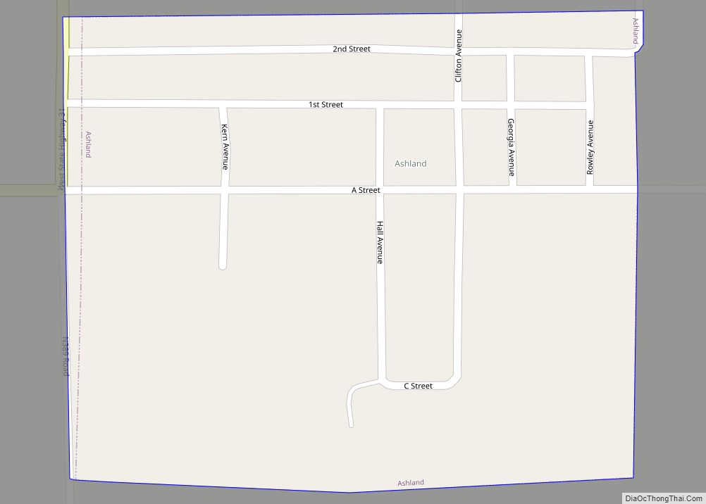
Savanna Road Map
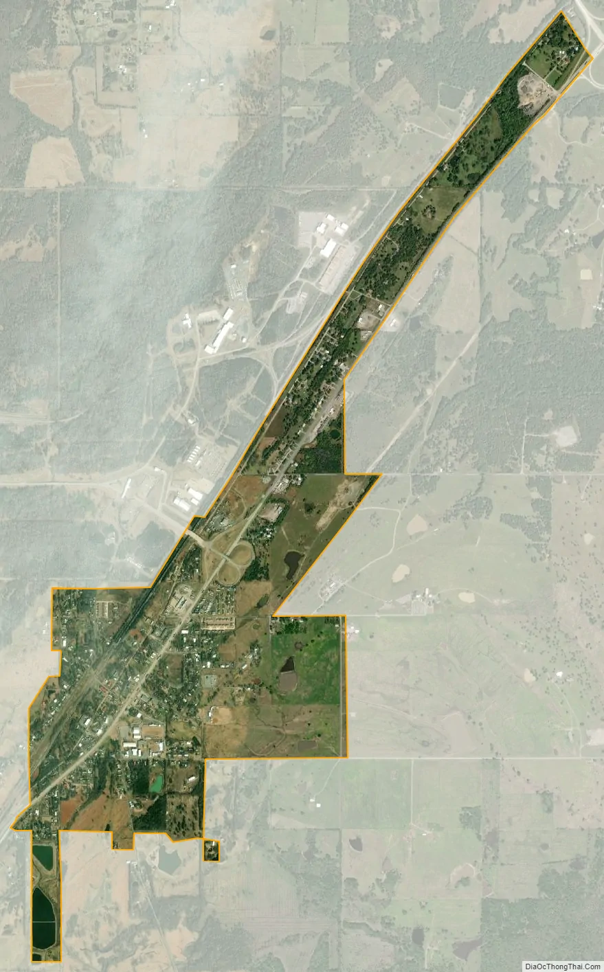
Savanna city Satellite Map
Geography
Savanna is located at 34°50′0″N 95°50′20″W / 34.83333°N 95.83889°W / 34.83333; -95.83889 (34.833229, -95.838768). It is 9 miles (14 km) south of McAlester on U.S. Highway 69. According to the United States Census Bureau, the town has a total area of 1.4 square miles (3.6 km), of which 1.4 square miles (3.6 km) is land and 0.71% is water.
See also
Map of Oklahoma State and its subdivision:- Adair
- Alfalfa
- Atoka
- Beaver
- Beckham
- Blaine
- Bryan
- Caddo
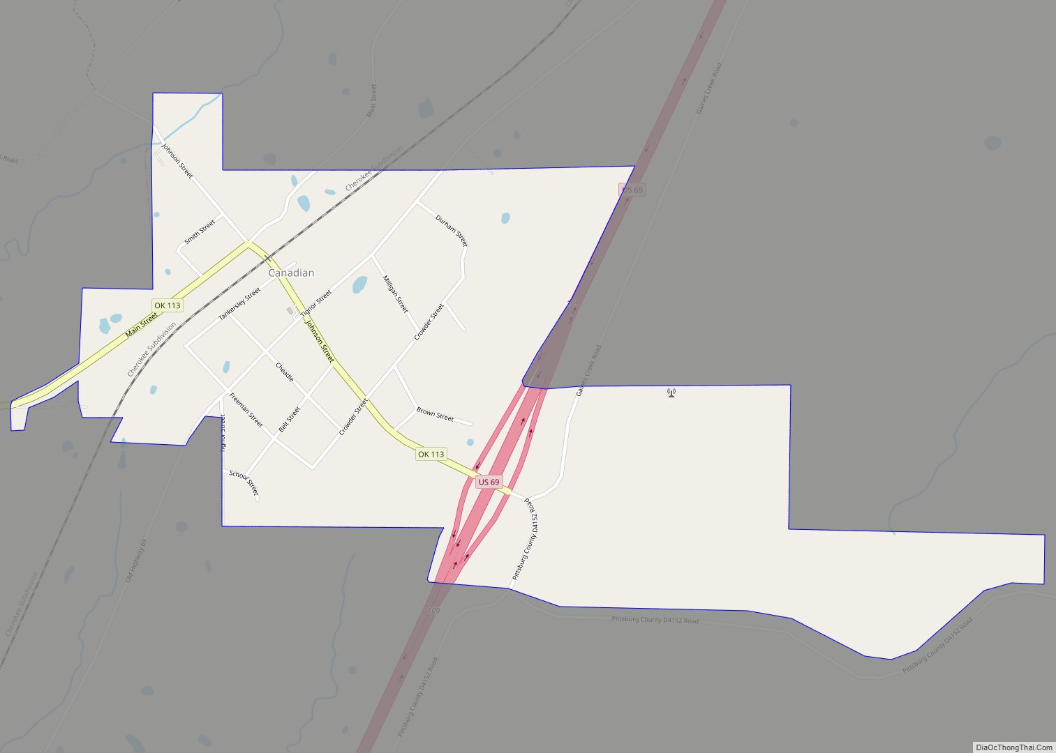
- Canadian
- Carter
- Cherokee
- Choctaw
- Cimarron
- Cleveland
- Coal
- Comanche
- Cotton
- Craig
- Creek
- Custer
- Delaware
- Dewey
- Ellis
- Garfield
- Garvin
- Grady
- Grant
- Greer
- Harmon
- Harper
- Haskell
- Hughes
- Jackson
- Jefferson
- Johnston
- Kay
- Kingfisher
- Kiowa
- Latimer
- Le Flore
- Lincoln
- Logan
- Love
- Major
- Marshall
- Mayes
- McClain
- McCurtain
- McIntosh
- Murray
- Muskogee
- Noble
- Nowata
- Okfuskee
- Oklahoma
- Okmulgee
- Osage
- Ottawa
- Pawnee
- Payne
- Pittsburg
- Pontotoc
- Pottawatomie
- Pushmataha
- Roger Mills
- Rogers
- Seminole
- Sequoyah
- Stephens
- Texas
- Tillman
- Tulsa
- Wagoner
- Washington
- Washita
- Woods
- Woodward
- Alabama
- Alaska
- Arizona
- Arkansas
- California
- Colorado
- Connecticut
- Delaware
- District of Columbia
- Florida
- Georgia
- Hawaii
- Idaho
- Illinois
- Indiana
- Iowa
- Kansas
- Kentucky
- Louisiana
- Maine
- Maryland
- Massachusetts
- Michigan
- Minnesota
- Mississippi
- Missouri
- Montana
- Nebraska
- Nevada
- New Hampshire
- New Jersey
- New Mexico
- New York
- North Carolina
- North Dakota
- Ohio
- Oklahoma
- Oregon
- Pennsylvania
- Rhode Island
- South Carolina
- South Dakota
- Tennessee
- Texas
- Utah
- Vermont
- Virginia
- Washington
- West Virginia
- Wisconsin
- Wyoming