Wagoner is a city in Wagoner County, Oklahoma, United States. The population was 8,323 at the 2010 census, compared to the figure of 7,669 recorded in 2000. It is the county seat of Wagoner County. Wagoner became the first city incorporated in Indian Territory on January 4, 1896.
| Name: | Wagoner city |
|---|---|
| LSAD Code: | 25 |
| LSAD Description: | city (suffix) |
| State: | Oklahoma |
| County: | Wagoner County |
| Elevation: | 591 ft (180 m) |
| Total Area: | 10.02 sq mi (25.94 km²) |
| Land Area: | 10.01 sq mi (25.93 km²) |
| Water Area: | 0.00 sq mi (0.01 km²) |
| Total Population: | 7,621 |
| Population Density: | 761.19/sq mi (293.90/km²) |
| ZIP code: | 74467, 74477 |
| Area code: | 539/918 |
| FIPS code: | 4077850 |
| GNISfeature ID: | 1099288 |
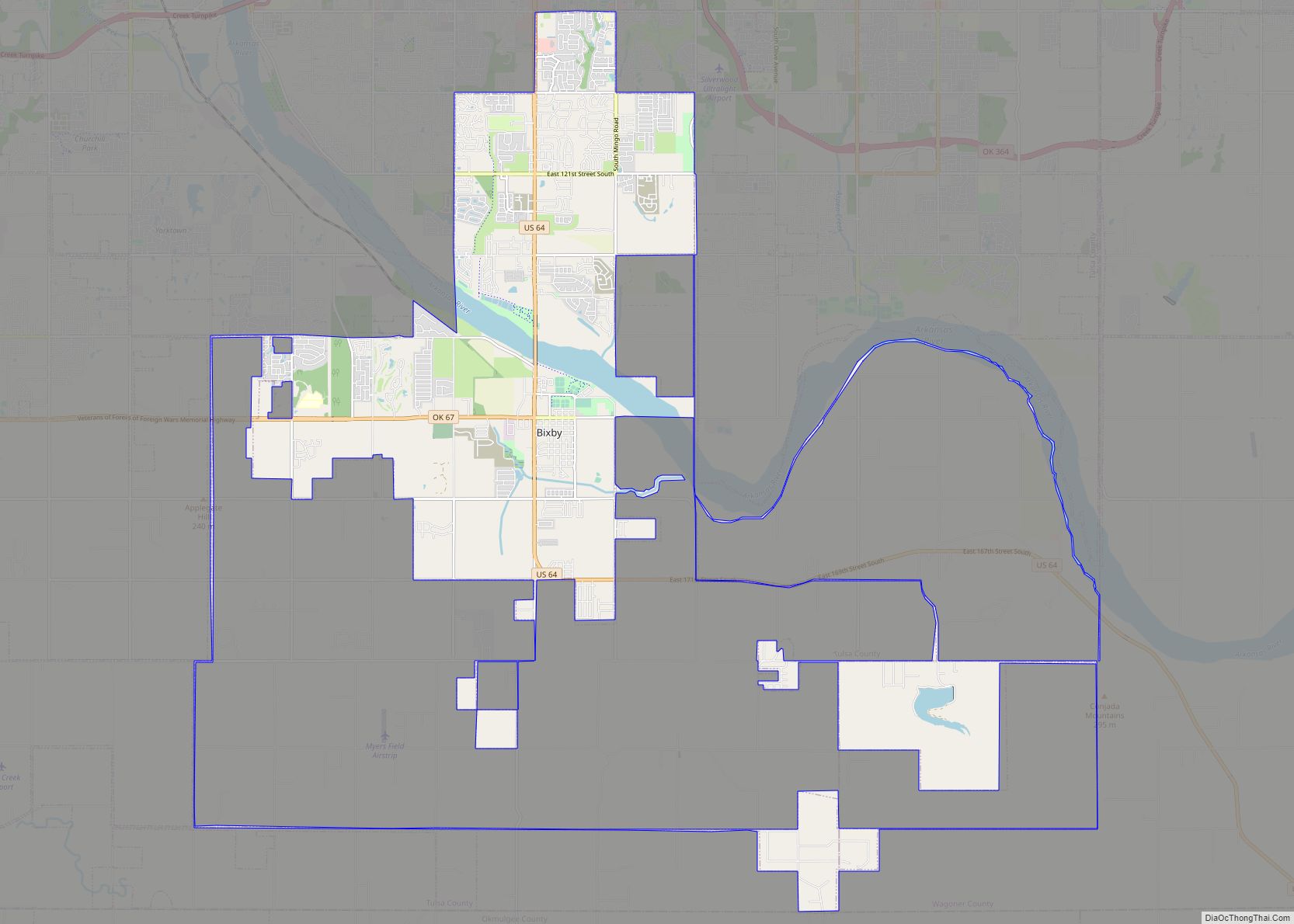
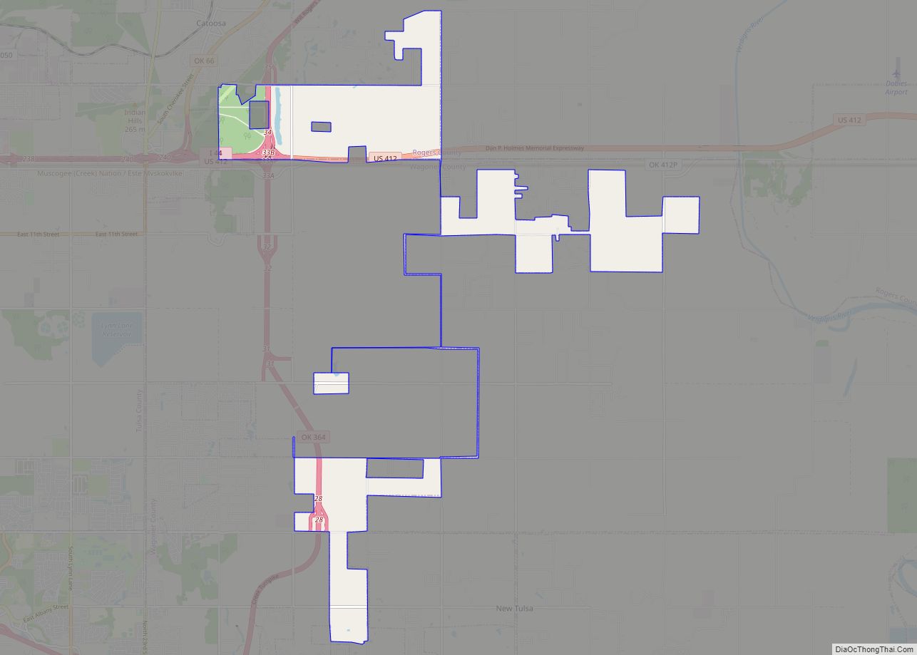
Online Interactive Map
Click on ![]() to view map in "full screen" mode.
to view map in "full screen" mode.
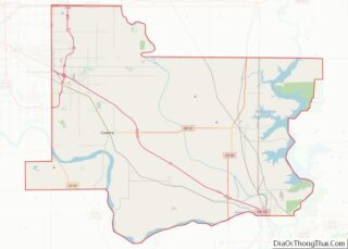
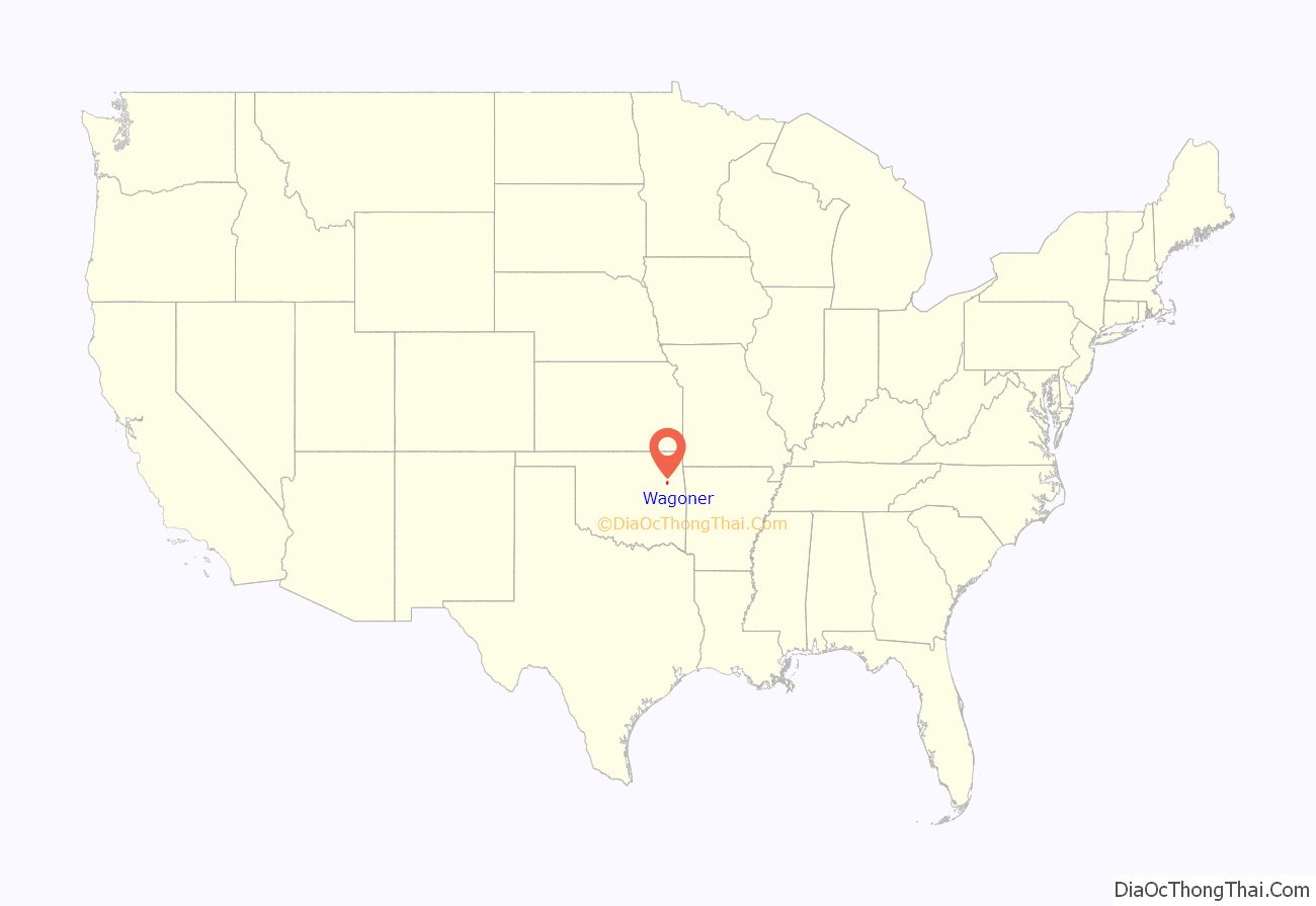
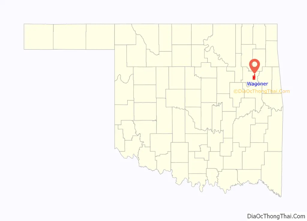
Wagoner location map. Where is Wagoner city?
History
Wagoner is along the path of the Texas Road cattle trail, and the later Jefferson Highway of the early National Trail System, both roughly along the route of U.S. Route 69 through Oklahoma today. The town began as a small community at the intersection of the Missouri-Kansas-Texas (MKT) Railway and the Kansas and Arkansas Valley Railway (later the Missouri Pacific Railway), when William McAnally, a foreman for the MKT built a small hotel at this isolated location in June 1887. By the next summer others had built two more hotels and two general stores. The town was named for railroad dispatcher Henry “Big Foot” Wagoner, who had reported the need for a railroad switch nearby to accommodate the shipment of logs and hay. The switch had been previously named “Wagoner’s Switch.” The switch soon relocated to the town and caused the development of a major cattle shipping business.
By 1894, the community had 642 names in a local census. A local newspaper began promoting the town in 1895, encouraging more people to move to there. By 1896, there were approximately 1,500 residents. In the fall of 1895, the community formed a commission that circulated a petition requesting incorporation under the statutes of Arkansas. Incorporation was granted by the U. S. District Court on January 4, 1896, making Wagoner the first city incorporated in Indian Territory.
A privately funded courthouse was built in 1897, which housed a newly created U. S. Western District Court. The Dawes Commission turned Indian Territory land from tribal to individual ownership by members of each tribe. The individuals were allowed to sell their land to non-Indians, causing a real estate boom in farmland around the area. By statehood, the city had 2,950 residents and was named as the county seat of Wagoner County.
In April 1914 Wagoner was the location of a brutal lynching of a 17 year old African American girl.
The boom continued through 1910, when the population reached 4,018. The MKT had located a division headquarters in the city, which then had three railroad trunk lines and twenty passenger trains a day. Industries included three grain elevators, a cotton gin, cotton oil mill, iron foundry, hardwood company, cement plant, and roller mill. However, the boom ended in 1913, when the MKT moved its division headquarters to Muskogee. The oil boom farther west and later, the Great Depression, caused a further decline in the city’s economy and population.
World War II started a revival of Wagoner’s fortunes. The city lay between two war-related Federal Government projects: Camp Gruber to the south and the Oklahoma Ordnance Works to the north.
After the war, several small manufacturing industries took root. Completion of the nearby Fort Gibson Lake in 1950 stimulated the economy and turned Wagoner into a sports and retirement center. The McLellan-Kerr navigational channel made the agricultural area accessible by barges, stimulating farm-related businesses. Highway improvements made Wagoner a bedroom community for Tulsa and Muskogee.
Wagoner Road Map
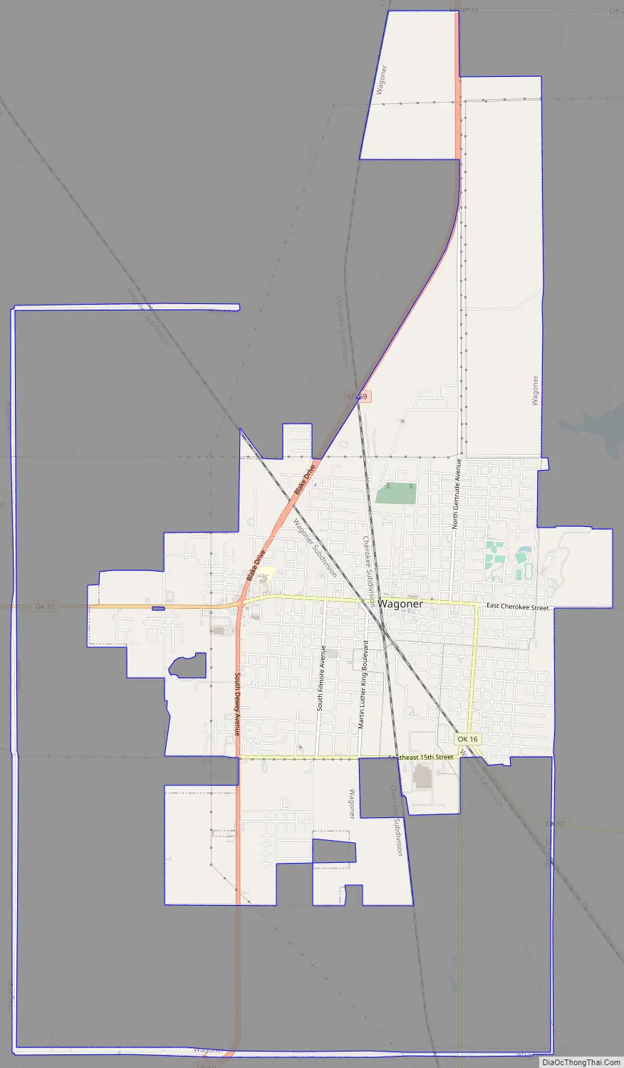
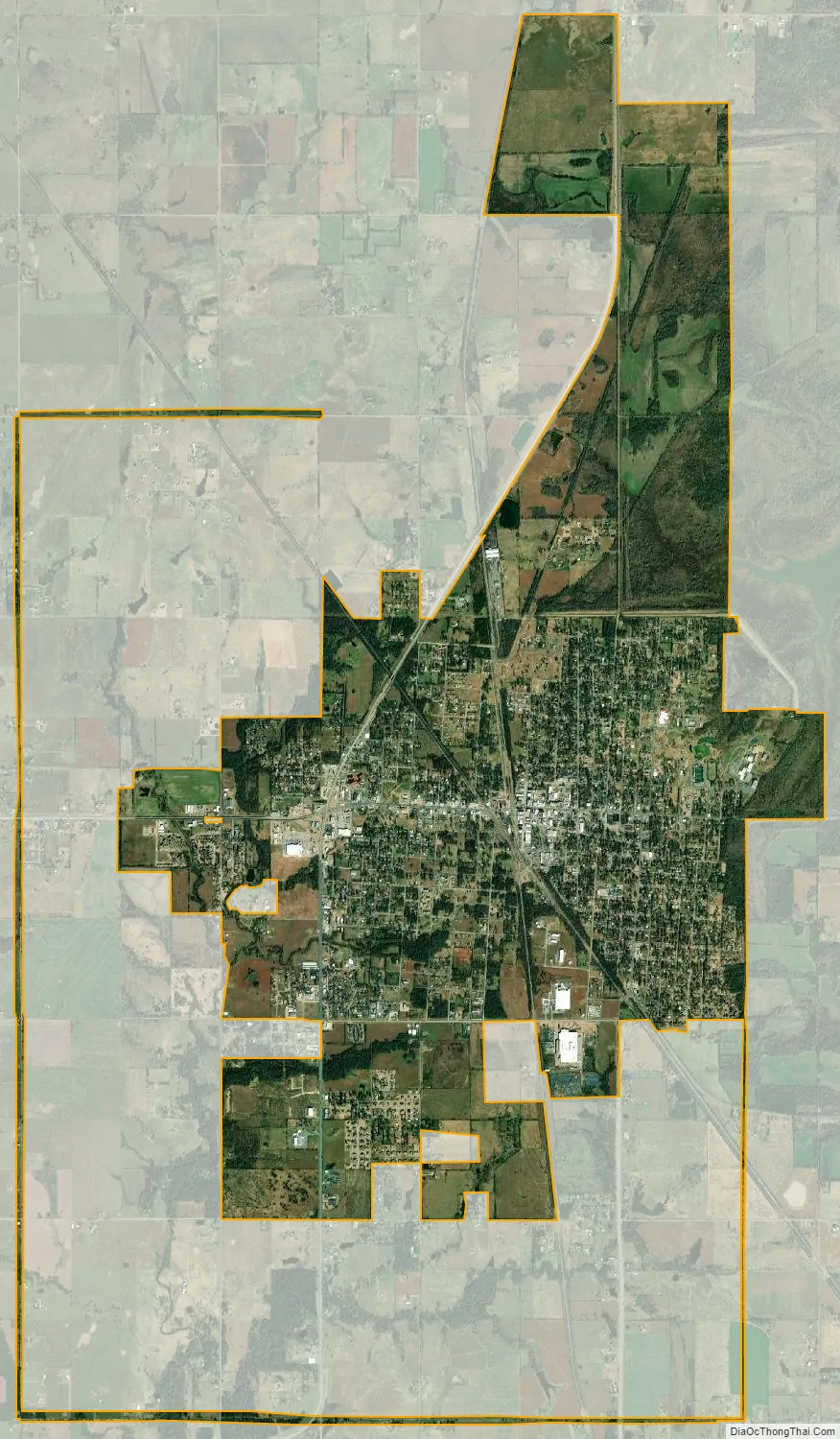
Wagoner city Satellite Map
Geography
Wagoner is located at 35°57′20″N 95°22′41″W / 35.95556°N 95.37806°W / 35.95556; -95.37806 (35.955501, -95.377938). It is 18 miles (29 km) north of Muskogee and 40 miles (64 km) east of Tulsa.
According to the United States Census Bureau, the city has a total area of 7.0 square miles (18 km), all land.
See also
Map of Oklahoma State and its subdivision:- Adair
- Alfalfa
- Atoka
- Beaver
- Beckham
- Blaine
- Bryan
- Caddo
- Canadian
- Carter
- Cherokee
- Choctaw
- Cimarron
- Cleveland
- Coal
- Comanche
- Cotton
- Craig
- Creek
- Custer
- Delaware
- Dewey
- Ellis
- Garfield
- Garvin
- Grady
- Grant
- Greer
- Harmon
- Harper
- Haskell
- Hughes
- Jackson
- Jefferson
- Johnston
- Kay
- Kingfisher
- Kiowa
- Latimer
- Le Flore
- Lincoln
- Logan
- Love
- Major
- Marshall
- Mayes
- McClain
- McCurtain
- McIntosh
- Murray
- Muskogee
- Noble
- Nowata
- Okfuskee
- Oklahoma
- Okmulgee
- Osage
- Ottawa
- Pawnee
- Payne
- Pittsburg
- Pontotoc
- Pottawatomie
- Pushmataha
- Roger Mills
- Rogers
- Seminole
- Sequoyah
- Stephens
- Texas
- Tillman
- Tulsa
- Wagoner
- Washington
- Washita
- Woods
- Woodward
- Alabama
- Alaska
- Arizona
- Arkansas
- California
- Colorado
- Connecticut
- Delaware
- District of Columbia
- Florida
- Georgia
- Hawaii
- Idaho
- Illinois
- Indiana
- Iowa
- Kansas
- Kentucky
- Louisiana
- Maine
- Maryland
- Massachusetts
- Michigan
- Minnesota
- Mississippi
- Missouri
- Montana
- Nebraska
- Nevada
- New Hampshire
- New Jersey
- New Mexico
- New York
- North Carolina
- North Dakota
- Ohio
- Oklahoma
- Oregon
- Pennsylvania
- Rhode Island
- South Carolina
- South Dakota
- Tennessee
- Texas
- Utah
- Vermont
- Virginia
- Washington
- West Virginia
- Wisconsin
- Wyoming