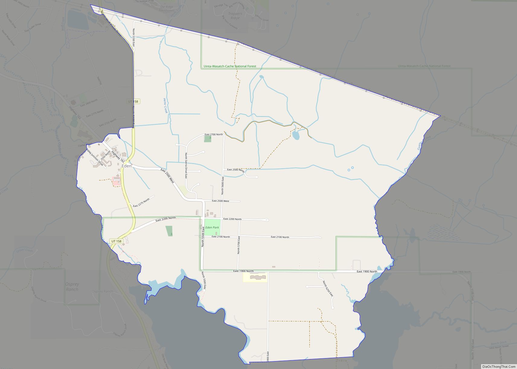
Eden is a census-designated place in Weber County, Utah, United States. It is home to Powder Mountain ski resort. It lies between the North and Middle Fork of the Ogden River, north of Pineview Reservoir, in the Ogden Valley. The elevation is 4,941 feet (1,506 m). The population was 600 at the 2010 census. It has a post office with the ZIP code 84310. Eden is part of the Ogden–Clearfield, Utah Metropolitan Statistical Area, as well as the Ogden Valley census county division
| Name: | Eden CDP |
|---|---|
| LSAD Code: | 57 |
| LSAD Description: | CDP (suffix) |
| State: | Utah |
| County: | Weber County |
| Elevation: | 4,941 ft (1,506 m) |
| Total Area: | 600 |
| ZIP code: | 84310 |
| Area code: | 385, 801 |
| FIPS code: | 4921990 |
| GNISfeature ID: | 2584764 |
Online Interactive Map
Click on ![]() to view map in "full screen" mode.
to view map in "full screen" mode.
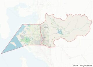
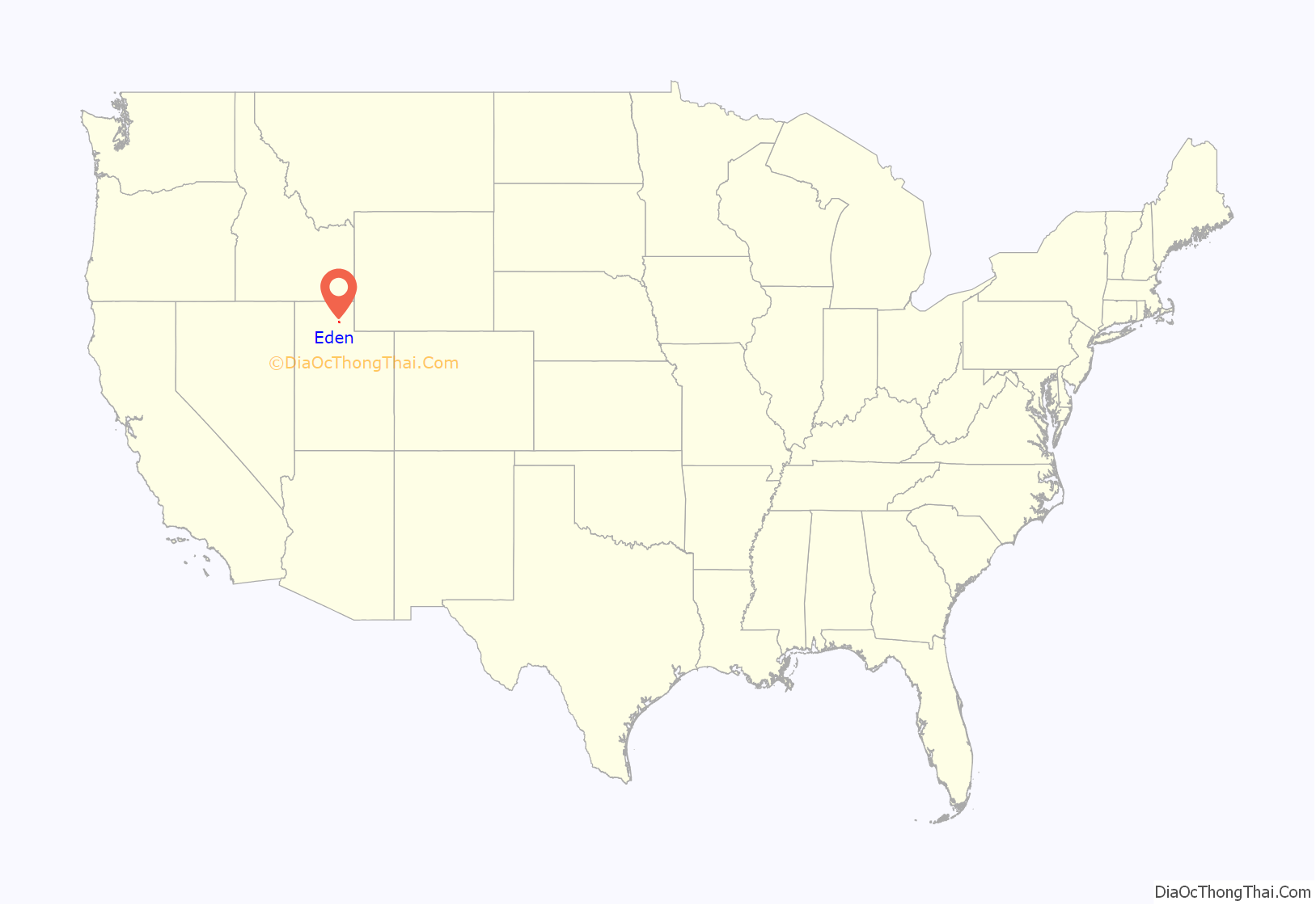
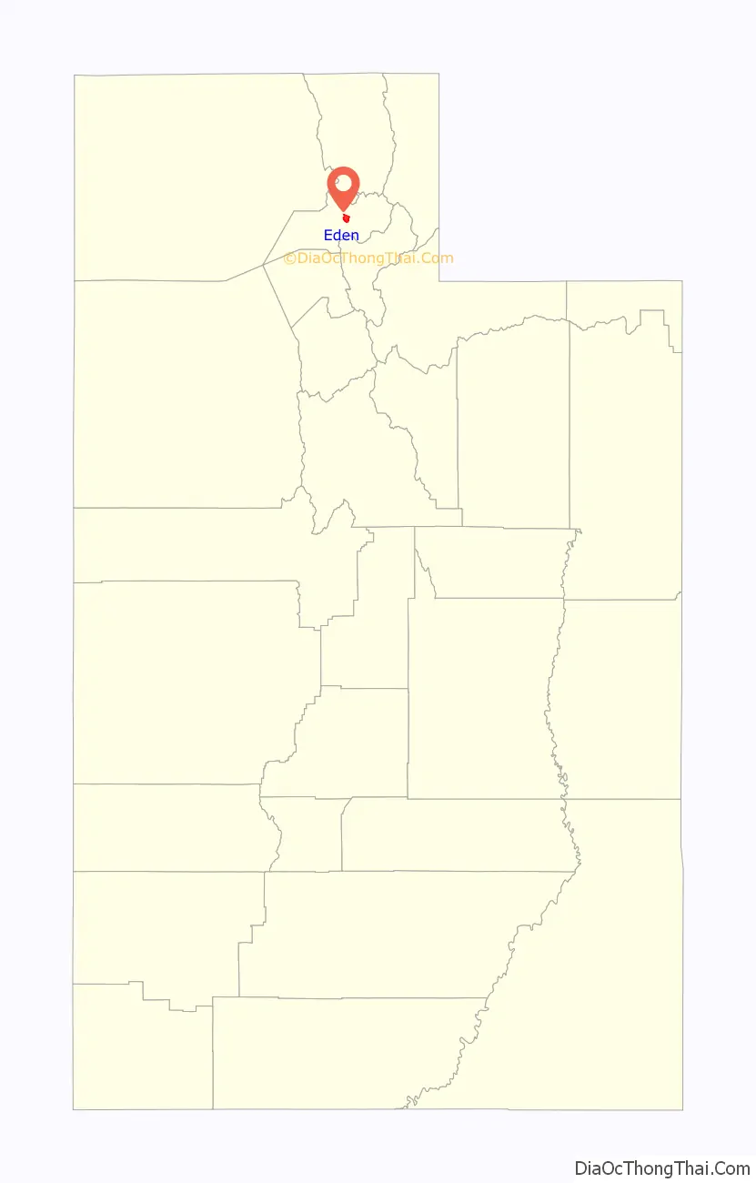
Eden location map. Where is Eden CDP?
History
The first home here was a log cabin built in 1857 for summer herdsmen Erastus Bingham and Joseph Hardy. A community was established in 1859 when fifteen families moved in via North Ogden Canyon and Pass. The settlers hired a government surveyor, Washington Jenkins, to plot the town. Jenkins said he thought the area was one of the most beautiful sites he had ever surveyed and suggested the biblical name “Eden”. An earlier temporary name was North Fork Town.
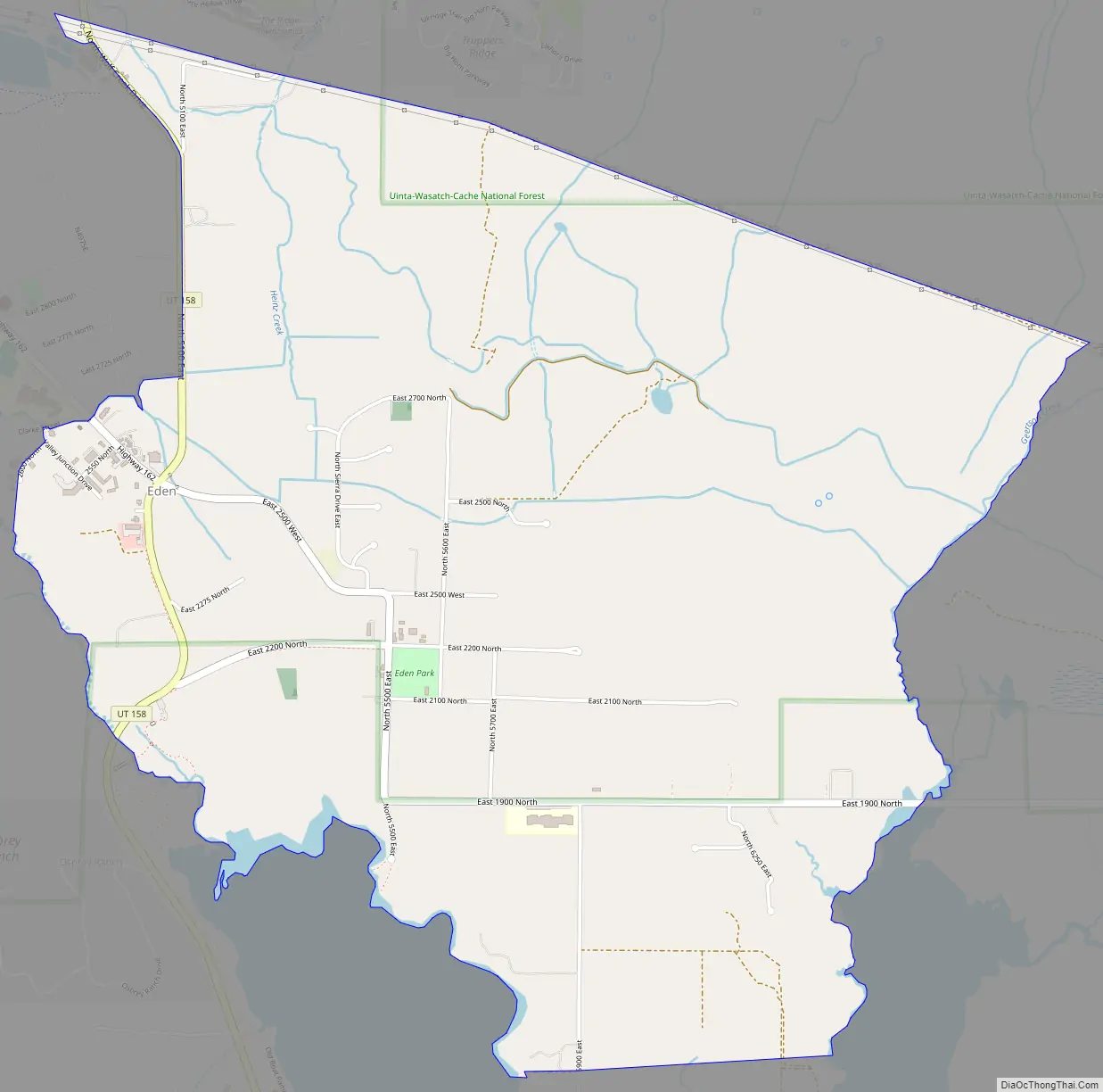
Eden Road Map
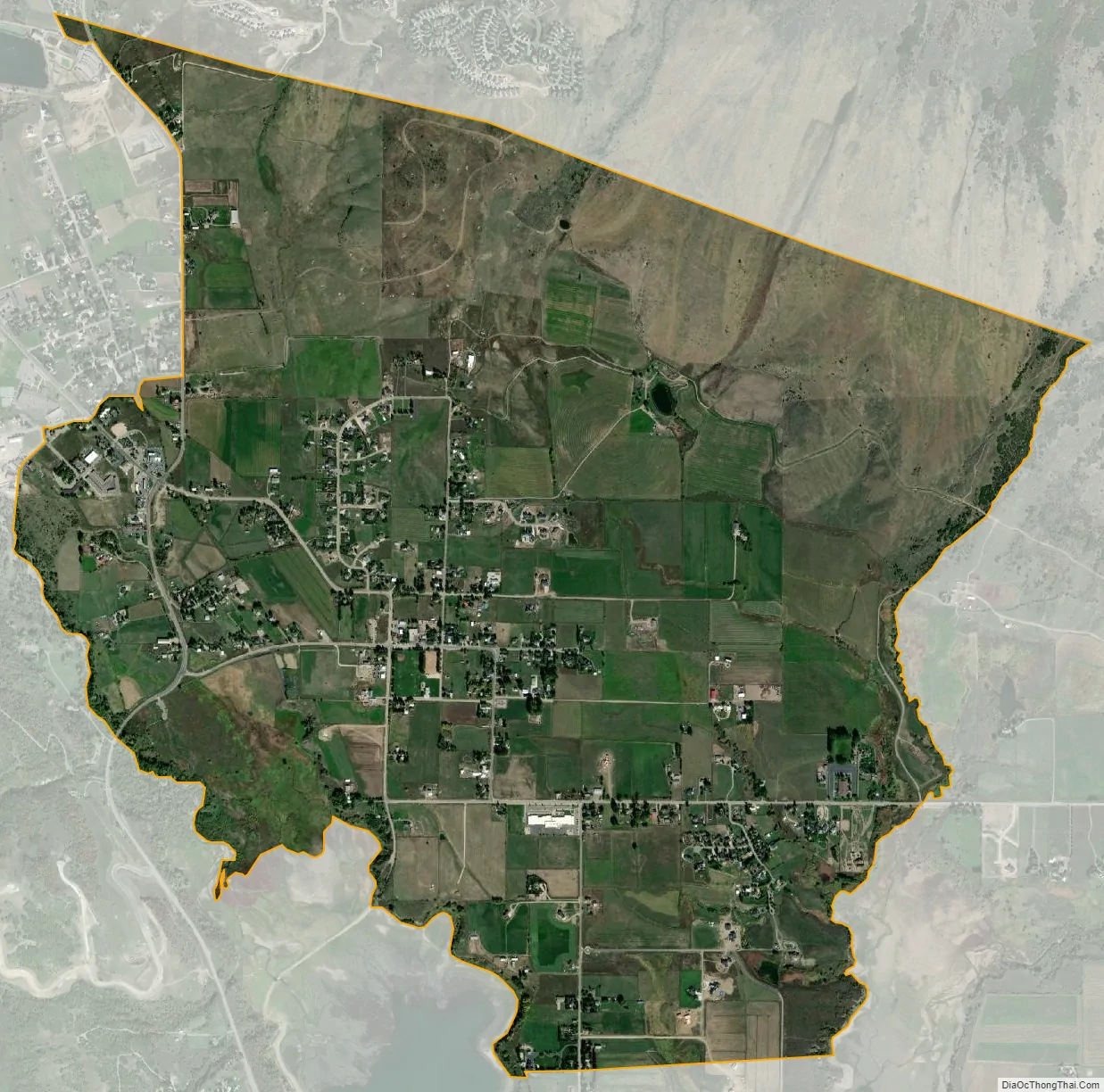
Eden city Satellite Map
See also
Map of Utah State and its subdivision: Map of other states:- Alabama
- Alaska
- Arizona
- Arkansas
- California
- Colorado
- Connecticut
- Delaware
- District of Columbia
- Florida
- Georgia
- Hawaii
- Idaho
- Illinois
- Indiana
- Iowa
- Kansas
- Kentucky
- Louisiana
- Maine
- Maryland
- Massachusetts
- Michigan
- Minnesota
- Mississippi
- Missouri
- Montana
- Nebraska
- Nevada
- New Hampshire
- New Jersey
- New Mexico
- New York
- North Carolina
- North Dakota
- Ohio
- Oklahoma
- Oregon
- Pennsylvania
- Rhode Island
- South Carolina
- South Dakota
- Tennessee
- Texas
- Utah
- Vermont
- Virginia
- Washington
- West Virginia
- Wisconsin
- Wyoming