Eureka is a city in Juab County, Utah, United States. It is part of the Provo–Orem metropolitan area. The population was 669 at the 2010 census, down from 766 in 2000.
The city was named from the Greek word eureka, meaning “I have found it!”
| Name: | Eureka city |
|---|---|
| LSAD Code: | 25 |
| LSAD Description: | city (suffix) |
| State: | Utah |
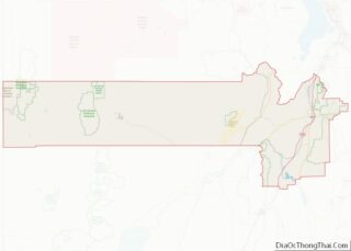
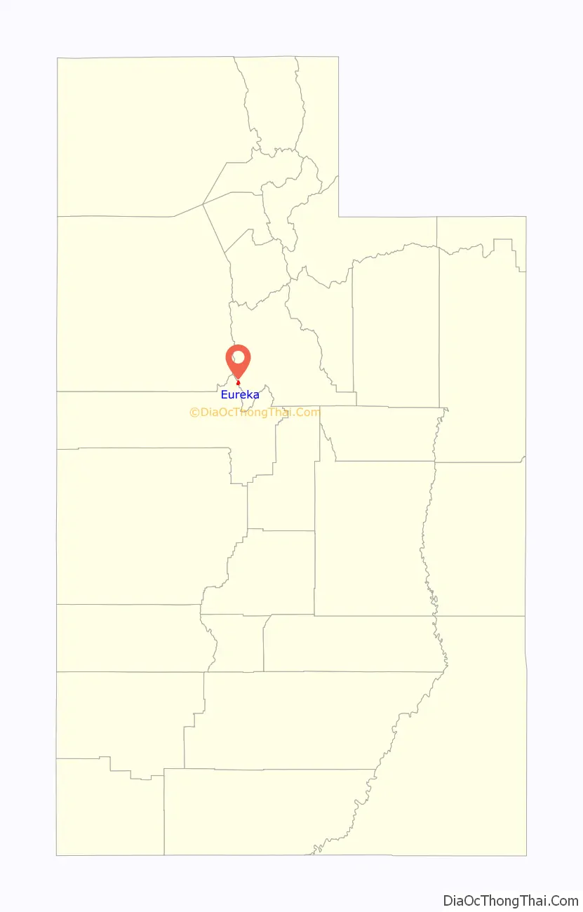
| County: | Juab County |
| Founded: | 1870 |
| Incorporated: | November 8, 1892 |
| Elevation: | 6,430 ft (1,960 m) |
| Total Area: | 1.48 sq mi (3.84 km²) |
| Land Area: | 1.48 sq mi (3.84 km²) |
| Water Area: | 0.00 sq mi (0.00 km²) |
| Total Population: | 669 |
| Population Density: | 477.38/sq mi (184.30/km²) |
| ZIP code: | 84628 |
| Area code: | 435 |
| FIPS code: | 4924080 |
| GNISfeature ID: | 1437974 |
| Website: | www.eurekautah.org |
Online Interactive Map
Click on ![]() to view map in "full screen" mode.
to view map in "full screen" mode.
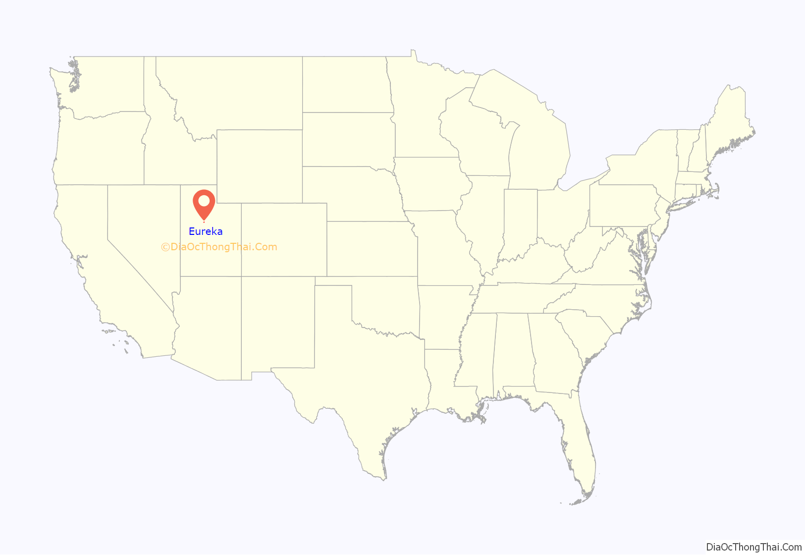
Eureka location map. Where is Eureka city?
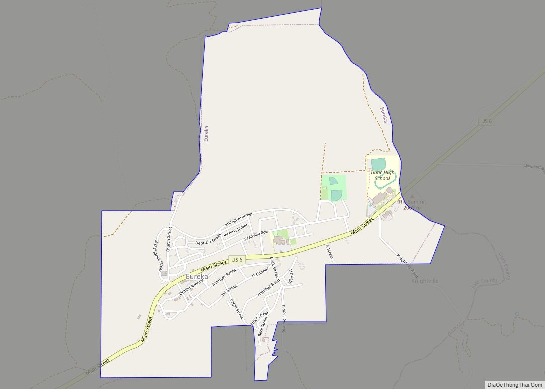
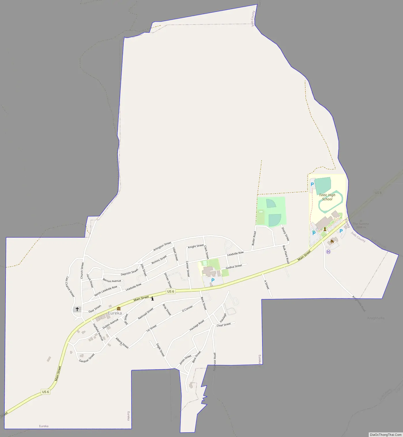
Eureka Road Map
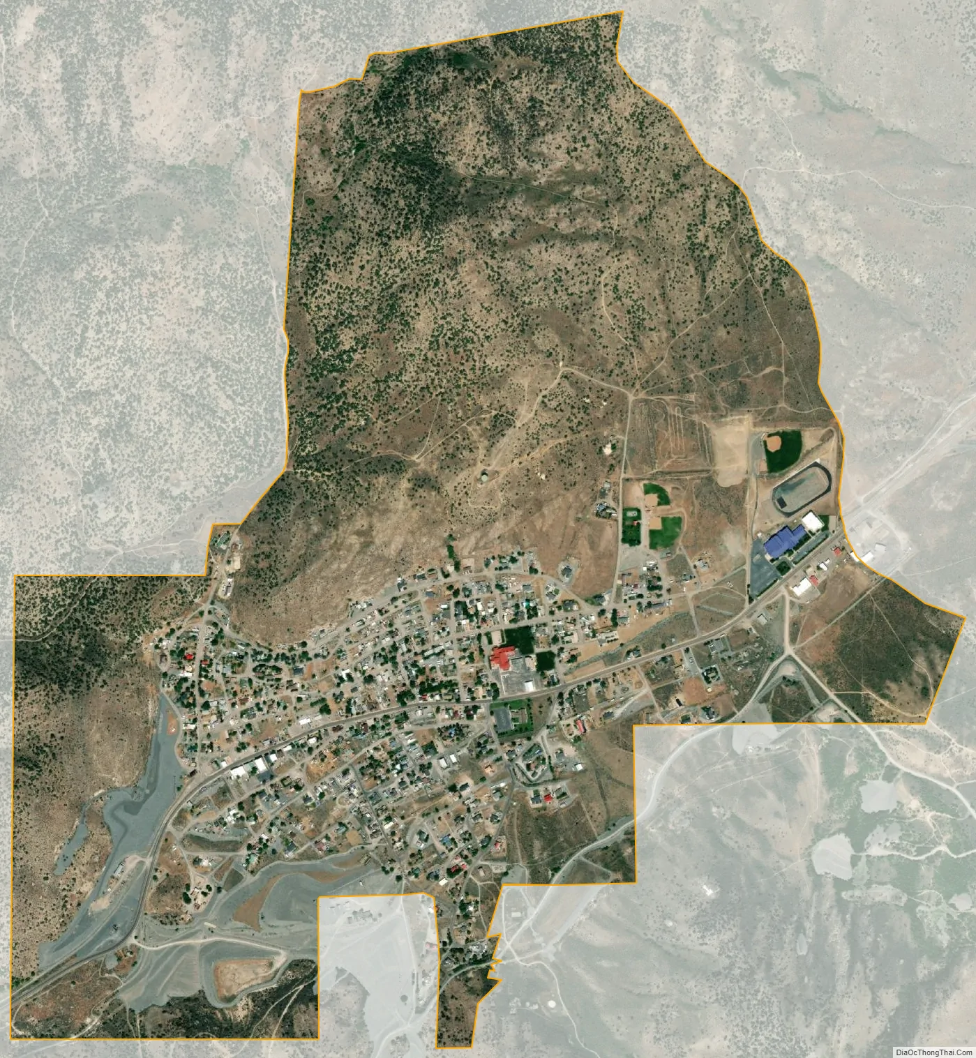
Eureka city Satellite Map
Geography
Eureka is located in northern Juab County at 39°57′18″N 112°6′59″W / 39.95500°N 112.11639°W / 39.95500; -112.11639 (39.954974, -112.116364). It sits in the East Tintic Mountains at an elevation of 6,430 feet (1,960 m) above sea level. The northeast boundary of the city is the Utah County line, following the height of land. 7,828-foot (2,386 m) Packard Peak is to the north, while 8,048-foot (2,453 m) Godiva Mountain and 7,917-foot (2,413 m) Eureka Ridge are to the south.
U.S. Route 6 forms Main Street through Eureka, leading east 20 miles (32 km) to Santaquin and southwest 51 miles (82 km) to Delta.
According to the United States Census Bureau, Eureka has a total area of 1.5 square miles (3.9 km), all land.
Climate
This climatic region is typified by large seasonal temperature differences, with warm to hot (and often humid) summers and cold (sometimes severely cold) winters. According to the Köppen Climate Classification system, Eureka has a humid continental climate, abbreviated “Dfb” on climate maps.
See also
Map of Utah State and its subdivision: Map of other states:- Alabama
- Alaska
- Arizona
- Arkansas
- California
- Colorado
- Connecticut
- Delaware
- District of Columbia
- Florida
- Georgia
- Hawaii
- Idaho
- Illinois
- Indiana
- Iowa
- Kansas
- Kentucky
- Louisiana
- Maine
- Maryland
- Massachusetts
- Michigan
- Minnesota
- Mississippi
- Missouri
- Montana
- Nebraska
- Nevada
- New Hampshire
- New Jersey
- New Mexico
- New York
- North Carolina
- North Dakota
- Ohio
- Oklahoma
- Oregon
- Pennsylvania
- Rhode Island
- South Carolina
- South Dakota
- Tennessee
- Texas
- Utah
- Vermont
- Virginia
- Washington
- West Virginia
- Wisconsin
- Wyoming