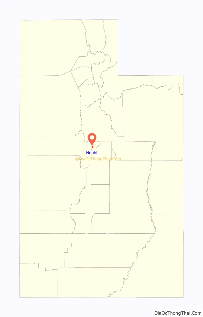
Nephi (/ˈniːfaɪ/ NEE-fy) is a city in Juab County, Utah, United States. It is part of the Provo–Orem metropolitan area. The population was 6,443 at the 2020 census. It is the county seat of Juab County. It was settled by Mormon pioneers in 1851 as Salt Creek, and it acquired its current name in 1882. It is the principal city in the Juab Valley, an agricultural area. Nephi was named after Nephi, son of Lehi, from the Book of Mormon.
| Name: | Nephi city |
|---|---|
| LSAD Code: | 25 |
| LSAD Description: | city (suffix) |
| State: | Utah |
| County: | Juab County |
| Elevation: | 5,128 ft (1,563 m) |
| Total Area: | 4.75 sq mi (12.31 km²) |
| Land Area: | 4.75 sq mi (12.31 km²) |
| Water Area: | 0.00 sq mi (0.00 km²) |
| Total Population: | 6,443 |
| Population Density: | 1,356.42/sq mi (523.4/km²) |
| ZIP code: | 84648 |
| Area code: | 435 |
| FIPS code: | 4954220 |
| GNISfeature ID: | 1443793 |
| Website: | nephi.utah.gov |
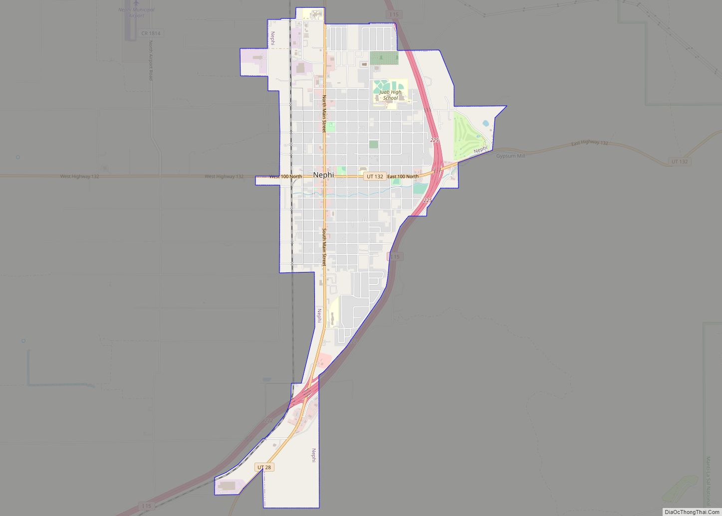
Online Interactive Map
Click on ![]() to view map in "full screen" mode.
to view map in "full screen" mode.
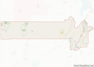
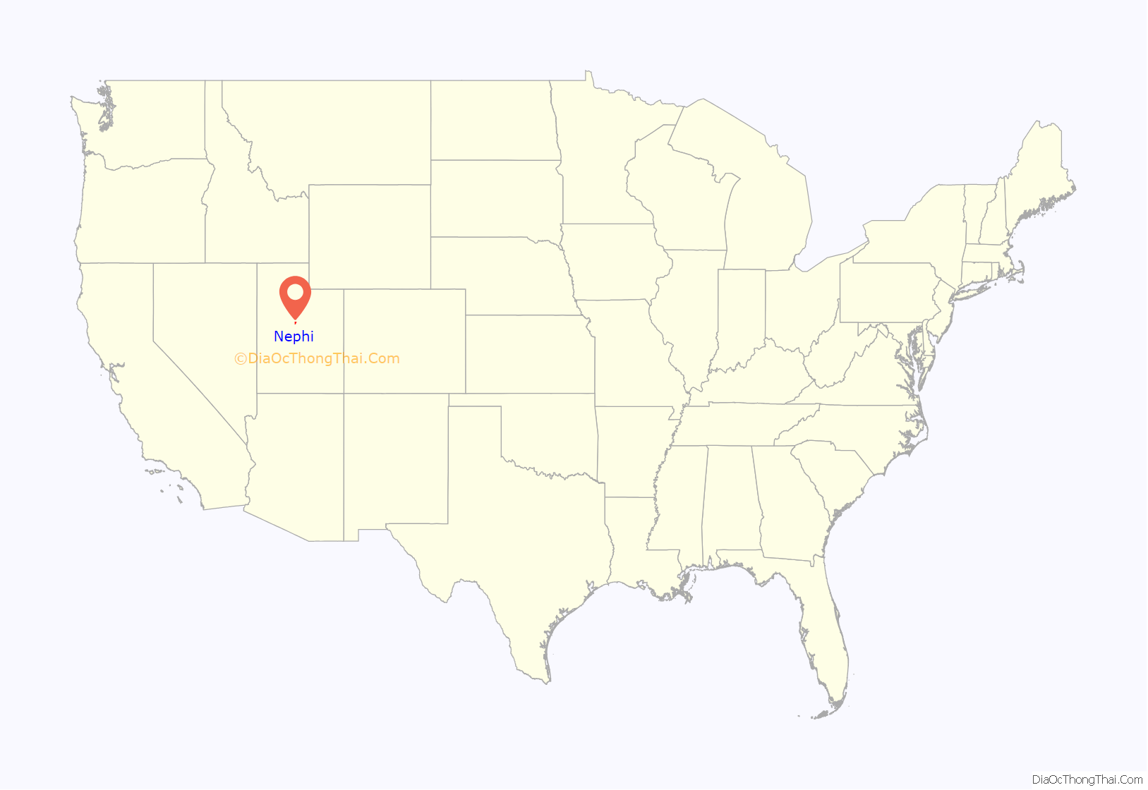
Nephi location map. Where is Nephi city?
History
Before the area was settled, the site along Salt Creek was first a camping place along the Old Mormon Road to Southern California. Mormon settlers established a settlement at the site in 1851, naming it after the creek. It retained that name until 1882 when the town and its post office became Nephi.
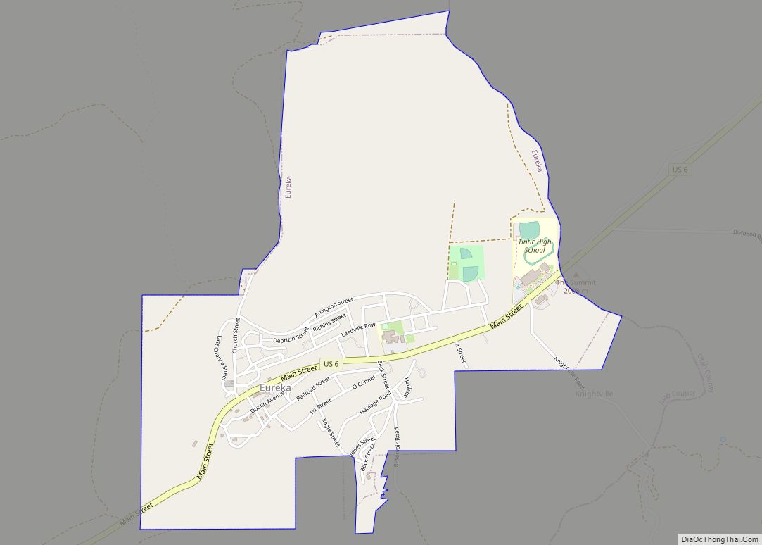
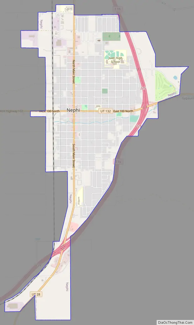
Nephi Road Map
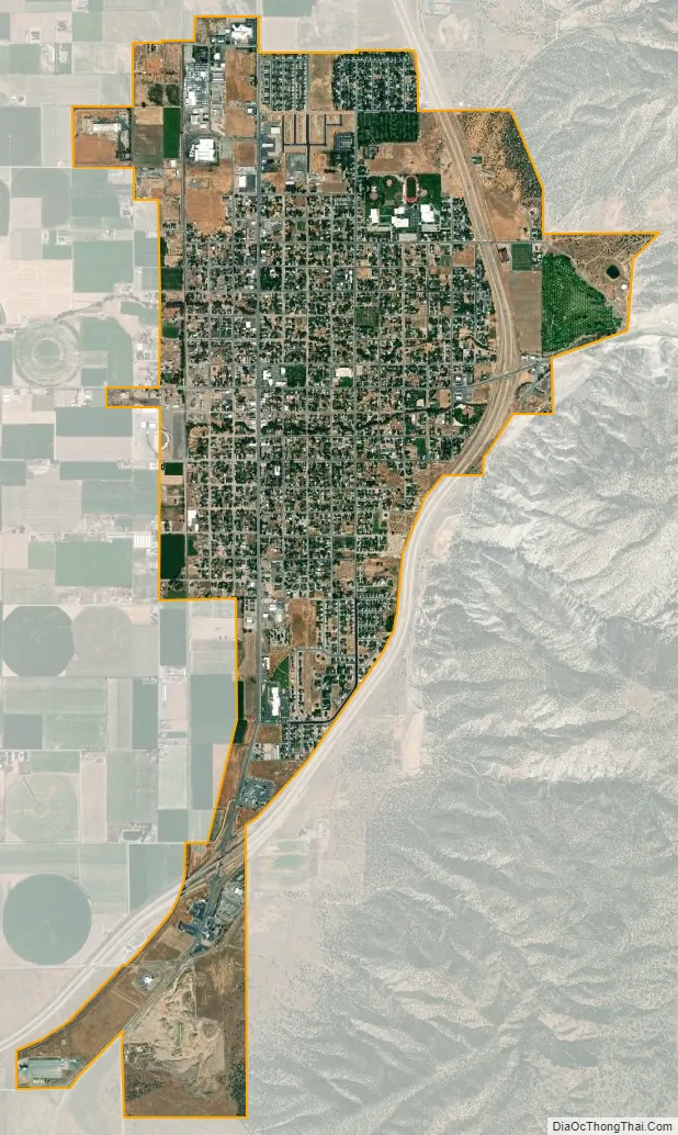
Nephi city Satellite Map
Geography
Nephi is in eastern Juab County in the Juab Valley, between the Wasatch and San Pitch Mountains to the east and the lower West Hills and Long Ridge to the west. Interstate 15 runs along the eastern edge of the city, with access from Exits 222, 225, and 228. I-15 leads north 31 miles (50 km) to Spanish Fork and south 37 miles (60 km) to Scipio. Utah State Route 28, Nephi’s Main Street, runs north 3 miles (5 km) to I-15 and south 41 miles (66 km) to Gunnison. Utah State Route 132 crosses Main Street in the center of town, leading southeast 22 miles (35 km) to Moroni and southwest 28 miles (45 km) to Leamington.
According to the U.S. Census Bureau, Nephi has a total area of 4.6 square miles (11.9 km), all land.
Climate
In the Köppen climate classification, Nephi has either a humid subtropical climate (Cfa) or humid continental climate (Dfa) depending on which variant of the system is used.
See also
Map of Utah State and its subdivision: Map of other states:- Alabama
- Alaska
- Arizona
- Arkansas
- California
- Colorado
- Connecticut
- Delaware
- District of Columbia
- Florida
- Georgia
- Hawaii
- Idaho
- Illinois
- Indiana
- Iowa
- Kansas
- Kentucky
- Louisiana
- Maine
- Maryland
- Massachusetts
- Michigan
- Minnesota
- Mississippi
- Missouri
- Montana
- Nebraska
- Nevada
- New Hampshire
- New Jersey
- New Mexico
- New York
- North Carolina
- North Dakota
- Ohio
- Oklahoma
- Oregon
- Pennsylvania
- Rhode Island
- South Carolina
- South Dakota
- Tennessee
- Texas
- Utah
- Vermont
- Virginia
- Washington
- West Virginia
- Wisconsin
- Wyoming