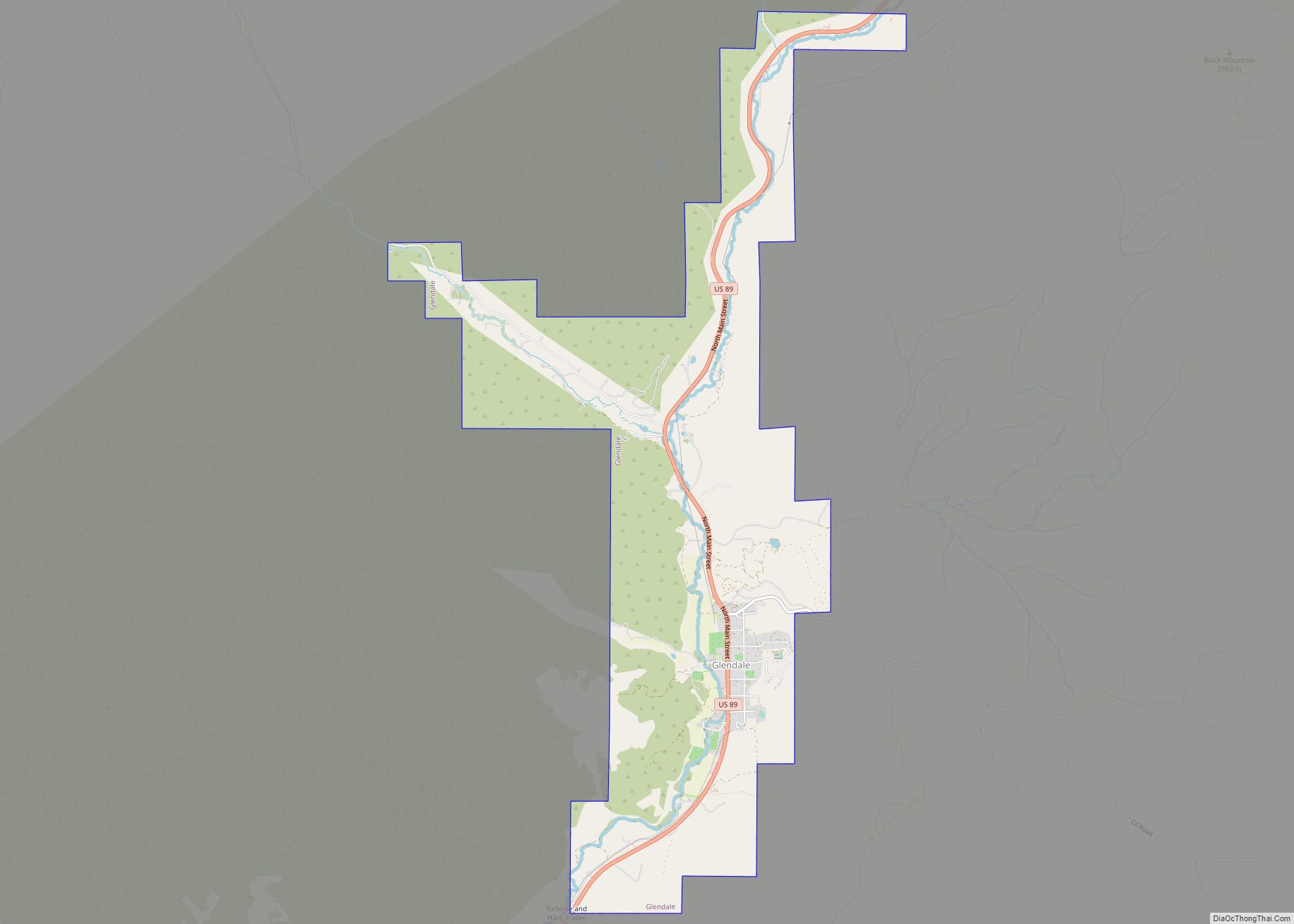
Glendale is a town in Kane County, Utah, United States. The population was 381 at the 2010 census.
| Name: | Glendale town |
|---|---|
| LSAD Code: | 43 |
| LSAD Description: | town (suffix) |
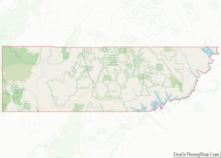
| State: | Utah |
| County: | Kane County |
| Founded: | 1862 |
| Incorporated: | March 29, 1935 |
| Elevation: | 5,778 ft (1,761 m) |
| Total Area: | 7.00 sq mi (18.12 km²) |
| Land Area: | 7.00 sq mi (18.12 km²) |
| Water Area: | 0.00 sq mi (0.00 km²) |
| Total Population: | 381 |
| Population Density: | 58.18/sq mi (22.46/km²) |
| ZIP code: | 84729 |
| Area code: | 435 |
| FIPS code: | 4929360 |
| GNISfeature ID: | 1428204 |
Online Interactive Map
Click on ![]() to view map in "full screen" mode.
to view map in "full screen" mode.
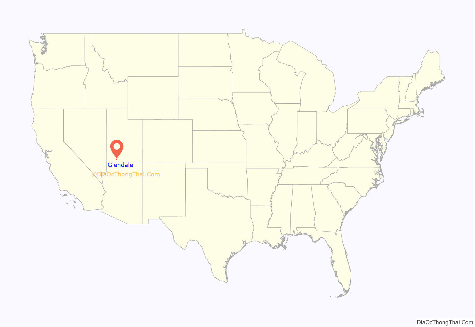
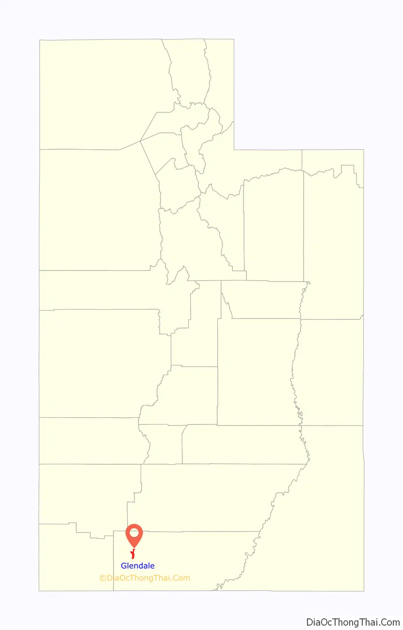
Glendale location map. Where is Glendale town?
History
Glendale was originally called “Berryville”, and under the latter name permanent settlement was first made in 1864. Sources differ whether the town was named for glens and dales near the town site, or after Glendale, Scotland, the native home of a share of the early settlers.
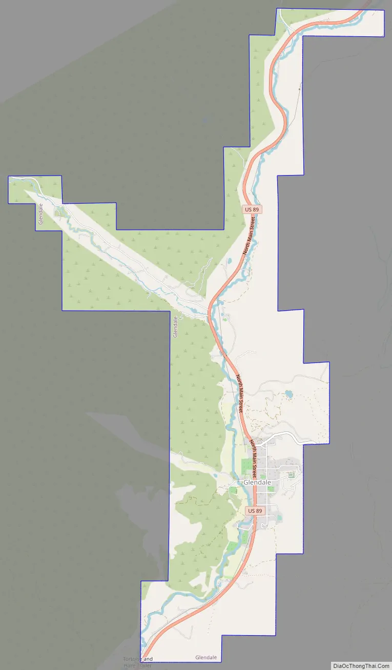
Glendale Road Map
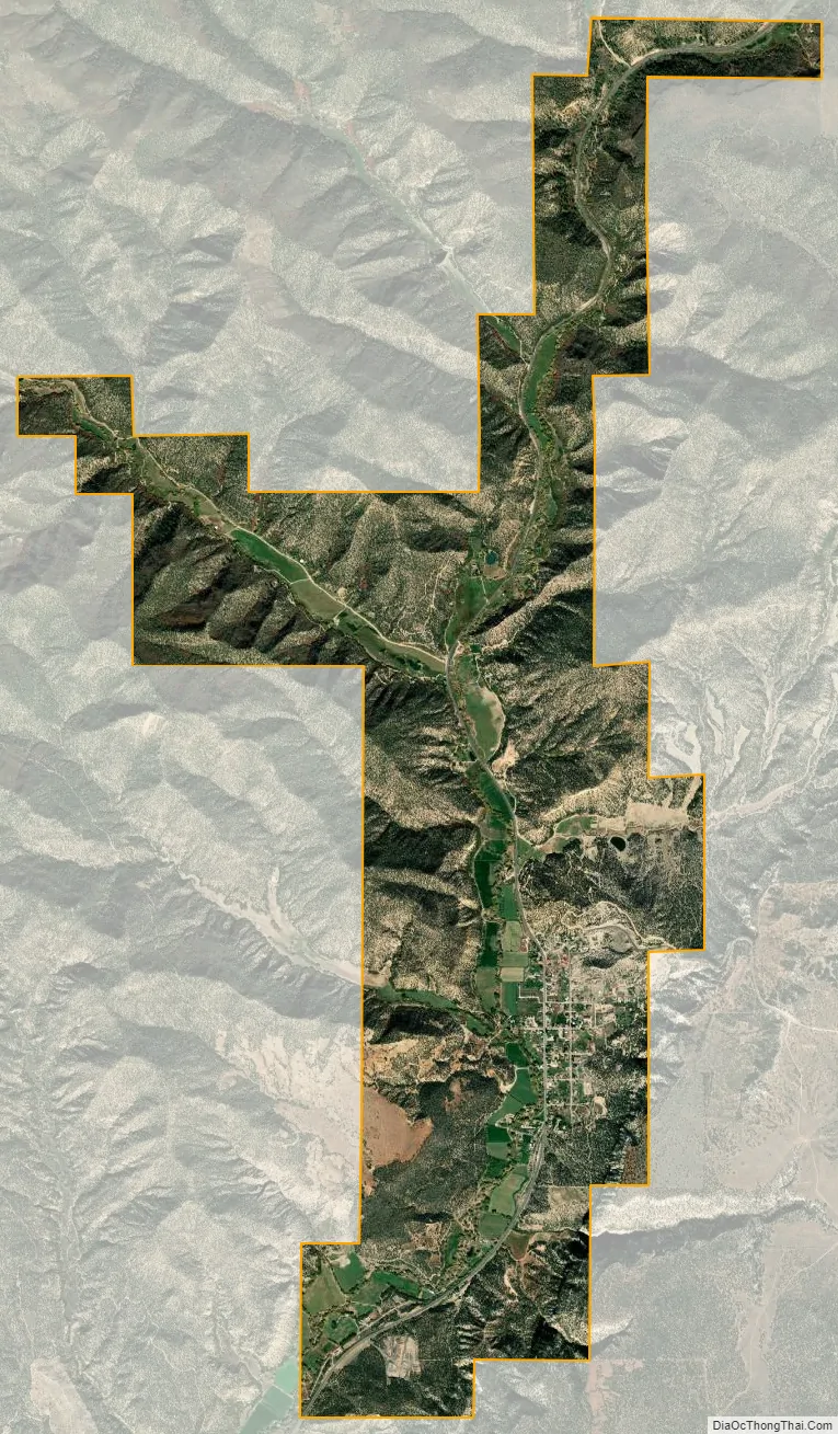
Glendale city Satellite Map
Geography
Glendale is located in western Kane County at an elevation of 5,800 feet (1,800 m) in Long Valley, along the East Fork of the Virgin River. U.S. Route 89 passes through the town as it follows the valley, leading southwest 4 miles (6 km) to Orderville and north 41 miles (66 km) to Panguitch.
According to the United States Census Bureau, Glendale has a total area of 7.8 square miles (20.2 km), all of it land.
Glendale Bench Road leads east from Glendale to the Grand Staircase–Escalante National Monument (GSENM). The rustic and scenic road meets Skutumpah Road, running through the GSENM and ending at one of the GSENM Visitor Centers in Cannonville, near Bryce Canyon.
See also
Map of Utah State and its subdivision: Map of other states:- Alabama
- Alaska
- Arizona
- Arkansas
- California
- Colorado
- Connecticut
- Delaware
- District of Columbia
- Florida
- Georgia
- Hawaii
- Idaho
- Illinois
- Indiana
- Iowa
- Kansas
- Kentucky
- Louisiana
- Maine
- Maryland
- Massachusetts
- Michigan
- Minnesota
- Mississippi
- Missouri
- Montana
- Nebraska
- Nevada
- New Hampshire
- New Jersey
- New Mexico
- New York
- North Carolina
- North Dakota
- Ohio
- Oklahoma
- Oregon
- Pennsylvania
- Rhode Island
- South Carolina
- South Dakota
- Tennessee
- Texas
- Utah
- Vermont
- Virginia
- Washington
- West Virginia
- Wisconsin
- Wyoming