Harrisville is a city in Weber County, Utah, United States. The population was 5,567 at the 2010 census. It is part of the Ogden–Clearfield, Utah Metropolitan Statistical Area. The current mayor is Michelle Tait.
| Name: | Harrisville city |
|---|---|
| LSAD Code: | 25 |
| LSAD Description: | city (suffix) |
| State: | Utah |
| County: | Weber County |
| Elevation: | 4,291 ft (1,308 m) |
| Total Area: | 2.98 sq mi (7.73 km²) |
| Land Area: | 2.98 sq mi (7.73 km²) |
| Water Area: | 0.00 sq mi (0.00 km²) |
| Total Population: | 5,567 |
| Population Density: | 2,302.95/sq mi (889.06/km²) |
| ZIP code: | 84404 |
| Area code: | 385, 801 |
| FIPS code: | 4933540 |
| GNISfeature ID: | 1441617 |
| Website: | www.cityofharrisville.com |
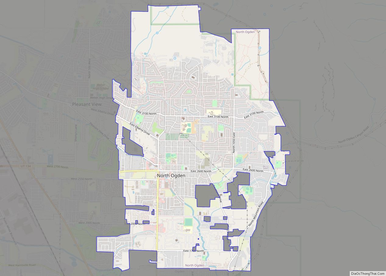
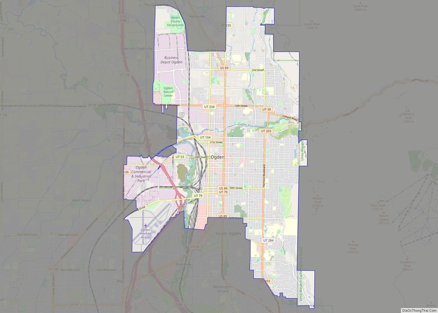
Online Interactive Map
Click on ![]() to view map in "full screen" mode.
to view map in "full screen" mode.
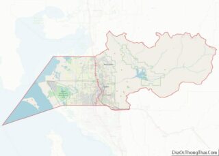
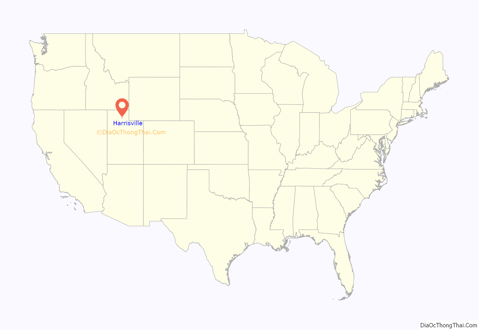
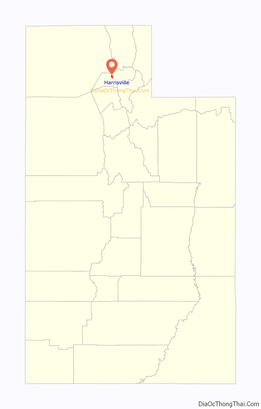
Harrisville location map. Where is Harrisville city?
History
The first permanent settlement at Harrisville was made in 1850. A post office called Harrisville was established in 1871, and remained in operation until 1902. The community was named after Martin H. Harris, a pioneer settler.
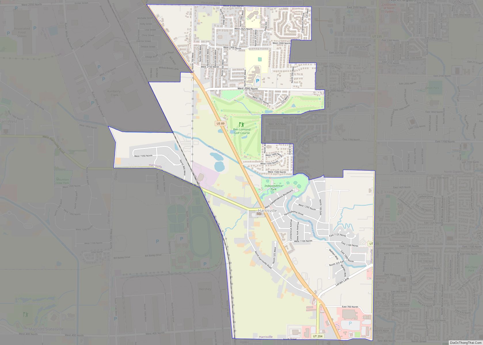
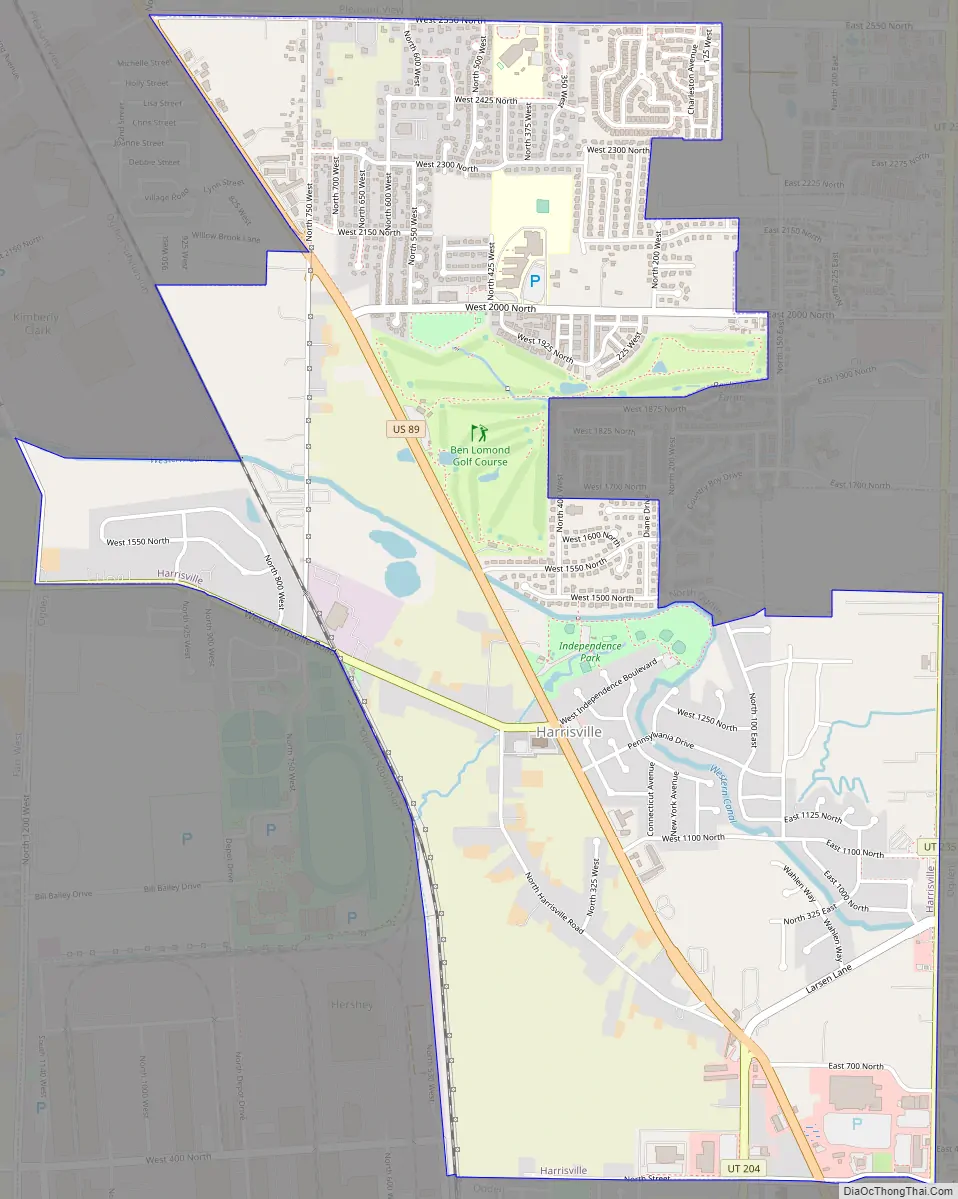
Harrisville Road Map
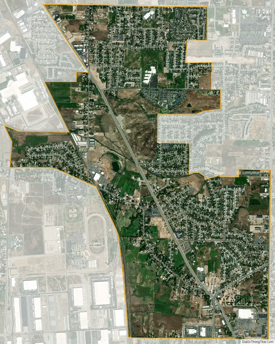
Harrisville city Satellite Map
Geography
According to the United States Census Bureau, the city has a total area of 2.7 square miles (7.0 km), all land.
See also
Map of Utah State and its subdivision: Map of other states:- Alabama
- Alaska
- Arizona
- Arkansas
- California
- Colorado
- Connecticut
- Delaware
- District of Columbia
- Florida
- Georgia
- Hawaii
- Idaho
- Illinois
- Indiana
- Iowa
- Kansas
- Kentucky
- Louisiana
- Maine
- Maryland
- Massachusetts
- Michigan
- Minnesota
- Mississippi
- Missouri
- Montana
- Nebraska
- Nevada
- New Hampshire
- New Jersey
- New Mexico
- New York
- North Carolina
- North Dakota
- Ohio
- Oklahoma
- Oregon
- Pennsylvania
- Rhode Island
- South Carolina
- South Dakota
- Tennessee
- Texas
- Utah
- Vermont
- Virginia
- Washington
- West Virginia
- Wisconsin
- Wyoming