Levan (/ləˈvæn/ lə-VAN) is a town in Juab County, Utah, United States. As of the 2020 census it had a population of 862.
It is often said that the name of the town derives from its location near the center of Utah, because the name is “navel” spelled backwards. Several other origins have been suggested for the name, from French, Latin, or Colorado River Numic language.
| Name: | Levan town |
|---|---|
| LSAD Code: | 43 |
| LSAD Description: | town (suffix) |
| State: | Utah |
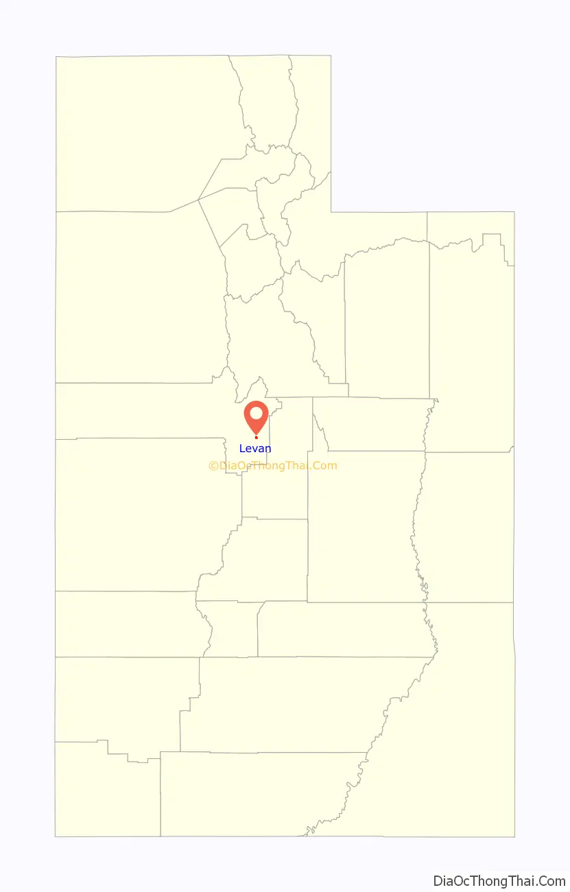
| County: | Juab County |
| Founded: | 1867 |
| Elevation: | 5,315 ft (1,620 m) |
| Total Area: | 0.81 sq mi (2.10 km²) |
| Land Area: | 0.81 sq mi (2.10 km²) |
| Water Area: | 0.00 sq mi (0.00 km²) |
| Total Population: | 862 |
| Population Density: | 1,064.2/sq mi (410.47/km²) |
| ZIP code: | 84639 |
| Area code: | 435 |
| FIPS code: | 4944650 |
| GNISfeature ID: | 1442564 |
| Website: | levantown.org |
Online Interactive Map
Click on ![]() to view map in "full screen" mode.
to view map in "full screen" mode.
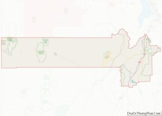
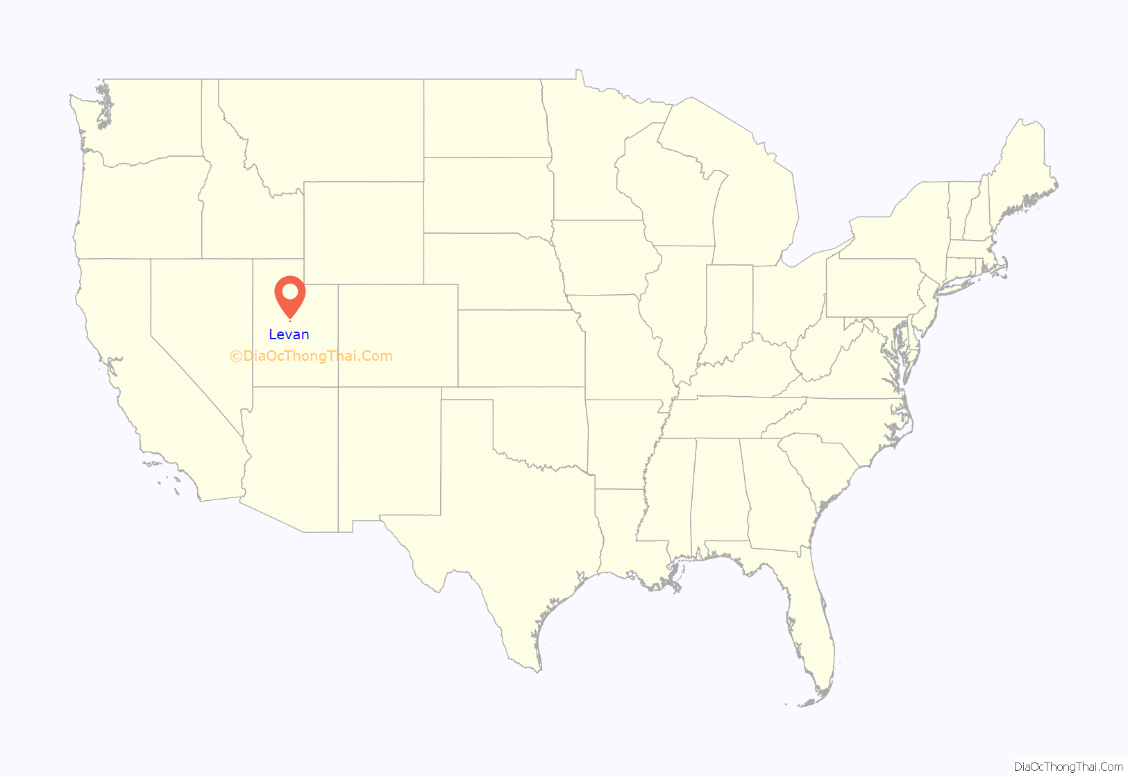
Levan location map. Where is Levan town?
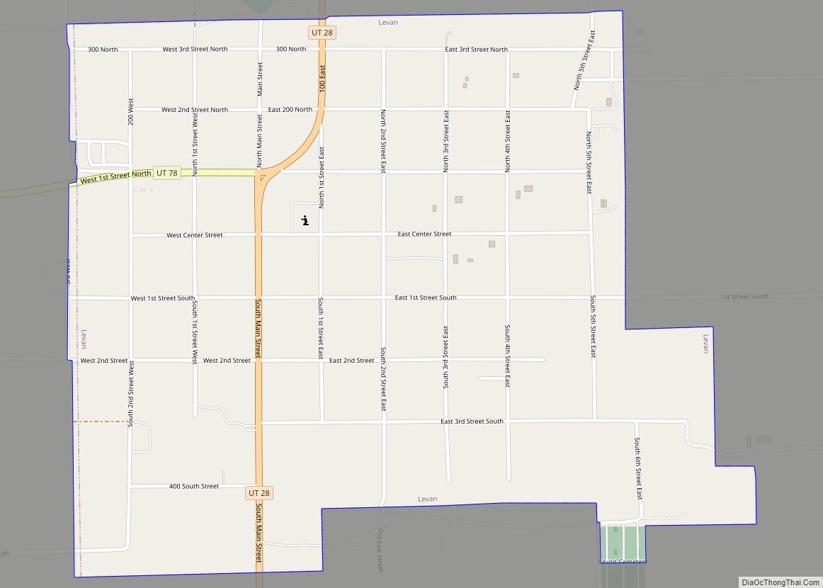
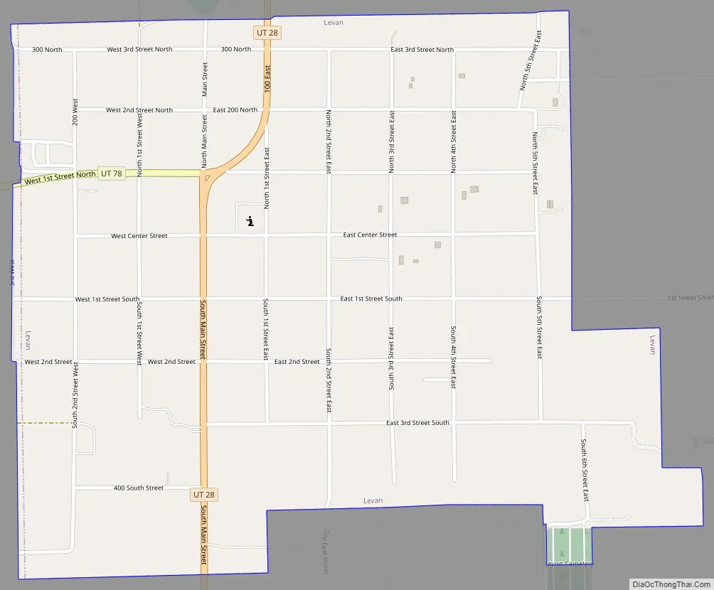
Levan Road Map
Levan city Satellite Map

Geography
Levan is in eastern Juab County, in the Juab Valley at the western base of the San Pitch Mountains. Utah State Route 28 passes through the town, leading north 10 miles (16 km) to Nephi, the county seat, and south 30 miles (48 km) to Gunnison. Utah State Route 78 leads southwest from Levan 11 miles (18 km) to Interstate 15 near Chicken Creek Reservoir.
According to the United States Census Bureau, Levan has a total area of 0.77 square miles (2.0 km), all land.
Climate
This climatic region is typified by large seasonal temperature differences, with hot summers and cold (sometimes severely cold) winters. According to the Köppen Climate Classification system, Levan has a humid continental climate, abbreviated “Dfa” on climate maps.
See also
Map of Utah State and its subdivision: Map of other states:- Alabama
- Alaska
- Arizona
- Arkansas
- California
- Colorado
- Connecticut
- Delaware
- District of Columbia
- Florida
- Georgia
- Hawaii
- Idaho
- Illinois
- Indiana
- Iowa
- Kansas
- Kentucky
- Louisiana
- Maine
- Maryland
- Massachusetts
- Michigan
- Minnesota
- Mississippi
- Missouri
- Montana
- Nebraska
- Nevada
- New Hampshire
- New Jersey
- New Mexico
- New York
- North Carolina
- North Dakota
- Ohio
- Oklahoma
- Oregon
- Pennsylvania
- Rhode Island
- South Carolina
- South Dakota
- Tennessee
- Texas
- Utah
- Vermont
- Virginia
- Washington
- West Virginia
- Wisconsin
- Wyoming