Mona is a city in Juab County, Utah, United States. As of the 2010 census it had a population of 1,547. It is part of the Provo–Orem metropolitan area.
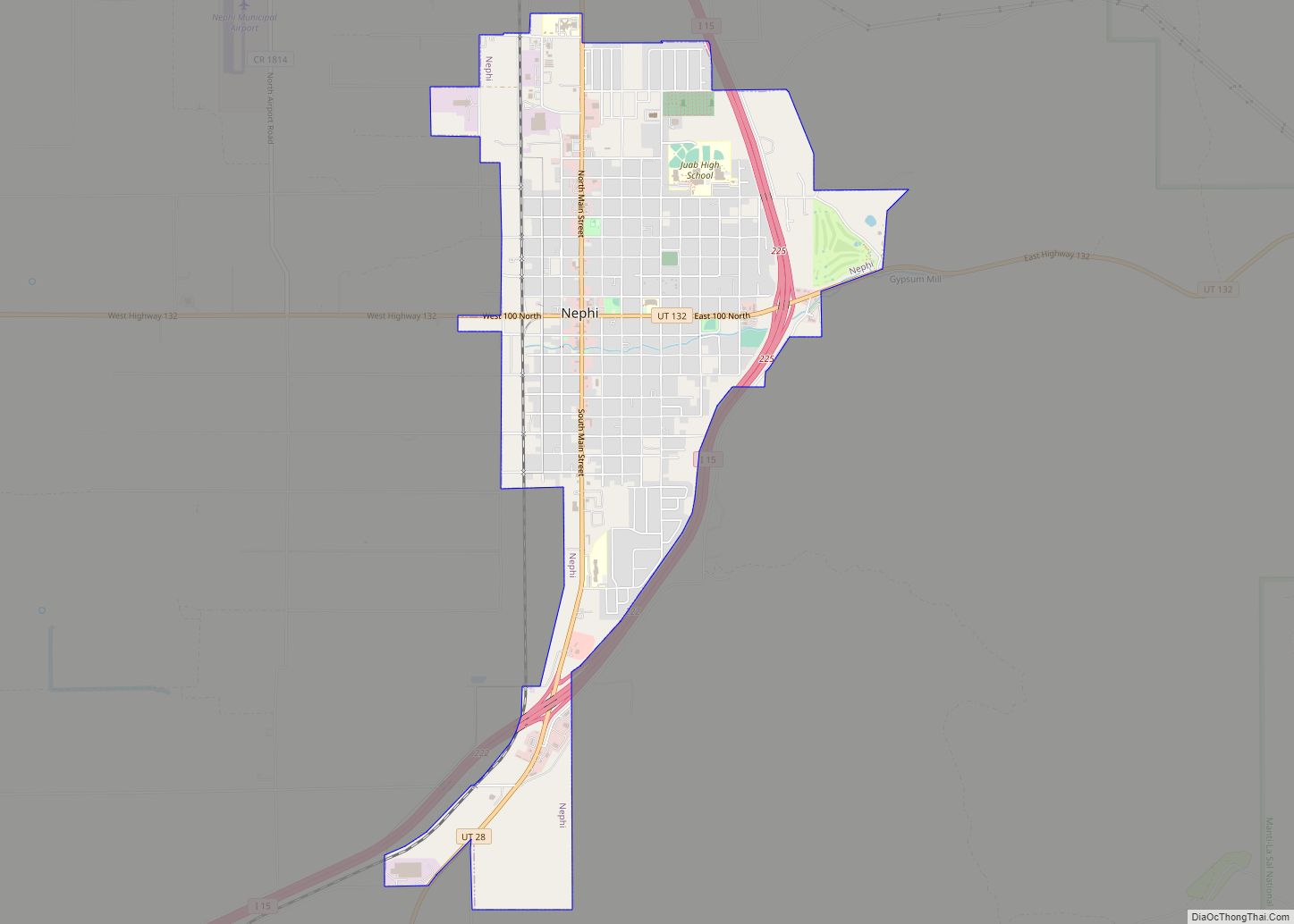
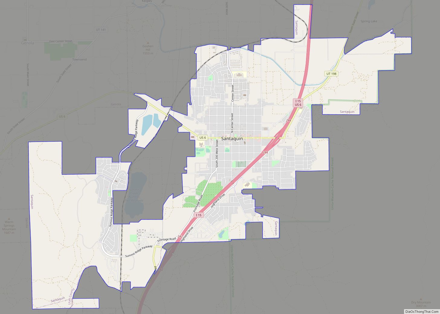
The city is about halfway between Santaquin and Nephi along Interstate 15. The population was 850 at the 2000 census, which at the time was sufficient under Utah state law for Mona to become a city. It did so in 2001.
A farm owned by Young Living raises 200 acres (0.81 km) of lavender on the north side of town. Mona is known for its annual Lavender Festival.
| Name: | Mona city |
|---|---|
| LSAD Code: | 25 |
| LSAD Description: | city (suffix) |
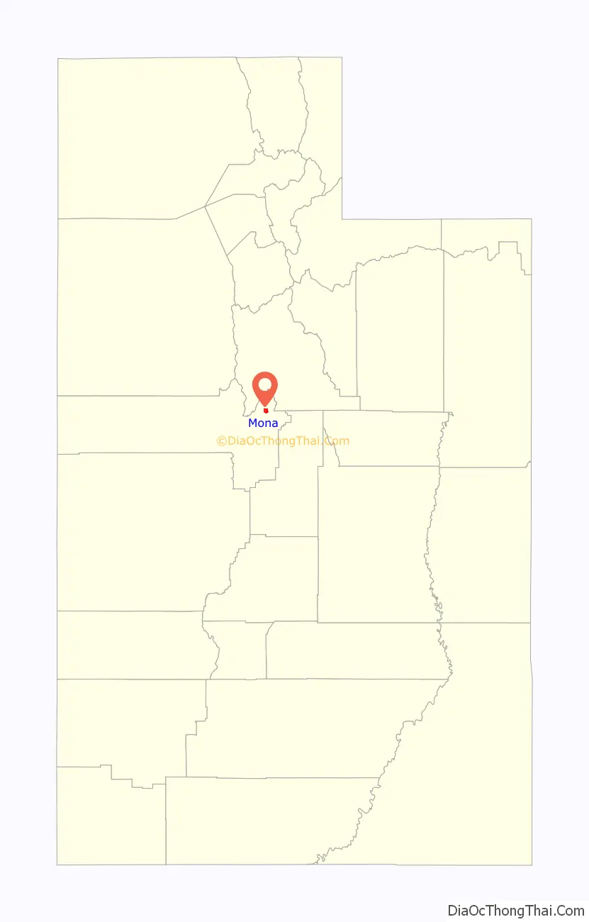
| State: | Utah |
| County: | Juab County |
| Incorporated: | 1924 |
| Elevation: | 4,974 ft (1,516 m) |
| Total Area: | 2.62 sq mi (6.79 km²) |
| Land Area: | 2.59 sq mi (6.71 km²) |
| Water Area: | 0.03 sq mi (0.08 km²) |
| Total Population: | 1,547 |
| Population Density: | 697.68/sq mi (269.40/km²) |
| ZIP code: | 84645 |
| Area code: | 435 |
| FIPS code: | 4951140 |
| GNISfeature ID: | 1443548 |
| Website: | www.monacity.org |
Online Interactive Map
Click on ![]() to view map in "full screen" mode.
to view map in "full screen" mode.
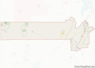
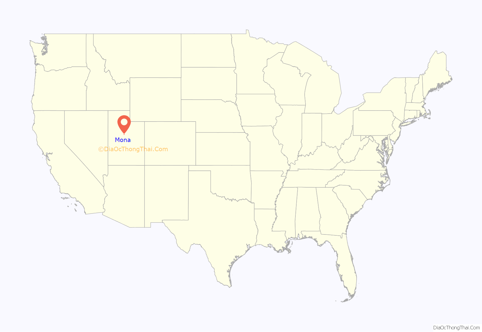
Mona location map. Where is Mona city?
History
Mona, one of the early settlements along the old Arrowhead Trail, was originally settled in 1852. First named Clover Creek for patches of wild clover that grew along the creek in the area, it was later renamed Willow Creek for its water source, then Starr for a local settler, before receiving its present name.
When he was a traveling worker and singer in the early 1930s, Burl Ives was once jailed in Mona for singing “Foggy Foggy Dew”, because it was considered bawdy by the authorities.
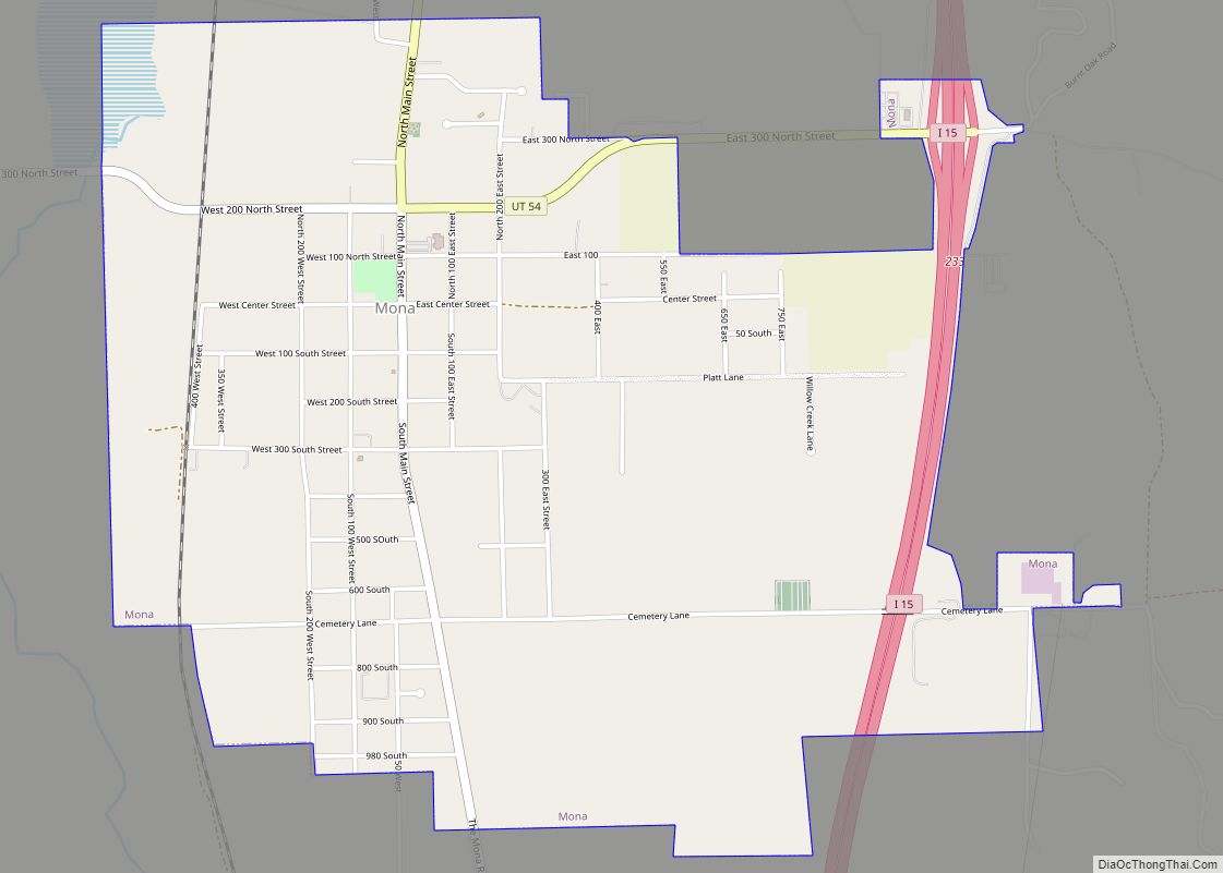
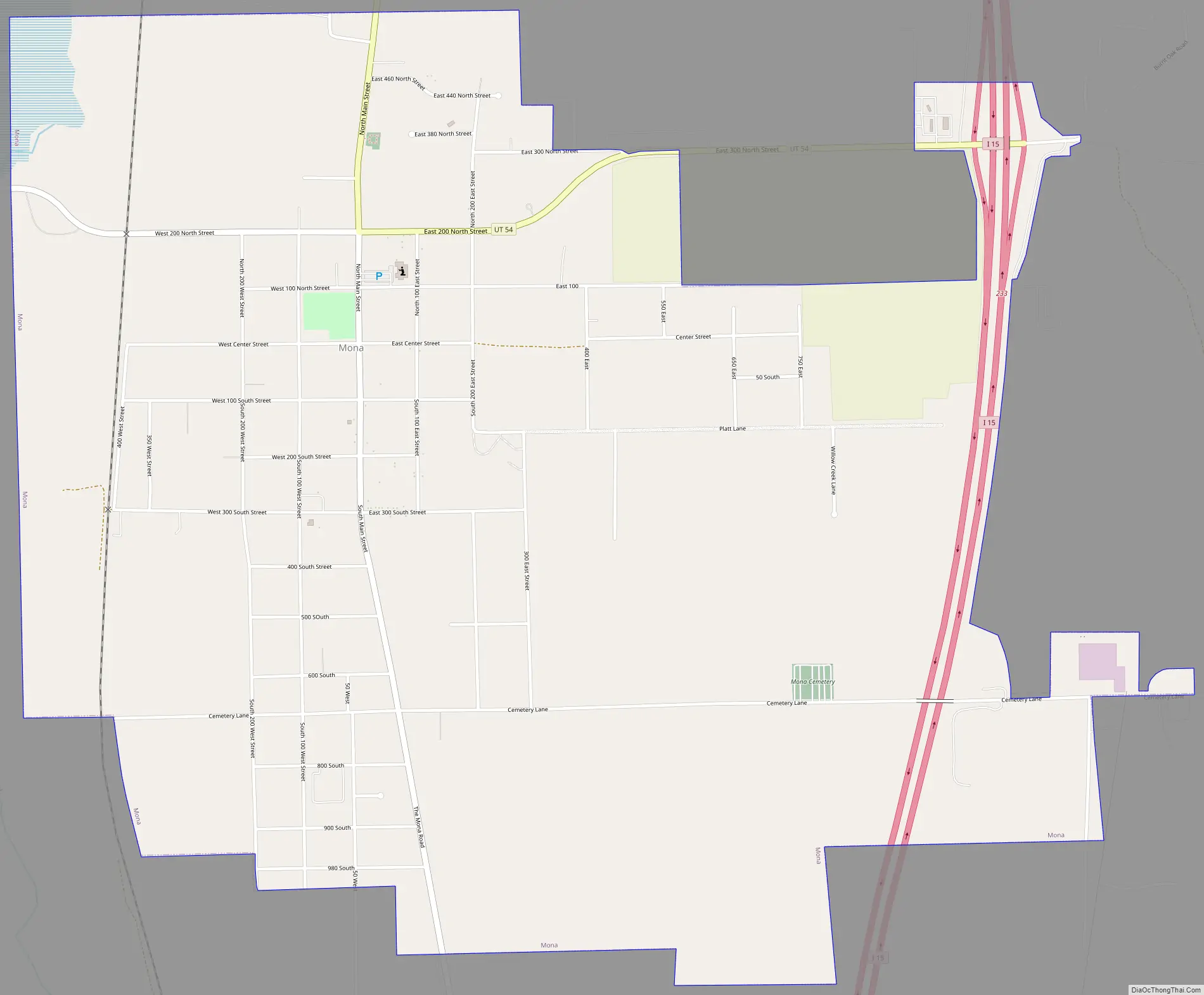
Mona Road Map
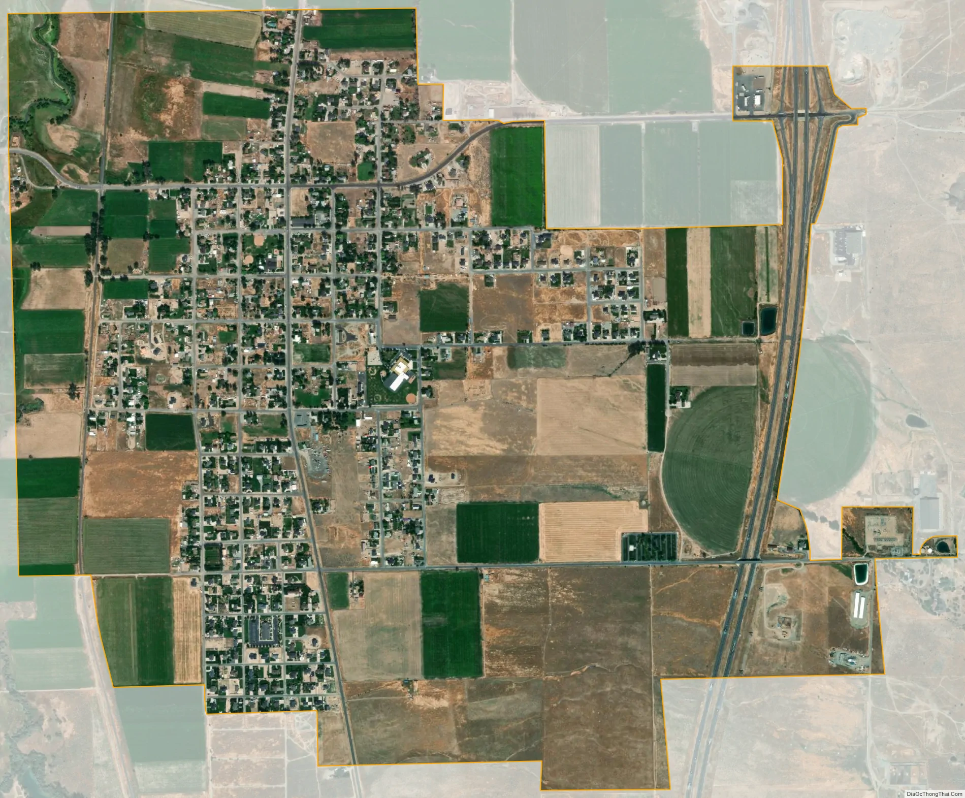
Mona city Satellite Map
Geography
Mona is located in northeastern Juab County at 39°48′55″N 111°51′23″W / 39.81528°N 111.85639°W / 39.81528; -111.85639 (39.815392, -111.856354). Interstate 15 passes along the eastern edge of the city limits, with access from Exit 233. I-15 leads north 12 miles (19 km) to Santaquin and 33 miles (53 km) to Provo, while to the south it leads 9 miles (14 km) to Nephi.
According to the United States Census Bureau, Mona has a total area of 2.8 square miles (7.3 km), of which 0.04 square miles (0.1 km), or 1.50%, are water. Part of the Mona Reservoir is in the northwest corner of the city. The reservoir is an impoundment on Currant Creek, which flows north to Utah Lake.
Mount Nebo, the southernmost and highest mountain in the Wasatch Range, rises 5 miles (8 km) east of Mona to an elevation of 11,928 feet (3,636 m).
See also
Map of Utah State and its subdivision: Map of other states:- Alabama
- Alaska
- Arizona
- Arkansas
- California
- Colorado
- Connecticut
- Delaware
- District of Columbia
- Florida
- Georgia
- Hawaii
- Idaho
- Illinois
- Indiana
- Iowa
- Kansas
- Kentucky
- Louisiana
- Maine
- Maryland
- Massachusetts
- Michigan
- Minnesota
- Mississippi
- Missouri
- Montana
- Nebraska
- Nevada
- New Hampshire
- New Jersey
- New Mexico
- New York
- North Carolina
- North Dakota
- Ohio
- Oklahoma
- Oregon
- Pennsylvania
- Rhode Island
- South Carolina
- South Dakota
- Tennessee
- Texas
- Utah
- Vermont
- Virginia
- Washington
- West Virginia
- Wisconsin
- Wyoming