Salem is a city in Utah County, Utah. It is part of the Provo–Orem metropolitan area. The population was 9,298 at the time of the 2020 U.S. census. Landmark locations in Salem include the Dream Mine of John Hyrum Koyle and the Salem Pond.
| Name: | Salem city |
|---|---|
| LSAD Code: | 25 |
| LSAD Description: | city (suffix) |
| State: | Utah |
| County: | Utah County |
| Incorporated: | May 10, 1920 |
| Elevation: | 4,610 ft (1,405 m) |
| Total Area: | 10.53 sq mi (27.26 km²) |
| Land Area: | 10.50 sq mi (27.21 km²) |
| Water Area: | 0.02 sq mi (0.06 km²) |
| Total Population: | 9,298 |
| Population Density: | 885.52/sq mi (341.71/km²) |
| ZIP code: | 84653 |
| Area code: | 385, 801 |
| FIPS code: | 4965770 |
| GNISfeature ID: | 1445262 |
| Website: | www.salemcity.org |
Online Interactive Map
Click on ![]() to view map in "full screen" mode.
to view map in "full screen" mode.
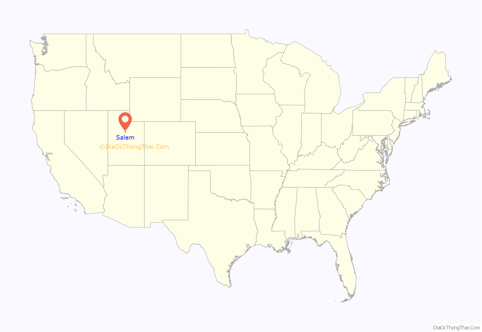
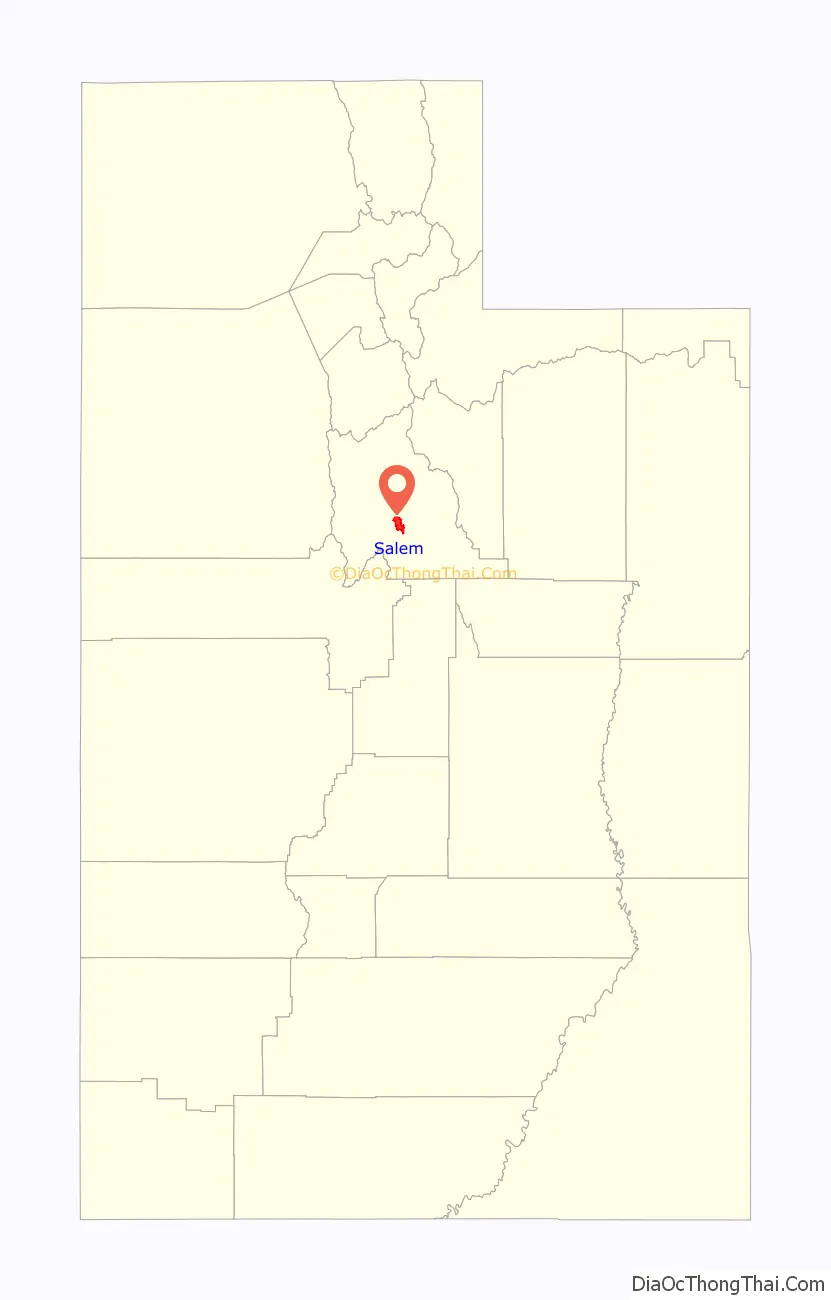
Salem location map. Where is Salem city?
History
Known as “Summer Spring” by the Indians, and “Pond Town” by early settlers. Pond Town was first settled in 1851.
Salem was later named after New Salem, Massachusetts, the birthplace of Lyman Curtis, to honor his contributions to the community. Curtis was good with a gun and a bodyguard for Joseph Smith. He was later among the earliest Latter-day Saint settlers in Utah. Curtis also was important in central Utah for founding a lumber mill and being involved in important irrigation efforts.
Salem Days
Salem Days is a week-long city celebration held in either the first or second week of August every year and are a collective of many activities, including a baby contest, car show, cardboard boat regatta, grand parade, firework show, pageant, children’s parade, and movie in the park. It has been going on since 1949 when the Church of Jesus Christ of Latter-day Saints asked the cities of Utah to celebrate their towns yearly.
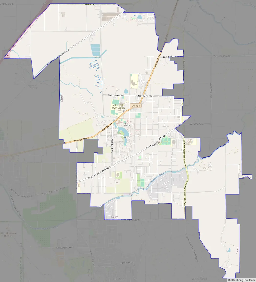
Salem Road Map
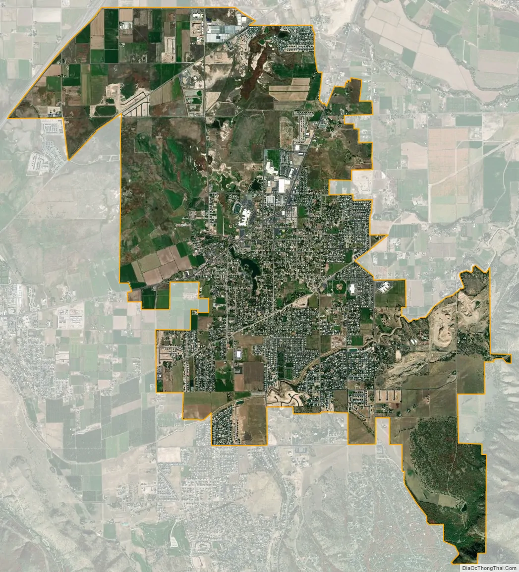
Salem city Satellite Map
Geography
According to the United States Census Bureau, the city has a total area of 10.2 square miles (26.4 km), of which 10.2 square miles (26.3 km) is land and 0.04 square miles (0.1 km), or 0.23%, is water. Salem is located 4.5 miles south of neighboring Spanish Fork, and 3.3 miles northeast of Payson.
Climate
This climatic region is typified by large seasonal temperature differences, with warm to hot (and often humid) summers and cold (sometimes severely cold) winters. According to the Köppen Climate Classification system, Salem has a humid continental climate, abbreviated “Dfb” on climate maps.
See also
Map of Utah State and its subdivision: Map of other states:- Alabama
- Alaska
- Arizona
- Arkansas
- California
- Colorado
- Connecticut
- Delaware
- District of Columbia
- Florida
- Georgia
- Hawaii
- Idaho
- Illinois
- Indiana
- Iowa
- Kansas
- Kentucky
- Louisiana
- Maine
- Maryland
- Massachusetts
- Michigan
- Minnesota
- Mississippi
- Missouri
- Montana
- Nebraska
- Nevada
- New Hampshire
- New Jersey
- New Mexico
- New York
- North Carolina
- North Dakota
- Ohio
- Oklahoma
- Oregon
- Pennsylvania
- Rhode Island
- South Carolina
- South Dakota
- Tennessee
- Texas
- Utah
- Vermont
- Virginia
- Washington
- West Virginia
- Wisconsin
- Wyoming


