Barre (/ˈbæri/ BARR-ee) is a town in Washington County, Vermont, United States. The population was 7,923 at the 2020 census, making it the 3rd largest municipality in Washington County and the 16th largest municipality in Vermont. Popularly referred to as “Barre Town”, the town of Barre almost completely surrounds “Barre City”, which is a separate municipality. The original town now known as Barre was first chartered in 1780 as the Town of Wildersburgh. In 1793 the name Wildersburgh was unpopular with the inhabitants and the name of the town was changed to Barre. In 1895 the City of Barre was incorporated and separated from the town of Barre, and both continue to exist as separate municipalities.
| Name: | Barre city |
|---|---|
| LSAD Code: | 25 |
| LSAD Description: | city (suffix) |
| State: | Vermont |
| County: | Washington County |
| Elevation: | 988 ft (301 m) |
| Total Area: | 30.7 sq mi (79.5 km²) |
| Land Area: | 30.6 sq mi (79.4 km²) |
| Water Area: | 0.1 sq mi (0.1 km²) |
| Total Population: | 7,923 |
| Population Density: | 258/sq mi (99.8/km²) |
| ZIP code: | 05641, 05649, 05654, 05670, 05678 |
| Area code: | 802 |
| FIPS code: | 5003175 |
| GNISfeature ID: | 1462036 |
| Website: | www.barretown.org |
Online Interactive Map
Click on ![]() to view map in "full screen" mode.
to view map in "full screen" mode.
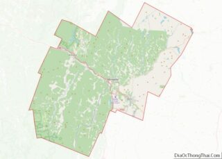
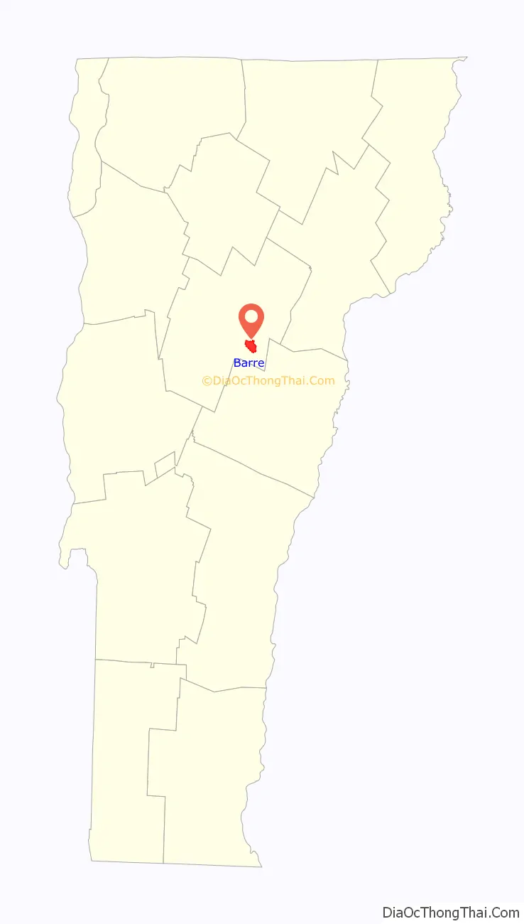
Barre location map. Where is Barre city?

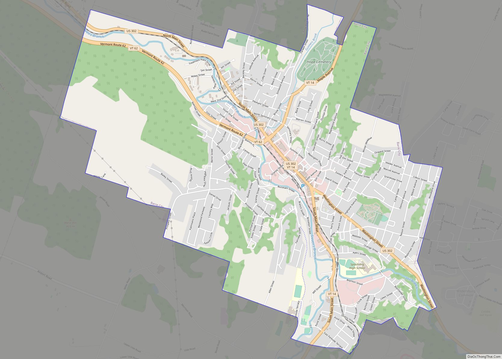
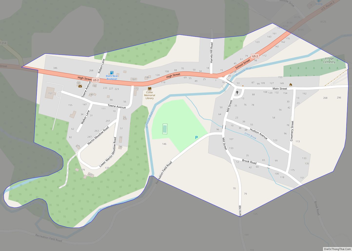
Barre Road Map
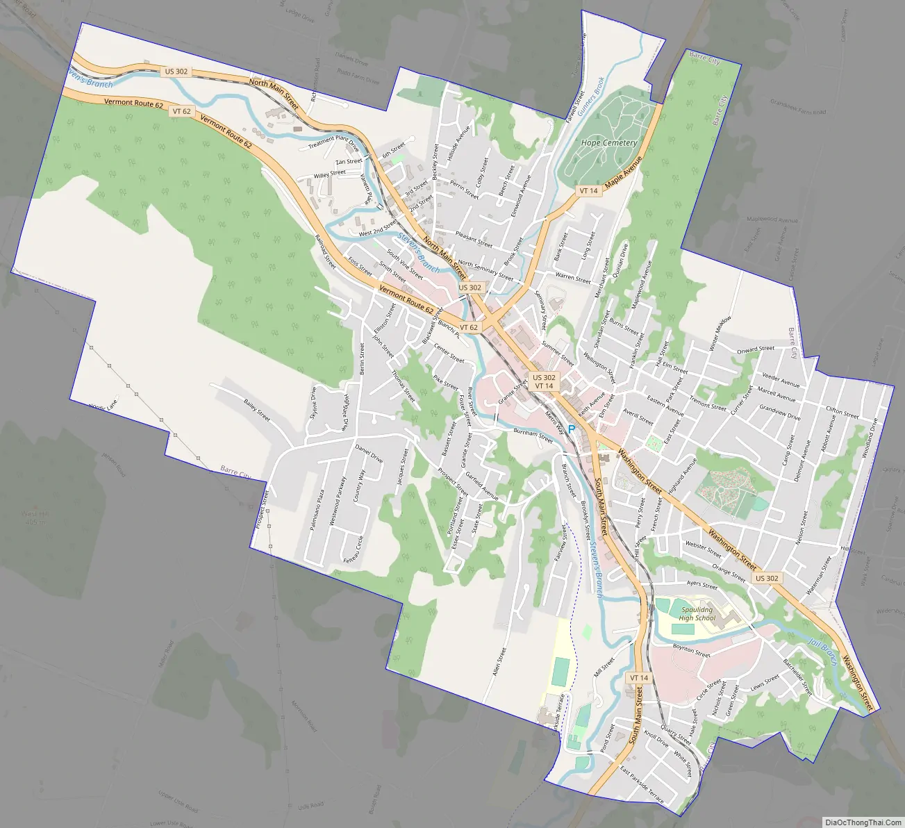
Barre city Satellite Map

Geography
According to the United States Census Bureau, the town has a total area of 30.7 square miles (79.5 km), of which 30.6 square miles (79.4 km) is land and 0.1 square mile (0.1 km) (0.16%) is water. Barre is the self-proclaimed “Granite Center of the World”. Initially established with the discovery of vast granite deposits at Millstone Hill soon after the War of 1812, the granite industry and the town itself saw a boom with the arrival of the railroad. The fame of this vast deposit of granite, which some geologists say is 4 miles (6.4 km) long, 2 miles (3.2 km) wide and 10 miles (16 km) deep, soon spread to Europe and Canada. Large numbers of people migrated to Barre from Italy, Scotland, Spain, Scandinavia, Greece, Lebanon, Canada, and a number of other countries. The population increased from 2,060 in 1880, to 6,790 in 1890, to 10,000 in 1894. Millstone Hill and the nearby Barre Town Forest are now the site of a recreational, wooded trail network, where the mining holes and grout piles are still peppered throughout.
See also
Map of Vermont State and its subdivision: Map of other states:- Alabama
- Alaska
- Arizona
- Arkansas
- California
- Colorado
- Connecticut
- Delaware
- District of Columbia
- Florida
- Georgia
- Hawaii
- Idaho
- Illinois
- Indiana
- Iowa
- Kansas
- Kentucky
- Louisiana
- Maine
- Maryland
- Massachusetts
- Michigan
- Minnesota
- Mississippi
- Missouri
- Montana
- Nebraska
- Nevada
- New Hampshire
- New Jersey
- New Mexico
- New York
- North Carolina
- North Dakota
- Ohio
- Oklahoma
- Oregon
- Pennsylvania
- Rhode Island
- South Carolina
- South Dakota
- Tennessee
- Texas
- Utah
- Vermont
- Virginia
- Washington
- West Virginia
- Wisconsin
- Wyoming